Wetter and somewhat cooler conditions will be welcome for much of the country – but record warmth will still be very much in the mix
Mar 30, 2026
Starting off this morning with a thanks for my subscribers’ patience with no posts over the weekend. I was very busy with volunteering with my daughter for the PGA tournament in Houston, spending wonderful quality time with family as my son and his girlfriend were in town as well, and nursing our sickly 15 year old Yorkie (who is much better). I may still be a bit off kilter for the next couple of weeks as I will be in Houston the rest of this week, and next week will be attending and presenting at the National Tropical Weather Conference in South Padre Island. I will definitely of course also be sharing some content from that meeting!
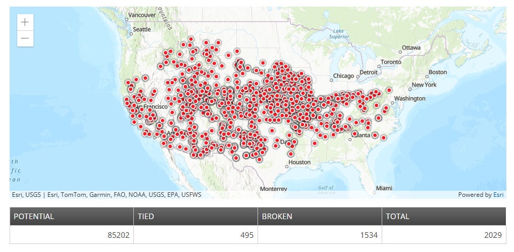
We are starting off a new week thankfully with a new weather pattern, after two weeks of what clearly seems to have been the most anomalous period of record warmth ever observed in the United States. Matt Lanza at The Eyewall has an excellent post today putting this unprecedented March heatwave into context. As Matt noted, the total number of monthly records (2029) exceeded the total number of all of the monthly records reached in 2025 (a hot year).
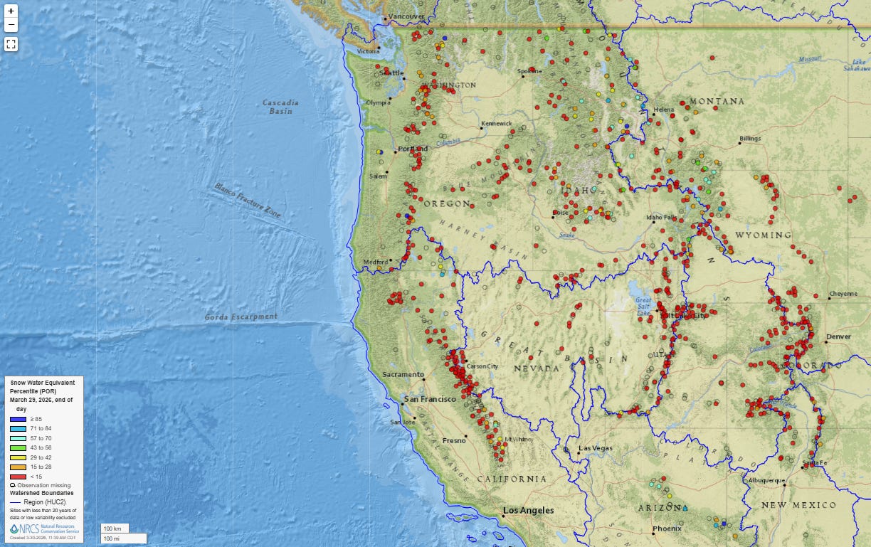
Matt also does a great job in his post talking about the dire situation that is evolving in the West. This recent period of extreme warmth comes at the end of the warmest winter on record in the West, and accordingly the current snowpack is in an alarmingly poor state even in northern areas and parts of the Sierra Nevada that had above normal precipitation this winter. All of those red sites on the map above represent locations where the current snow water equivalent (the amount of water that would be produced if all of the snow on the ground were melted) values are in the bottom 15% of the location’s period of record. With much of the West’s summer water supply reliant upon snowmelt, this is obviously a potentially serious situation that bears close monitoring.
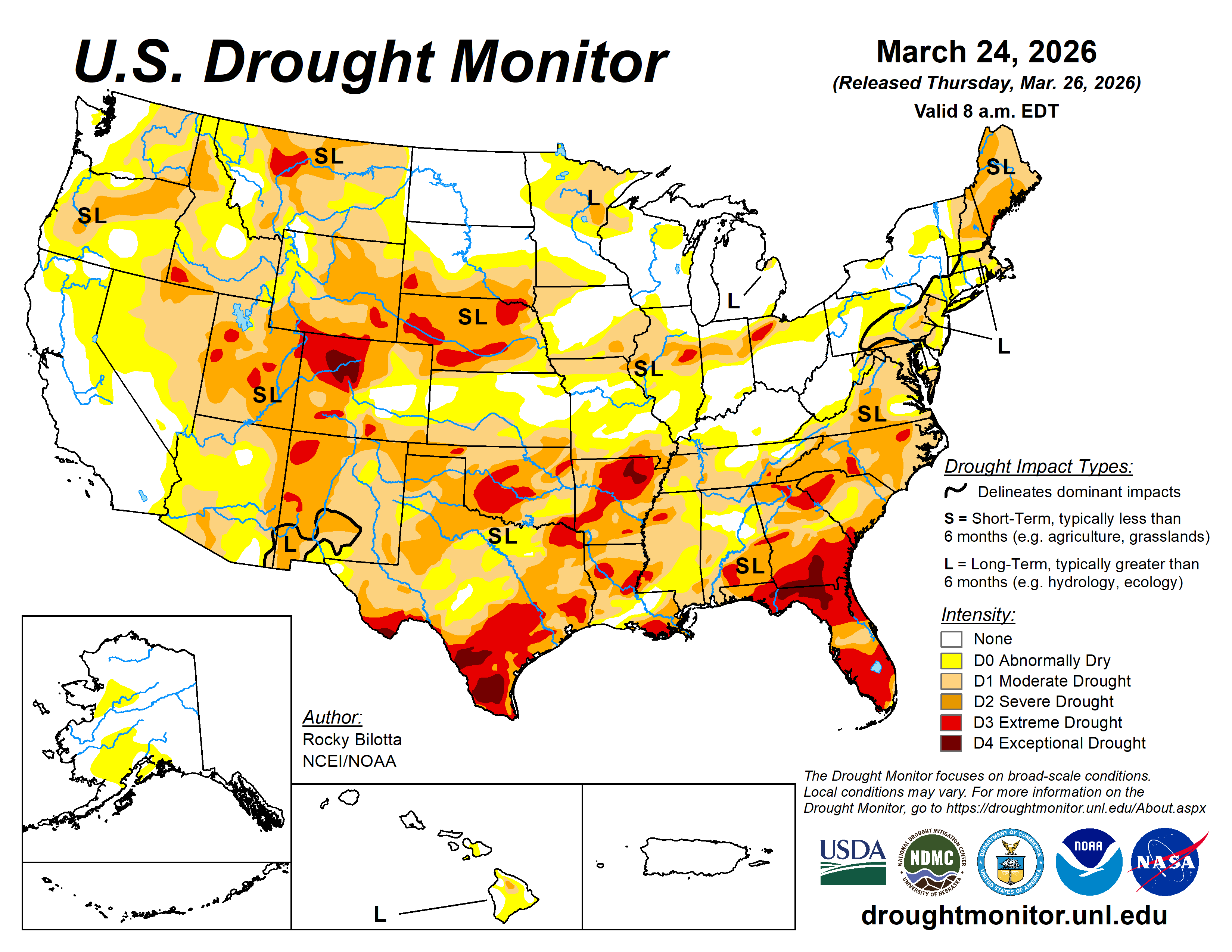
To be clear, the West is not the only place hurting as far as drought and water supply. More than 75% of the country is now abnormally dry per the US Drought Monitor, with just more than 50% of the nation in at least moderate drought. This is the highest percentage of the country in moderate drought since late 2022. My fellow retired NOAA meteorologist John Lewis posted about some of the other areas of the country dealing with water supply issues, including south Texas.
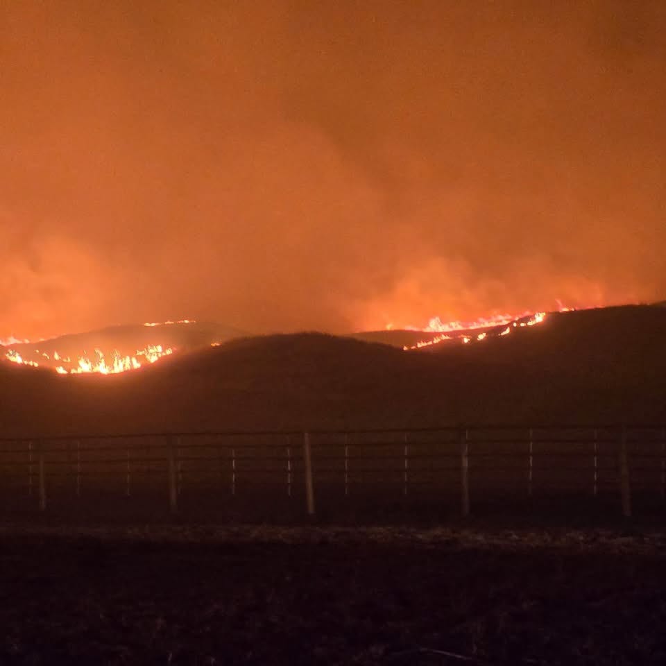
Wildfires have already been a huge issue this year, with The Hotshot Wake Up Substack reporting that more than 1.5M acres have burned, more than triple the historic year-to-date average, along with a record number of new fire starts. Nebraska has seen historic wildfires with huge areas burned, and recently significant wildfires have occurred in parts of the Southeast. Northern Florida and south Georgia will be an area of particular concern this spring given extreme to exceptional drought conditions in a region prone to serious wildfire activity, including the Okefenokee Swamp. Of course, the West will be of increasing concern going into the summer given already dry conditions.
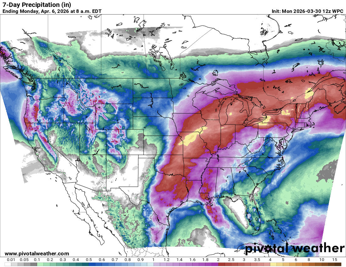
As I mentioned above, this week will see a shift in the weather pattern, as a series of upper level troughs of low pressure will move through the western United States, bringing cooler and wetter weather there. However, these systems will be weakening as they move inland and their track will be such that they will not be huge precipitation producers, though they will bring some snowfall to higher elevations. These systems will also setup southerly winds from the Gulf of Mexico and trigger waves of showers and thunderstorms east of the Rockies that will bring beneficial rainfall to many areas.
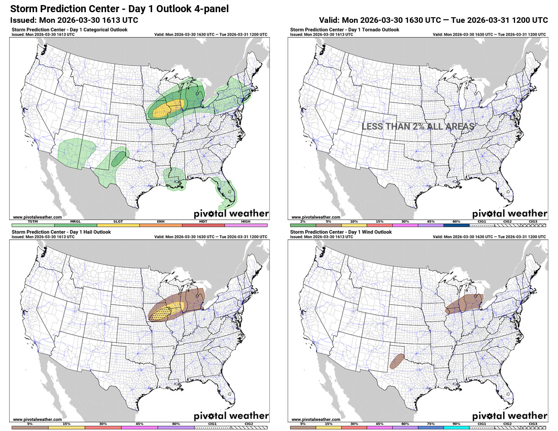
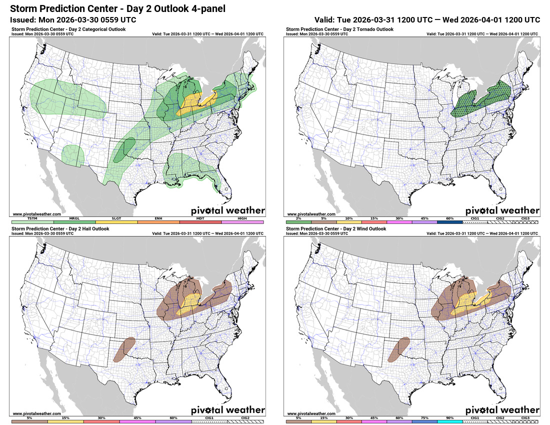
A few severe thunderstorms are possible today and Tuesday, with large hail the primary severe weather risk today, and damaging winds the most likely threat on Tuesday.
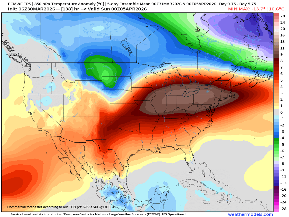
While cooler than the extreme warmth of the last couple of weeks particularly over the West, temperatures will continue to be well above normal for much of the country this week. Record warmth will be widespread today from the Southwest through the Midwest, and will shift east the next couple of days. Record high temperatures will become less numerous as the week goes on, but record warm minimum temperatures will persist across the East through the week as unusual warmth and moisture comes north from the Gulf.

Leave a comment