Multiple days of severe weather potential from the Southern Plains to the Great Lakes
Mar 31, 2026
Had a busy day today, so doing a quick late day update on severe weather risks across the country this week.
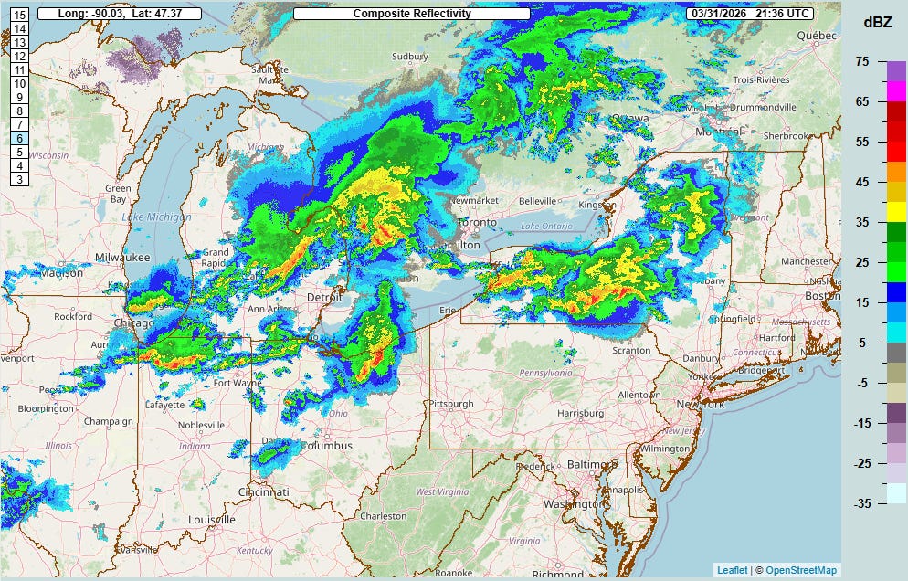
Clusters of strong to severe thunderstorms are ongoing as of 6 pm EDT across the lower Great Lakes region. A number of reports of hail up to golf ball sized occurred earlier today in northern Illinois and eastern Iowa with the storms now in the western Great Lakes region.
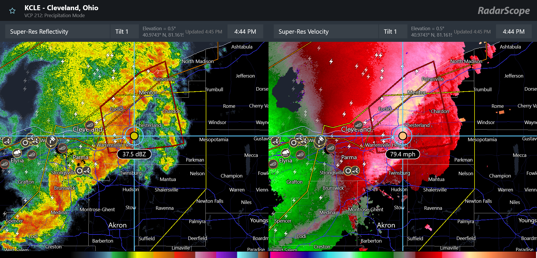
The most intense thunderstorm activity is currently the line of severe storms moving through the Greater Cleveland area. The band of storms has been producing damaging winds along the south shore of Lake Erie, with the automated observing equipment at both Cleveland Hopkins and Burke Lakefront airports reporting 71 mph wind gusts in the last 30 minutes. As you can see above, radar is showing winds of up to 80 mph just above ground level moving through the eastern suburbs of the Cleveland metro area just before 6 pm ET.

Severe thunderstorm watches are in effect through the evening for the eastern Great Lakes region for these severe storms. Additionally, a new severe thunderstorm watch was recently issued for parts of western Oklahoma and northern Texas, where scattered severe storms producing hail up to golf ball size and damaging wind gusts are expected.
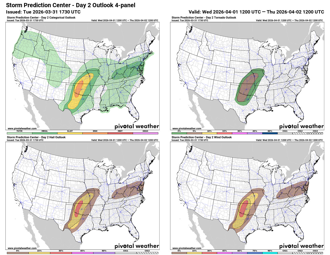
Additional severe thunderstorms are expected on Wednesday, focused in the central US. Scattered supercell severe storms are expected to develop across the Southern Plains during the mid to late afternoon hours, with the potential for very large hail and possibly a few tornadoes. As the storms evolve into more of an organized band of severe storms and move east toward the Interstate 35 corridor from southern Kansas to the Red River, the risk of damaging winds and potentially some tornadoes is expected to increase. An enhanced (level 3 of 5) risk of severe storms is in place from the Storm Prediction Center for this area.
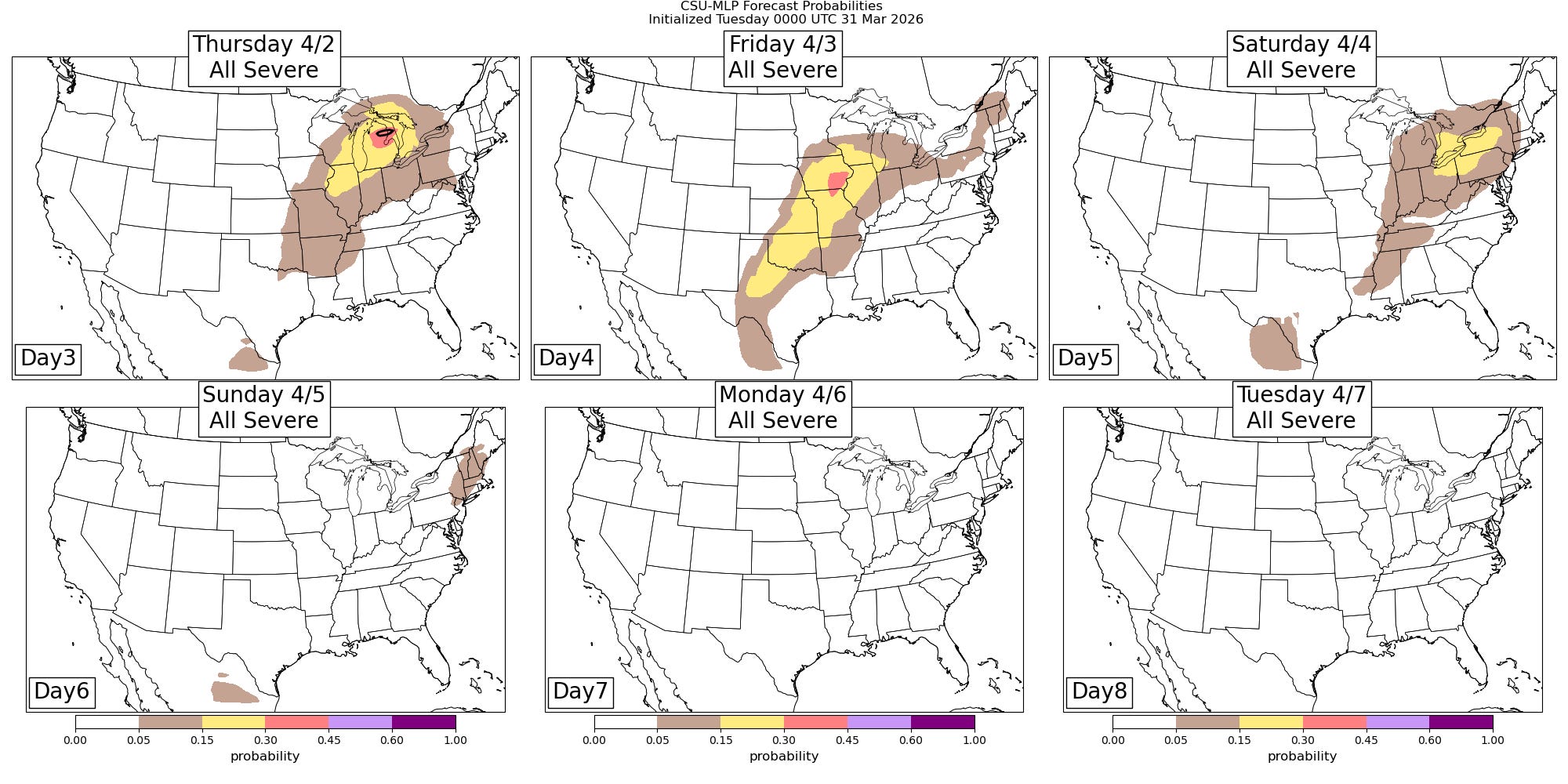
As additional upper level disturbances move east and interact with Gulf moisture and instability streaming north, risks of severe storms will continue for the remainder of the week from the Southern Plains northeast into the Great Lakes region. The forecast from the Colorado State University-Machine Learning Probabilities (CSU-MLP) seems to have a reasonable initial forecast for this longer forecast range — we will be able to better refine these risk areas as we get later into the week.

Leave a comment