Guam threatened by Sinlaku while Hawai’i continues to deal with storms and heavy rainfall. Meanwhile, Eastern US looks to see record warmth next week.
Apr 10, 2026

Good Friday morning! Posting again from another exciting day at the National Tropical Weather Conference in South Padre Island, TX, and currently listening to Tom Andersson, one of the lead scientists at Google working on their DeepMind AI tropical model that has been developed in partnership with the National Hurricane Center. Tom discussed how this work did not really start until 2023, but by last year it had quickly become the leading tropical cyclone forecast guidance.
Tom’s presentation came after hurricane chaser Josh Morgerman yesterday gave an incredibly powerful talk about his experience in the heart of the landfall of Hurricane Melissa in Jamaica last November. Josh’s presentation really gave the audience the visceral experience of what it is like to live through the landfall of a category 5 hurricane. I encourage you to check out his report on this event to better understand the true power of one of these storms and why the work of atmospheric scientists in helping people prepare for these events is so important.
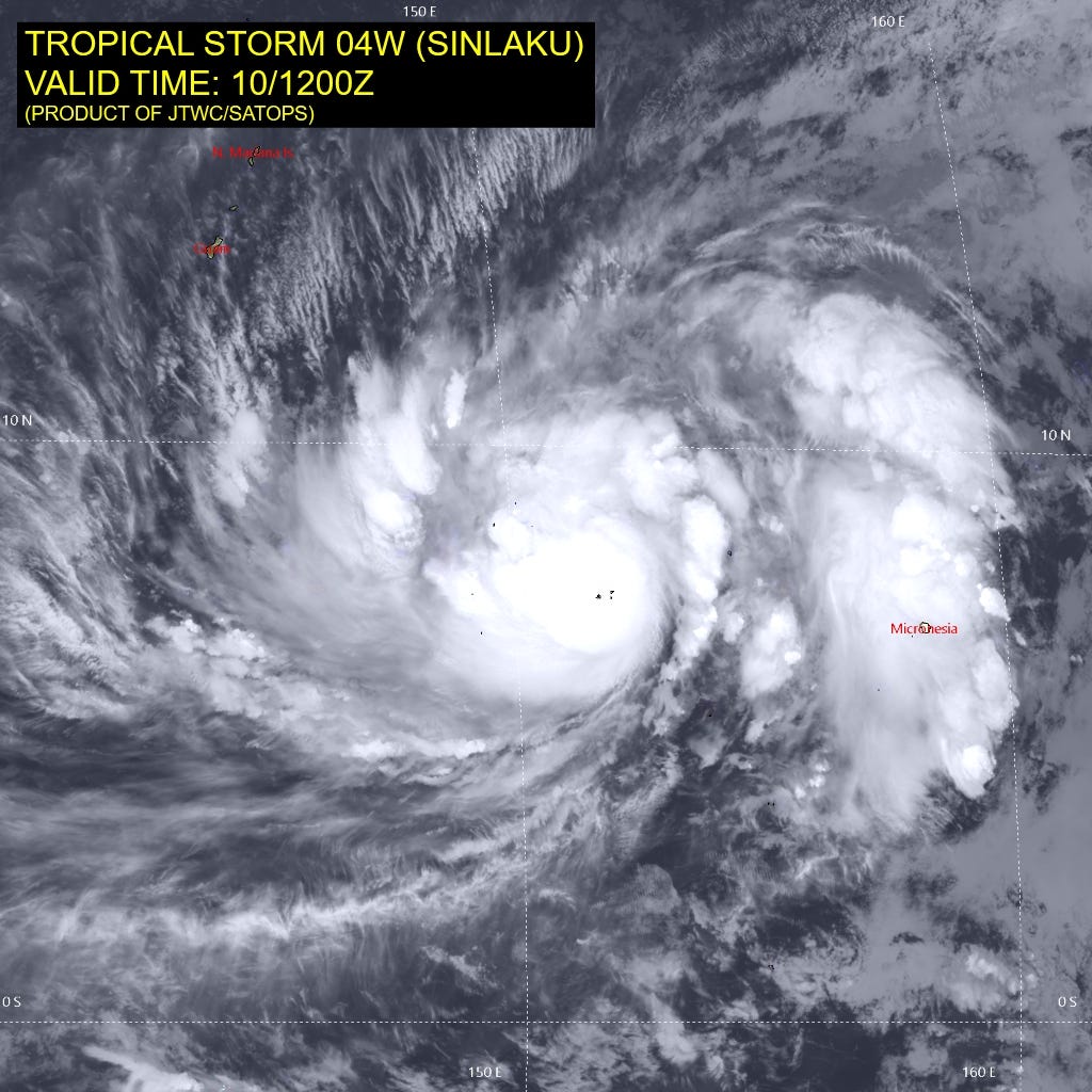
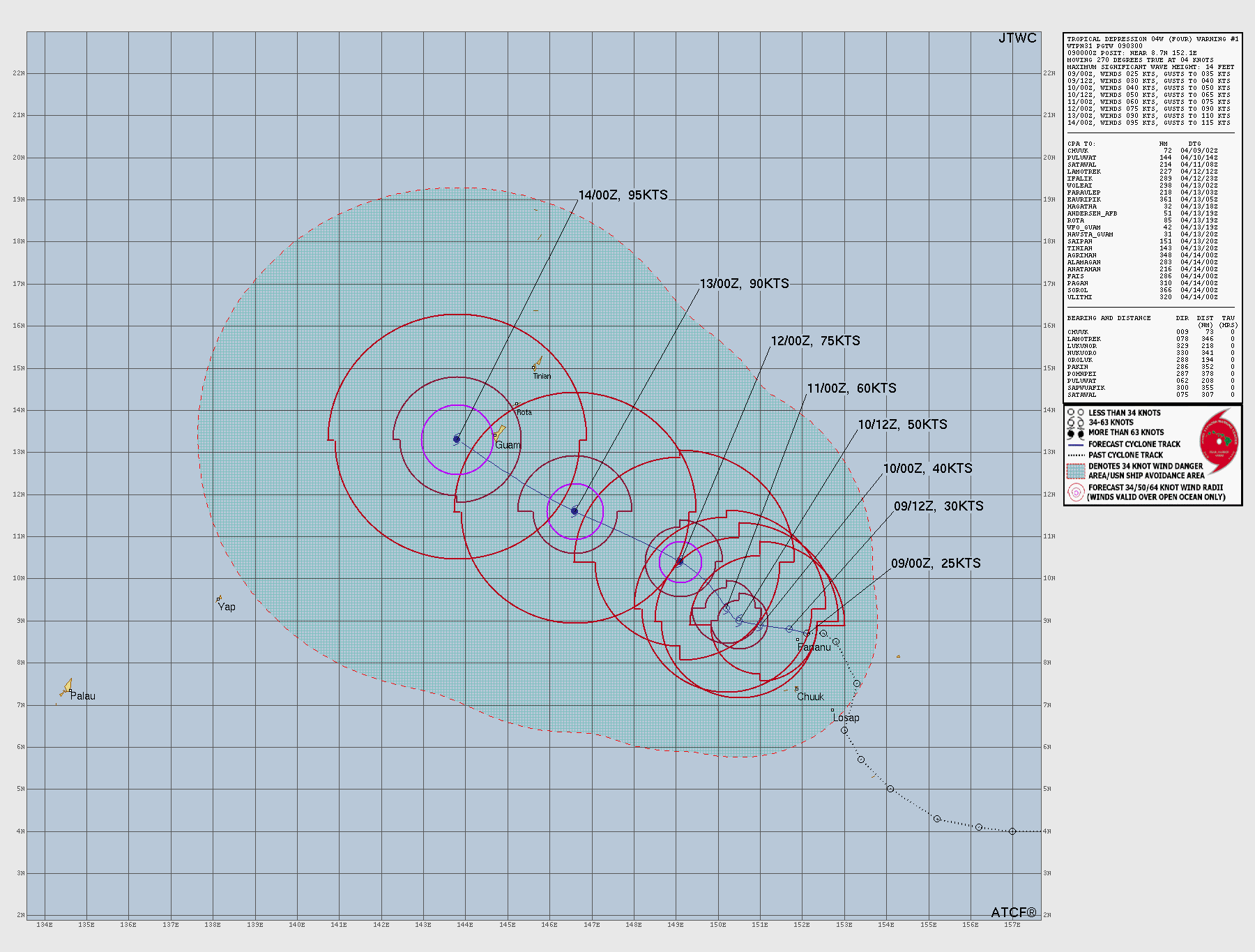
Speaking of the tropics, a big weather story today is intensifying Tropical Storm Sinlaku to the southeast of the Mariana Islands. Conditions look favorable to Sinlaku to continue to intensify and likely become a powerful typhoon over the next several days.
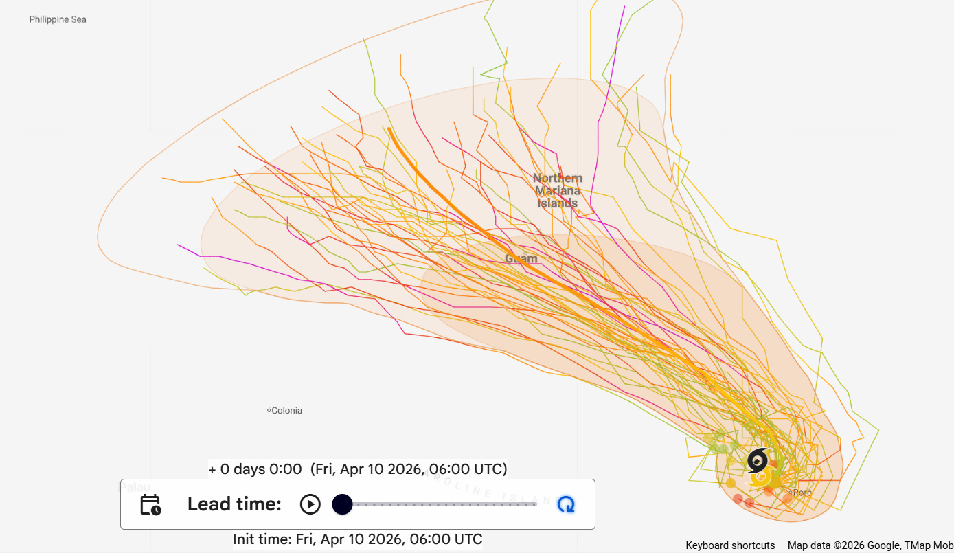
With regard to track, there are some differences in the models. The European ensemble model shows a track to the west-northwest pretty much directly across Guam in a few days.
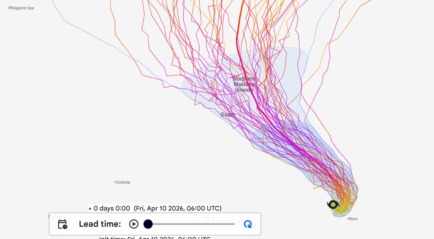
Meanwhile, the Google DeepMind ensemble implies a track more to the northwest and north-northwest toward Saipan. The official forecast from the Joint Typhoon Warning Center follows more of the European scenario, with the center of a typhoon at the equivalent of a category 4 hurricane moving across Guam late Sunday into Monday. Obviously we will be following this into the weekend.
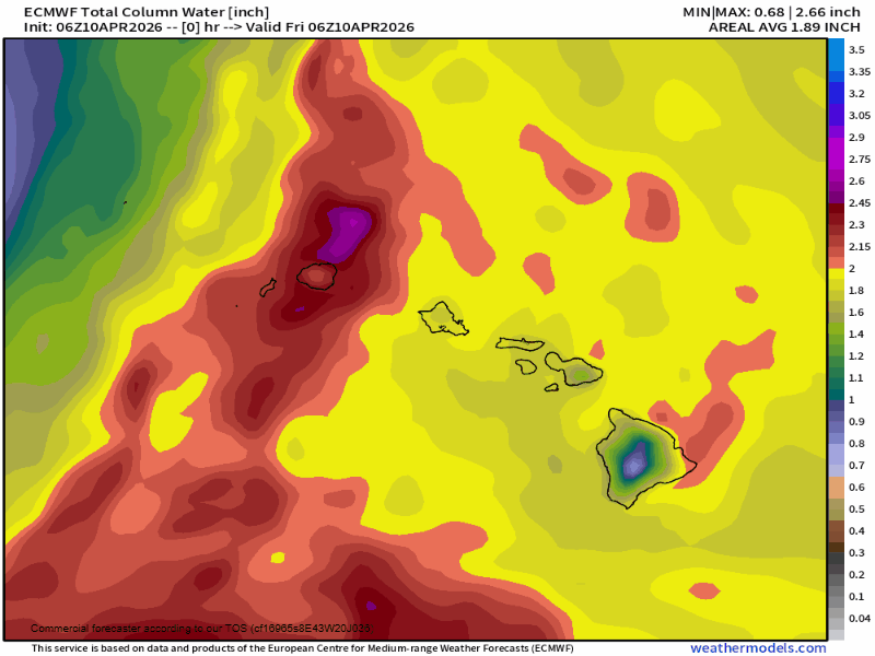
Farther east, Hawai’i continues to be under risk for heavy rain, flash flooding and strong thunderstorms today with flood watches in effect statewide. The forecast loop of precipitable water (total atmospheric moisture) from the European model above shows how after a brief break later this weekend, the active weather pattern rapidly sets back up across the state into next week.
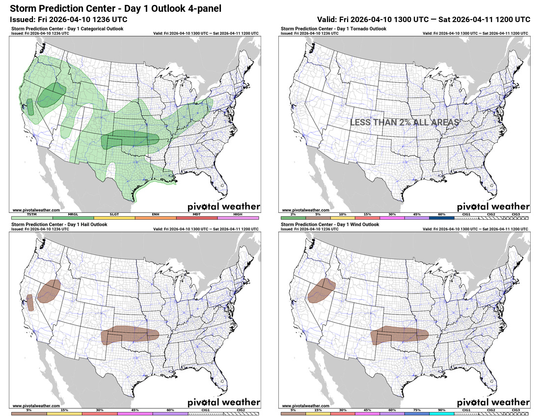
A more active pattern is also in store for the Lower 48, as a series of upper level weather disturbances move into the West Coast and across the Midwest and Great Lakes region. Today, a strong upper level disturbance moving onshore will bring showers and some strong to severe thunderstorms across parts of northern California into the Great Basin. Along with beneficial rainfall, some high elevation snowfall is also expected in the Sierra Nevada.

This active pattern will continue into much of next week — the AI severe weather probabilities from NCAR based on the European ensemble model shows multiple days of severe weather risk across the Midwest and into parts of the Great Lakes next week.
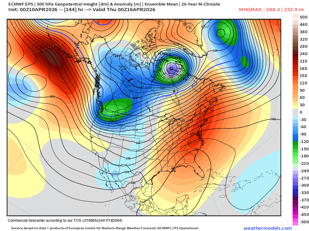
Downstream of this active pattern, a very large and unusually strong area of upper level high pressure will become anchored along the East Coast, supporting yet another springtime heat wave across this region next week.
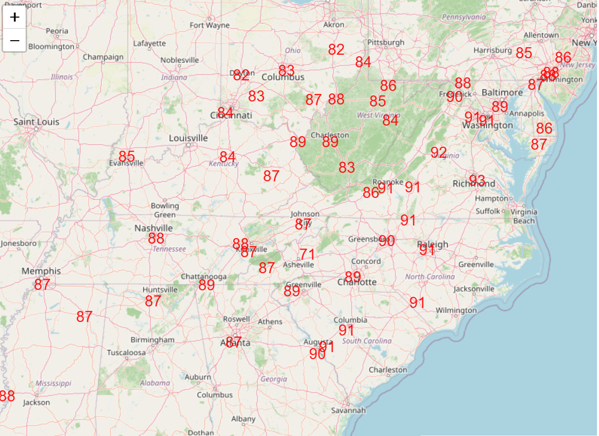
Widespread high temperatures in the 80s and 90s are anticipated, with an initial peak in the heat expected on Wednesday with dozens of record high temperatures (above) and record warm minimum temperatures anticipated. Prolonged dry weather is expected across most of this region as well, further exacerbating ongoing drought conditions.

Leave a comment