Busy week of weather for US expected, with severe weather, wildfire concerns, and record heat
Apr 12, 2026
Good Sunday evening — been traveling today, but wanted to give a quick update on Sinlaku and this week’s weather.
Sinlaku has spent the last 24 hours steadily intensifying and has become a category 5 equivalent supertyphoon with maximum sustained winds of 180 mph. This system relative (the frame moves with the storm to keep the eye in the center) visible satellite loop of sunrise over Sinlaku shows an incredibly impressive typhoon, with a very clear eye that has mesovortices — small scale, intense low pressure areas — rotating around inside it.
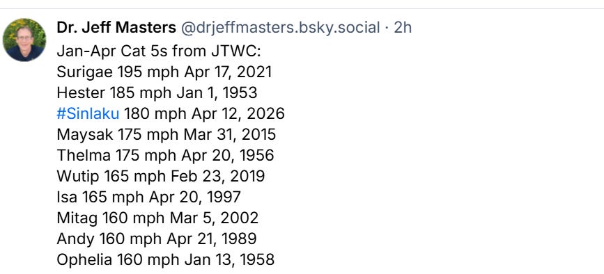
As this list of strongest early season typhoons from Dr. Jeff Masters shows, Sinlaku has reached 180 mph sustained winds at the earliest point of the year of any western Pacific typhoon on record other than Hester in 1953.

Sinlaku is moving steadily northwest, and it expected to continue that general motion for the next 24 to 36 hours before gradually turning more toward the north. The models (Google DeepMind shown for illustration) are now in good agreement on the core of Sinlaku moving near or directly over Saipan, the island with the largest population (~45,000) in the Northern Mariana Islands, and Tinian in about 24-36 hours.
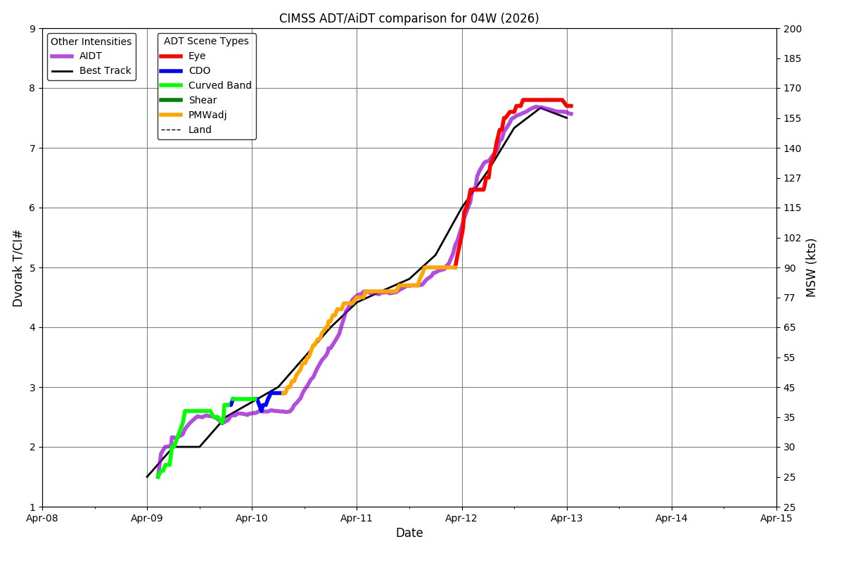
As far as intensity, automated satellite intensity algorithms show that the typhoon has likely leveled off at its maximum intensity, and the Joint Typhoon Warning Center noted in its most recent discussion signs that the typhoon was beginning to undergo an eyewall replacement cycle. This means that Sinlaku will likely be somewhat weaker than its current extreme intensity when it passes through the Marianas, but is still expected to have winds of 140-150 mph.
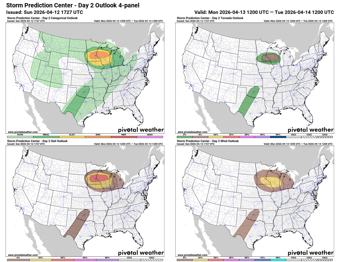
Stateside, an active early season severe weather risk day is anticipated on Monday in the Upper Midwest. An enhanced (level 3 of 5) risk of severe storms is in place, as supercell severe storms with the potential for very large hail and possibly tornadoes are expected to move east across the region.
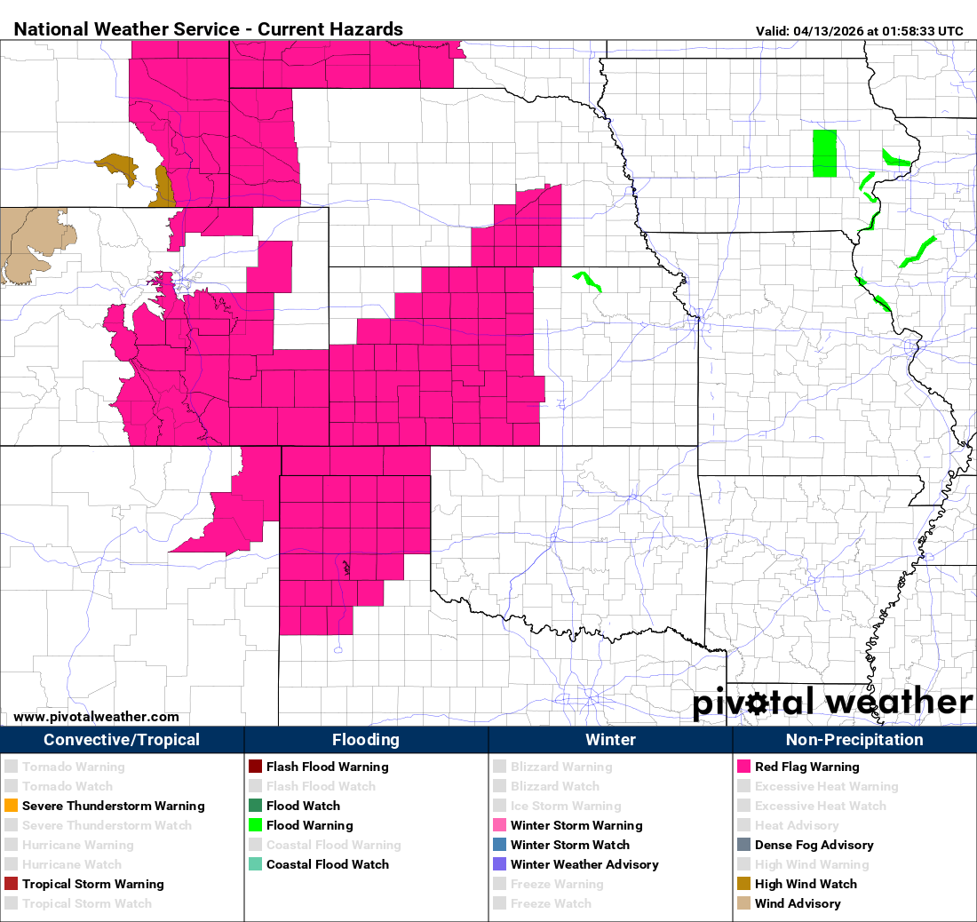
This severe weather threat to start the work week will be followed up by multiple days of potential severe weather over parts of the Southern Plains through the Midwest and Great Lakes. Additionally, fire weather will be a concern through the middle of the week across portions of the central United States, where red flag warnings are in effect. Wildfire risk will also likely be a concern over parts of the East as the week goes on with ongoing drought, several days of near record warmth, and occasional periods of breeziness.

Leave a comment