Tornado outbreak in progress
This visible satellite loop from College of Dupage weather with GOES lightning data does a good job of showing the overall picture here at mid-afternoon.
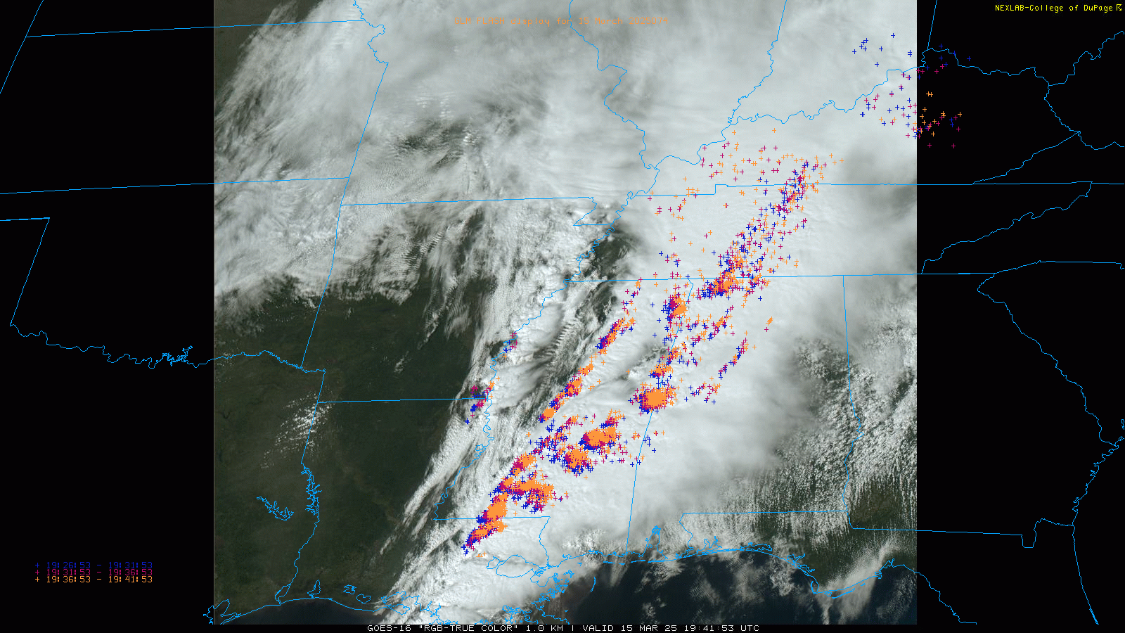
Several intense, discrete (individual) supercell thunderstorms are lined up from extreme west central AL down to just northwest of New Orleans metro area. There have been a number of tornadoes with these storms this afternoon – including likely a few significant tornadoes. Significant damage has been reported near Taylorville and Tylertown in Mississippi.
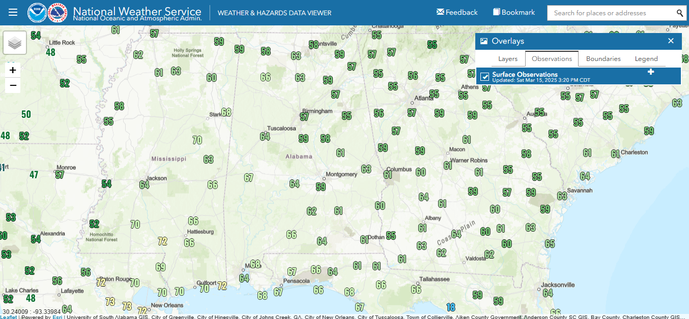
The overall atmospheric setup generally favors the axis of most intense storms only slowly shifting east over the next few hours. This plot of low level dewpoints shows that moisture has been struggling to get into the eastern half of Alabama as dewpoints remain below 60F. The models have shown this fairly well – and the NSSL Warn-on-Forecast model has done a good job today in keeping the focus for tornadic storms locked in east and southeast Mississippi and far western Alabama. These models imply that after about 6 pm better moisture will finally start to return into the areas east of I-65/I-59 and conditions will likely become more favorable for severe weather.
So the overall forecast evolution still remains as expected and SPC’s mid-afternoon update is still very similar other than bringing the high risk a little southwest into far south-central Mississippi to account for recent trends.
We continue to have a live severe weather chat ongoing on Substack Chat for all subscribers given that we are still testing out our processes. Feel free to join at the button below and ask questions!

Leave a comment