9 pm CT: Not over yet
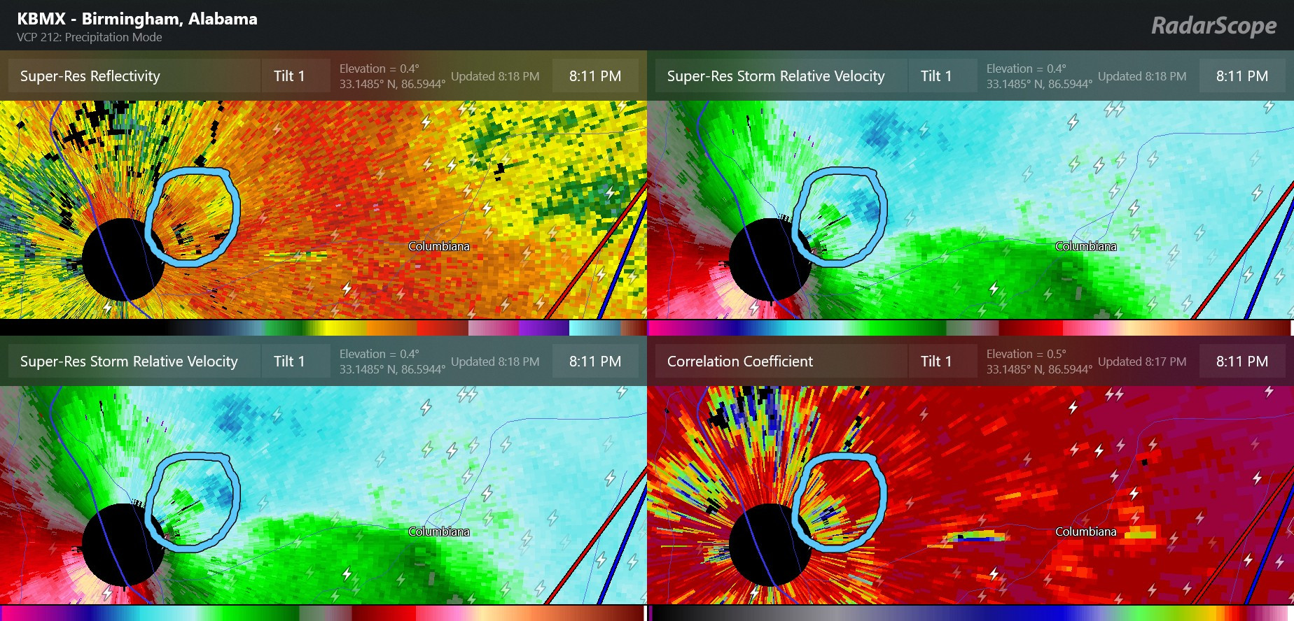
Let’s start out by looking at what has been happening this evening and how the overnight looks. After a bit of an late early evening lull, severe activity has been increasing again the last hour or two. A likely significant tornado passed very close to the NWS Birmingham (which is actually in Calera) around 8 pm CT; as you can see in the image below it passed through the extreme eastern edge of the KBMX radar “hole” which is the very small area around the radar that is too close for data to be collected. Lofted debris from the tornado is indicated by the circle blue area in the lower right hand radar image (correlation coefficient product).
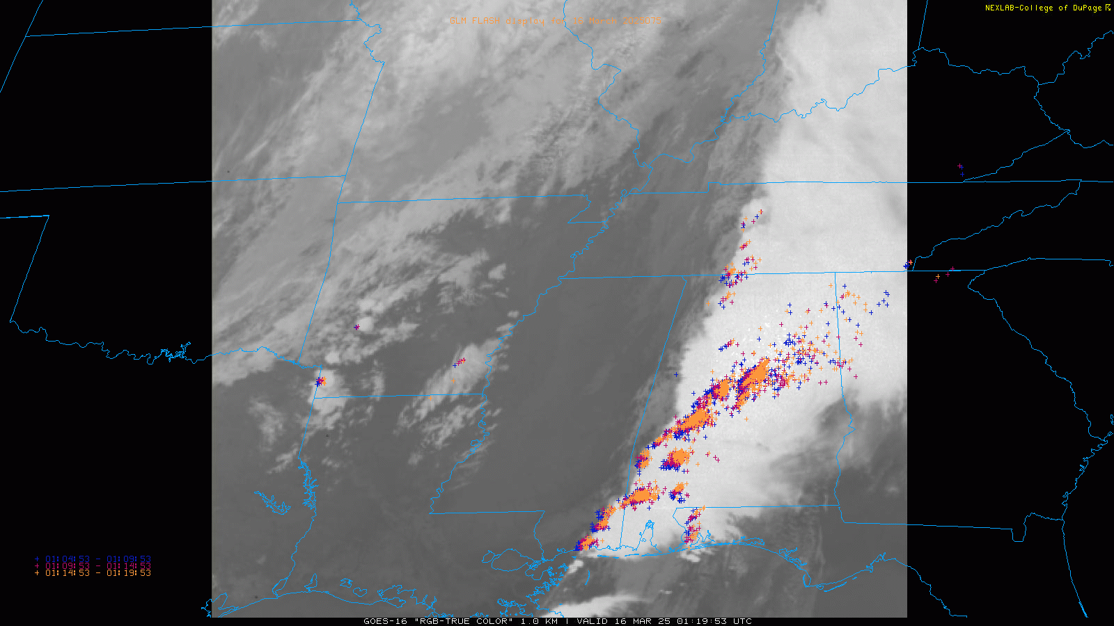
Looking at the evening satellite and lightning data, the storms appear to be becoming more discrete (individual) again, and several of the storms are now tornado warned. Another impulse in the mid and upper levels of the atmosphere is approaching from the west as shown by new storms developing in the Arklamiss area, and this impulse will likely support further intensification of the storms.
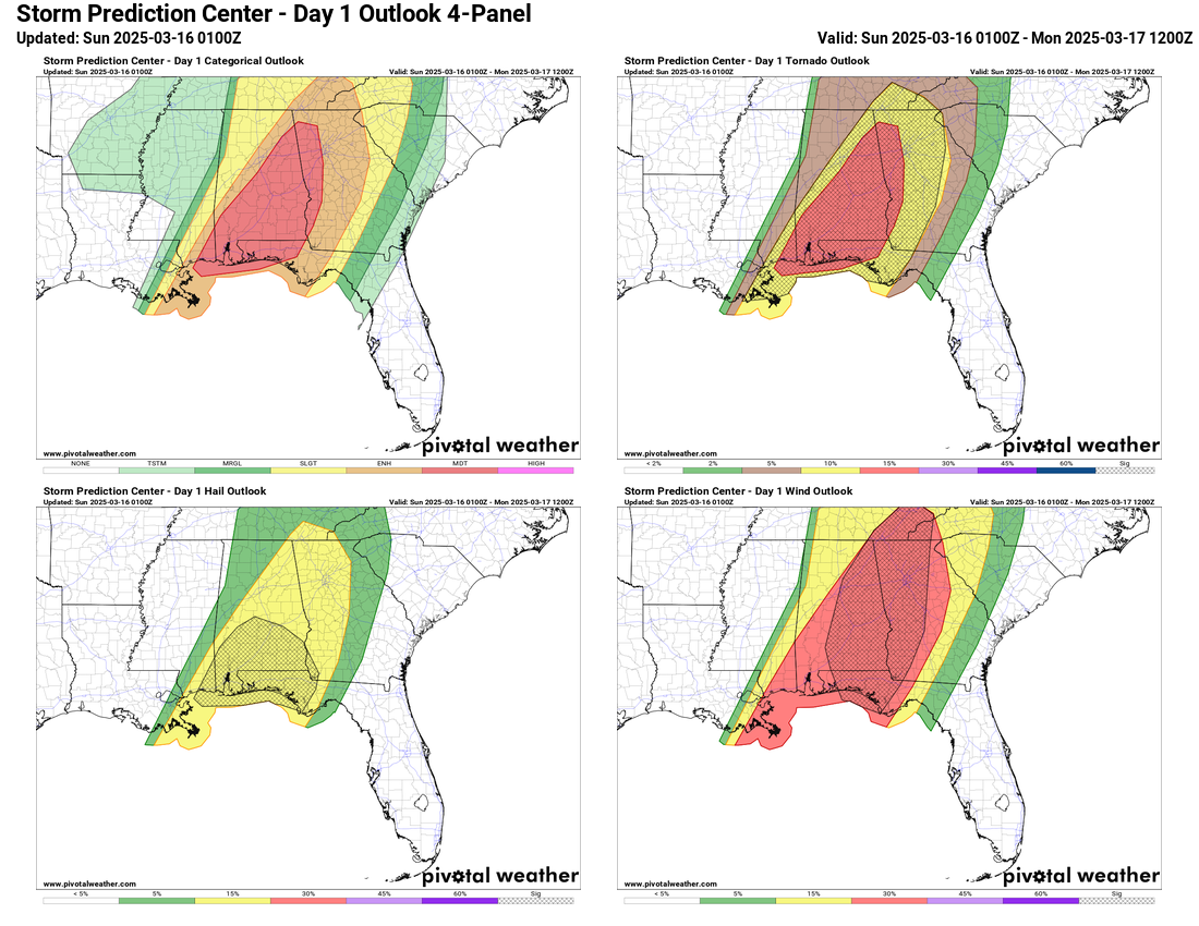
The overall atmosphere is still VERY favorable for significant tornadoes; current values for the significant tornado parameter, which measure both the instability of the atmosphere and the wind shear that provides a favorable environment for tornadoes, is shown in the image below. Values above 5 are indicative of potential for strong/violent tornadoes.

A moderate risk (level 4 of 5) remains in place from SPC along with tornado watches for much of Alabama; while the watches are no longer “particularly dangerous situation” watches, they still include the risk of intense tornadoes. Bottom line: strong/violent tornadoes remain very possible tonight across much of Alabama into western Georgia and parts of the Florida Panhandle, and people in these areas should have a way to receive warnings overnight.
Recapping Today
Several significant tornadoes occurred today across Mississippi and Alabama.
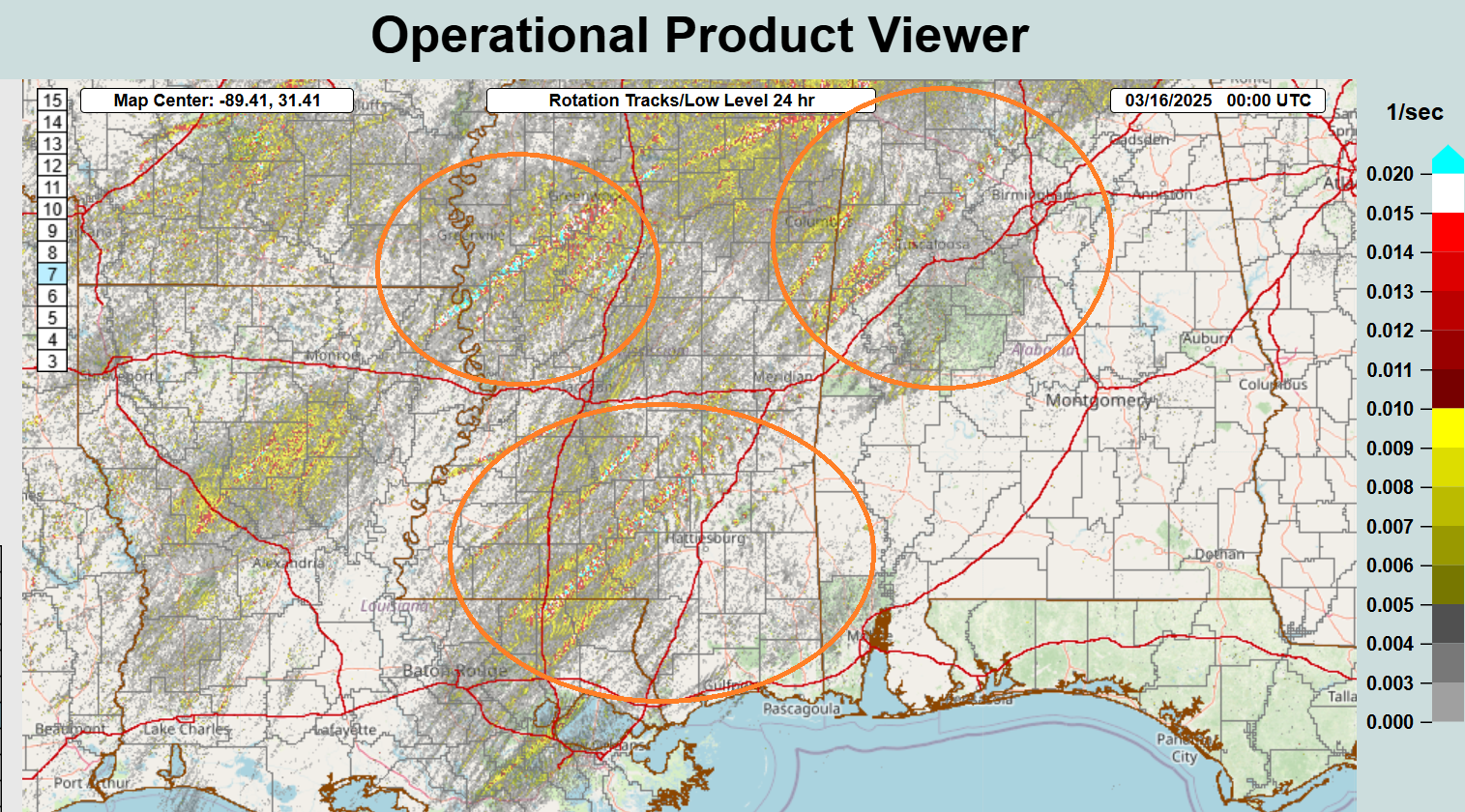
This graphic is the MRMS Rotation Tracks product, showing the paths of low level rotation from the various supercells that occurred today. The storms today occurred in 3 main areas and waves. The first was over the Mississippi Delta where a persistent rotating storm moved through in the mid to late morning, and produced a likely tornado near Grace in Issaquena County, MS, where injuries were reported.
The second area was over southern Mississippi and extreme eastern Louisiana, where numerous strongly rotating supercells moved through over a period of several hours from late morning through mid afternoon. Several significant tornadoes likely occurred in this region, with the most intense damage occurring near Tylertown, Bassfield, and Taylorsville in Mississippi. While the extent of damage and injuries will not become clear until tomorrow, several fatalities and numerous injuries have been preliminarily reported from these storms.
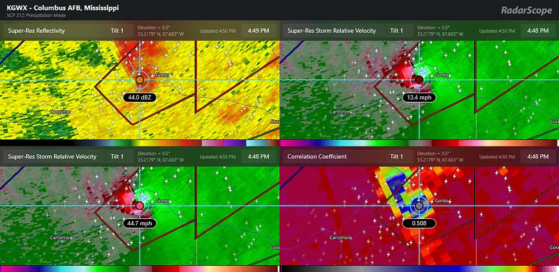
The final area was in northwest Alabama where several tornadoes occurred in the mid to late afternoon, the most intense of which was near Gordo. As shown below, radar showed indications of a very intense tornado with strong rotation (upper right hand corner) and a large area of lofted debris (lower right hand corner). Debris was detected up to 20,000 feet in the atmosphere, also indicative of a very intense tornado.
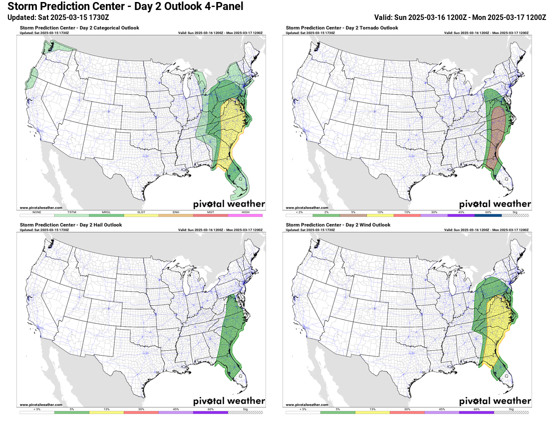
Sunday Severe Weather Risk
As this whole system continues east Sunday, the risk of severe weather will continue. While not as extreme a risk as the last 48 hours, there is still a slight risk (level 2 of 5) for the mid-Atlantic region into northern Florida as shown below. Evening high resolution models are showing a favorable environment for rotating storms in the slight risk area, so at least a few tornadoes are possible. More on this risk in our Sunday morning update.

Leave a comment