March 19
Before I talk about today’s shenanigans, I want to take a minute to talk about yesterday. Yesterday was another crazy day for wind, dust and wildfire in the southern Rockies and Plains, and this satellite loop posted by Albuquerque broadcast meteorologist Grant Tosterud is just a mesmerizing summary of what evolved.
You can literally see the dust lofted into the atmosphere by the strong winds, and can see the distinct difference between the browner dust and the white sand being picked up from White Sands NP in southern New Mexico. Unfortunately, all of this had societal impacts on the grounds, as visibilities near zero at times caused traffic accidents and highway closures, and wildfires caused evacuations in New Mexico.
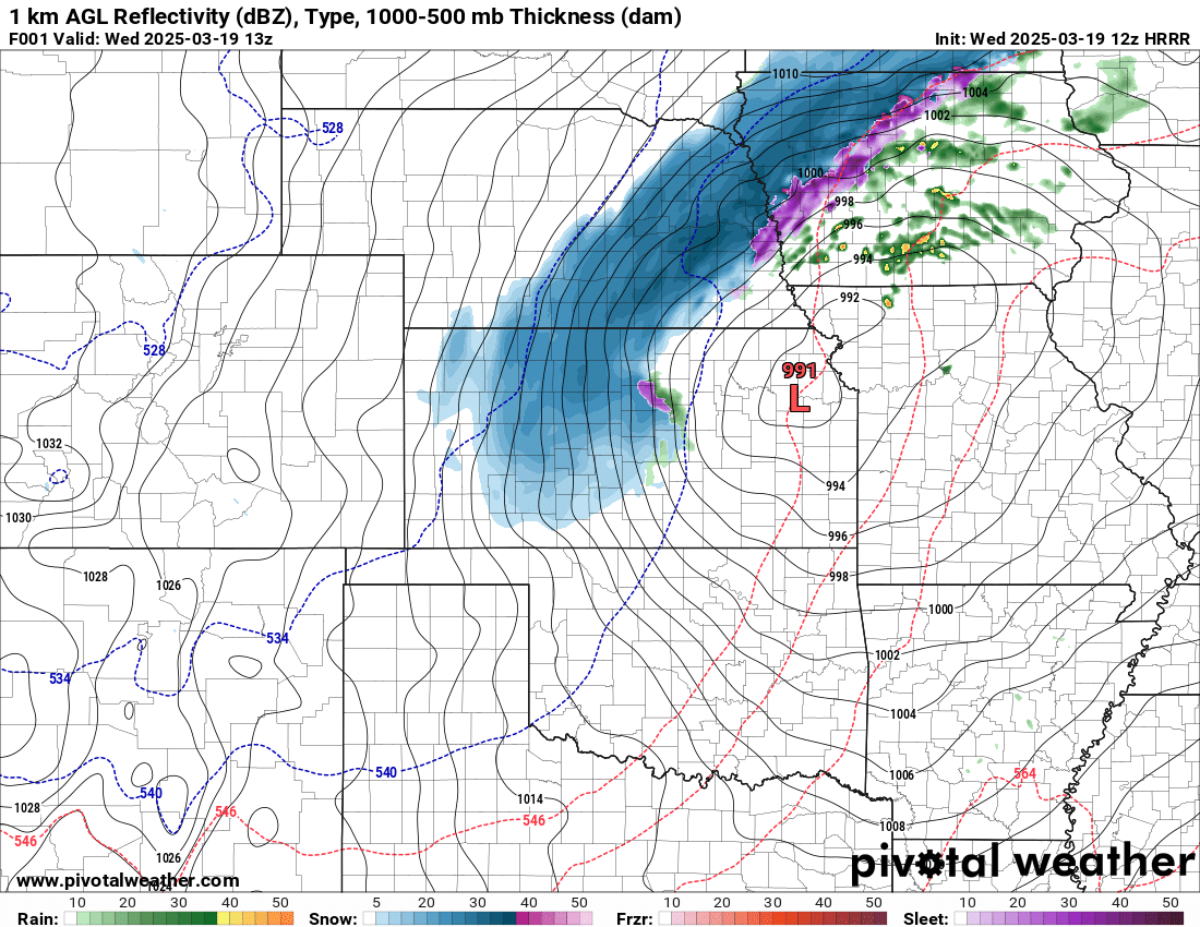
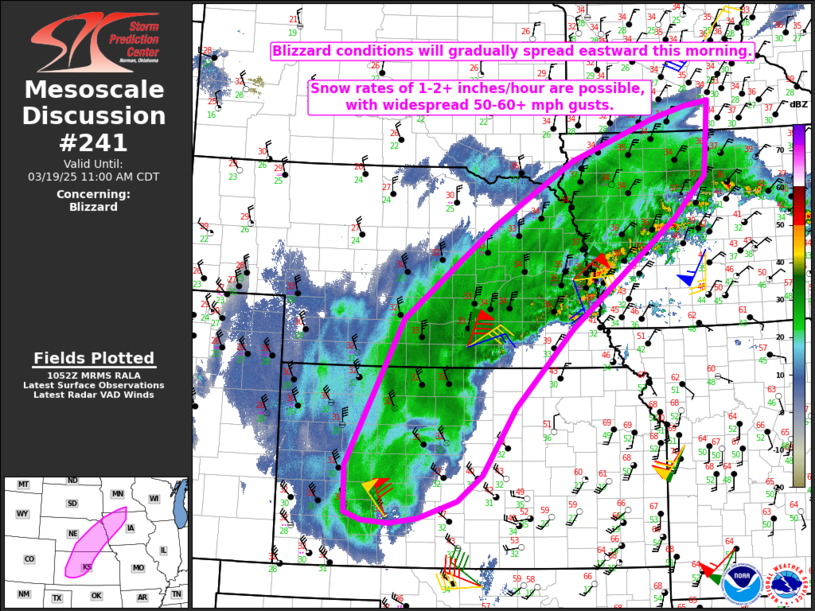
The strong low pressure system responsible for all of this has moved to the general vicinity of Kansas City, and is spreading a swath of heavy snow and high winds across parts of Kansas, Nebraska and Iowa – widespread 50 to 60 mph gusts – resulting in blizzard conditions. Travel not recommended in this area as highlighted below by a recent Storm Prediction Center mesoscale discussion.
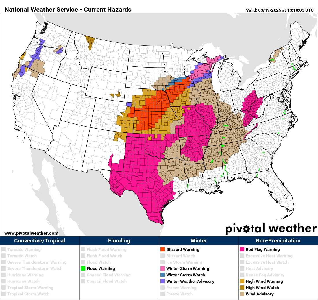
Along with the blizzard warnings in this area, winter storm warnings are in effect farther northeast (shown above) as heavy snow and winds (just not quite as strong as farther southwest) will create very difficult travel. Strong winds surrounding the strong low pressure system will cause issues with travel, downed trees, etc., and wind advisories and high wind warnings are in effect for much of the Midwest and mid-South. While fire weather conditions will not be as extreme as seen over the southern Rockies and Plains yesterday, strong winds combined with dry vegetation is resulting in Red Flag Warnings for fire danger over large areas of Texas, Oklahoma, the mid-Mississippi Valley and mid-South, and in parts of Ohio and West Virginia.

Some of that dust is also still caught up in the system as you can see in this early morning visible satellite image from eastern Missouri down into Texas, and that will spread east as well.
Severe weather risk for Midwest today

As we’ve discussed in the last couple of days, there will not be as widespread of a risk of severe thunderstorms with this weather system as the one last week, but that does not mean there is no risk. Recent forecast trends now show that just enough low level moisture is likely to get far enough north to near the track of the intense low pressure system to result in a narrow favorable area for severe storms. I’ve highlighted in the above instability forecast from this morning’s high resolution rapid refresh (HRRR) the area which is forecast to become unstable enough by early to mid afternoon to support severe thunderstorms just ahead of the cold front associated with this intense weather system.
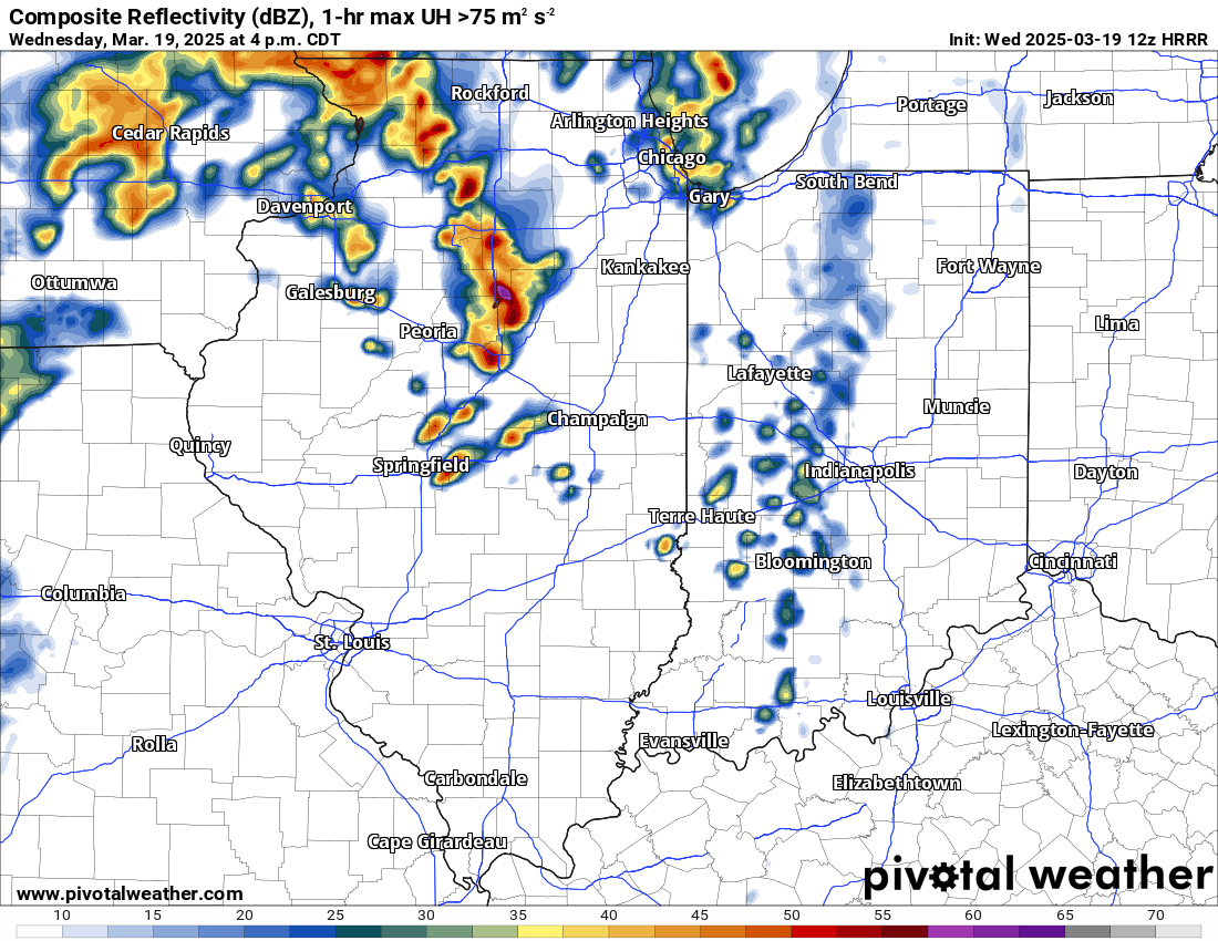
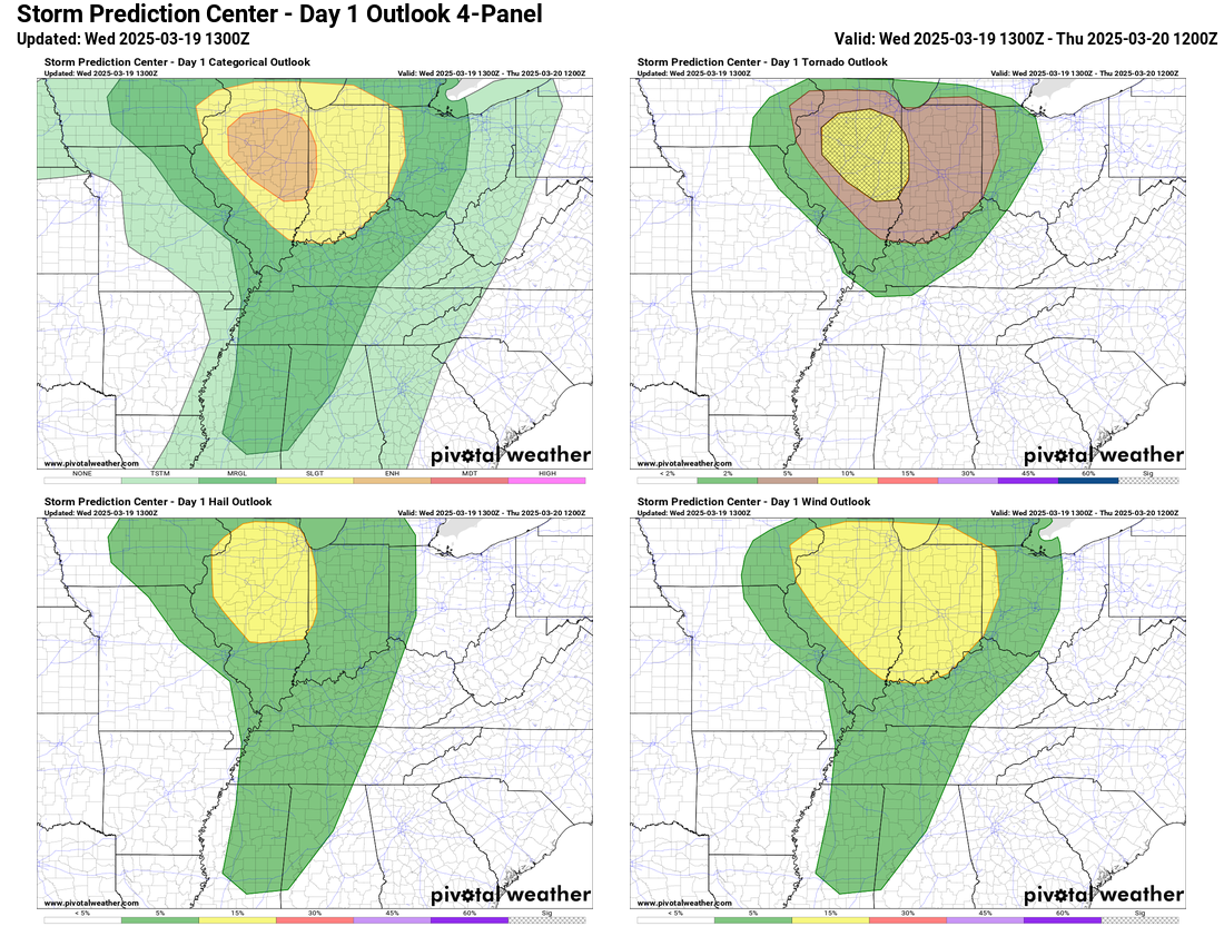
This image from the HRRR model gives an idea of what the radar could look like at 4 pm CT with a band of low-topped (not as deep into the atmosphere as big severe storms like the south had Saturday, but still intense) supercell storms moving across northern and central Illinois. While the unstable air will be somewhat limited, with intense forcing from the upper level system and strong wind shear in the atmosphere, conditions will be favorable for these supercells to potentially produce tornadoes, and as a result SPC has outlooked parts of Illinois into western Indiana for an enhanced (level 3 of 5, see below) risk of severe storms, primarily for the risk of tornadoes, a few of which could be EF-2 or greater.
I’ll provide updates later today via Substack notes and, if conditions warrant, special posts and possibly a chat. Again, given I’m still experimenting with Substack’s features, all of this will be available for all subscribers. I also post updates on my BlueSky social media account.
Again, after today, we’ll have quieter weather for the next couple of days; this system will move east through the eastern seaboard with showers/storms on Thursday but as of now, the severe weather risk looks minimal.

Leave a comment