March 20
Good morning! Let’s start off with a recap of yesterday.

As anticipated, a band of severe storms developed over northwest Illinois and swept east across Illinois and Indiana. There were a few reported tornadoes in central Illinois – and even though the map doesn’t show it yet, there were reports of wind damage in eastern Illinois and Indiana that NWS surveys will likely confirm later as tornadoes. There were quite a few wind damage and hail reports along the Ohio River as well from the band of severe storms.
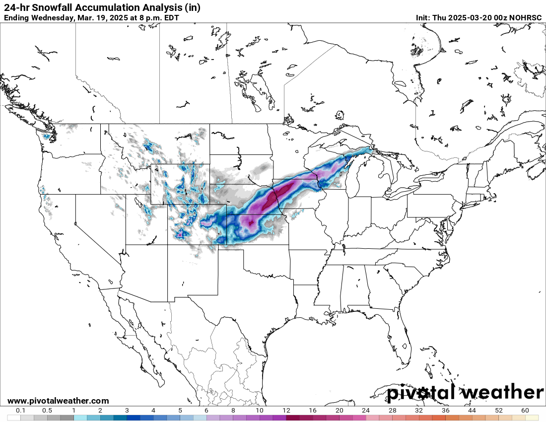
On the wintry side of the storm system, a band of heavy snow – with high winds gusting to over 50 mph causing blizzard conditions – occurred from Kansas northeast into Wisconsin. The heaviest band with 12 to 16” was in eastern Nebraska and western Iowa including the Omaha metro area. At the blizzard’s peak, nearly 100,000 customers in this region were without power; as of 9 am CT this morning, nearly 50,000 customers in Nebraska were still without power per poweroutage.us.
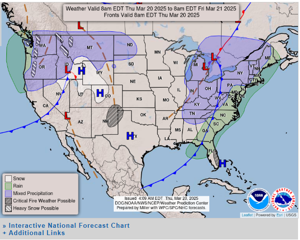
Conditions will overall be quieter today. Yesterday’s system will push through the eastern seaboard region with showers/storms along the mid-Atlantic to northern Florida, as well as some pockets of mixed wintry precipitation in the Great Lakes and Northeast. Another weather system will be pushing into the Pacific Northwest and Northern Intermountain region with some rain and snow as shown above.
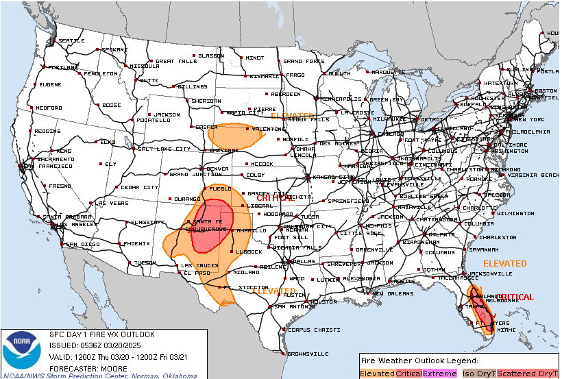
SPC’s fire weather outlook for today does show a few areas of concern. One is in the southern Rockies/Plains where gusty winds and low RH will occur in areas which have already been dealing with wildfires over the last week. Another area of concern is in Florida.
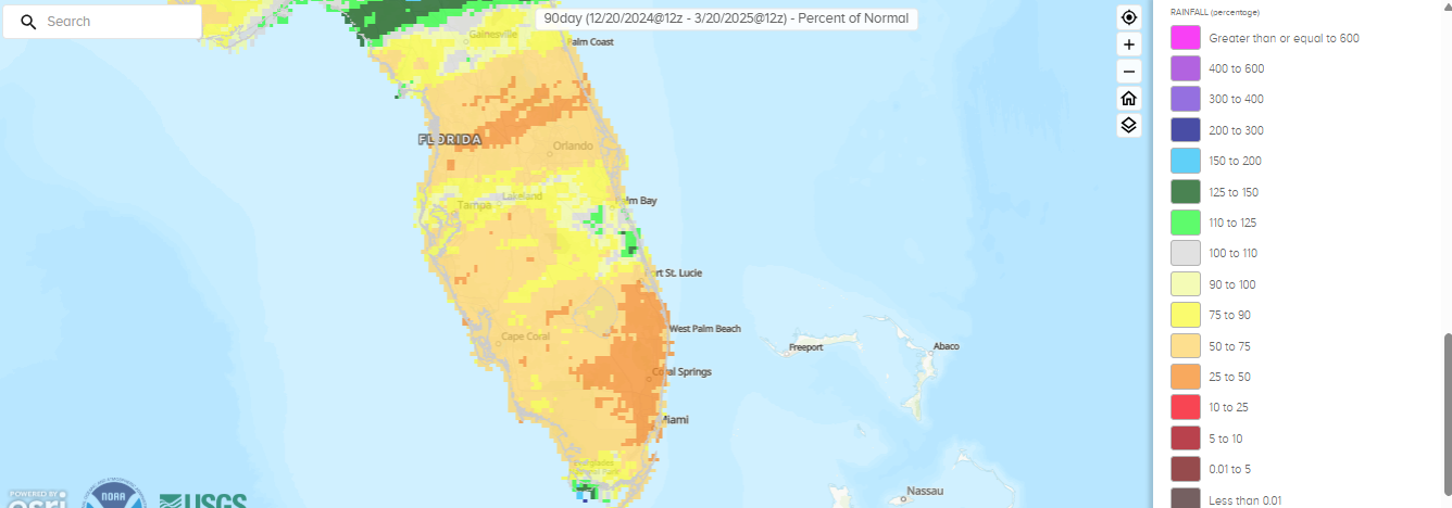
The winter dry season has been particularly dry across much of Florida; the map above shows the percent of normal precipitation for the last 90 days, and you can see much of peninsular Florida has been well below normal. That could set the stage for a more active spring fire weather season for Florida depending on how the weather pattern sets up over the next several weeks. For today, gusty west winds and relative humidity values bottoming out at 20 to 30% this afternoon will result in critical fire danger.
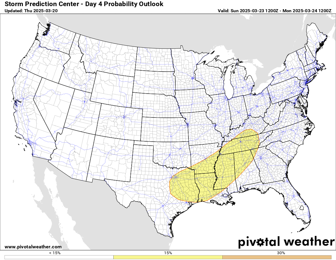
The next weather system will be moving from west to east across the country this weekend, and it looks like it will bring a risk of severe weather from Texas northeast into the Tennessee Valley on Sunday. Right now, this looks like more of a “typical” March severe weather risk than what we saw last weekend, but there will be a risk of severe storms and a few tornadoes. We’ll take a deeper dive into that risk tomorrow.

Leave a comment