March 21
Since the weather today is at least a bit quieter than much of the last week, let’s start off with a few interesting items. First, for those that may have missed, the National Weather Service yesterday announced reductions in upper air weather balloon releases at several locations due to staffing shortages. You can read more about this decision and the potential impacts to weather forecasts and warnings in my full story here.
Interesting factoids continue to arise from the major weather system last weekend. The NWS in Jackson discovered a location in Covington County, MS that got hit by two separate tornadoes in a period of 41 minutes during the rash of tornadic supercells in southern Mississippi last Saturday. Their excellent Facebook post shows an aerial view of the location and radar images where you can see the two tornadic debris signatures move over the same spot. Another NWS Jackson Facebook post highlights a measured 94 mph wind gust that occurred last Friday night at a Delta Agricultural Weather Center Site in Sidon, MS when a tornadic supercell passed over it.
Weekend Weather

While the weather is relatively quieter compared to the last week, that doesn’t mean there isn’t some active, hazardous weather happening. Three separate weather systems are affecting the northern half of the country today as seen in the weather map from the NWS Weather Prediction Center above. The most impactful system is the one in the Northwest which is causing heavy mountain snows.

While fire danger is also not as high today as in the past week, gusty March winds and dry conditions are still creating conditions favorable for rapid fire growth in a number of areas where Red Flag Warnings (warnings for hazardous fire weather conditions) are in effect as seen above. The worst conditions are expected in central Texas where SPC has outlooked a critical fire danger area.

As the Pacific Northwest system pulls out into the Plains on Saturday, strong winds and dry conditions will result in more fire weather concerns in the Plains and southern Rockies. Southern New Mexico and western Texas – which have seen issues with wind and fire danger multiple times this month – will likely have the strongest winds and driest conditions as seen in the SPC fire weather outlook above.
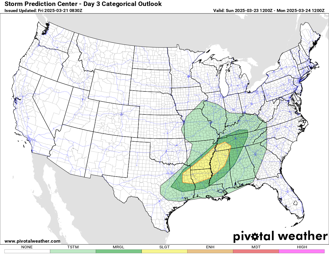
As this weather system moves farther east, it will begin to encounter some Gulf moisture return, supporting the development of thunderstorms starting late Saturday but especially on Sunday. Moisture return will be somewhat limited and the track and intensity of this system are not conducive to a large scale severe weather outbreak. Still, there will an area with sufficient instability and wind shear to support a risk of severe storms over the Arklatex and lower Mississippi Valley Sunday. As noted by SPC in their discussion, while conditions may support a tornado or two, wind damage and hail appear to be the primary risks with these storms. We will have updated info on this risk in Saturday’s newsletter.

Leave a comment