March 24
Sunday Weather Recap
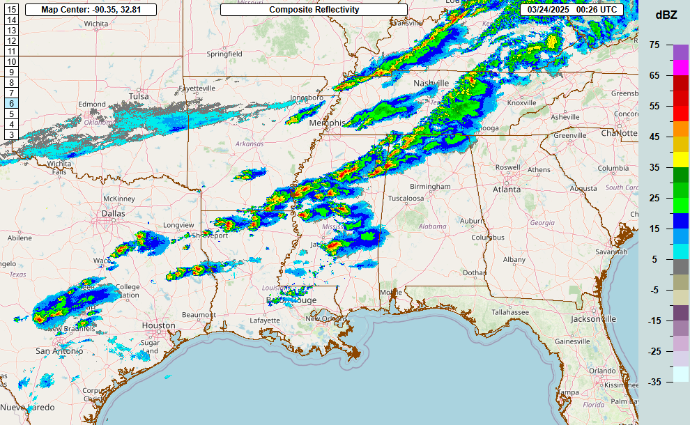

Let’s start the week off with a recap of Sunday’s severe weather. As can be seen on the evening radar above, scattered supercells developed yesterday evening from middle Tennessee to central Texas ahead of a southeast moving cold front. As anticipated, large hail was the main threat with these storms as there were nearly 100 reports of large (1” or greater) hail. There were a few reports of 2” or greater hail; the storms over central Texas produced the largest hail with some reports of tennis ball to baseball sized hail around Kerrville. As of now the only tornado reported was a brief tornado near Rolling Fork, MS which produced some damage to a home. The storms did evolve into more of an band/line of storms as the night went on, and a cluster of more organized storms produced some high winds and wind damage in southeast Texas early this morning, including a couple of measured 70 mph wind gusts.
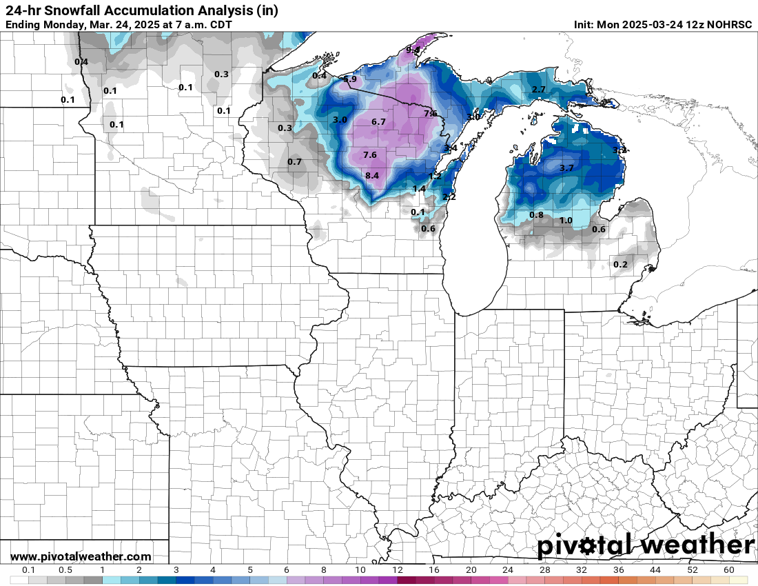
Sunday’s storm system also produce heavy snow over northern Wisconsin and the Upper Peninsula of Michigan, with an area of 6-9” totals.
This Week’s Weather
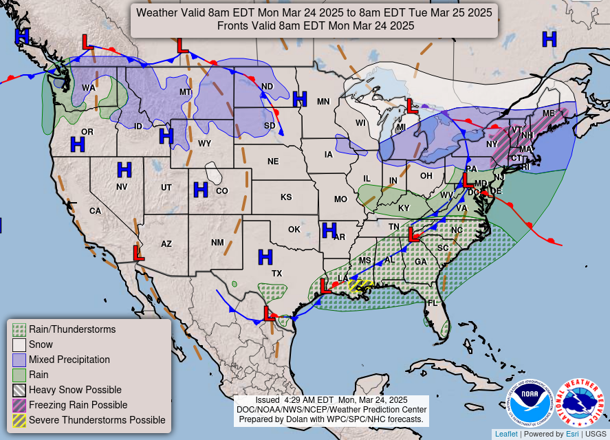
The storm system that produced the severe and winter weather yesterday will continue to shift east and southeast today. Some wintry precipitation, including areas of freezing rain, will affect the Great Lakes and Northeast, while showers and storms will occur from the mid-Atlantic to the Southeast. A few severe thunderstorms will occur along the remnant band of storms from yesterday, and in fact a severe storm has already produced a measured 78 mph wind gust at the official NWS observing site at Baton Rouge airport earlier this morning.
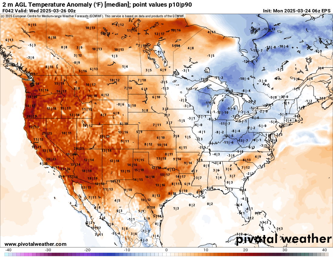
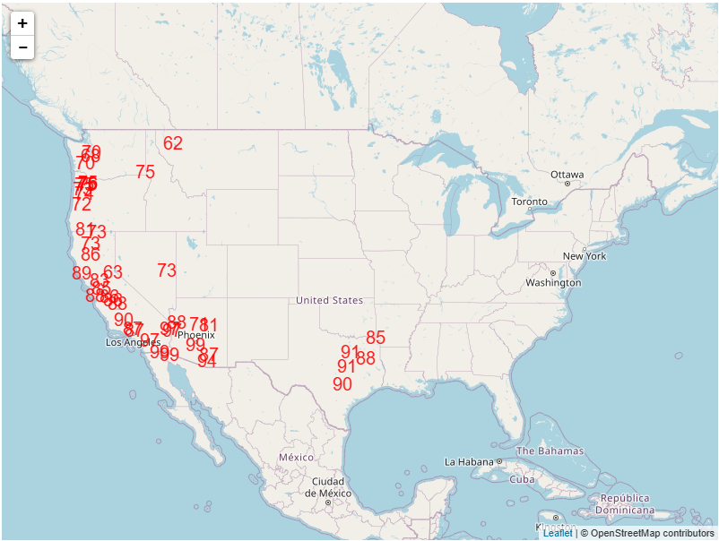
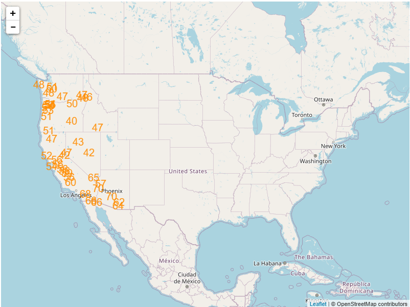
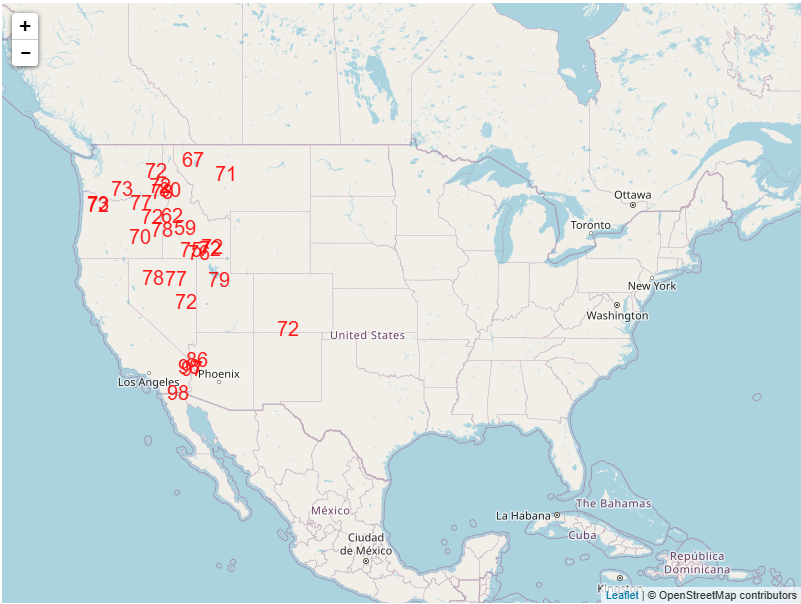
After today, the big weather story for the next few days will be record warmth for the western and southern U.S. Temperatures as much as 25 degrees F above normal will spread from the West Coast today east across much of the western two-thirds of the country by midweek. Numerous locations are expected to threaten or break record warm temperatures – both maximums and minimums – across the region Tuesday and Wednesday as shown on the maps below.
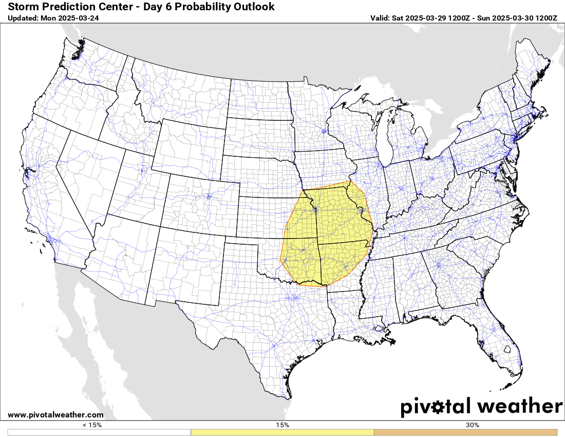
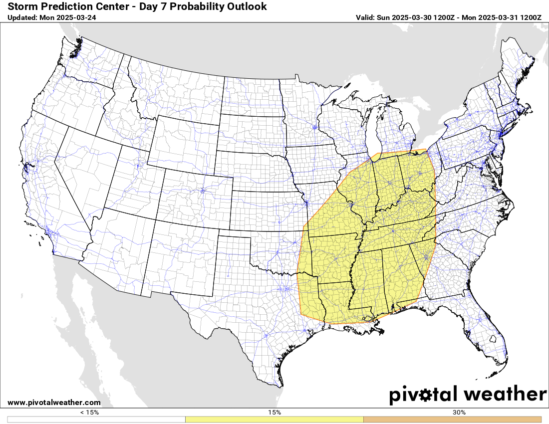
The upper level weather pattern supporting these record temperatures will be relatively short lived, however, and by late in the work a new series of storm systems will start to move into the western U.S., with heavy rains and snows in the Northwest. By next weekend, this pattern will begin to support an increasing risk of severe weather in the middle part of the country, and SPC has already outlooked areas of severe weather risk for next Saturday and Sunday as shown below. We will talk more about these threats as the week goes on.
US Drought Status

Given that record warmth is going to be a big weather story this week – and given all of the fire weather and dust storm issues we have had over the last couple of weeks – I thought it would be good to take a look at where we stand as far as drought heading into the start of the spring season.
37% of the country is currently in drought, which if you look at the time series for the last 4 years is about where we have been running much of that time; for some perspective, the highest national drought extent since 2000 is 55%. The part of the country most impacted by drought currently is the Southwest, which is the only area of the country currently suffering any exceptional (D4) drought, the highest level of drought. This includes southern New Mexico into southwest Texas, which is one of the areas that has been impacted by dust storms in the last couple of weeks. Moderate to severe drought extends northward from southern Texas across much of the Plains region, and into the upper Midwest and Great Lakes.
Along with the direct negative societal impacts that drought has, drought can also have meteorological impacts that forecasters have to take into consideration as far as both short term and long term forecasts. An old forecaster’s adage is “drought begets drought,” meaning that once drought conditions are established, the lack of moisture in the impacted region can help reinforce the established drought conditions. Drought conditions can also have an impact on temperatures, as dryness can contribute to larger diurnal temperatures swings, potentially meaning warmer temperatures during the day and cooler temperatures at night.
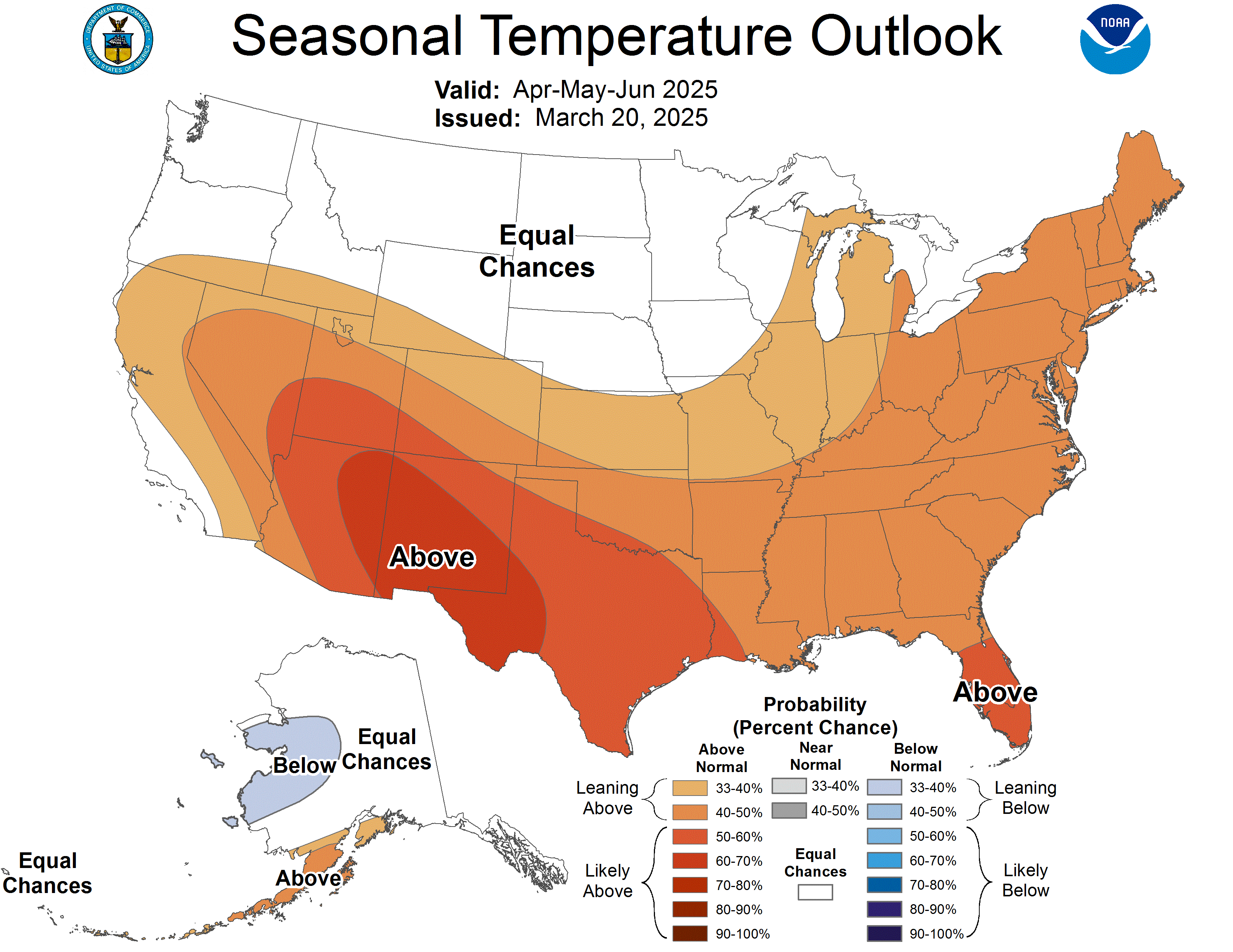
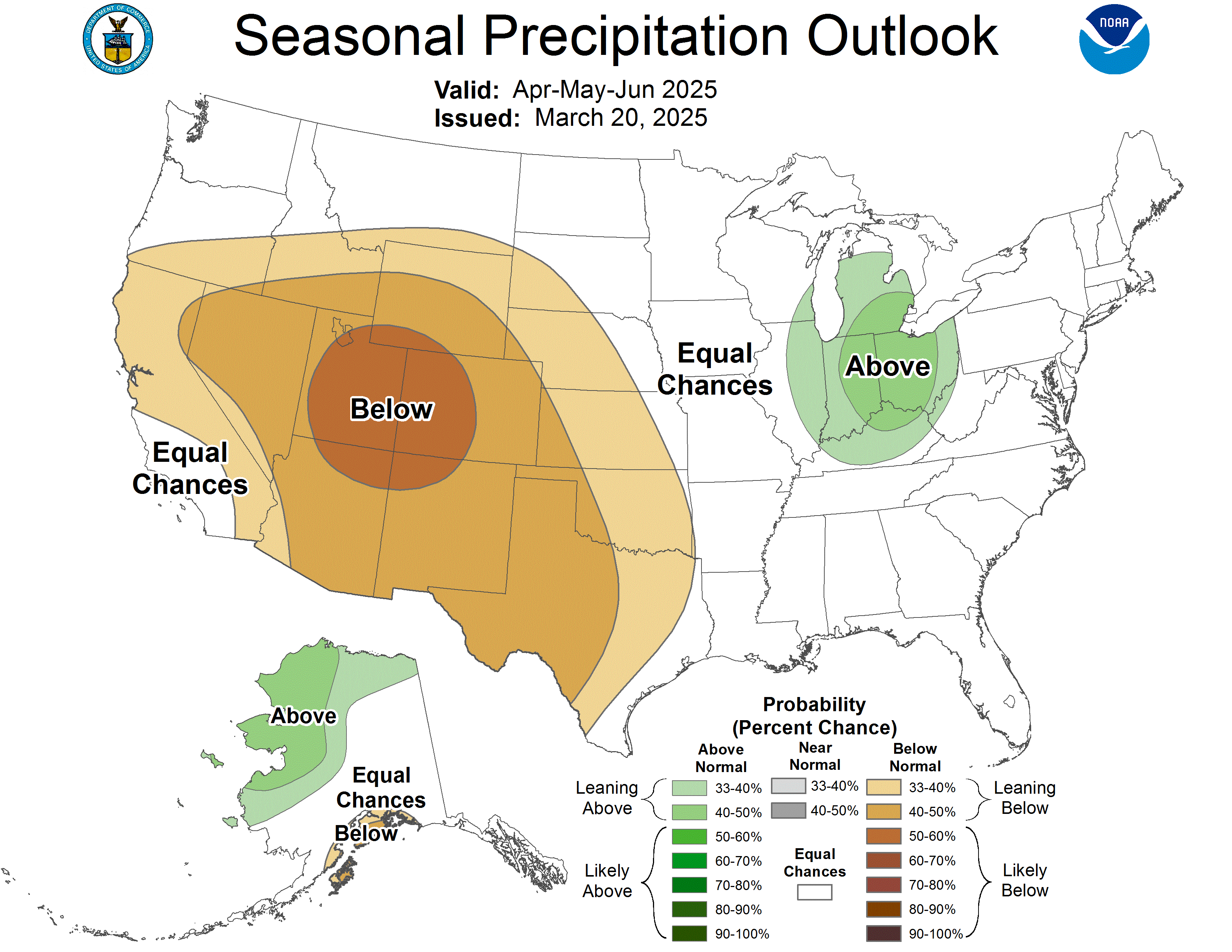
The three month outlook for April through June isn’t particularly promising for a lot of the drought affected areas, with higher probabilities of above normal temperatures and below normal precipitation. This implies the potential for worsening drought conditions in many areas. Many locations in the southwest United States have had brutal summers the last two years. For example, Phoenix had its hottest summer on record in 2024, after having its hottest summer on record the prior year in 2023. Phoenix has finally had some decent rain this month (0.84”, slightly above normal month to date) but is still only running at about 20% of its normal water year rainfall (water years run October 1 to September 30). The heat and drought in the Southwest will be a story to watch as head through spring and into summer.

Leave a comment