March 27
Good morning! Starting off today taking a look back at the storms and warmth in the Northwest yesterday.
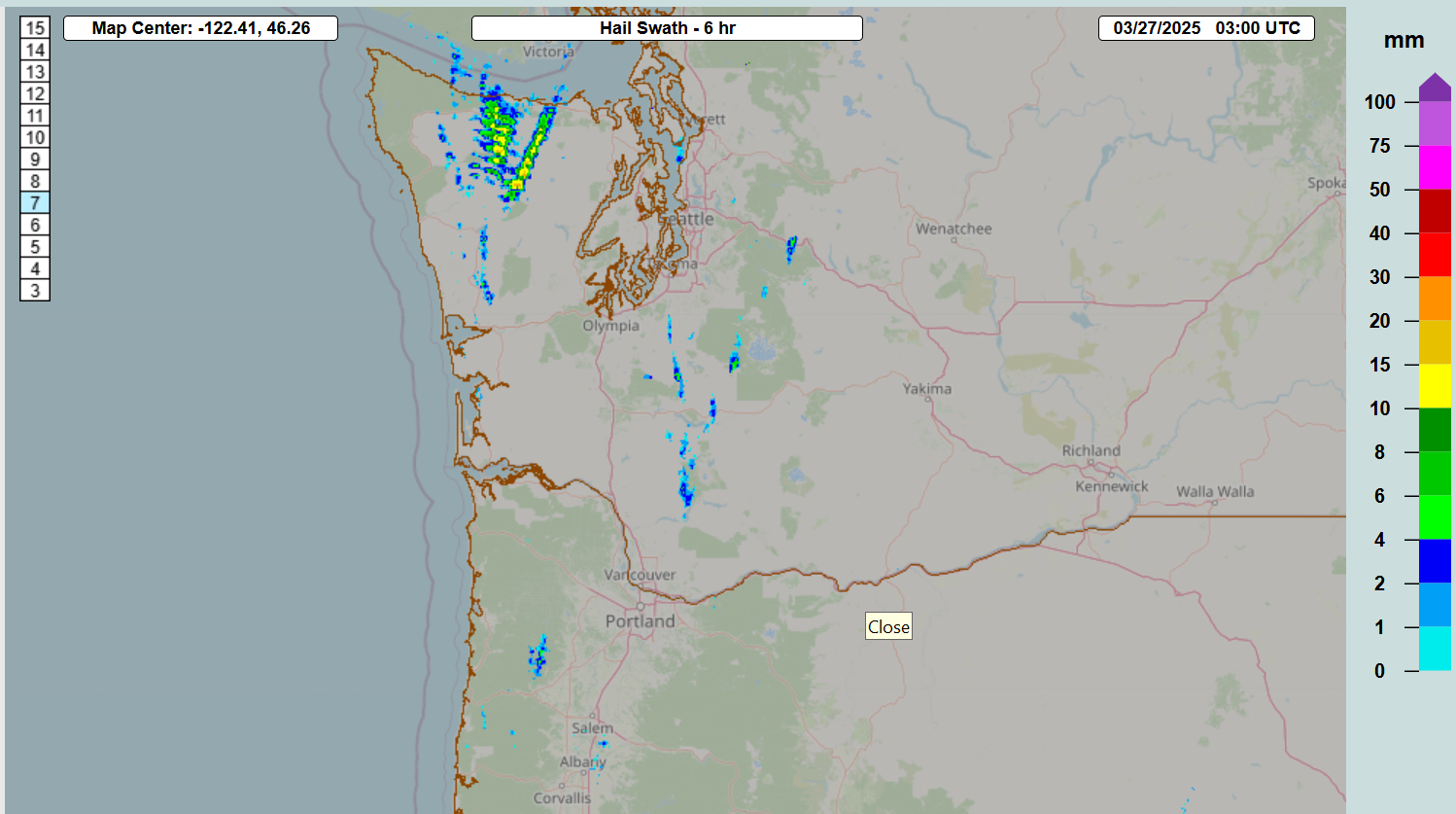
As far as the thunderstorms in the Pacific Northwest, they definitely underperformed compared to the potential we talked about the last couple of days. The chart above is the MRMS swath of maximum hail size as estimated by radar, and while there were numerous thunderstorms across the region with a few reports of small hail, the more intense supercells with larger hail potential that were a concern did not materialize.


A very quick post-mortem analysis of the event revealed several potential issues; an obvious one was that low level moisture appeared somewhat overforecast by most of the forecast models, resulting in the actual atmosphere not being as unstable as anticipated. In the images above, the top image is an 18 hour forecast of surface dewpoint from the HRRR for 5 pm PT Wednesday, and the bottom is the observed analysis for the same time. As you can see the model forecast had a significant area of lower 60s dewpoint values forecast across western Washington and in the Portland metro area that did not actually occur in the observed atmosphere at that time.


Another potential issue was with the mid and upper level forcing and wind shear supporting the thunderstorm activity. Discerning this is a bit more subtle, but looking at the 500 mb (~18K ft AGL) weather feature, the 18 hour forecast above suggests stronger forcing than what is implied by the observed chart below. The trough of low pressure in the forecast chart looks at bit sharper and is bit farther east; you can see that the stronger winds as shown by the red/orange colors do not extend quite as far east into Oregon in the bottom observed chart as the forecast chart shows. To me, this implies that the mid level system was a bit weaker and delayed than the forecast models had shown, potentially resulting in less intense storms.
Some deeper analysis is certainly warranted, but the extreme rarity of 2” hail as shown by the climate records shows that you need a near perfect setup in this region to get the supercell storms needed for large hail. The strong model consensus (I showed the HRRR in my post-mortem above, but the other high resolution models also showed supercells with large hail potential) and overall synoptic setup to me certainly justified the forecast, but whatever the exact reasons, there was obviously enough of a difference between the modeled atmosphere and the real atmosphere to keep the supercell storms from occurring.
Where the forecast in this region did work out well was the forecast of record warmth. Numerous record high temperatures were set again on Wednesday. The most impressive was probably Portland setting a new March record high of 82F, which also broke the daily record by an incredible 9 degrees.
Upcoming severe and flash flood risks

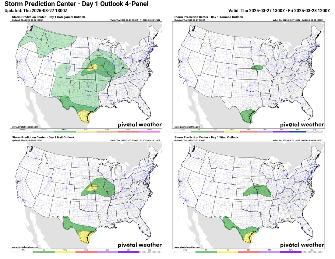
A slow moving disturbance in the southern branch of the jet stream will produce numerous showers and thunderstorms in Deep South Texas today. Given the potential for several inches of rain in just a few hours due to repeat storms, the Weather Prediction Center has a moderate (level 3 of 4) risk of flash flooding forecast for this area. Conditions also look favorable for a few storms to produce severe weather, so a slight (level 2 of 5) risk has been outlooked by SPC. A few severe storms are also possible today from the mid-Missouri to mid-Mississippi Valleys. An east-west stationary front will focus shower and storm activity in this area, and while conditions are not favorable for widespread severe weather, a few storms producing large hail are possible.

Both of these weather systems will only slowly shift locations on Friday. The south Texas heavy rainfall risk will become more focused along the immediate coast, while a second day of potential storms in the mid-Missouri and mid-Mississippi valleys could start to bring a few instances of flash flooding, resulting in a marginal (level 1 of 4) risk from WPC. Only marginal risks of severe weather are forecast by SPC.

The forecast models remain relatively consistent with the severe weather setup being shown for this weekend and early next week. Sunday into Sunday night still looks like the most favorable time period, and while the severe risk still looks to exist over a rather large area, it does appear like the focus for more significant, higher end severe weather may be in the Mid-South region. The weather pattern for next week beyond this system still looks quite active as well. Look for a special newsletter post later today or this evening in which I will be taking a deeper dive into the next 7 to 10 days and discussing our tools for forecasting severe weather in what meteorologists refer to as the medium and long range, i.e., days 4-8 and beyond.

Leave a comment