April 2
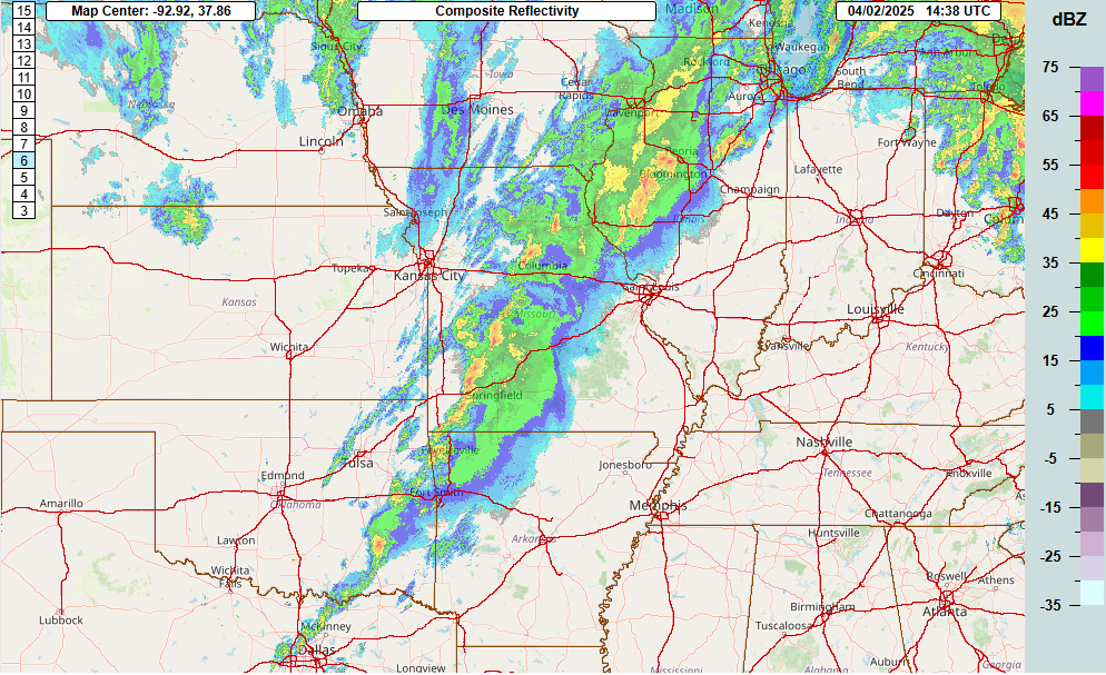
Welcome to Wednesday, the day that has looked like a severe weather outbreak for several days now. We start off the day with a band of strong to severe storms extending from northeast Missouri down to northwest of Dallas. This band evolved from an evening line of severe storms over parts of Kansas, along with a new band of severe storms that developed after midnight in Oklahoma after a couple of late afternoon Oklahoma supercells dissipated.
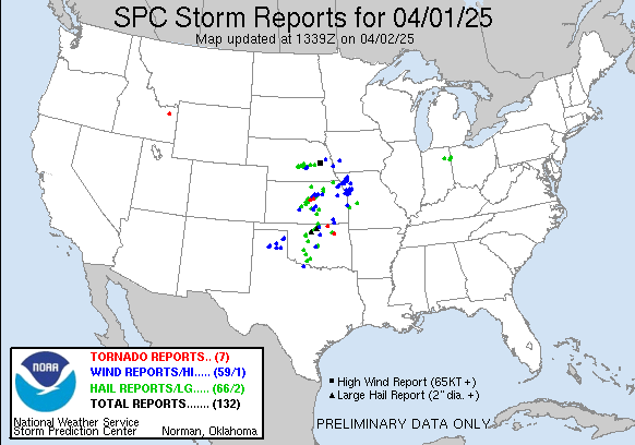
A number of reports of large hail and wind damage occurred with the Kansas and Oklahoma storms, with a number of reports of wind damage as the storms moved into the Kansas City/St. Joseph Missouri areas. Early this morning a couple of tornadoes were reported in the Tulsa area, and between 7:30 and 8 am a tornado moved through Nevada, MO causing damage.
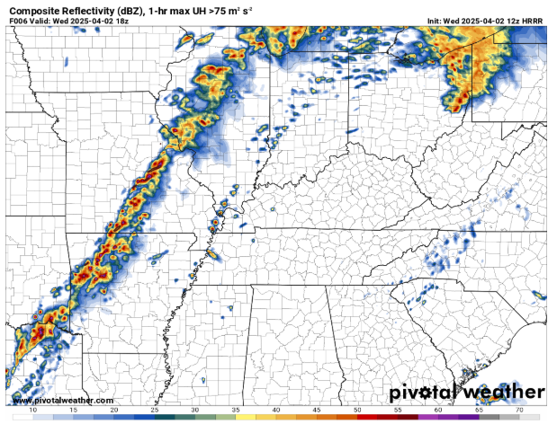
While unlikely to be exactly right, this 6-hour forecast of radar reflectivity from the morning High Resolution Rapid Refresh (HRRR) model gives us a decent approximation of where the band of storms is likely to be around 1 pm.
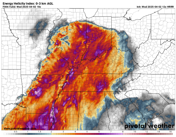
Ahead of the band of strong to severe storms, a large sector of warm, moist and unstable air with strong wind shear will become very favorable for severe storms and tornadoes as shown in this HRRR forecast of energy helicity index (EHI) for 1 pm. EHI combines instability and low level wind shear into a single product, giving meteorologists a quick idea of how favorable conditions are for tornadoes (in this case, very favorable).
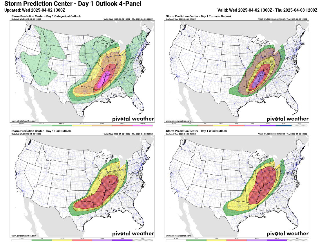
Given this setup, the Storm Prediction Center has outlooked a large area from the lower Great Lakes to the Arklatex with high probabilities for tornadoes, hail and damaging wind, all with hatched areas, meaning at least a 10% probability for significant incidences of these hazards, i.e., EF2+ tornadoes, 2+” hail, 75+ mph wind gusts. This results in a large area of enhanced (level 3 of 5) and moderate (level 4 of 5) risks across the area, along with a narrow high risk (level 5 of 5) in the area with the absolute highest probabilities of tornadoes from eastern Arkansas to the Ohio/Mississippi River confluence area.
While the high risk area obviously has the greatest probabilistic risk of impactful severe weather, as we have discussed the last few days, this is a situation where a large area will have very favorable conditions for impactful severe storms and tornadoes, and where the maximum impacts end up will be governed by smaller scale storm evolution and interactions. One thing to watch for later today is if any supercell storms can develop out ahead of the main band of severe storms; given the favorable environment, any storms like this that can develop out on their own would have particular concern for producing high end severe weather including intense tornadoes.
As we’ve been discussing, the strong mid/upper level weather system driving today’s severe weather will lift away later tonight, but will leave behind a strong mid/upper level trough over the Southwest US. That will result in the cold front forcing the band of severe storms stalling out. By late tonight, the band of storms should be somewhere from the central Appalachians to northern Texas. Meanwhile, a new upper level impulse will begin to interact with the western edge of these storms and lead to an intensification of severe storm activity across north Texas in the pre-dawn hours Thursday.
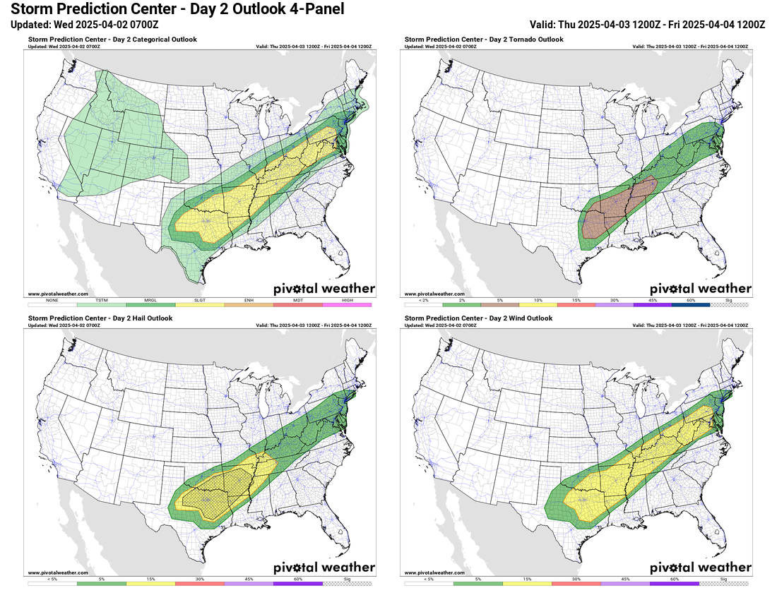
The highest probabilities for severe weather on Thursday look to be the general region of the Arklatex, where SPC has higher tornado probabilities and a hatched hail area forecast, while lower probabilities of severe storm hazards extend northeast from there into the Mid-Atlantic region. Right now all of the probabilities are only at slight risk (level 2 of 5) but it would not be surprising to see some areas increased to enhanced risk in later updates.
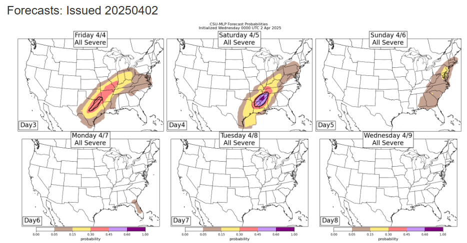
Active severe weather will continue through the weekend as the main Southwest US mid/upper level system finally pulls east. The Colorado State University machine learning system probabilities show an increasing risk for severe storms into Saturday from Texas east into the lower Mississippi Valley. After a lesser risk of severe storms along the east coast Sunday, the passage of this system across the country will force a significant pattern change with a mid/upper level trough of low pressure becoming established in the eastern United States, shutting down the active weather pattern for a while.
High risk for flash flooding too…and other threats
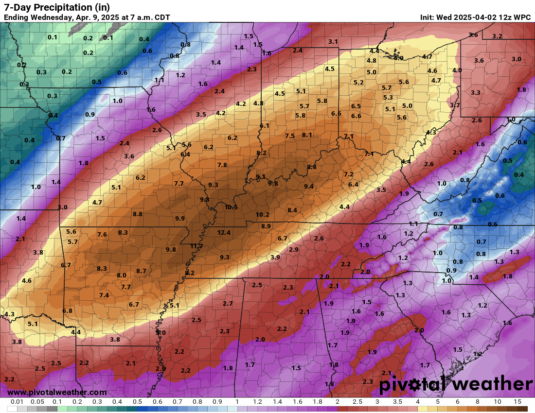
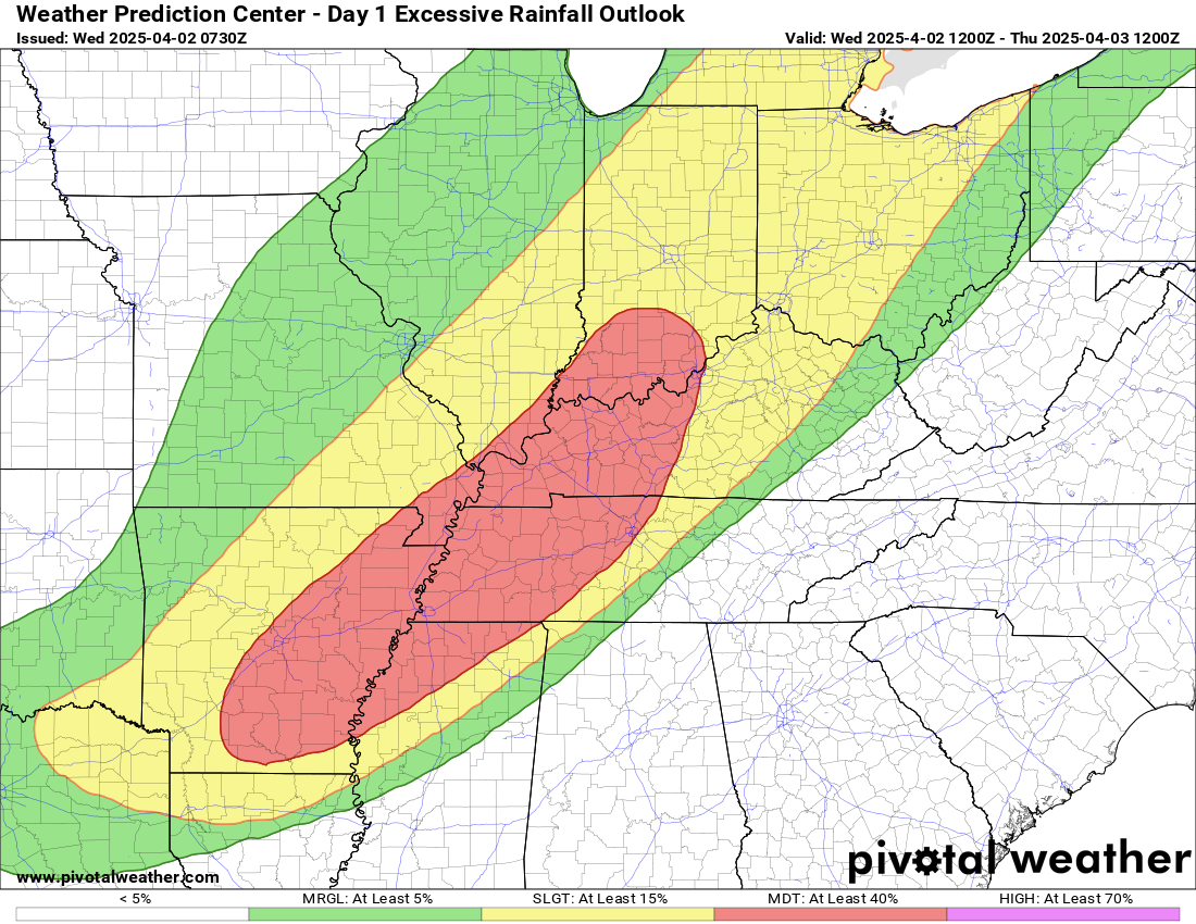
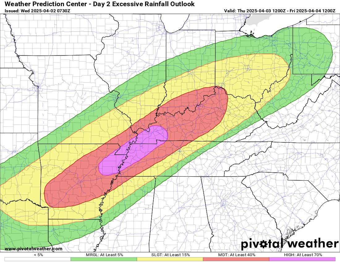
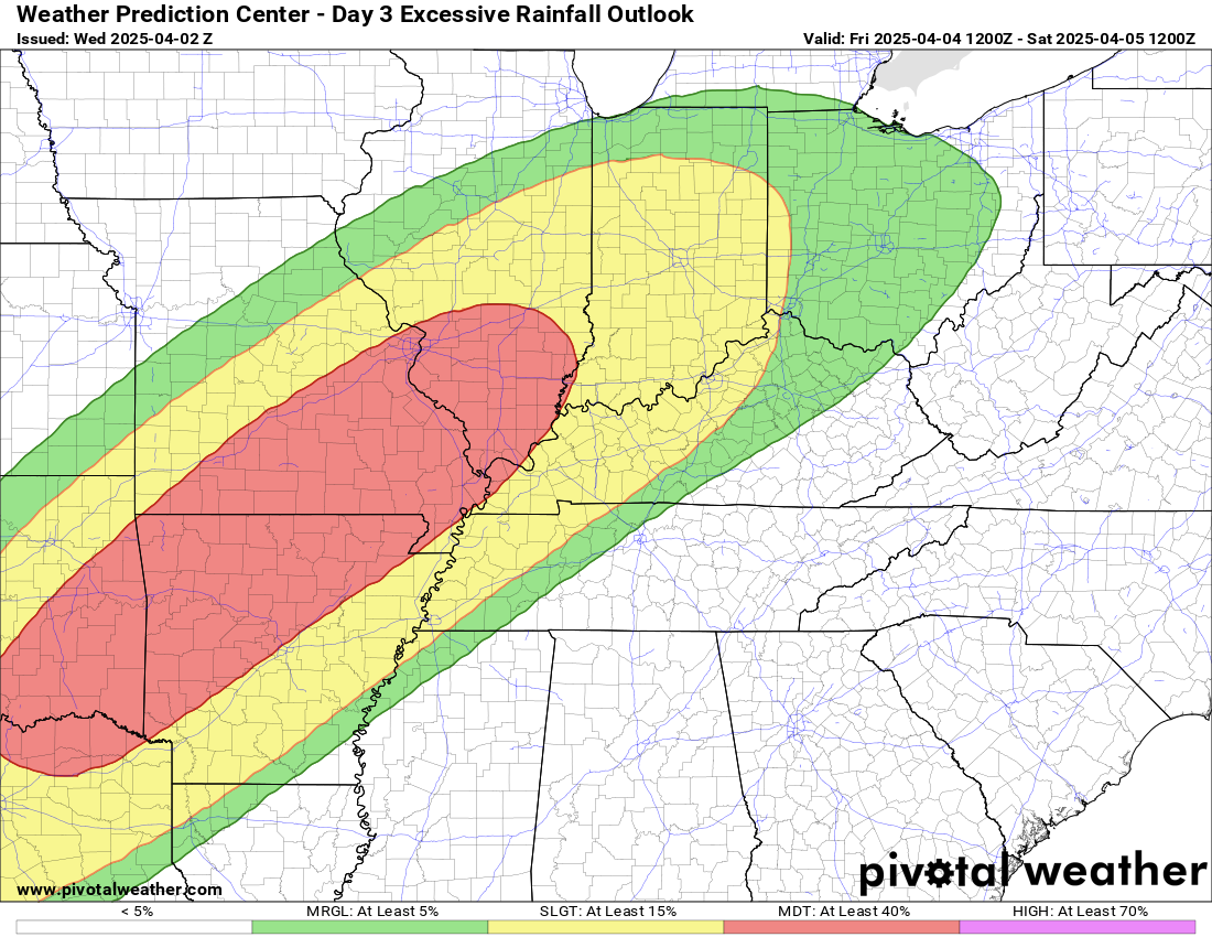
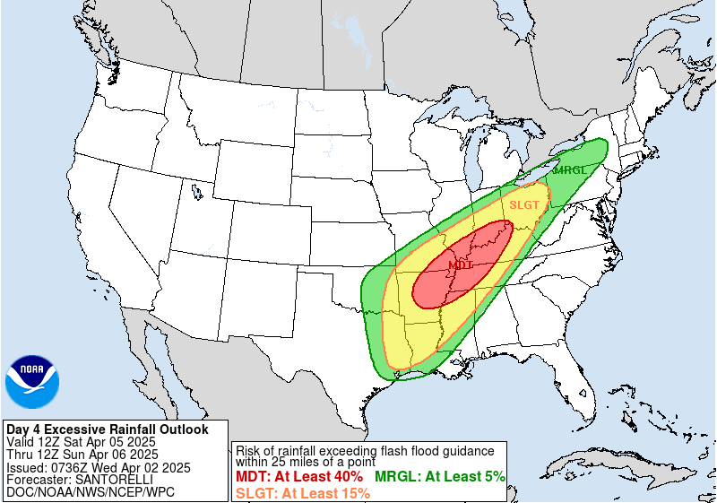
The stalling front scenario discussed for later tonight is what is going to set the stage for a potentially historic rainfall event from the Arklatex into the Ohio Valley over the next several days. Impulses riding along the front combined with near record levels of moisture in the atmosphere will result in multiple waves of storms producing very heavy rainfall over the same areas. The Weather Prediction Center is explicitly forecasting a swath of 6-12” of total rainfall across much of this area with multiple days of major flash flood risks. The flash flooding risk will really ramp up tomorrow with the stalling out of the front, and WPC has a high risk – level 4 of 4 – of flash flooding in the mid-South region.
While I have been focusing on the high end severe weather risk in my newsletters and updates the last couple of days, that is primarily because that event is coming before this major heavy rainfall event. I want to emphasize this is a serious flash and river flood setup, with NWS offices warning of potentially catastrophic impacts. We will be talking more about the meteorology and potential impacts of this event in coming days.
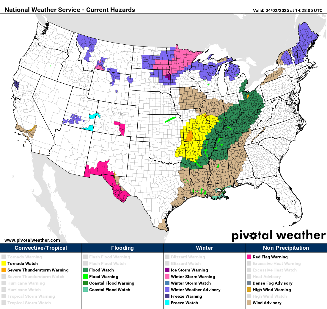
And last but not least, need to mention that there continues to be critical fire danger concern in portions of New Mexico and west Texas, and winter weather impacts along the northern tier of states where winter storm warnings and advisories are in effect.
Programming note: Given the very busy weather this week, I am planning to continue to provide periodic updates via special posts, video briefings, Notes and real-time Substack chats. As I continue to better learn Substack and the subscriber base continues to grow (over 200 now, thanks!), the briefings and chats will become paid subscriber benefits as outlined here.

Leave a comment