But major river flooding to persist for days
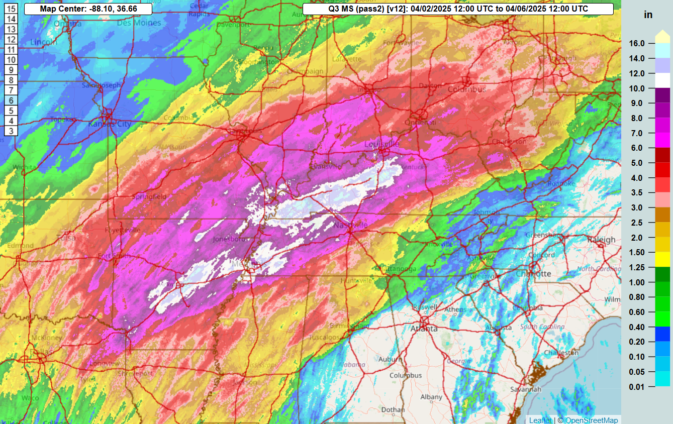
With the weather finally trending quieter today, let’s start by taking stock of what we ended up with so far as far as rainfall and how it is going to impact rivers with major flooding in the coming days. This graphic shows the MRMS total estimated 4-day rainfall ending this morning at 7 am CT. This MRMS estimate is produced using a multi-sensor process that makes adjustments to its radar estimates using observed gauge amounts, which makes it an excellent combination of the spatial and temporal benefits of radar estimates with actual ground truth. You can see clearly that Kentucky was the ground zero for this event, with much of the state receiving more than 10” of rain with amounts of up to 16”. Another similar axis runs right through the Little Rock and Memphis metropolitan areas. The spatial area impacted by very heavy rain is quite impressive, the 6” plus totals much of the Mid-Mississippi Valley, Ohio Valley and Mid-South regions.
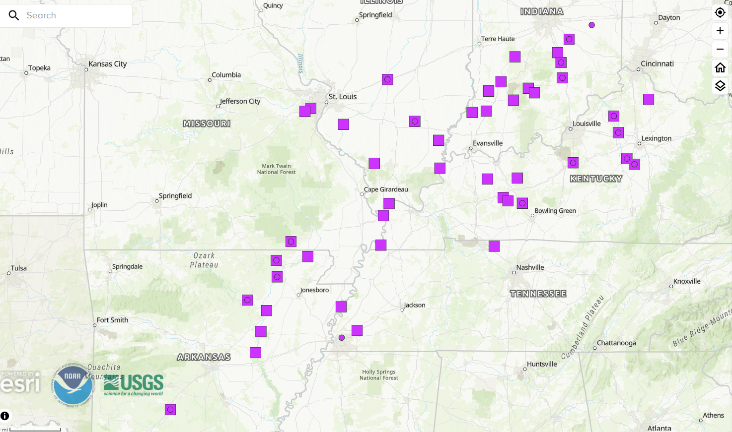
All of that rainfall must eventually runoff through the river systems and eventually into the lower Mississippi River. This map shows river gauge sites that are either currently or are forecast to reach major flood stage; the points currently in major flood show as a circle (either on its own or within a square), the squares only indicate a point not yet at major flood but forecast to reach that level. In total, 48 points are forecast to reach major flood stage in the coming days.

Not surprisingly given the observed rainfall, Kentucky looks to have had the most impactful river and flash flooding. The Kentucky River is forecast to reach record flood levels at the Frankfort and and Lockport gage locations. The current record at Lockport was set in the 1937 flood which is one of the benchmark flood events for the Ohio and lower Mississippi Valleys, which gives some historical perspective on this rainfall and flood event.

While all of this water will make its way down into the lower Mississippi River, some of the other tributaries that run into the river below Memphis were not as impacted by heavy rainfall, so flooding on the main river below Memphis will be at more moderate levels.

Yesterday there were several swaths of heavy rain greater than 3” as storms producing intense rainfall rates moved across the region. The heaviest rain was in the Memphis metro area where a band of strong to severe storms stalled out for a couple of hours allowing the heavy rainfall rates to persist for a bit. Severe flash flooding resulted in the area, prompting a flash flood emergency to be issued. To give an idea of the extreme rainfall rates, Memphis International Airport reported .85” of rain in under 15 minutes.
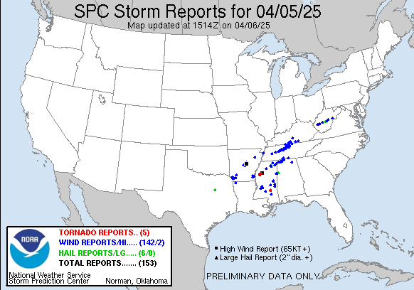
Severe thunderstorms were very impactful across the region as well. An intense line of severe storms produced significant wind damage across central and eastern Arkansas in the midday hours, killing at least 1 person and leaving more than 75,000 customers without power. This line of storms continued across central and middle Tennessee during the afternoon with additional wind damage. A separate area of severe storms moved cross Mississippi and Alabama late in the day and overnight, producing numerous reports of wind damage and tornadoes. A supercell produced a particularly large, intense tornado southwest of New Albany, MS in the early evening.
Given the prolonged and expansive nature of this severe weather and flash flood event this week, it will take days for the National Weather Service and emergency managers to document the impacts, and I will be providing updates in future newsletters. As of now, the media is reporting that 16 people have been killed by a combination of severe storms/tornadoes and flooding.
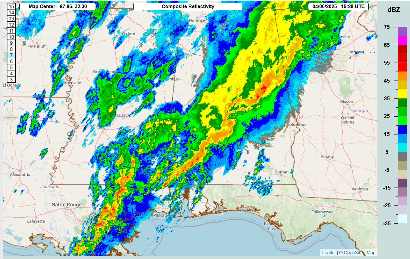


While the weather is trending quieter, it will take another 24 to 36 hours to completely calm down. As of late morning local time, bands of strong thunderstorms were still ongoing across Alabama, southern Mississippi and southeast Louisiana. These storms will continue to present some risk for severe weather and flash flooding as shown in the SPC and WPC outlooks above. SPC has a slight (level 2 of 5) risk primarily for some risk of damaging winds and a few tornadoes as the band of storms moves slowly east. While compared to the last several days these risks are much less, obviously people in the region should be alert for severe weather and flash flooding.

The strong upper level trough of low pressure that we have been talking about for days will finally get absorbed into a new trough developing over the northeast US over the next 24 hours. The associated cold front will still be slowly moving across the Southeast on Monday, and another day of a slight risk (level 2 of 5) for some damaging winds and potentially a few tornadoes is in place across southern Georgian and north Florida.

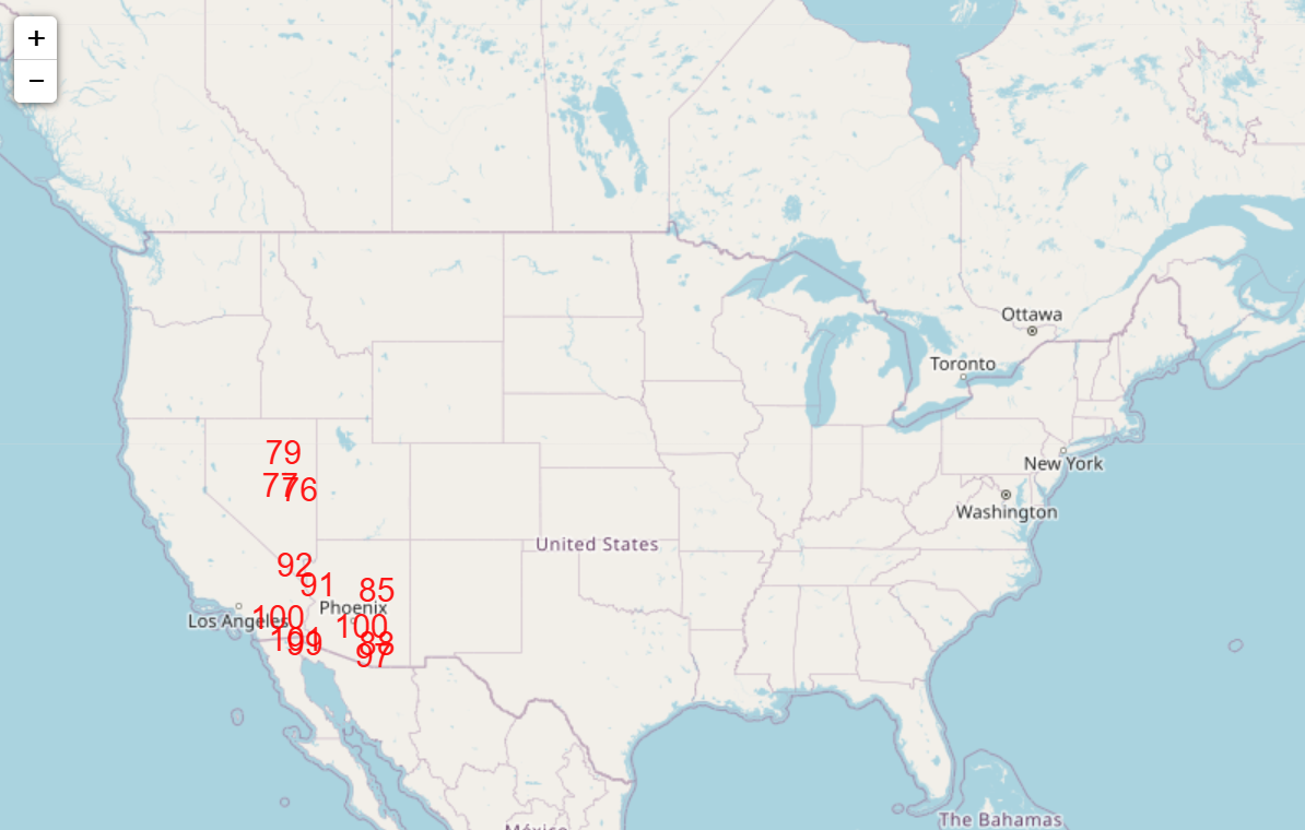
As we go through the upcoming week, it still appears that the weather pattern will become dominated by a large mid and upper level ridge of high pressure across the western United States, with an associated downstream trough over the eastern US. While temperatures will be cooler than normal in the east, record high temperatures are forecast in parts of the Southwest for the middle and latter part of the week (shown below are potential record highs from NWS forecasts for Thursday).

Leave a comment