And continuing to recap the last week
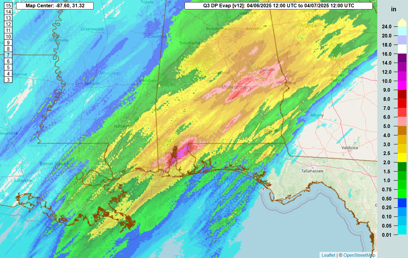
Good morning and welcome to a new work week. While yesterday was a “quieter” day than previous days, there were still some significant weather impacts. Thunderstorms producing torrential rains stalled out near the coast in the Mobile Bay Region, resulting in a band of up to 12” of rain in just a few hours in eastern Mobile and northern Baldwin counties, resulting in significant flash flooding.
Sunday did not see a lot of severe thunderstorm activity with just about a dozen reports of wind damage from southeast Mississippi into Georgia and likely a couple of tornadoes. Sadly, however, the danger that falling trees can present was reinforced tragically in Columbus, GA, where two men were killed on a golf course when a tree was blown down and landed on them while they were sheltering in a golf cart.
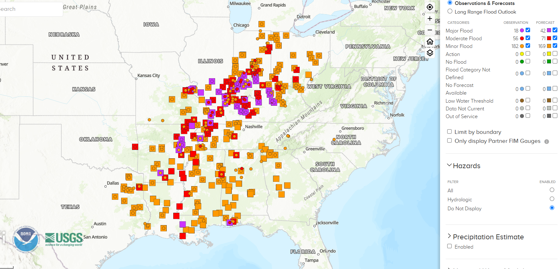
Nearly 300 river forecast points are at or forecast to be in flood stage due to the rainfall event of the last week, with more than 40 in major flood. The Kentucky River at Frankfort – which has a period of record of more than 200 years – crested this morning just inches below its all time record crest in 1978. Numerous rain gauges recorded more than 12” of rain in Kentucky in the last week, with the highest total I have seen being 15.31” at a CoCoRaHS gauge northeast of Hopkinsville.
While river flooding will continue to be an issue this week, the calmer weather will let NWS offices in the region be able to do more damage assessments and obtain a clearer picture on the magnitude of the severe weather and flood impacts. As of this morning, the media is reporting that 19 people have died in severe weather and flood related incidents over the last week.
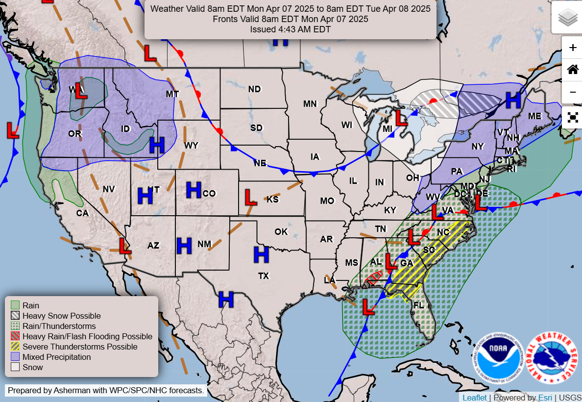
We start off a new week with the weather pattern continuing to transition toward an upper level trough of low pressure and colder weather in the east, while an unseasonably strong ridge develops out west with a trend toward record heat. Today will see wet conditions along the east coast, while wintry precipitation will be possible in the Great Lakes and Northeast, as well as in the mountains of the Northwest.
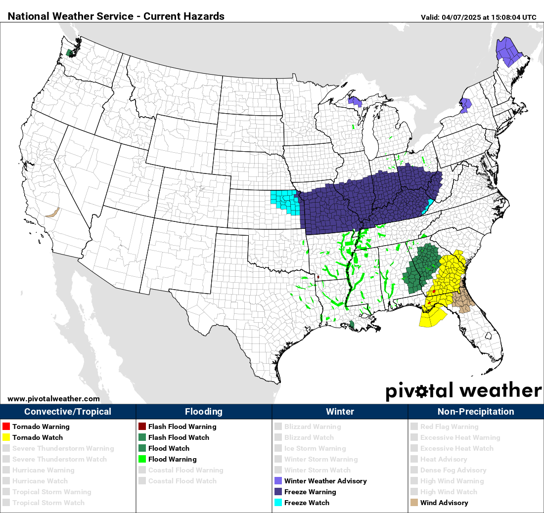
A slight (level 2 of 5) risk of severe storms is in place from northern Florida to eastern North Carolina and southeast Virginia. Scattered strong thunderstorms in this region could producing damaging wind gusts and perhaps a few tornadoes. A tornado watch is in effect this morning from northern Florida to southern South Carolina. With the colder weather filtering into the East and Midwest, freeze warnings are in effect for a large area from eastern Kansas to West Virginia.
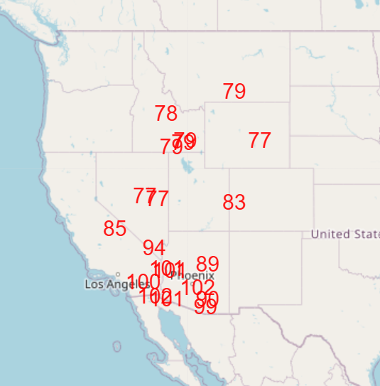
As the week progresses, warmth will build in the West, with a number of locations expected to be near or above record high temperatures by Friday as shown above. While Friday looks to be the peak in this initial wave of record warmth, long range model ensembles suggest that the overall weather pattern we are establishing this week looks to be the favored weather pattern for the foreseeable future, with no particular signs of a return to an active severe weather pattern coming anytime soon.

Leave a comment