And a few severe storms in the South today
Good Thursday morning! The NWS Climate Prediction Center (CPC) released their monthly El Nino Southern Oscillation (ENSO) diagnostic discussion this morning, and “officially” declared the end of La Nina, stating that “ENSO-neutral conditions” had returned. ENSO-neutral essentially means that neither El Nino nor La Nina presently exist, and their current outlook suggests that ENSO-neutral conditions will continue into autumn.
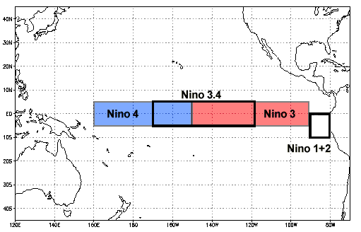
Scientists monitor sea surface temperatures (SSTs) across the equatorial Pacific for changes that influence ENSO – which is the broad term describing the cyclical pattern of warmer and colder SSTs in the region and their influence on global weather patterns. The equatorial Pacific is divided up into “Nino regions” for monitoring as shown above, and the Nino 3.4 region – which is a combination of the eastern part of the Nino 4 and western part of the Nino 3 regions – is the benchmark region in which SST values determine the “official” state of ENSO.

This graphic shows the evolution of the SSTs in the various Nino regions over the last year. SSTs have been warming over the entire region last couple of months, most dramatically over the eastern Pacific where SSTs are now well above normal. In the Nino 3.4 region, SST anomalies have now been above the -0.5C threshold needed for La Nina since early February, ending a short (3 month) period of La Nina conditions.
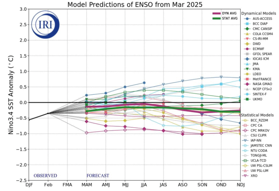
This graphic shows the forecast for the Nino 3.4 SST anomalies from all of the models run by the various national meteorological services and research entities. There is a pretty strong consensus for ENSO-neutral conditions to persist through the remainder of 2025. However, predicting the ENSO state for the upcoming fall/winter in the spring is notoriously difficult, so much so that climate scientists routinely refer to the “spring predictability barrier,” i.e., it’s very difficult to anticipate the fall/winter ENSO state during the prior spring.
While the initial Atlantic seasonal hurricane forecasts are made in the spring, they generally have very limited skill, primarily due to this ENSO spring predictability barrier. Seasonal hurricane activity is greatly influenced by the state of ENSO in the late summer and fall, so if the ENSO forecast is off, the seasonal hurricane forecast will also likely be poor. As of now, the early seasonal outlooks are generally calling for another season of above normal hurricane activity in the Atlantic, but in another couple of months the ENSO state should be much clearer and we should be able to better anticipate what the peak of hurricane season should be like.

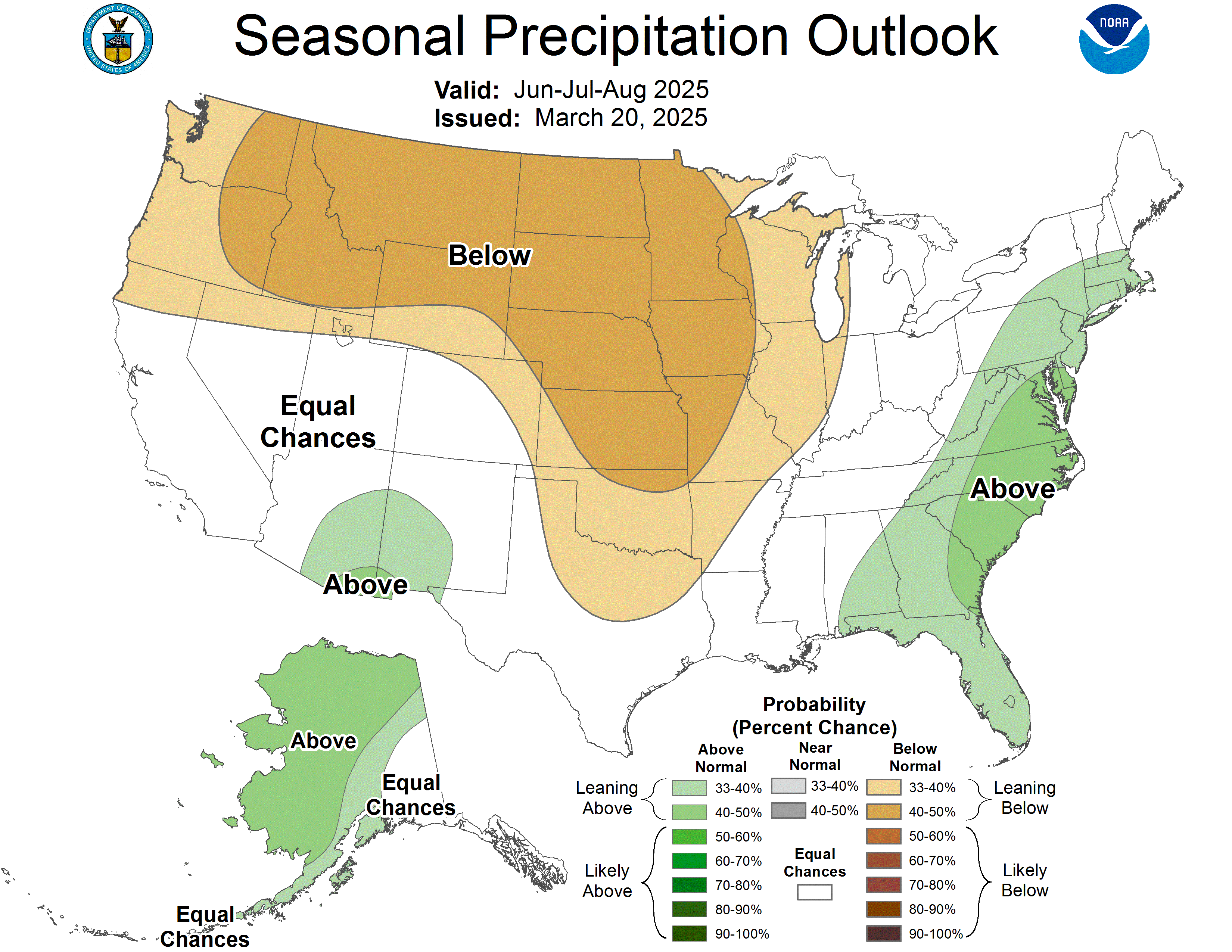
Given the anticipated ENSO-neutral state and other global atmospheric factors, CPC is currently calling for higher chances of above normal temperatures for the entire country this summer. Higher chances of below normal precipitation also exist for much of the country, except along the Eastern Seaboard and Alaska. CPC is also calling for a bit higher chances of a more active monsoon season in parts of Arizona and New Mexico.
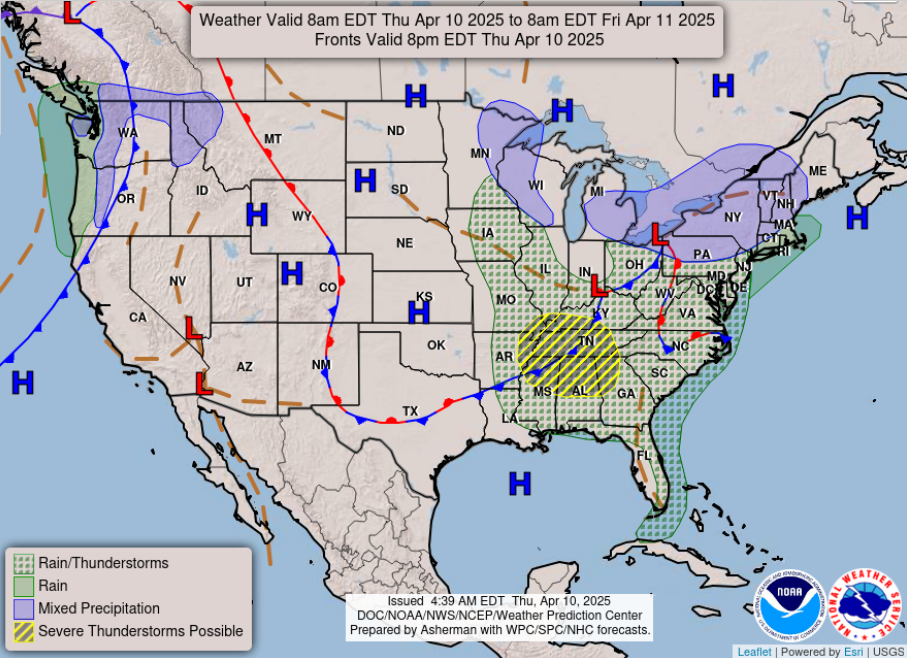
Turning to today’s weather, a storm system will bring wet weather to much of the east, with some mixed wintry precipitation possible over the Great Lakes and Northeast. Enough instability and wind shear will exist in the atmosphere to support scattered strong to severe thunderstorms in the Mid-South and Tennessee Valley regions where SPC has a slight (level 2 of 5) risk in place. This is not a high end severe weather risk day, but still some storms will have the potential to produce large hail and damaging winds. Interestingly, SPC discussed this morning that anticipated conditions later today in the Southeast will be somewhat similar to the “inverted-V” soundings that I discussed in my science post a couple of days ago. These sorts of conditions are not common in the Southeast, but having them today will help enhance the potential for strong wind gusts with the more intense storms.

The eastern US storm system will only slowly move east the next 24 hours, so showers and storms will linger along the Eastern Seaboard into Friday. In fact, for the Mid-Atlantic region rainfall will be heavier and more persistent on Friday, and could lead to a few areas of minor flooding.

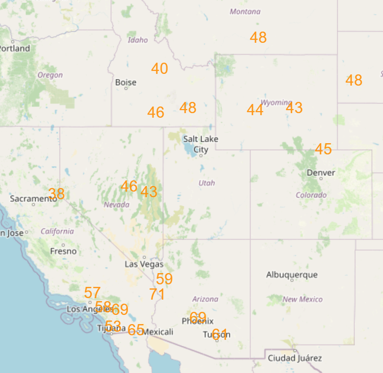
Meanwhile, in the West record warmth – both daytime highs and nighttime lows – will be the main weather story the next few days. The record warmth is expected to peak Friday into early Saturday as shown in the forecast record maximums and record high minimums above – but warmer than normal conditions are expected to persist over much of the region into next week.

Leave a comment