And signs of a more active pattern on the horizon
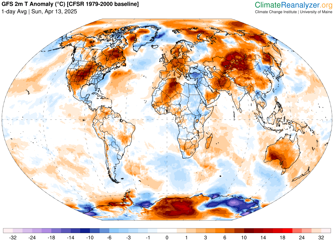
The globe saw lots of record warmth again over the last 24 hours. Numerous record warm temperatures were set in the western and central United States on Saturday, including record highs at Albuquerque with 88F (previous record 84F in 1981), Phoenix with 99F (tied record set in 1936), Tucson with 99F (previous record 96F in 1988), Denver with 86F (previous record 85F in 2023), and Pueblo, CO with 93F, which along with being a daily record (previous was 90F in 2023) was also the warmest ever so early in the season. Record high minimums included Las Vegas with 74F (previous record 72F in 2002) and Midland, TX with 64F (tied record set in 2022). Meanwhile, even greater record warmth continues unabated for parts of Asia and Australia with records of both high maximums and minimums. Numerous locations in India saw low temperatures greater than 30C (86F).
Downstream of the large upper level ridge of high pressure producing the record warmth in the western US, a persistent upper level of trough of low pressure has been bringing colder and wetter than normal conditions to the eastern United States the last several days. While for the most part this has not been record cool weather, on Saturday several locations along the East Coast set records for lowest daily maximum temperatures, including 41F at LaGuardia Airport NY (previous record 44F set in 1976).
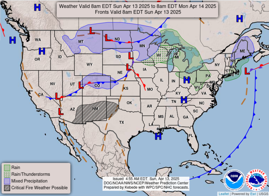
Today, the low pressure system responsible for the cool, wet weather in the East will meander into the western Atlantic, while a new storm system brings some wintry precipitation to the upper Midwest and showers and storms to the Great Lakes region. To the south of this system, critical fire danger will exist in the southern Rockies and Plains region.
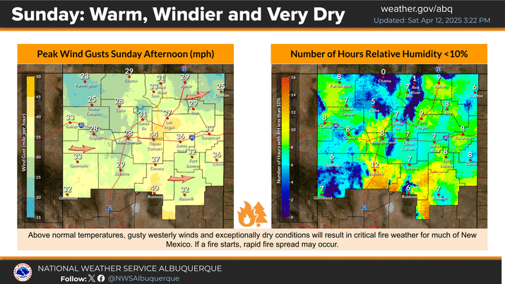
New Mexico will be of particular concern as gusty west winds, near record warmth and persistent drought will lead to the potential for rapid growth of any wildfires that might start today.
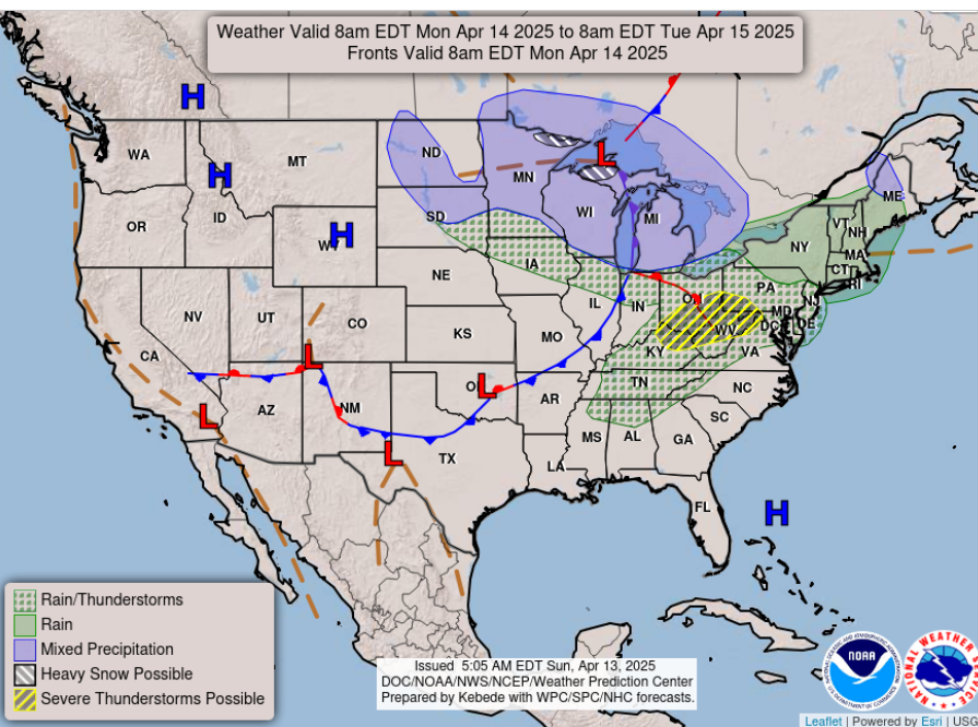
On Monday, the upper Midwest system will move east, bringing more widespread showers and storms to much of the east, along with colder air and wintry precipitation to the Great Lakes region. The NWS Storm Prediction Center has outlooked the upper Ohio Valley region in a slight (level 2 of 5) risk of severe storms for Monday afternoon. There is still a fair amount of uncertainty as to how warm and unstable conditions could become in this region, but if enough instability exists, a few supercell storms capable of producing large hail, damaging winds and a couple of tornadoes could develop.
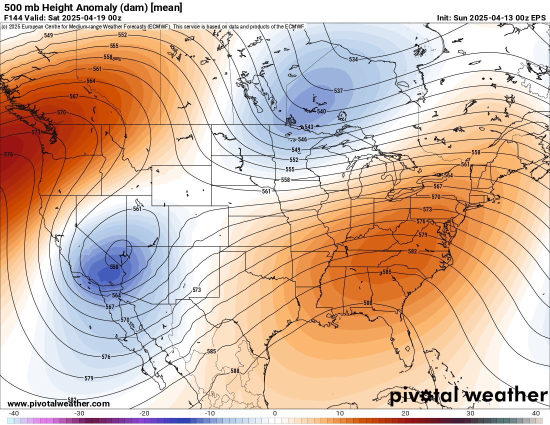
As we get later into the upcoming week, there are signs that the weather pattern is going to trend more active again with the return of an upper level weather pattern favoring a trough of low pressure in the western United States and a downstream ridge of high pressure over the eastern United States.
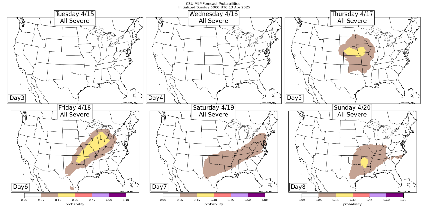
This pattern is more similar to what we saw at the end of March and start of April with active severe weather and heavy rains in the middle part of the country. The Colorado State University machine learning probabilities (CSU-MLP) is accordingly starting to show periods of severe weather risk starting Thursday.

Leave a comment