And more record heat Sunday
While we had some severe thunderstorm activity last week – most notably in the Southeast on Thursday – in comparison to the very active weather pattern of much of March and early April, it was certainly more tempered. It looks like the trend for severe weather activity will be on the upswing again over the next 7 to 10 days, and that will start today.
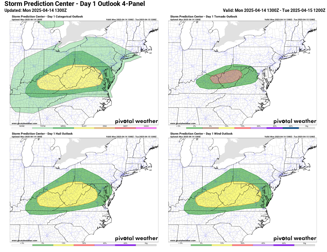
The storm system that developed over the upper Midwest this weekend will push into the Great Lakes region today. Ahead of the associated cold front, morning satellite imagery indicates there will be plenty of sunshine to create a warm and decently unstable airmass across the upper Ohio Valley and central Appalachians region. This will yield an environment supportive for some supercell severe thunderstorms, and the Storm Prediction Center has outlooked a slight (level 2 of 5) risk of severe storms for the region.
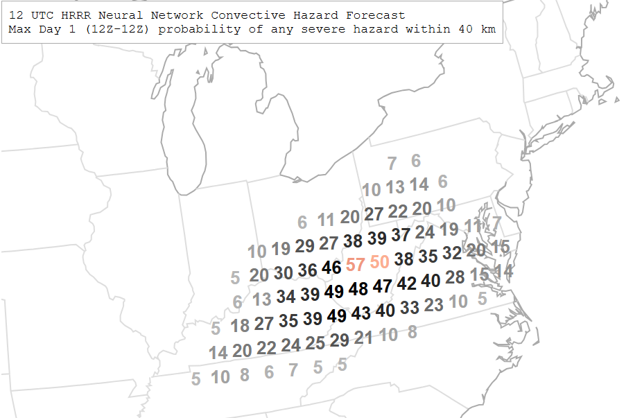
The morning high resolution models have trended somewhat more aggressive with this scenario, and the morning National Center for Atmospheric Research (NCAR) machine learning guidance has rather high probabilities for a severe weather report centered on West Virginia. It seems likely we will see several severe storms develop in the region with large hail and damaging winds the main risk, but a couple of tornadoes are also possible.
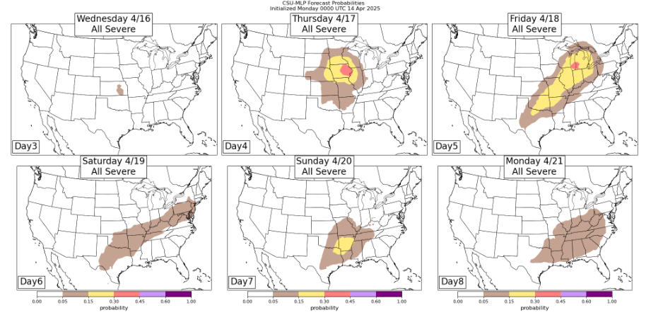
After this system moves off the East Coast over the next 24 hours, things will be quieter for a couple of days, but then a new storm system will take shape over the Rockies and move east, bringing a risk of severe weather on Thursday and Friday as shown by the Colorado State University machine learning (CSU-MLP) system. This system will exit to the east on Saturday, but it looks to be the harbinger of an overall trend toward a pattern of more storm systems developing over the western United States and tracking east or northeast through the Midwest. This should bring additional risks of severe storms into next week in the central United States along with possibly some heavy rainfall risk.

Turning back to today, outside of the severe weather risk, the Great Lakes system will also bring wintry precipitation to the upper Midwest and lakes regions, including some pockets of heavy snow in northern Minnesota and the Upper Peninsula of Michigan. Rain and thunderstorms will be extend along the cold front from the Northeast to the Lower Mississippi Valley region.

A few record high temperatures are possible today ahead of the cold front moving south across the Southern US. Sunday saw a number of record high temperatures in Texas, including 96F at Lubbock (prior record 91F in 2006), 93F at El Paso (prior record 92F in 1995), 98F at Midland (prior record 97F in 1972) and 93F at Dallas-Fort Worth (tied record set in 1972). Rio Grande Valley hit 108F to be the hot spot for the country.
Globally, while numerous record high temperatures were set again on Sunday, there are some pockets of colder than normal weather. The Korean Peninsula saw cold air move in, and Seoul saw snow in April for the first time in 80 years as you can see in this news story.

Leave a comment