And talking about rainfall impacts in central US later in the week
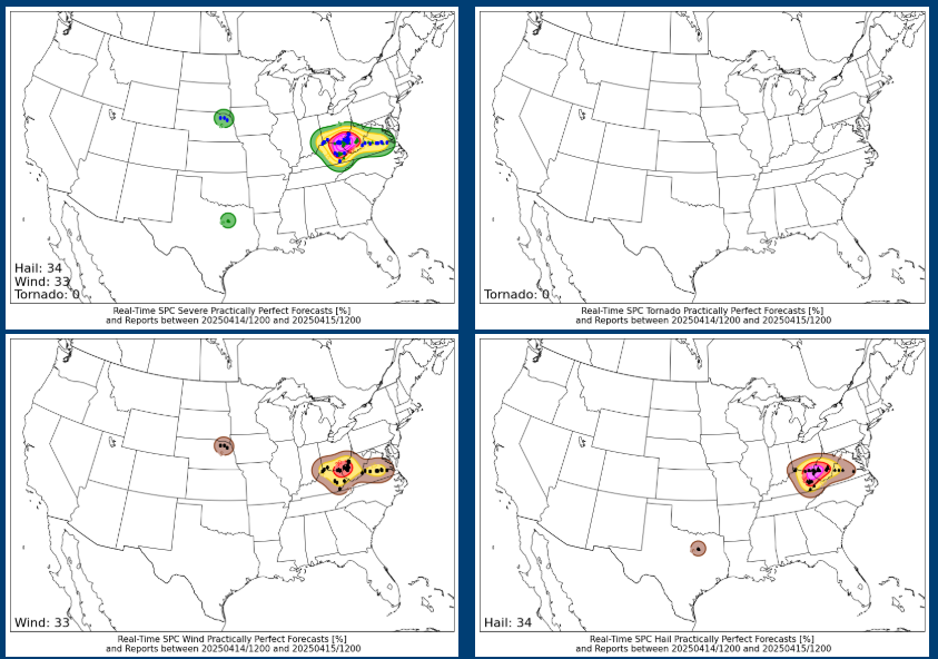
We discussed in yesterday’s newsletter that the morning high resolution models were trending more aggressively with the severe weather scenario in the vicinity of West Virginia – and that ended up verifying pretty well. A number of severe supercell storms developed and moved east/southeast across the region yesterday afternoon and evening, producing over 100 reports of large hail and damaging winds. SPC upgraded much of West Virginia to an enhanced (level 3 of 5) risk of severe weather in their late morning update, and that certainly appears to have been justified. The activity was maximized around the Huntington, WV where the practically perfect forecasts – taking the observed severe weather reports and analyzing them to produce what the Storm Prediction Center probabilistic forecast should have been if it had been “perfect” – showed 30% wind and 45% hail areas, correlating to enhanced risk areas. Several reports of very large hail – 2” or greater – were received from the region, the largest being a 3” hail report from Lawrence County in extreme southeast Ohio.

Today will be a quieter day in the weather world. The storm system that produced the severe weather over the central Appalachians region on Monday will continue to slide east, producing some rain and bit of late season snow for the Northeast. Much of the rest of the country will be dry and cooler in the wake of the cold front.

As we have been discussing the last few days, it still looks like a more active weather pattern will set up for the rest of this week as a series of storm systems progress from the Rockies to the Great Lakes. While none of the upcoming days look like high end, widespread severe weather outbreaks like we have seen several times over the last month, there should be several days with risks of severe weather and some regionally focused areas of greater severe potential could develop.
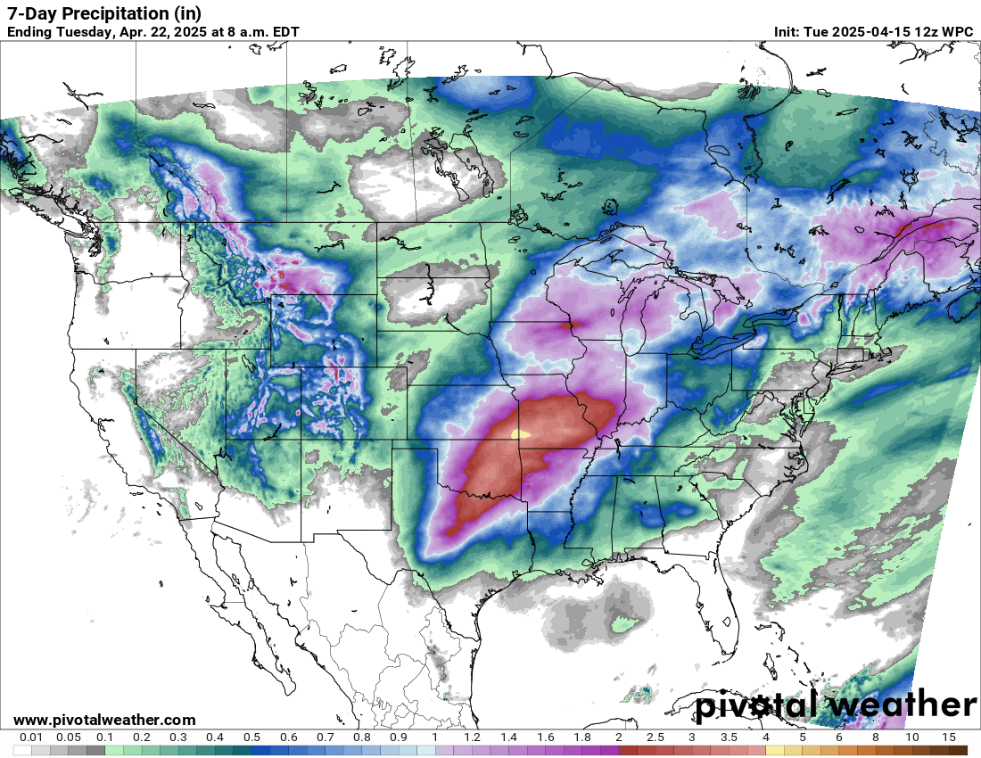
This pattern will also result in a rather large area of moderate to heavy rainfall as several rounds of showers and storms move across the region from northern Texas to the mid and upper Mississippi Valley region.
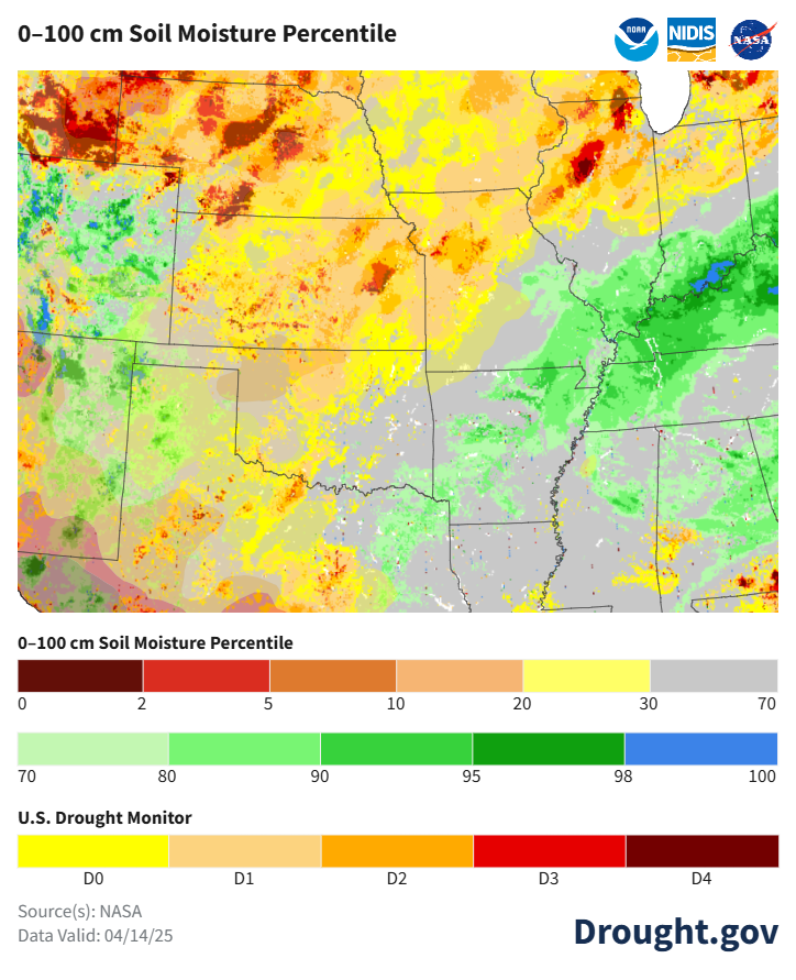
The impacts from this rainfall will vary quite dramatically from west to east as this map of current soil moisture and drought conditions helps to show. For areas from north Texas across Oklahoma and into the upper Mississippi Valley, soil conditions are quite dry with various stages of drought observed. So this rainfall will for the most part be welcome here. As one goes farther east into the mid-Mississippi and lower Ohio Valley regions, soil moisture is quite high and river flooding is still ongoing from the record rainfall earlier in April. Here, the additional heavy rainfall may prolong the river flooding and keep the region vulnerable to additional flood concerns should this more active pattern continue into late April.
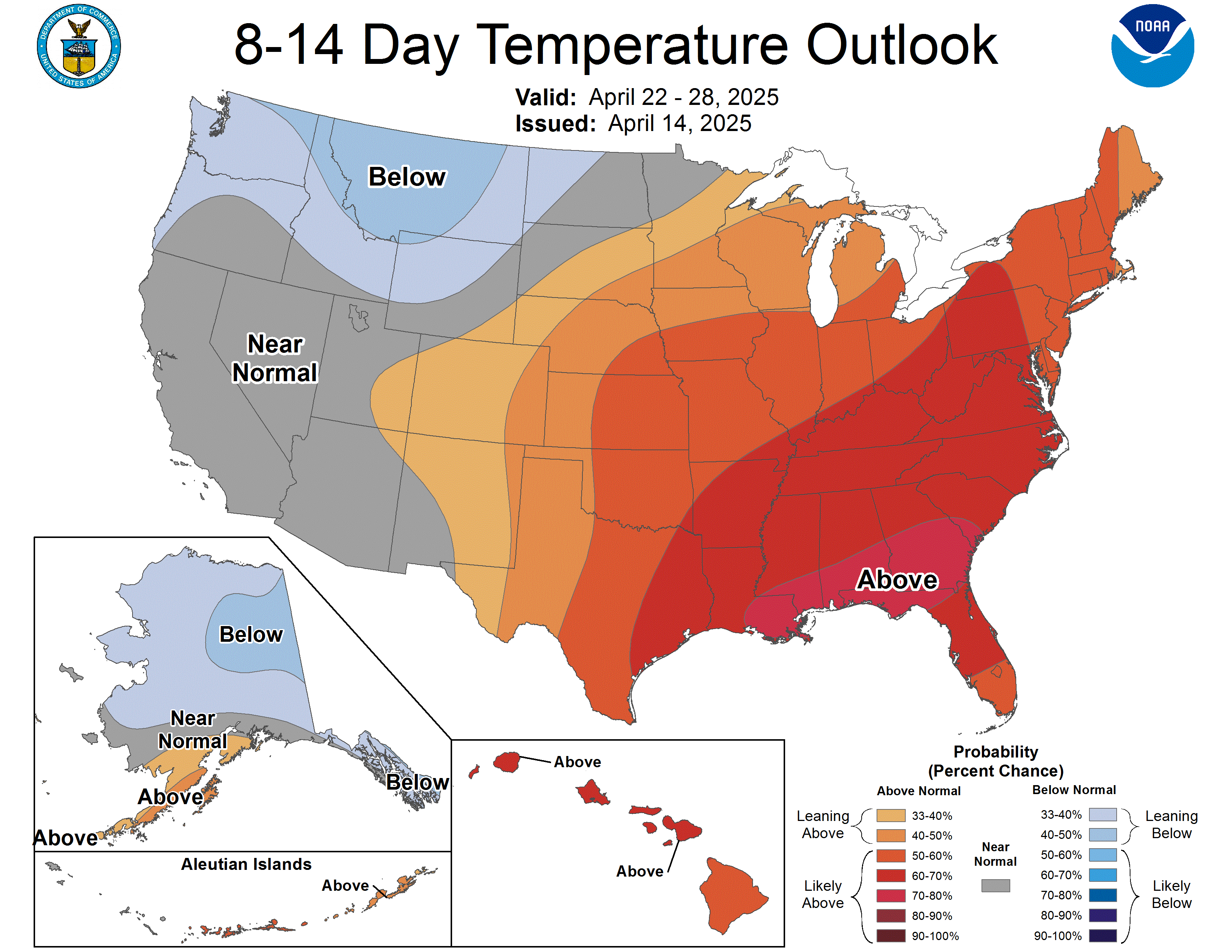

As far as that late April outlook is concerned, the most recent outlook from the NWS Climate Prediction Center shows a greater risk for above normal rainfall across the center of the country, which at this time of year generally correlates to an above normal risk for severe weather and heavy rainfall. So this will be something we will continue to watch as we go through the coming days, especially for the lower Mississippi River where the crest from the early April rainfall is still one to two weeks away.

Leave a comment