And heavy central US rains into the weekend
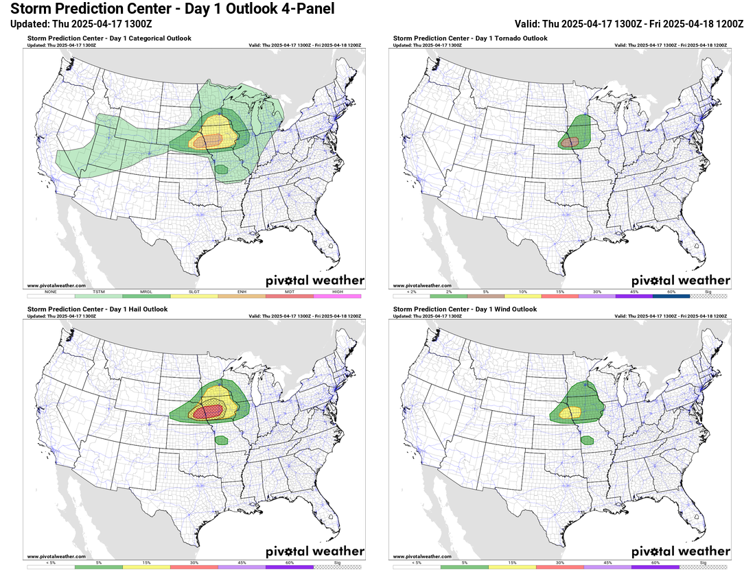
Good Thursday morning! Looking for a more active weather day today as a relatively strong low pressure system develops over the central United States. As Gulf moisture streams north ahead of the low this afternoon, it will result in increasing instability in the mid-Missouri Valley region. Sufficient forcing and instability for storm development will likely not exist until late in the day or this evening, but once storms develop, cold mid level temperatures and strong wind shear will allow scattered severe supercell thunderstorms capable of producing very large hail.
The overall situation looks a bit more potent than earlier forecasts had shown, and the NWS Storm Prediction Center has an enhanced (level 3 of 5) risk of severe weather that includes Omaha and Des Moines. While very large hail (possibly baseball sized or larger) is the primary severe weather hazard, a few tornadoes are certainly possible. The tornado risk primarily hinges on the amount of low level moisture that makes it to the region before storms develop, and if that low level moisture were a bit more than forecast, the tornado risk would increase. This will be something we will be watching today and this evening.
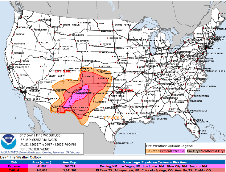
On the southwest dry side of this storm system, dangerous fire weather conditions are anticipated today. A large area of dry near surface air with single digit relative humidity values and gusty winds over 40 mph will result in a large area of critical fire danger over the southern Rockies and parts of the central and southern Plains.
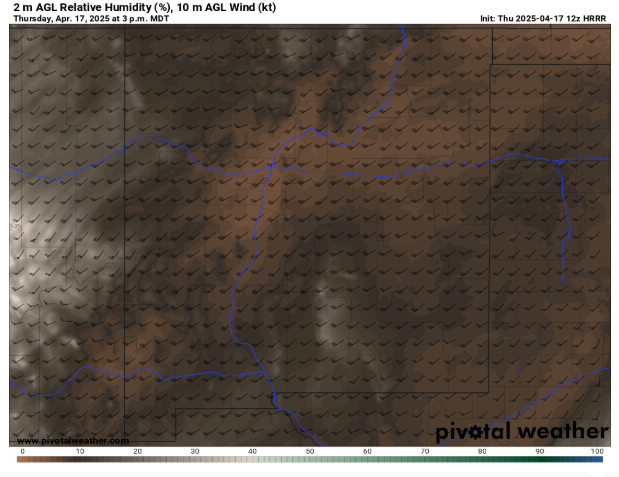
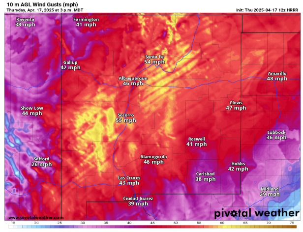
Within this area, the core of strongest low and mid level winds over New Mexico will correspond with an area of relative humidity values near 5%. This will result in particularly dangerous conditions for rapid wildfire spread, and SPC has outlooked an extremely critical fire risk for this area.
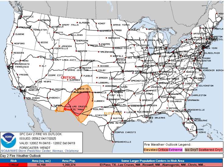
Eastern New Mexico and parts of southwest Texas will have critical fire danger again on Friday.
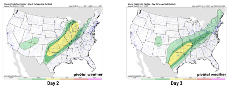
As the storm system pulls into the Great Lakes region Friday, the cold front associated with it will slow and eventually stall out from the southern Great Lakes to the southern Plains. Impulses will move along it resulting in several complexes of thunderstorms moving northeast in the vicinity of the front. Some of these storms could be severe, and SPC has outlooked a large, broad swath of marginal and slight (levels 1 and 2 of 5) risks of severe weather for Friday and Saturday. This definitely appears to be a situation where some more localized areas of greater risks for severe storms could evolve, but will not become clearer until we get closer in time.
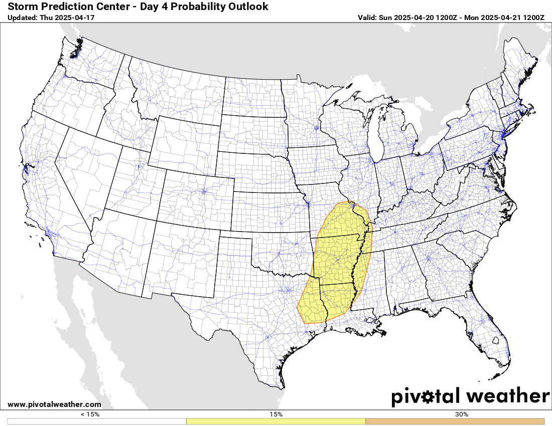
As the last main upper level impulse ejects out of the Southwest on Sunday, there will be an additional risk of severe storms from the mid-Mississippi Valley to the Arklatex. There are still some model uncertainties to resolve for Sunday, with the European models showing a more potent severe weather setup than the American global models.
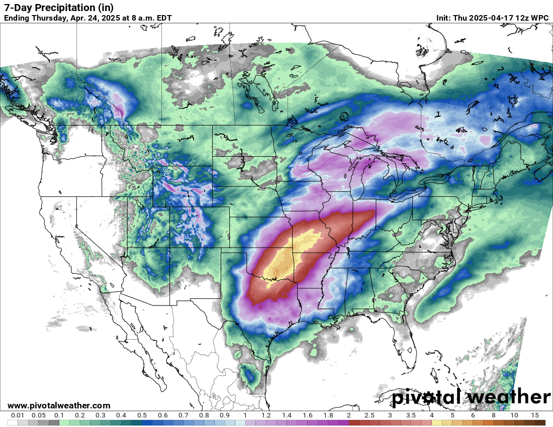
This pattern with waves of storms moving along a stationary front will result in another multi-day heavy rainfall event. This event will not be nearly as heavy or prolonged as the one we saw in early April, and will also be focused a bit farther northwest, centered from Oklahoma into the mid-Mississippi Valley. Western parts of this region are in drought, so initial rainfall will be beneficial, but repeated rains could result in some flash flooding concerns even here. Areas farther to the east in the mid-Mississippi Valley and lower Ohio Valley region are much wetter and still experiencing significant river flooding from the early April event, so additional heavy rain here will likely exacerbate and prolong flooding issues.
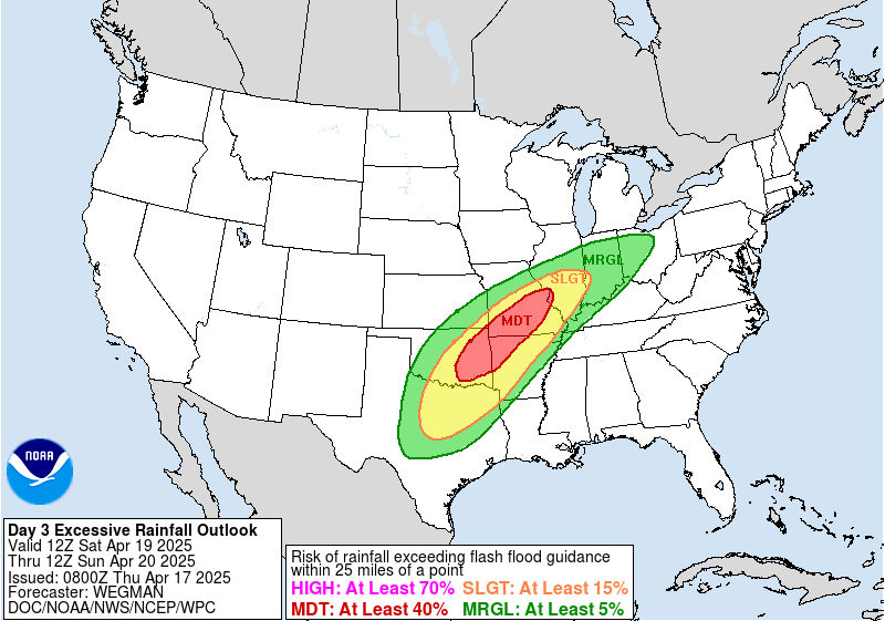
Saturday currently looks like the day with the greatest flash flood risk, and the NWS Weather Prediction Center (WPC) has outlooked a large moderate (level 3 of 4) risk from eastern Oklahoma northeast through the St. Louis area.
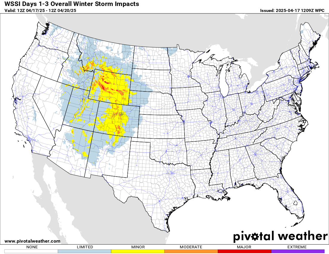
Finally, we cannot forget the winter weather that we will have on the northwest side of this storm system. Heavy mountain snows are forecast the next few days across the central and northern Rockies and adjoining foothills.
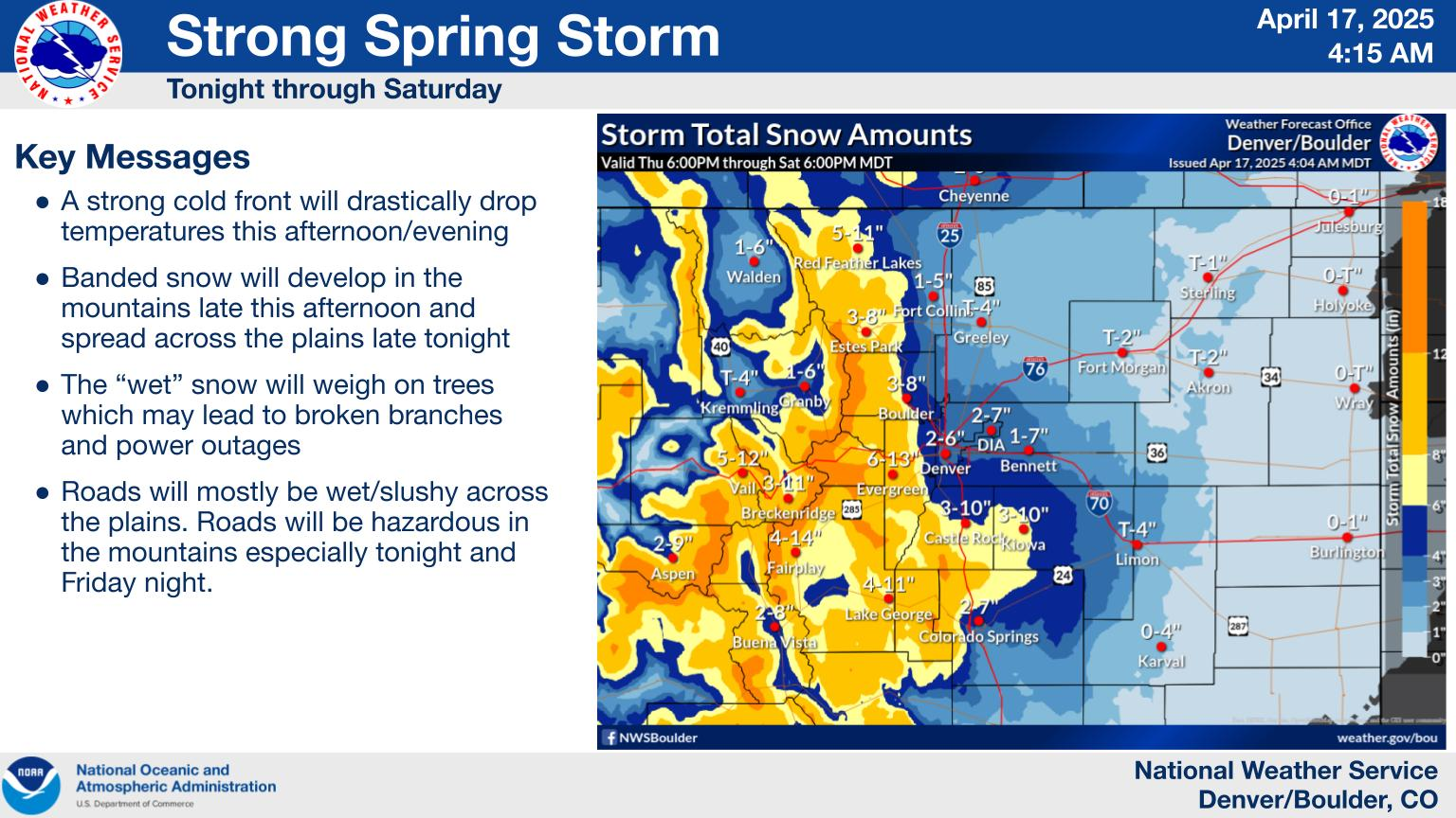
NWS Denver/Boulder is forecasting heavy wet snow in their region later today through tonight and Friday that will occur after Denver sees high temperatures in the lower 70s today – things change fast there!

Leave a comment