And more severe weather and flash flood risks into the weekend
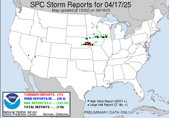
Happy Friday! Let’s start this morning by recapping the last 24 hours. As anticipated, supercell thunderstorms developed in eastern Nebraska late yesterday. We discussed in yesterday’s newsletter about there being a tornado risk and that if low level moisture became sufficient there could be a more significant risk. That ended up being the case, and a couple of likely strong tornadoes developed in Omaha area, affecting the areas around Bennington, NE and Essex, IA. Very large hail was also a serious impact, with more than 3 dozen reports of hail 2” in diameter or larger from the storms in eastern Nebraska and southwest Iowa, along with a separate cluster of severe storms that moved across northern Iowa and southern Wisconsin late last night and this morning. A number of reports of baseball to softball sized hail were received. This article from WOWT-TV has some pictures of tornado and hail damage from the Omaha region.
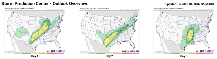
The scenario for today into the weekend still looks fairly similar to what we have been discussing the last couple of days. As the storm system responsible for all of the severe weather the last 24 hours moves east and weakens, the associated cold front will stall out from the southern Great Lakes to Texas. A broad area along this front will become somewhat favorable for strong to severe thunderstorms, and as waves of low pressure ejecting out of the Southwest move along it, several clusters of storms will move northeast along the front through Saturday. As of now, SPC has nothing higher than a slight (level 2 of 5, in yellow on the maps above) risk outlooked for potential large hail, damaging winds and a couple of tornadoes. There does appear to be a bit of a higher risk of supercell storms that could produce very large hail and a few tornadoes across parts of Oklahoma and northeast Texas this afternoon and evening.
By Sunday, the main upper level weather disturbance will eject out of the Southwest and bring a slight risk of severe storms from the mid-Mississippi Valley to the Arklatex region. There is still some model uncertainty to resolve for Sunday, and it is still possible we could trend toward a greater risk of severe weather somewhere within that broad slight risk, hoping for a clearer picture by tomorrow.
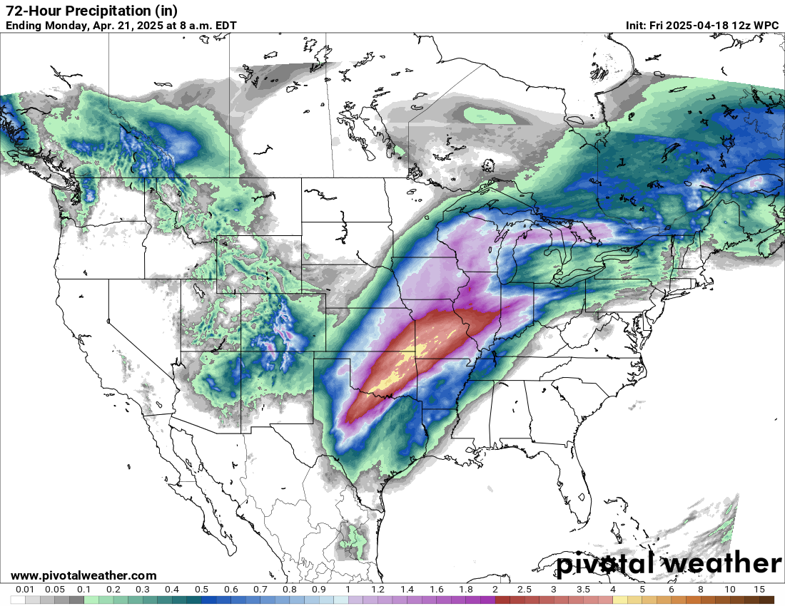
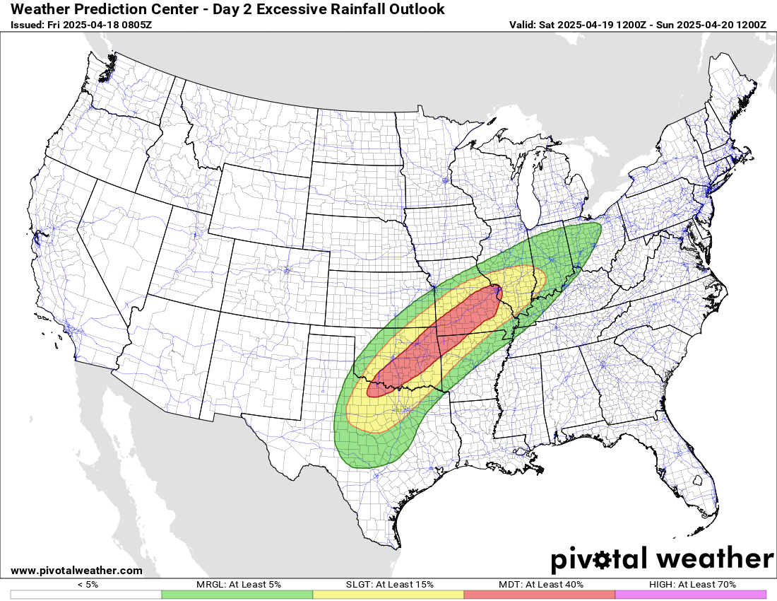
Along with the severe weather risk, multiple rounds of heavy rain producing thunderstorms will result in an increasing risk for flash flooding, with Saturday into Saturday night looking to be the most significant risk. While this heavy rain event will be occurring mainly to the northwest of the hardest hit area from the early April flood event, high rainfall rates falling on increasingly wet ground will likely result in some more significant flash flooding issues, and the Weather Prediction Center has placed a moderate (level 3 of 4) risk of flash flooding from north central Texas and eastern Oklahoma to the St. Louis area.
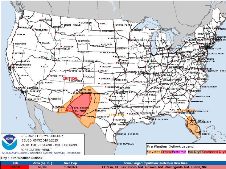
Extremely critical fire conditions did evolve as forecast across New Mexico yesterday, with Albuquerque Int’l Airport reporting wind gusts of up to 63 mph and relative humidity values as low as 5%. At least one wildfire south of Albuquerque prompted evacuations yesterday. Blowing dust was also an issue across New Mexico and parts of Arizona. While not as extreme as yesterday, critical fire danger is anticipated again today across parts of New Mexico and southwest Texas on the southwest side of the storm system.
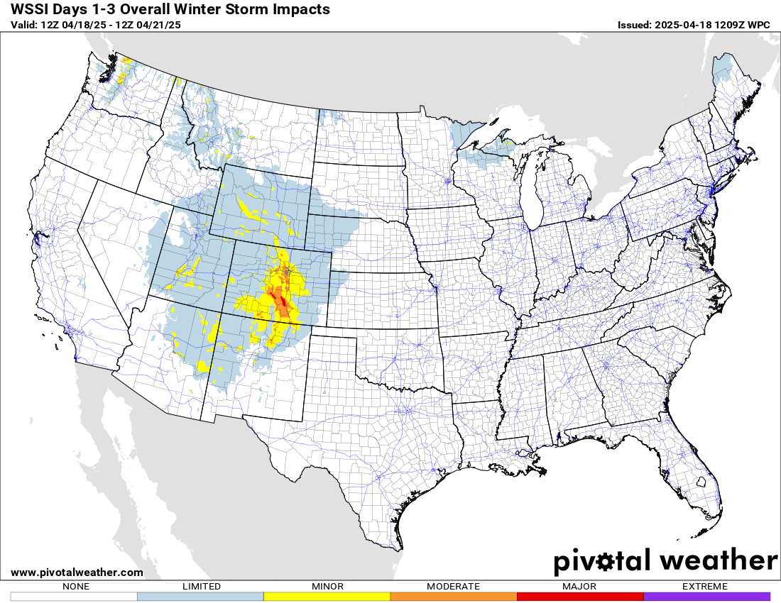
Winter weather will continue to an issue on the north and west side of this overall weather setup, primarily with heavy mountain snows focused across Colorado and northern New Mexico.
The last main system lifting out northeast across the southern Plains and Midwest on Sunday will fairly rapidly move northeast and weaken on Monday. Behind this system, the overall weather pattern next week looks to be dominated by a trough of low pressure aloft along the west coast, with a large scale upper level ridge of high pressure dominating much of the rest of the country. This should mean widespread above normal temperatures for next week, and potentially some record warm temperatures for parts of the eastern United States by later in the week. Severe weather risk looks like it may be mainly focused in the Texas region. More on all of this to come in future newsletters.

Leave a comment