Severe storm and heavy rainfall risks
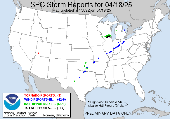
Welcome to the weekend! Yesterday ended up playing out about as expected with regard to severe weather. After the early morning cluster of severe storms with large hail across southern Wisconsin, several clusters of strong to severe storms developed along the front in the afternoon and night. Along with the morning Wisconsin storms, just over 100 reports of wind damage and hail were received (along with a lone landspout tornado over southwest Utah!)
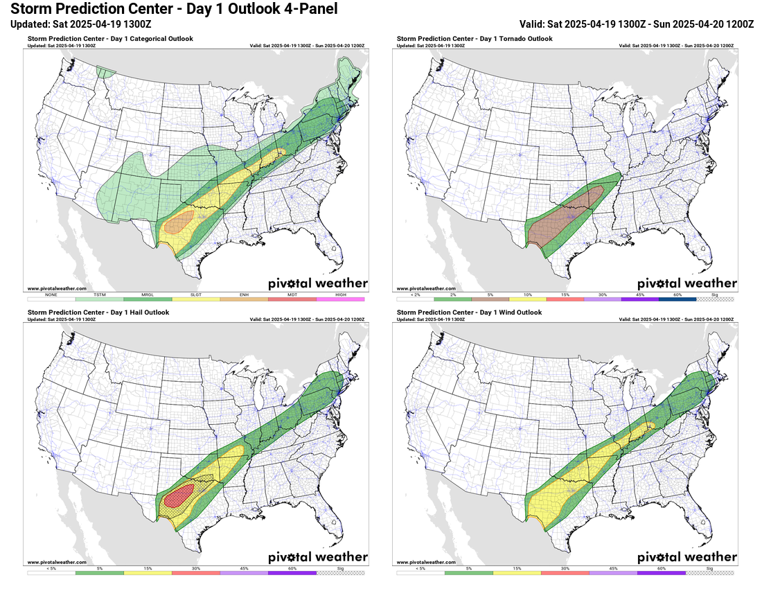
Today will actually be a relatively similar day, with upper level impulses interacting with moist and moderately unstable air along the stationary front resulting in several clusters of strong to occasionally severe thunderstorms. As the main upper level area of low pressure over the Southwest that we have been talking about the last couple of days starts to move into New Mexico late in the day, there will be increase in severe storm coverage and intensity over Texas, especially tonight.
For this reason, the Storm Prediction Center has placed an enhanced (level 3 of 5) risk for severe storms in central Texas for the potential for several intense supercell storms capable of producing very large hail greater than 2”, damaging winds and a few tornadoes. Northeast of there along the front, slight and marginal risks of severe storms are in place.
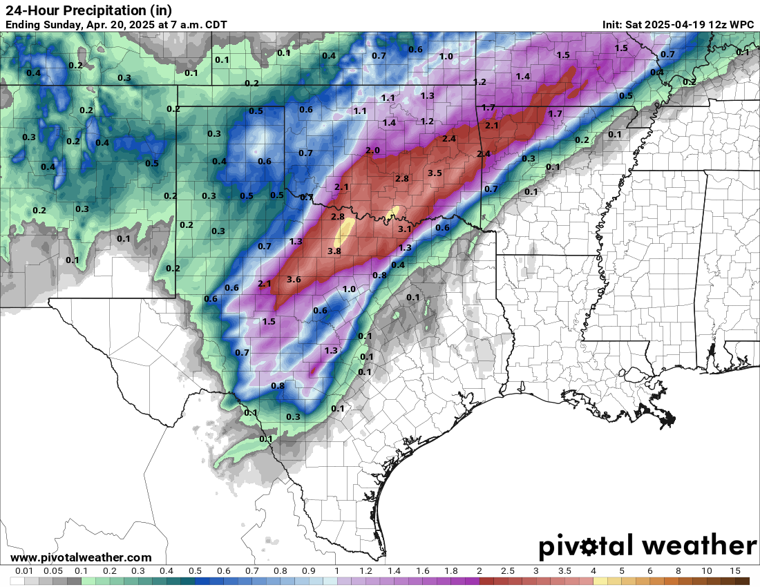
With repeated rounds of thunderstorms, heavy rainfall and flash flooding will also become a concern in this same general region. Widespread 2 to 4” of rain with localized heavier amounts are expected and the Weather Prediction Center has a moderate (level 3 of 4) risk of flash flooding from north central Texas into southern Missouri.
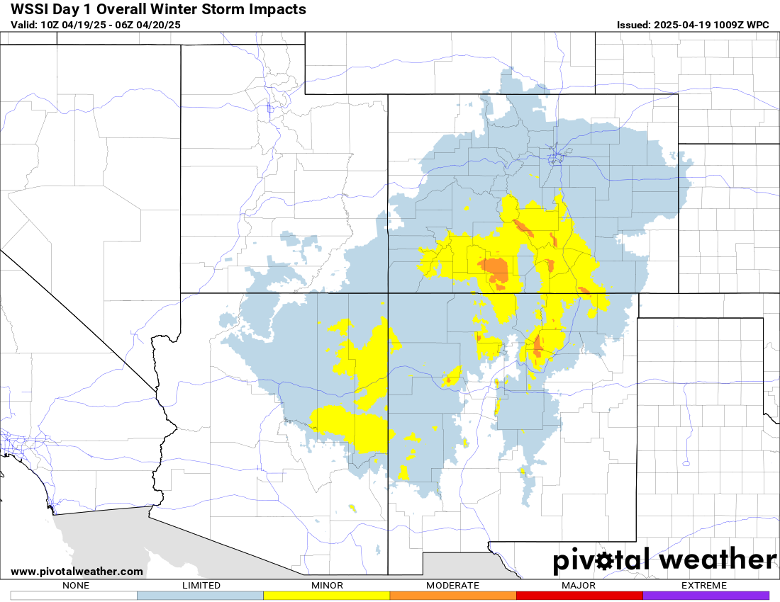
Under the upper level area of low pressure, moderate to heavy late season mountain snows will continue today in the Four Corners region.

As the main upper level system continues northeast toward the mid-Mississippi Valley Sunday, strong wind shear throughout the atmosphere and moderate instability will support the redevelopment of scattered supercell severe storms capable of producing damaging winds, tornadoes and sporadic large hail across Missouri and northern Arkansas. Once again, an enhanced (level 3 of 5) risk of severe storms is in place, with a slight risk extending south into the Arklatex region. There are some signs in the most recent models that the higher risk could extend a bit farther northeast into parts of southwest and central Illinois, so that is something to monitor. While the heavy rain threat does not look as organized tomorrow as today, there could still be some locally heavy rainfall that causes some flash flooding.
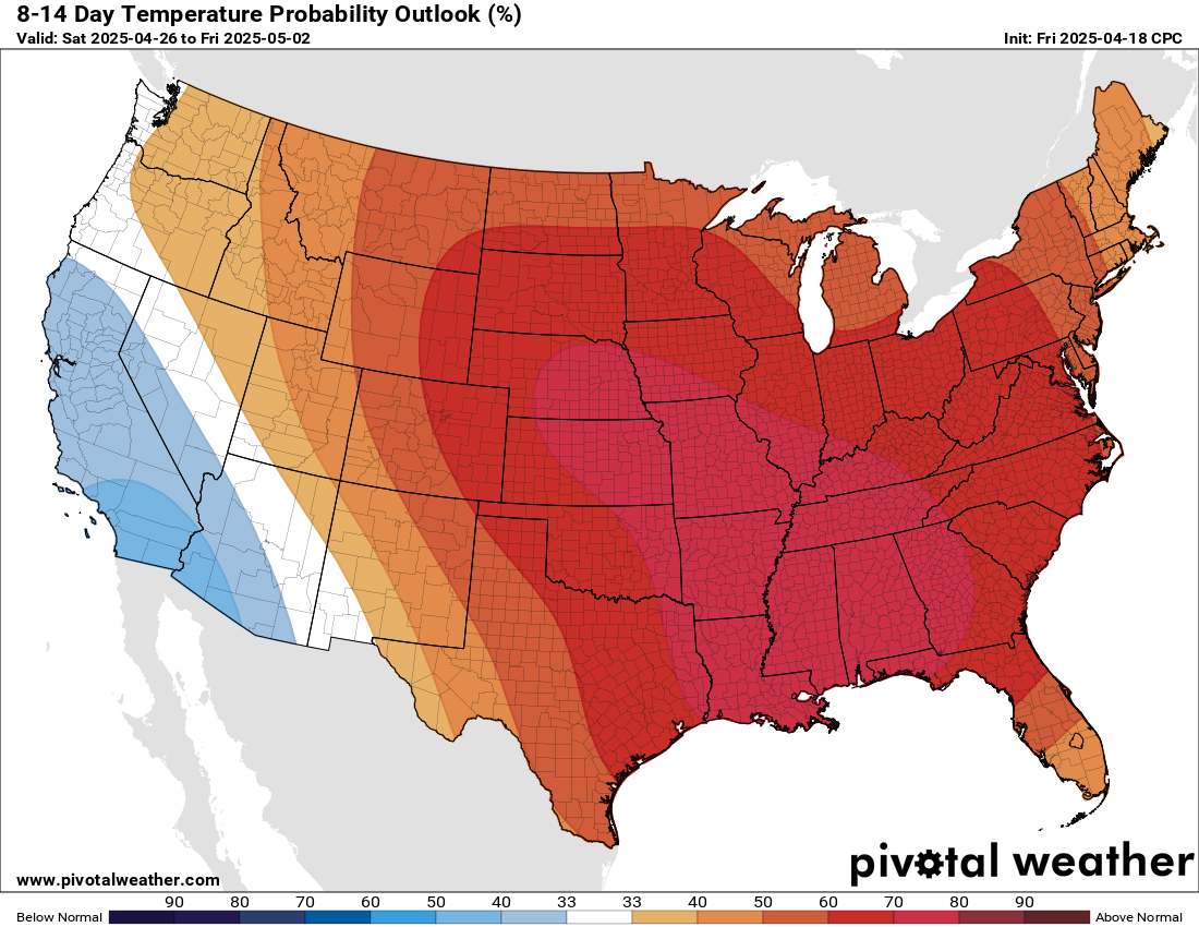
As we get into next week, the overall weather pattern will be dominated by an upper level trough of low pressure along the west coast, with a large ridge of high pressure downstream of it. That will mean widespread above normal temperatures across much of the country except the west coast. Some near record warm temperatures are possible, especially record high minimum temperatures across the Mid-Atlantic and parts of the Southeast.
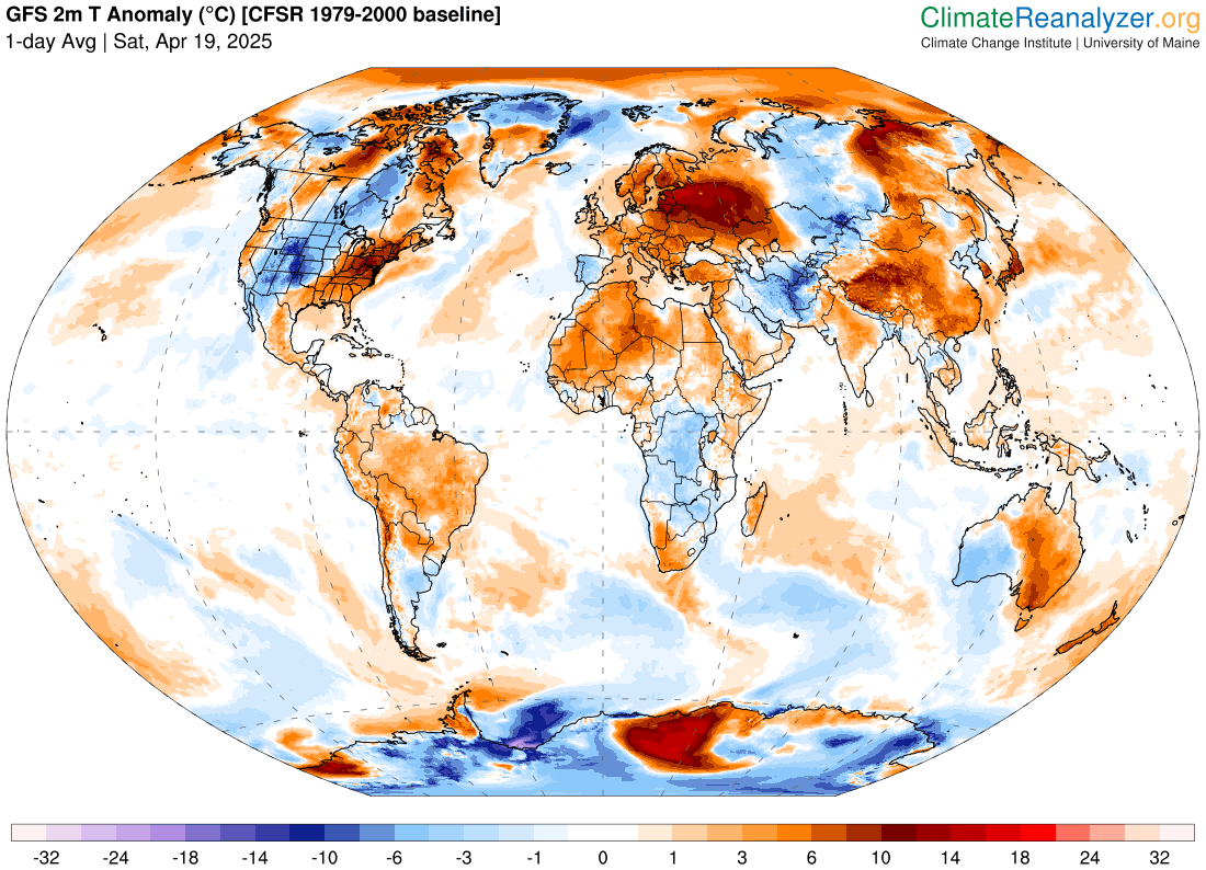
Speaking of record warmth, record heat has continued to be a significant story across much of Asia, southern Australia, and eastern Europe. Numerous record warm temperatures for April have been set in all of these areas. The Extreme Temperatures around the World BlueSky feed has a lot of information about the record heat.

Leave a comment