More severe weather for Easter Sunday
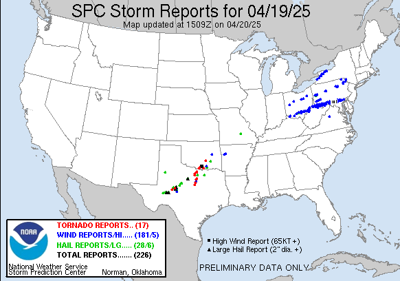
Let’s start off this morning’s newsletter by recapping the last 24 hours. First, the expected severe weather: as anticipated, severe thunderstorms increased in coverage and intensity over west Texas late Saturday afternoon and moved northeast across north Texas and southern and eastern Oklahoma last night. A number of tornadoes were reported along with reports of hail larger than 2” in diameter and straight line wind damage.
What was unexpected: a couple of swaths of wind damage impacted the Northeast and Mid-Atlantic region yesterday and last night. They were caused by two clusters of severe storms. The first moved across northern Ohio, northern Pennsylvania and southern New York during the day, and a second cluster that moved across southern Ohio and along the borders between West Virginia, Maryland and Pennsylvania late in the day and Saturday evening. The second cluster was the most impressive, producing numerous reports of wind damage including some measured wind gusts over 75 mph. As of this morning, PowerOutage.US reports about 75,000 customers without power in the region.
While much of the area impacted by these storms was under a marginal risk of severe weather yesterday, these storms were much more impactful that anticipated. I would need to do a more detailed analysis, but my initial sense is that at least the later severe storms were particularly significant wind producers due to a bit of an “inverted-V” type situation that I described in a recent post. Hagerstown, MD reported a wind gusts of 75 mph around 10 pm ET when the storms moved through, and prior to the storm’s arrival, their temperature was 83F with a dewpoint of only 54F for a relative humidity of 37%. When combined with the nearest upper air data, that suggests that there was some enhancement of the winds due to warmer, drier air near the ground. Regardless of the exact mechanisms, it was certainly a rather impressive (and surprising) event.
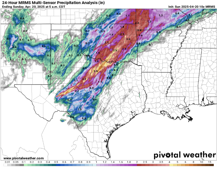
In addition to the severe weather, a swath of very heavy rainfall accompanied the southern Plains storms, with morning MRMS 24-hour rainfall estimates showing amounts greater than 4” common along the main band of storms. The highest observed amount I have seen so far is 8.18” at a CoCoRaHS site in Nocona, TX.
If you look closely at the MRMS rainfall graphic above, you can see a second, narrower band of heavy rainfall that goes through the Oklahoma City metro area. While this band was narrower and not as heavy, it was very impactful as it fell in a short period of time over an urban area, and the high rainfall rates caused significant urban flash flooding. Sadly, two people were killed in Moore, Oklahoma when their vehicle was swept away by flood waters Saturday evening.
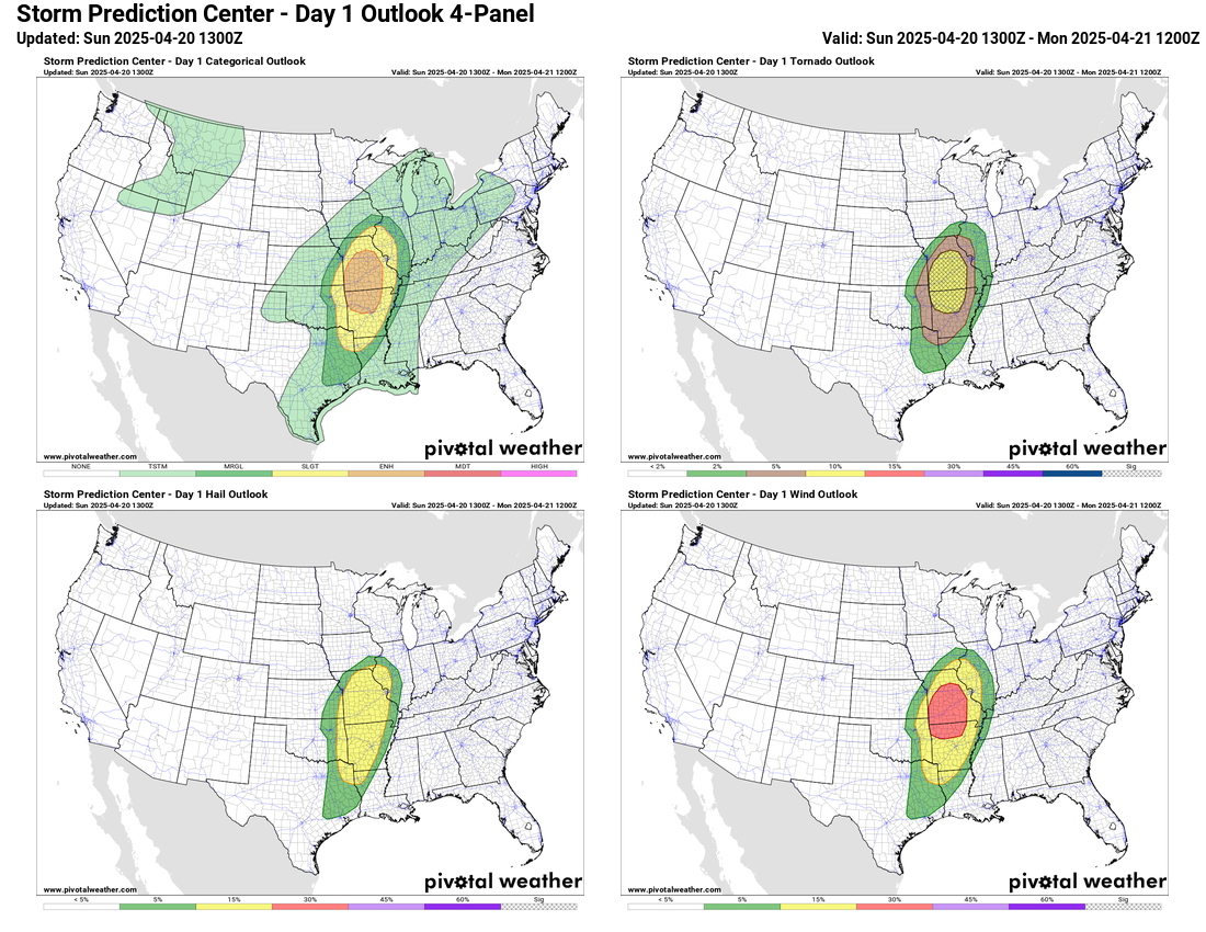
Today looks like another active day for severe weather, with the focus shifting to Missouri and Arkansas. As the main upper level weather system we’ve been talking about the last few days moves northeast into this region, strong winds in mid levels of the atmosphere will move over an area that has decent instability. This will create an environment favorable for several supercell severe thunderstorms that could produce tornadoes, some of which could be strong, along with damaging winds and sporadic large hail. The storms should eventually organize into more of a line of storms which will move east into western Illinois with a continued risk for damaging winds and a few tornadoes. SPC has an enhanced (level 3 of 5) risk for this scenario.
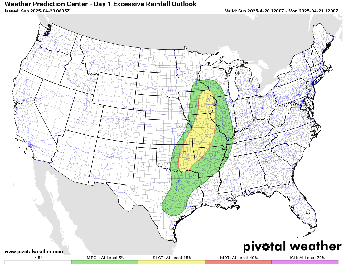
While the heavy rainfall risk will not be as organized as Saturday, there will still be some localized bands of heavy rainfall where a few storms move repeatedly over the same area.
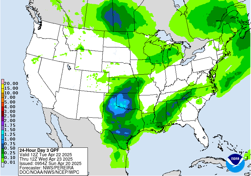
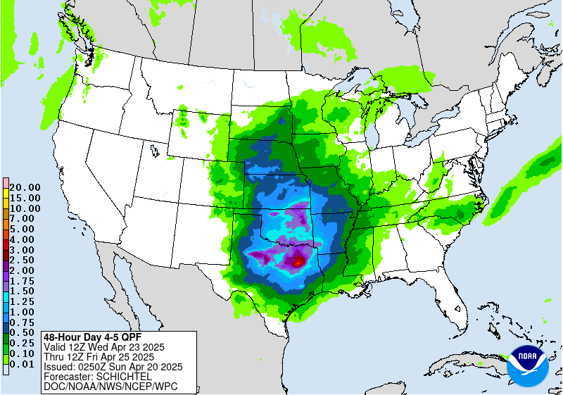
As we have been discussing, the upcoming week will be dominated by a pattern with an upper level trough of low pressure along the west coast and a large upper level ridge of high pressure over much of the rest of the country, leading to warm conditions for most. An upper level weather disturbance in the southern branch of the jet stream should bring active weather to the southern Plains and adjacent regions with numerous rounds of thunderstorms expected. There will at least be some risk of severe storms and flash flooding with this activity starting on Tuesday – more to come as the week goes on.

Leave a comment