But things get a bit busier again this week

Yesterday worked out about as anticipated from a forecast perspective, as a complex of severe storms evolved and moved northeast across Missouri and into western Illinois, with numerous reports of wind damage and several tornadoes. Supercell thunderstorms in Arkansas also caused wind damage and at least one tornado.
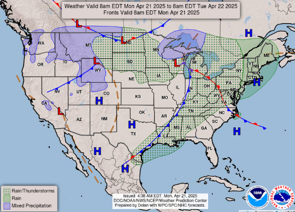
Today will be a quieter day as far as severe weather and flash flooding, but the system that caused the severe weather over the weekend will still be producing rain and thunderstorms from the Northeast to the Gulf Coast. A few severe storms are possible along the front, but conditions are not particularly favorable and the Storm Prediction Center only has a marginal (level 1 of 5) risk outlooked in the lower Mississippi and Tennessee Valleys and eastern Great Lakes region. Some wintry precipitation is expected around Lake Superior and in the northern Rockies.

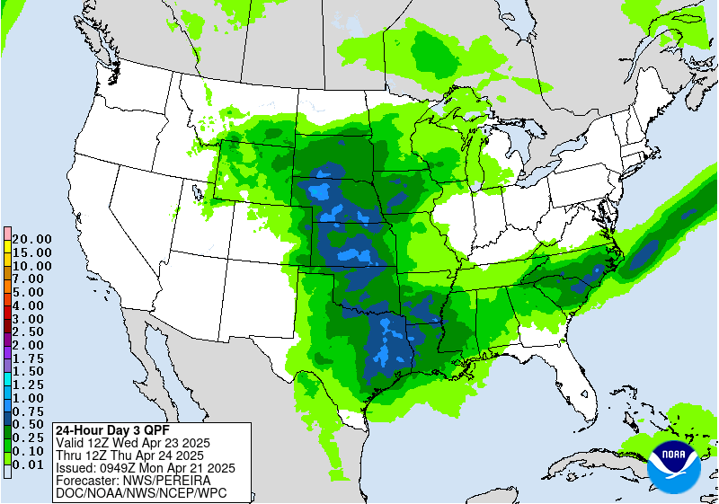
The weather pattern this week will feature an upper level trough of low pressure along the west coast with a large ridge of high pressure aloft dominating much of the rest of the country, resulting in above normal temperatures for much of the nation by midweek. An impulse in the southern branch of the jet stream moving slowly from the southwest United States into the Midwest will cause showers and thunderstorms to become rather numerous Tuesday and Wednesday through the middle part of the country.
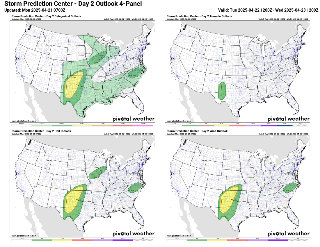
Some severe storms are possible within this region, with the Storm Prediction Center having a slight (level 2 of 5) risk of severe storms from western Texas into southern Kansas on Tuesday. A similar risk will likely exist on Wednesday, but also expand somewhat across eastern Colorado and into parts of Nebraska. At this point, the pattern does not appear conducive to a higher end risk of severe weather the next couple of days, and the heavy rain risk looks to be limited to locally heavy amounts, especially over parts of Texas and Oklahoma.
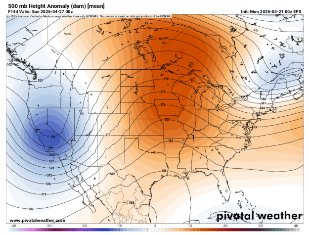
By late in the week and into next weekend, the trough of low pressure along the West Coast will begin to slowly move east into the Southwest US and eventually Rockies. That will likely set the stage for additional thunderstorm activity across the Plains and Midwest. Conditions could eventually become more conducive for severe weather and flash flooding risks as we go through the weekend and into early next week.

Leave a comment