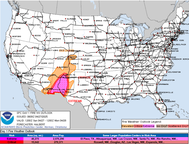
Extreme fire danger in New Mexico today

Jumping right into today’s weather with a look at the severe weather and fire weather outlooks from the NWS Storm Prediction Center. As the strong upper level weather system over the western United States that I have been discussing the last few days starts to move east today, it will increase the risk of severe storms in the High Plains. A slight (level 2 of 5) risk is in place from southern North Dakota to west Texas for scattered supercell thunderstorms capable of very large hail, damaging wind and a few tornadoes.
Farther south, strong winds in low and mid levels of the atmosphere on the south side of the upper level system will move across New Mexico. The airmass here will be very dry this afternoon with single digit relative humidity values. Combined with recent drought, all of this will result in very favorable conditions for rapid fire spread if any wildfires develop today, and SPC has outlooked an extremely critical fire danger area for a large of New Mexico into extreme west Texas. This includes the Albuquerque and El Paso metro areas.
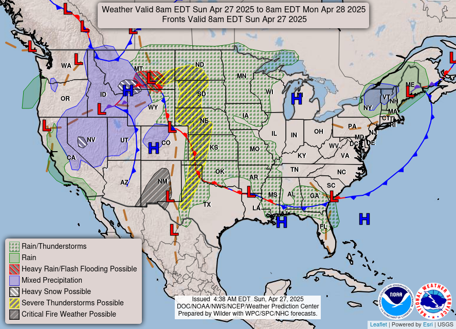
The western US system will also produce mountain snows across high elevations of the west, with locally heavy amounts possible especially in Nevada and Montana.

As the upper level system moves into the northern Plains on Monday, it will interact with anomalously moist and unstable air for late April in the upper Midwest to result in a very supportive environment for severe thunderstorms. SPC continues to highlight a potential severe weather outbreak in this region, and has a moderate (level 4 of 5) risk in place. Conditions look to become favorable by mid afternoon into the evening for intense, long tracked supercell storms capable of strong tornadoes, very large hail, and damaging winds.
The timeframe of this event is starting to come into the range of our high resolution models, and to this point they are showing a surprising lack of thunderstorm development in this region Monday afternoon and evening, likely due to the presence of a strong cap of mid level warm air helping to suppress development. The expectation as of now is that the upper level weather system and forcing along a surface cold front will erode that cap sufficiently to result in at least widely scattered thunderstorm development along the front in Minnesota and Iowa, while the activity will become more uncertain and isolated along the front to the southwest into Oklahoma and northwest Texas.
I will continue to provide updates as new data comes in later today through Substack Notes and social media posts. On Monday, I am planning video briefings and a Substack chat for paid subscribers to cover this severe weather event.
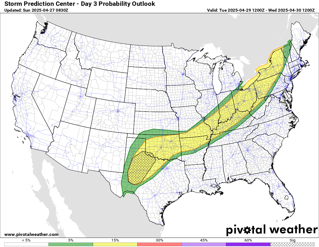
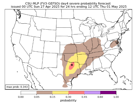
As we have seen a number of times this year, the front associated with this system will become nearly stationary from the eastern Great Lakes to west Texas on Tuesday. A risk of severe storms will continue along the front and SPC has a slight (level 2 of 5) risk of severe storms outlooked for this region. On Wednesday, the next upper level system will come out of the Southwest and interact with the front, resulting in a risk of severe storms across the south central US as shown in the Colorado State University machine learning probabilities.

Leave a comment