Additional severe storms in Texas
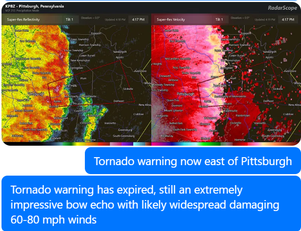
A complex of severe storms has caused significant impacts across Ohio, the West Virginia panhandle, and western Pennsylvania this afternoon. As you can see in the radar loop above, this was a powerful “bow echo,” so called because of the bowing nature the storms take as seen in the reflectivity data on the left. Intense winds can be seen coming into the back of the line of storms aloft – known as the rear inflow jet – along with a band of intense winds at the surface along the leading edge of the line of storms which produces the strong, damaging wind gusts.
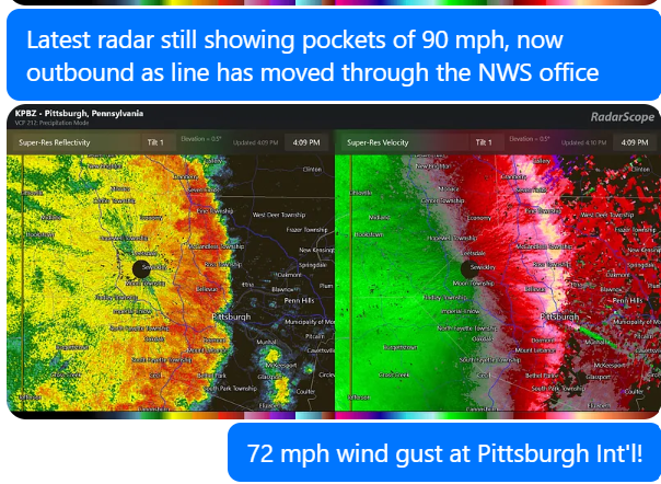
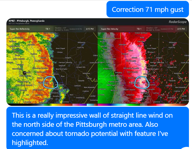
The Pittsburgh NWS Doppler radar consistently showed a solid band of 60 to at times 90 mph winds along the leading edge as the storms moved through the region, and this was borne out by observations. Multiple locations reported winds reported winds near or above 70 mph, including 71 mph at Pittsburgh Int’l Airport, 70 mph at Wheeling, WV and 69 mph at Allegheny County Airport. Earlier, severe wind gusts were also measured at observing sites in Dayton, Columbus and Zanesville OH. As of 6 pm ET, poweroutage.us reports that more than 275,000 customers are without power in eastern Ohio, western Pennsylvania, and the panhandle of West Virginia.
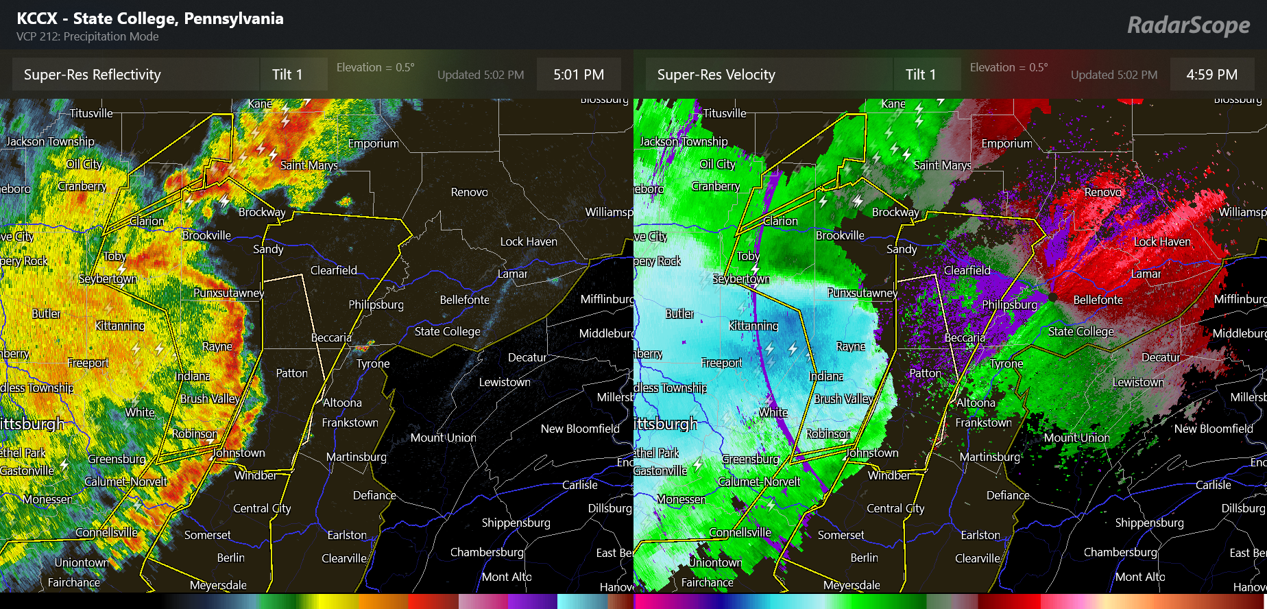
The line of severe storms is now moving into central Pennsylvania, and while perhaps not quite as well organized as a couple of hours ago, it is still an impressive bow echo. NWS continues to warn for 70 mph winds and the line will soon be approaching the Altoona and State College regions.
Elsewhere, the complex of severe storms that moved across southwest Missouri this morning continued to remain well organized as it moved east into southern Illinois and southwest Indiana, producing numerous reports of wind damage. 60,000 customers are still without power in Missouri from this complex of storms. It has become less organized finally, but there are still scattered strong to severe storms over parts of western Kentucky, southern Indiana and southwest Ohio.
Back over west Texas, the supercells that we were anticipating have developed over the last couple of hours.
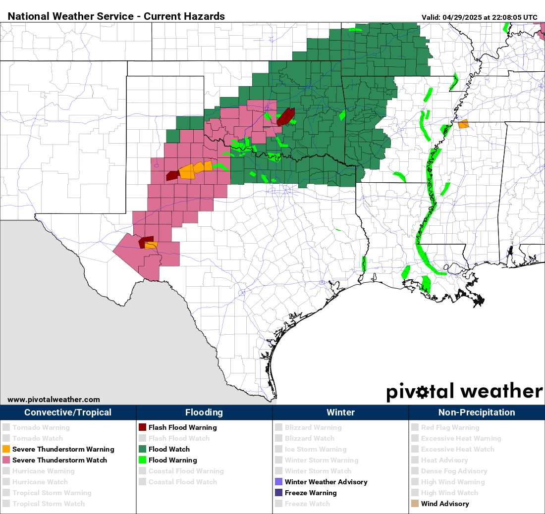
As of now, these storms are only moving very slowly east-northeast. With time, these storms should become more widespread and organized and begin moving more steadily northeast across Oklahoma and northern Texas. Severe weather and flash flooding are expected to be a significant risk through the night as this complex moves northeast, and eventually another complex of severe storms evolves over northwest Texas later tonight and moves along a similar track after midnight.
I will be continuing to provide updates this evening via Substack Notes, BlueSky, and Facebook. Additionally, for paid subscribers I have a real-time Substack Chat ongoing where I am providing frequent updates using radar, storm reports and other data. I’ve posted some screen captures below from this afternoon’s chat as the bow echo was moving through the Pittsburgh area to give you an idea of what kind of information I am sharing in these chats I do during significant weather events.

Leave a comment