And the rain keeps adding up in Oklahoma
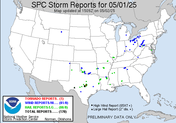
Happy Friday! Starting off with a quick look at the last 24 hours: as expected, there were a couple of focused areas of severe weather reports yesterday and last night, one in Oklahoma and another in the eastern Great Lakes. An additional area ended up being in central Texas, where at least one intense supercell storm produced hail up to baseball sized and a tornado near Briggs, TX that damaged several homes and injured one person.
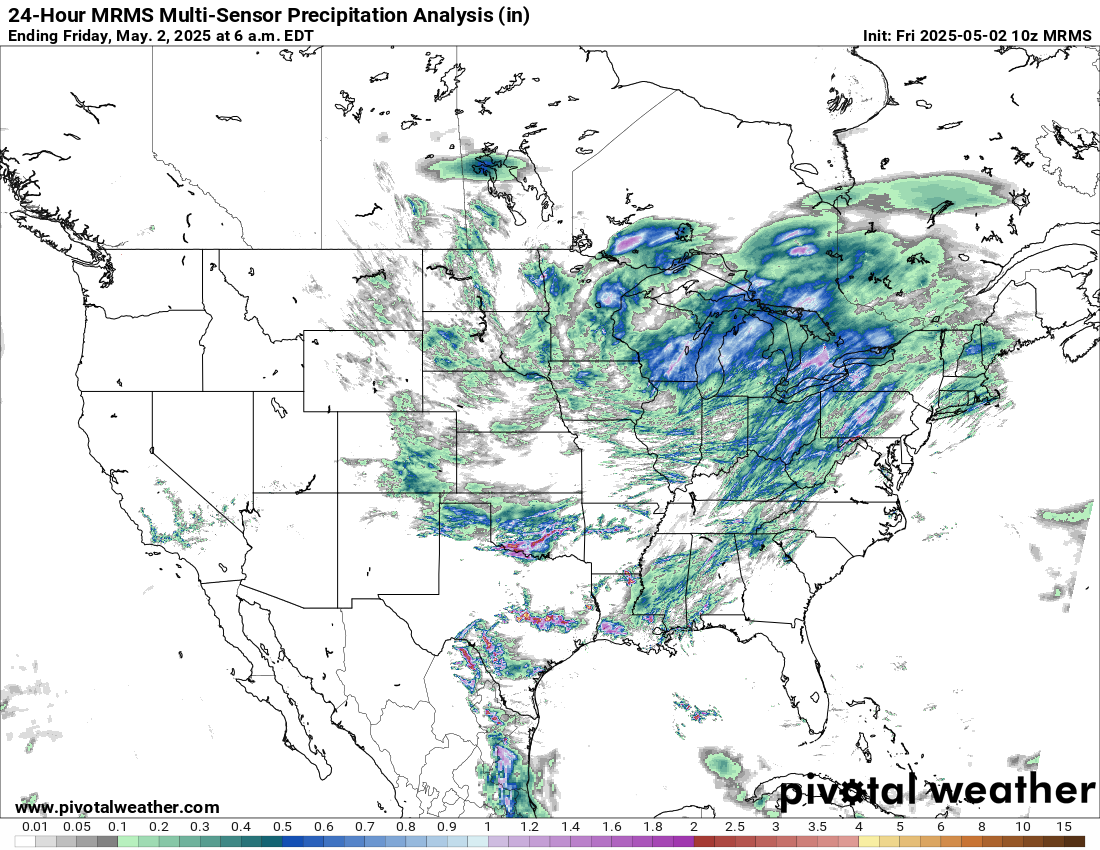
Conditions were quite wet around the Great Lakes region in general, while locally heavy rainfall occurred with the thunderstorms in Texas and Oklahoma.
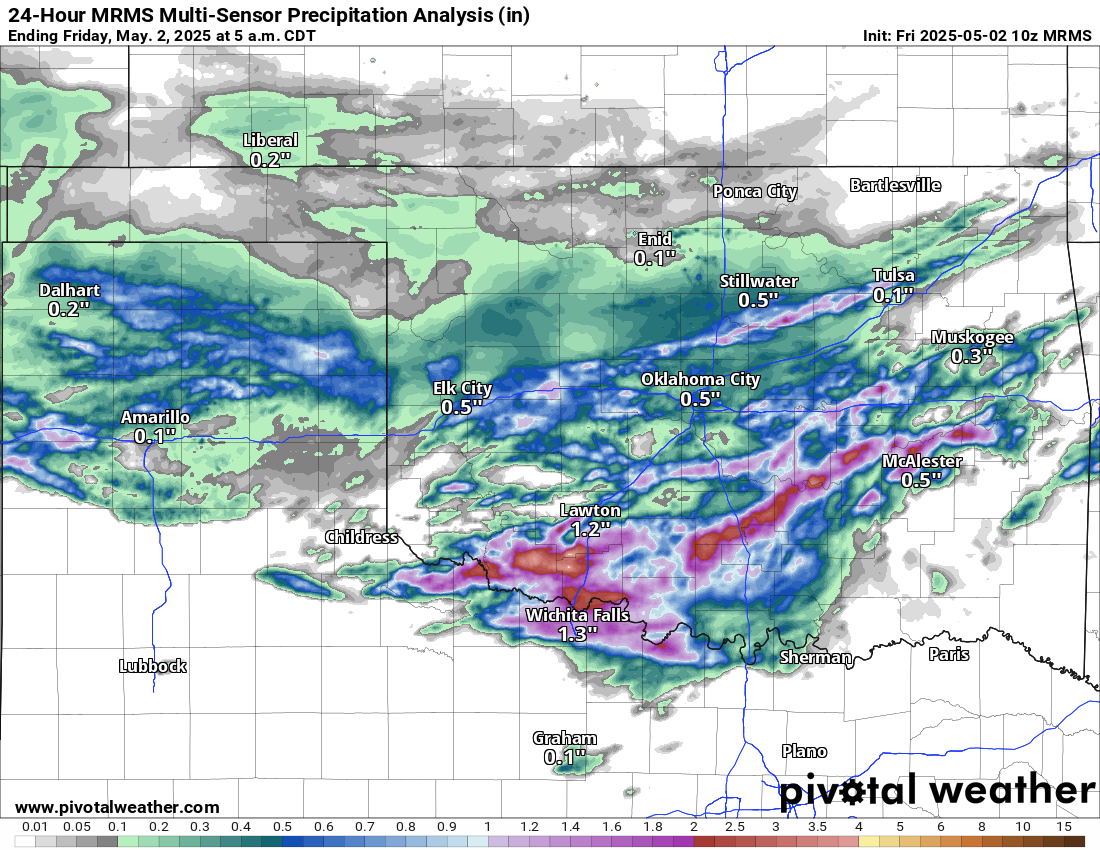
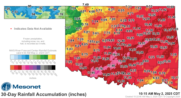
Areas in southwest Oklahoma had localized amounts greater than 4 inches overnight, causing renewed flash flooding. Several Oklahoma Mesonet sites in southern through eastern Oklahoma have received more than 12” of rain in the last 30 days, with a couple of sites approaching 20” over the last month.
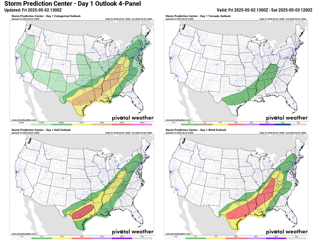
With a nearly stationary front aligned from Texas into the eastern Great Lakes, a broad area along and south of it will see conditions become favorable for severe storms this afternoon and evening and SPC has a large enhanced (level 3 of 5) risk outlooked. Gulf moisture and some daytime heating will result in instability and modestly strongly winds aloft will provide sufficient wind shear for organized severe storms capable of producing large hail and damaging winds. While the threat of organized heavy rainfall is low, given relatively slow moving strong thunderstorms producing heavy rainfall, localized flash flooding is possible in this region as well. The threat of tornadoes is not zero but is relatively low given a lack of wind shear in lower levels of the atmosphere. Areas in central and eastern Texas look to have an enhanced risk of very large hail as instability will become quite strong in this area, leading to potentially intense supercell storms.
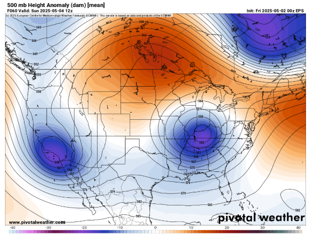
As I discussed in yesterday’s newsletter, the pattern the next several days will be dominated by two strong upper level low pressure centers, one over the Southwest United States and the other over the Ohio Valley region. Weather patterns like the one above are called “blocks” because the strong low pressure centers underneath strong regions of high pressure tend to get stuck and are slow to break down. This will be the case here as these two upper level lows will be the main players in the weather through the middle of next week.
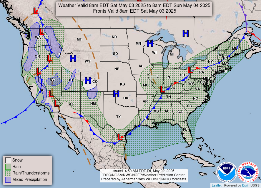
For this weekend, this will mean unsettled conditions for both the eastern and western parts of the country. Numerous showers and thunderstorms can be expected across the East; while the setup is not overly favorable for severe storms, a few isolated severe storms are possible. In the West, low elevation rain showers and thunderstorms can be expected with late season high elevation snow.
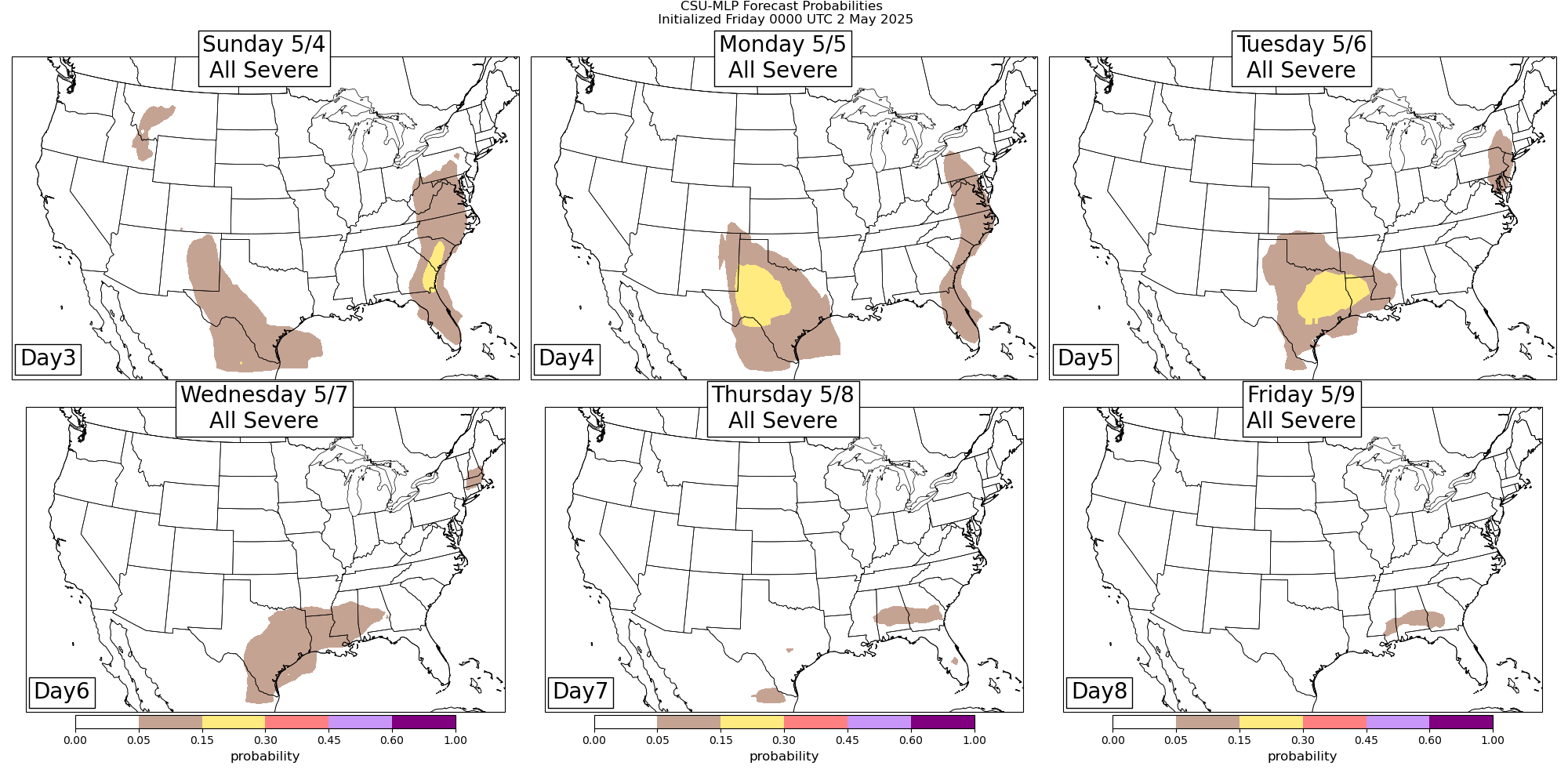
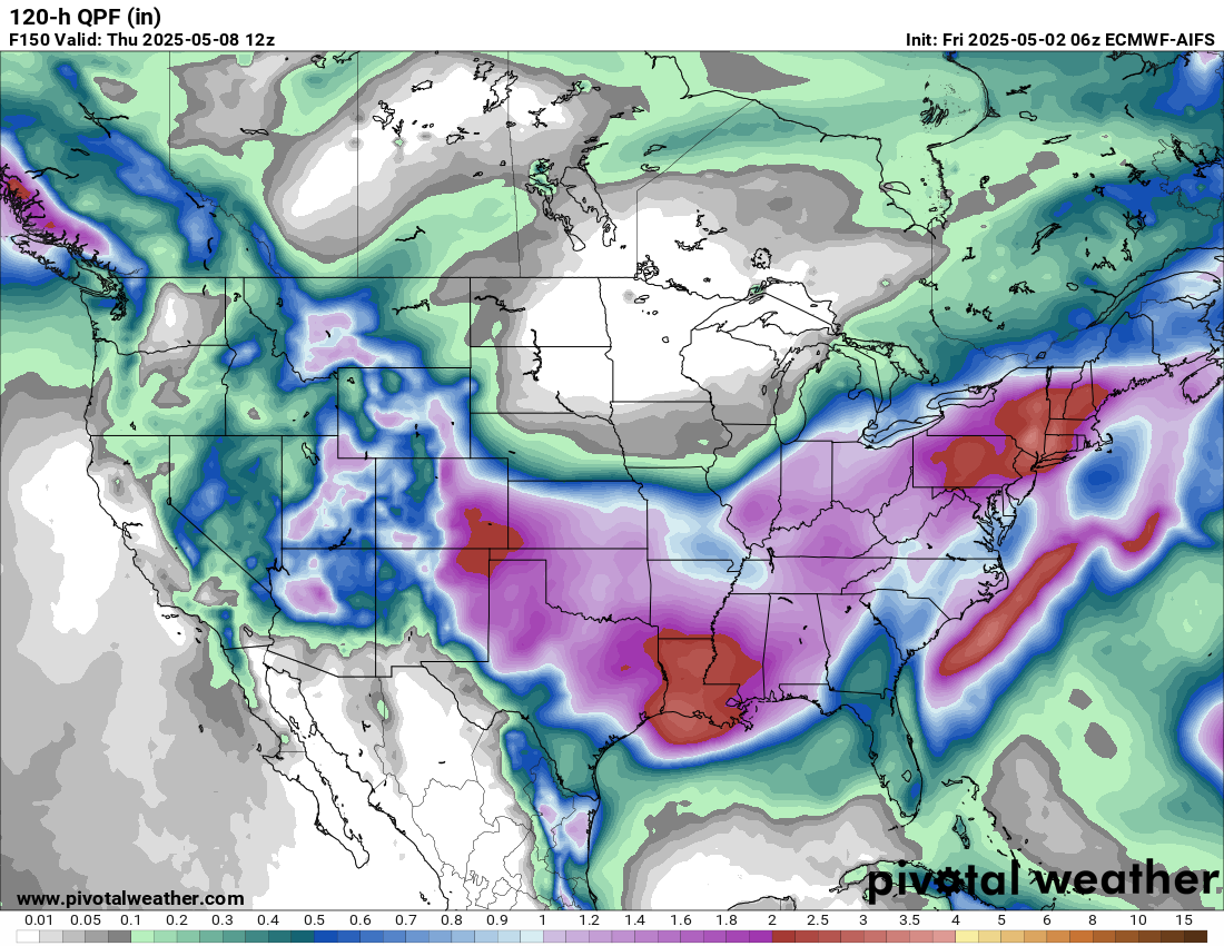
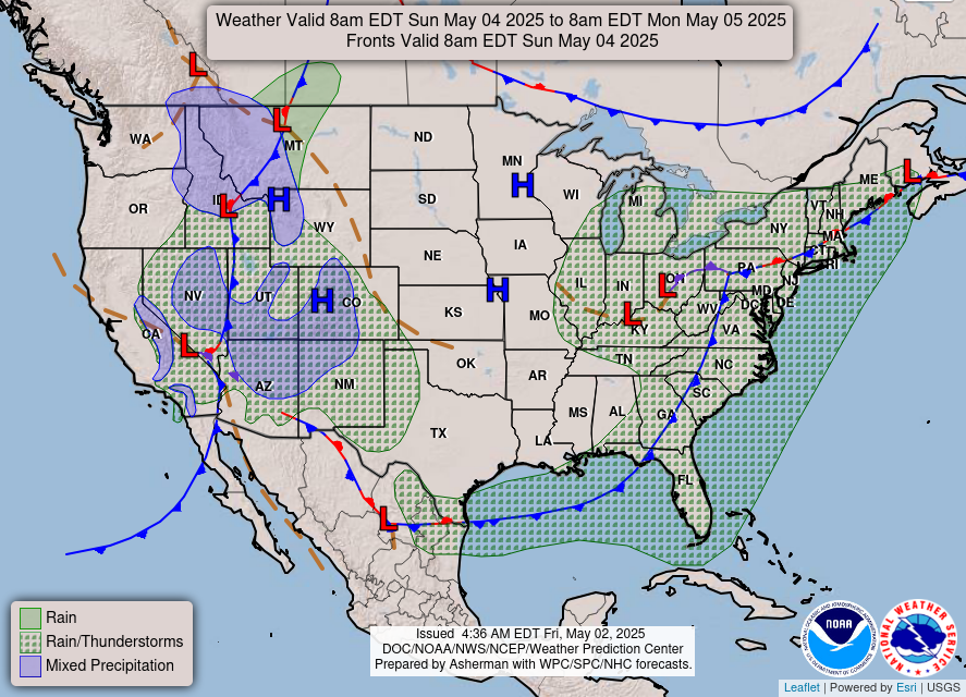
As we head into the early and middle part of next week, the eastern US upper low should start to slowly move east and weaken, but it will bring days of wet weather to much of the East with a large part of the Northeast looking to pick up 3-5” of rain as shown in the European AI model 5 day rainfall ending next Thursday. While much of this region has been experiencing drought, there could eventually be some flooding issues, and WPC has outlooked marginal risks of flash flooding in this region next Monday and Tuesday.
To the west, it now looks like the Southwest upper low will start to progress a bit more rapidly into the south central US. This will likely bring an increasing risk of severe storms and heavy rainfall/flash flooding to Texas once again, which will spread into the lower Mississippi Valley by the middle of the week.

Leave a comment