And more severe weather and flash flooding for Texas this week

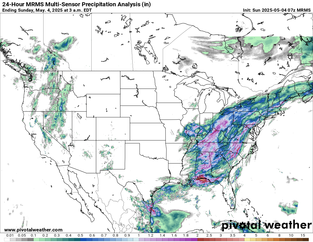
Good Sunday morning. Looking back quickly at Saturday, while the severe weather was not as widespread as the previous days, there were several focused clusters of severe storms that produced wind damage and some hail across the eastern US. Rainfall was widespread over the east with one inch amounts common from the Tennessee Valley into the upper Ohio Valley. The west saw scattered rain and snow showers especially across the Great Basin.

We have been talking the last few days about two upper level low pressure centers being the focus of the weather this weekend, one over the Southwest and the other over the Ohio Valley. As these systems continue their very slow eastward movement, today will be relatively similar to yesterday, with just a bit of an eastward shift. Isolated severe storms will continue to be possible in the east ahead of the slow moving cold front running from West Virginia to Florida, while with the Southwest system, a bit more focused thunderstorm activity is expected in eastern New Mexico where there are slight risks of both severe storms and flash flooding.
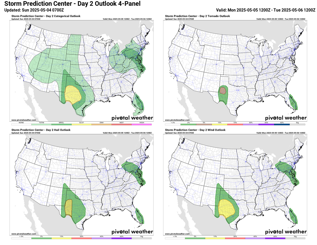

As the systems continue to move slowly east on Monday, their associated thunderstorm activity will continue to focus a bit farther east. Moisture and instability feeding northwest out of the Gulf will begin to interact more significantly with the Southwest US system, and this will result in increasing risks for severe weather and flash flooding across Texas. Severe weather and flash flood risks are anticipated to be less with the eastern system, but there will be marginal risks of severe storms and flash flooding as seen above.

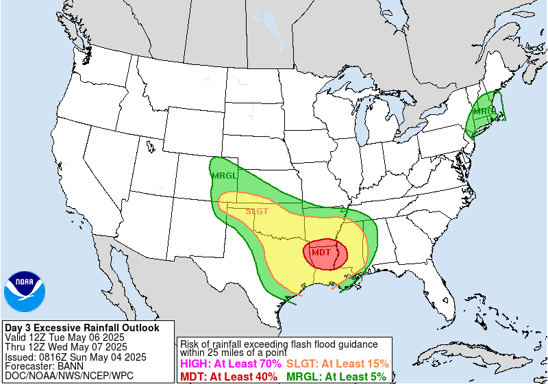
Tuesday will see a continued slow eastward shift of both systems. The risk of flash flooding will become more significant on Tuesday with the western upper low as thunderstorms with heavy rainfall become more widespread and also begin to impact regions that have been quite wet over the last several weeks. WPC continues to have a moderate risk of flash flooding focused from the Arklatex to the Arklamiss region. Severe storms will also be possible as well in this region.
Beyond Tuesday, it continues to look as if the western upper low will continue to slowly move east and southeast and cause shower and thunderstorm activity to focus over the Southeast with at least a low risk of some severe storms. Farther north, the initial upper low will move off the coast but a new system dropping south out of Canada will keep cool and unsettled weather for much of the eastern seaboard. In the West, a large ridge of high pressure aloft will be developing, bringing drier and warmer conditions.

Leave a comment