And an unusual supercell in the Mojave Desert

Good morning and welcome to hump day! As expected, the last 24 hours were quite active from east Texas across Louisiana, with over 100 reports of severe weather. Luckily the storms remained relatively “messy” limiting the tornado activity, although at least one tornado moved very close to the NWS Shreveport radar causing some reported tree damage. Additional severe storms occurred over the Northeast as well with the upper low in that part of the country.

You can also see on the severe weather report map a couple of reports of large hail in southern Nevada. A small upper low pressure area rotating around the northwest side of the main upper level low we have been talking about yielded an unusual environment favorable for a few supercell severe storms in the Mojave Desert region. The radar image above from the Las Vegas radar shows a well developed rotating supercell storm with high reflectivity values (left) and clear rotation in the velocity data (right) to the west of Bullhead City, AZ Tuesday afternoon.
Also of interest in this radar image is the large “spike” I have circled (the spike is more visible in the velocity data). That is a “three-body scatter spike” or TBSS, a data artifact we see when large hail causes the radar beam to not only reflect back toward the radar, but also to reflect down to the ground, back up to the hail, and then back to the radar. Meteorologists use the presence of a TBSS as an indicator of large hail with a storm and as evidence of the need for a severe thunderstorm warning. Needless to say, TBSSs are not particularly common in this part of the country.
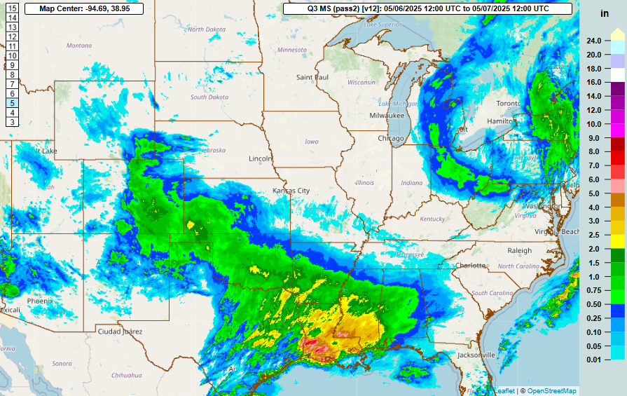
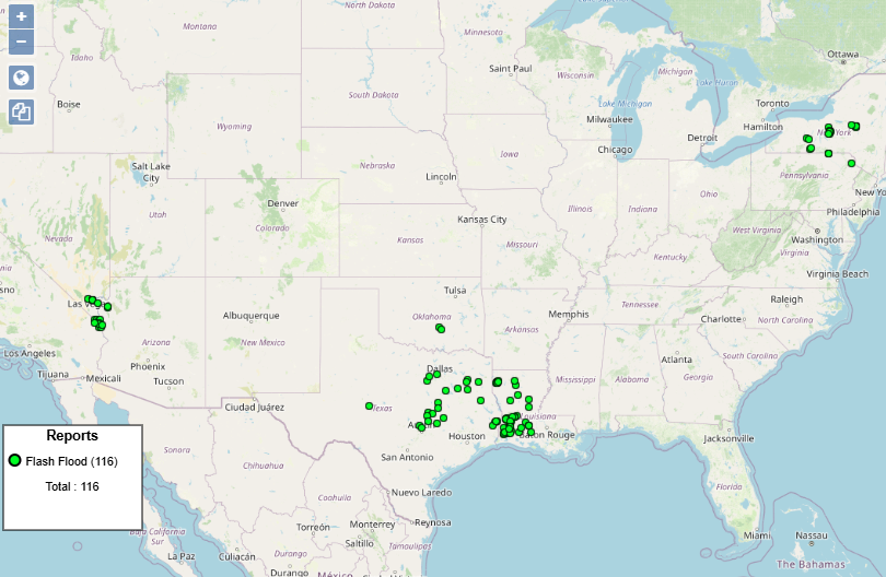
Turning to rainfall and flash flooding, as one might expect the storms over the Mojave Desert region caused some localized flash flooding. The most widespread heavy rainfall and flash flooding was in the east Texas and Louisiana area. As often happens with thunderstorm events in this part of the country, the heaviest rain ended up falling close to the Gulf Coast, with radar showing a couple of swaths of amounts up to 8” in southwest Louisiana. Significant flash flooding occurred in this area, and urban flooding issues were also reported in the Shreveport area. While rainfall amounts were much less than in Louisiana, the upper low in the Northeast produced some localized 2” totals which was sufficient in the hillier and more flood prone region to produce some flash flooding.
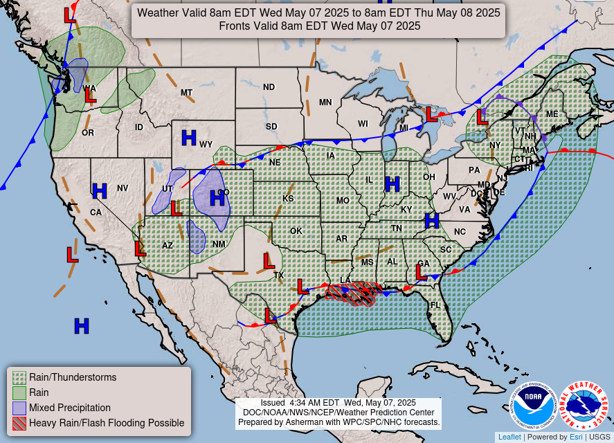
The main hazardous weather focus today will be flash flooding along the central Gulf Coast. While most of the intense thunderstorm activity will be shifting out over the Gulf, one more round of storms should occur this afternoon and evening across south central and southeast Louisiana, potentially producing some flash flooding as well as a few incidences of severe weather.
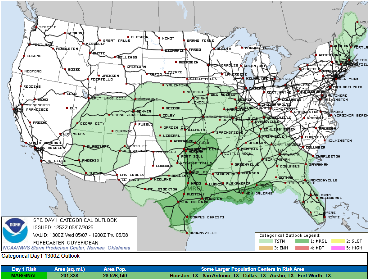
Farther north and west, a few severe storms could develop underneath the upper level low pressure area, with large hail the main threat. SPC has marginal (level 1 of 5) risks outlooked for all of these areas. In the Northeast, the upper level low in that part of the country will finally weaken and start to move off the coast, but scattered thunderstorms will still be possible with it today.

On Thursday, the upper level low in the south will continue to move east toward the Southeast, with scattered to numerous showers and thunderstorms ahead of it. While conditions will not be favorable for widespread or higher intensity severe storms, a few severe storms with large hail and damaging downburst winds are possible over a large region where SPC has a marginal risk of severe storms in the forecast.
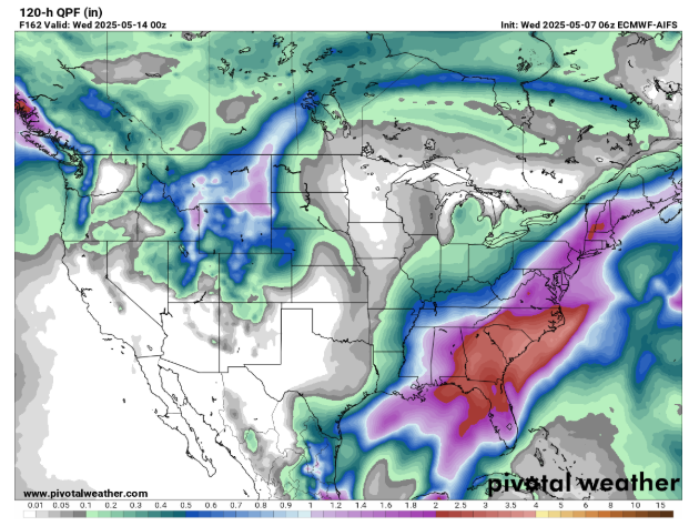
For this weekend into early next week, the southern US upper level low is going to become semi-parked over the Southeast, resulting in multiple days of showers and storms. While it will not be raining all the time, several waves of storms will result in heavy rainfall totals. A new separate upper level low dropping south out of Canada will bring more wet and cool weather to the Northeast.

Meanwhile, over the western United States, a large ridge of high pressure aloft will bring warm and dry weather the next few days, with some record high temperatures possible Saturday. By Sunday, a new storm system will begin to move into the Northwest, bringing increasing rain and some snow there and eventually to the northern Rockies.
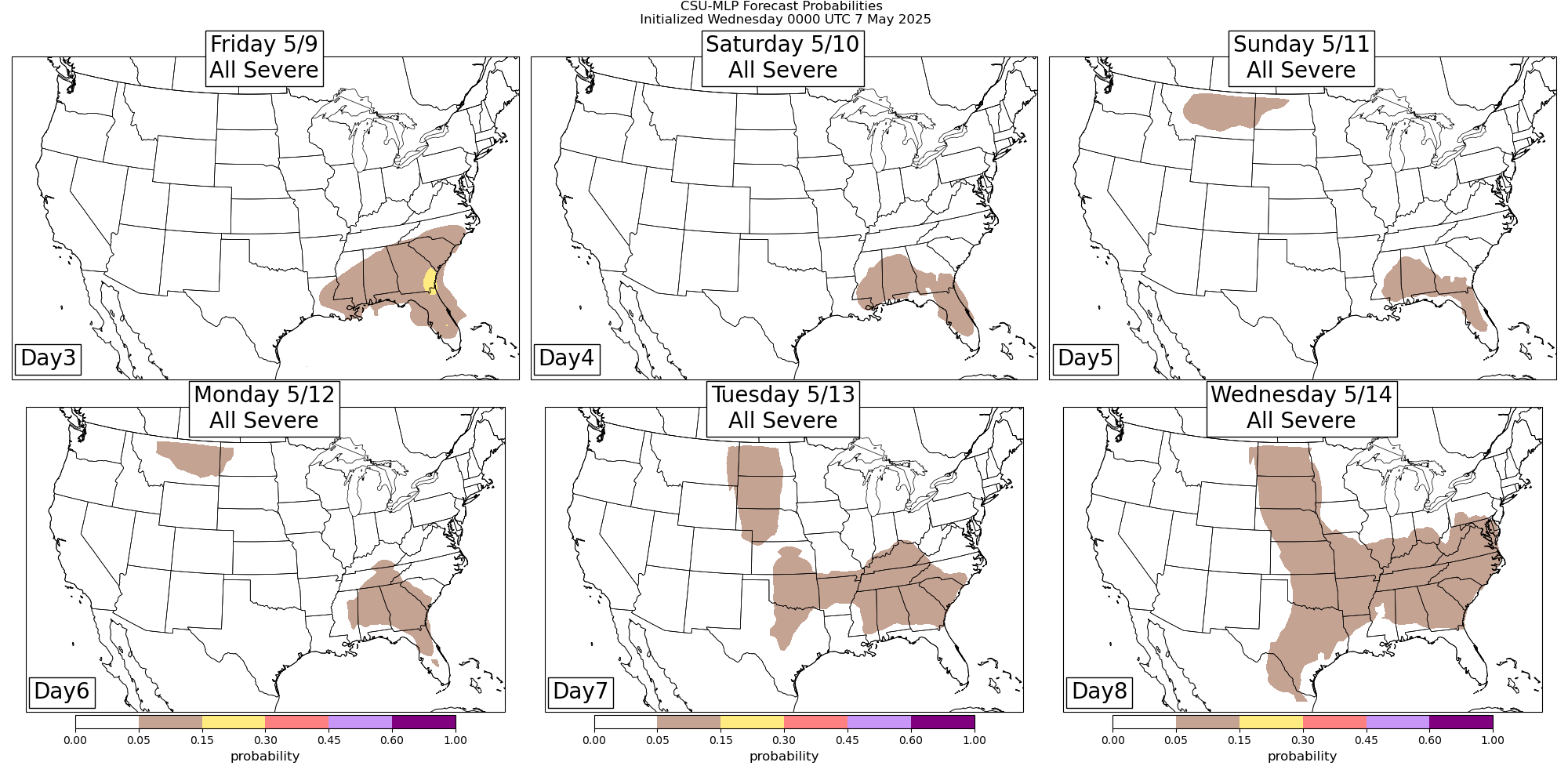
As far as the risk of severe storms, there will continue to be a risk of at least isolated severe storms through the weekend with the upper level low in the Southeast as can be seen in the CSU probabilities above. Looking at the longer range models, it seems possible that a piece of energy could rotate around the upper low and potentially cause a more focused risk of severe storms somewhere from northern Florida up through the Carolinas late in the weekend or early next week, but that will just have to be something to keep an eye on for now. Eventually, the new system coming into the Northwest early next week will begin to yield a pattern for increasing severe weather risk again in the Plains.

Leave a comment