And some record warmth in the West
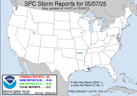
It’s always worth highlighting a quiet severe weather day in May since there tend to not be too many of them. Yesterday was one though, with only 17 reports of severe weather nationwide, most of them in the New Orleans metro and over Arkansas.
The heaviest rainfall was along the Louisiana coast where some spots picked up 4-5”.

Today should be more active with regard to severe weather. The upper level low we have been tracking across the southwest and south-central states the last several days will be moving a bit farther east today. Cold temperatures aloft with the upper low will combine with plenty of moisture and heating to result in a rather unstable atmosphere across the Southeast. Strong winds in mid and upper levels of the atmosphere associated with the upper low will provide sufficient wind shear for supercell storms capable of large hail and damaging winds. A few of the storms could produce very large hail especially over the Tennessee Valley and central Appalachians region where conditions will be most favorable and a slight (level 2 of 5) risk is in place. Low level wind shear should be relatively weak across the region, but could be sufficient to support a few tornadoes in the slight risk area.
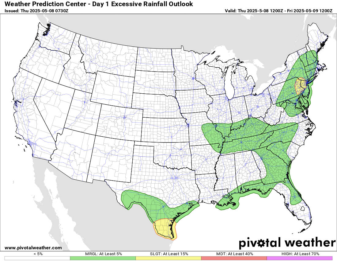
Farther west, a disturbance moving southeast on the backside of the upper low will produce several intense supercells in northern Mexico and far southern Texas. Very large hail, damaging winds and a few tornadoes are possible with this activity. Locally heavy rain could also pose a risk of flash flooding in deep South Texas, and the Weather Prediction Center (WPC) has a slight (level 2 of 4) risk of excessive rainfall there. A slight risk is also in place in parts of the Northeast, where a new upper level system dropping south out of Canada will produce increasing shower and thunderstorm activity later today and especially tonight into Friday and Saturday. Given heavy rainfall over the last several days, this could cause some flash flooding issues.
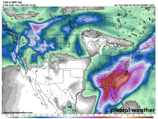
The upper level low in the Southeast is going to be very slow moving, and will produce waves of showers and thunderstorms for the next several days. While it will not be raining all the time, the days of periodic rainfall will add up, and a large part of the Southeast is likely to see 2-4” of rain over the period from Saturday through next Wednesday. The overall weather pattern is not particularly favorable for severe thunderstorms, but a few isolated severe storms will be possible in the region each afternoon and evening, particularly over Florida.
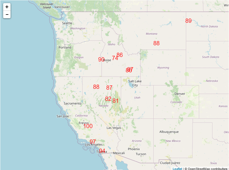
Meanwhile, in the western United States, a large ridge of high pressure aloft will bring warmer and drier weather the next few days, with a number of record high temperatures possible by Saturday. On Sunday, a new storm system will begin to move into the Northwest, bringing increasing rain and high elevation snow as shown in the precipitation forecast map above.
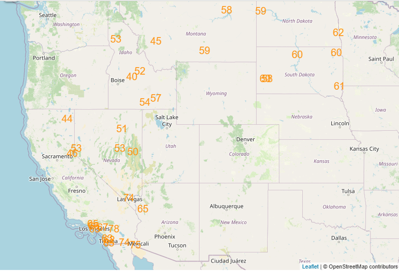
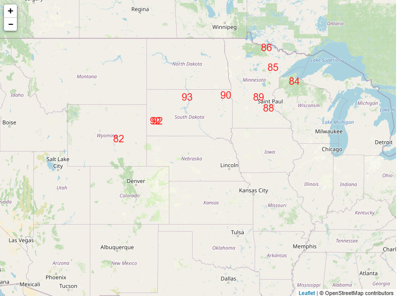
The unseasonably warm air will shift east ahead of this system, and could result in a number of record high minimum temperatures Sunday morning from the Southwest to the upper Midwest. Several record high temperatures will be possible across the upper Midwest on Sunday afternoon.
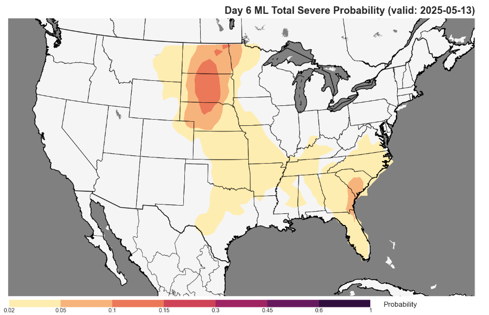
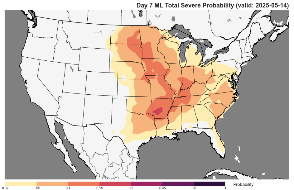
The system coming into the Northwest early next week will move far enough east by Tuesday to start increasing the risk of severe thunderstorms in the Northern Plains. The risk should then increase farther south and southeast from there for the middle of next week.

Leave a comment