And recapping Friday National Science Foundation news
I want to start off this morning’s newsletter discussing some Friday night news that impacts the weather community. I wrote a special post yesterday about a funding shortfall from the National Science Foundation (NSF) causing a suspension of operations at Unidata, the University Corporation for Atmospheric Research’s geosciences data management and visualization consortium. Last night I updated the post (twice) because of Friday evening news about NSF and NOAA that I want to be sure those that might not have seen the later post have awareness of.
First, Science reported that NSF management released a memo to their staff yesterday with details about the planned reorganization of the agency. Based on the description in the article, I do not think it is an exaggeration to describe the plan as a complete reimagination of NSF. The plan calls for a significant reduction of staff and elimination of all current organizational divisions. While the high level science directorates of NSF would be maintained, they would focus on funding research in five administration identified priorities: artificial intelligence, quantum information science, biotechnology, nuclear energy, and translational science. Where this will leave programs currently funded by NSF that do not fall into these five priorities is uncertain, but it seems clear there would be profound impacts for US science in general and of course meteorology.
On a more positive note for those concerned about these potential changes, later in the evening a federal judge issued a 2-week temporary restraining order halting the Trump Administration from implementing any reorganizations or reductions-in-force in 20 agencies, including NSF and the Department of Commerce/NOAA. You can read more about the judge’s order in this NPR article. While this again is only a temporary pause (until May 23rd) for now, it shows that the legal wrangling about this process is far from over and nothing is finalized yet.

Let’s talk about the weekend weather now. The upper level low that we’ve been talking about for days – and will be talking about for days more – will remain nearly stationary this weekend along the western Gulf Coast region. Waves of showers and thunderstorms will move across the Southeast on the eastern side of this system through the weekend. By Monday the upper low will start to slowly move northeast, but showers and storms will continue to affect much of the same region.

Heading into this rainfall event, much of the Southeast has been quite dry, with drought conditions prevalent in the most recent US Drought Monitor. So for many this rainfall will be quite welcome and beneficial.
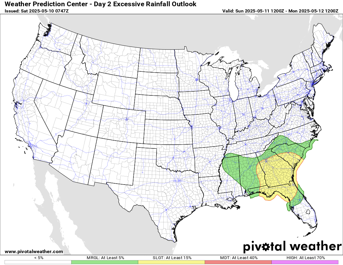

However, as multiple days of heavy rainfall starts to cause wetter conditions, flash flooding will become an increasing concern, and the Weather Prediction Center has slight (level 2 of 4) risk areas for excessive rainfall in place for both Sunday and Monday. Even today, high rainfall rates and potential training could cause isolated flash flooding issues in the Southeast.

While severe weather should not be widespread, some isolated severe storms capable of large hail and damaging downburst winds will be possible.

For the west, as we have been discussing today will a warm day with a number of record high temperatures possible. While overall conditions will be dry, the daytime heating will cause some isolated afternoon and evening thunderstorms, and as shown on the day 1 SPC outlook above, a few isolated severe storms are possible, primarily in Montana and Idaho. For Sunday, a stronger weather system will move into the Northwest, bringing more widespread rain and thunderstorm activity, as well as some high elevation snowfall.

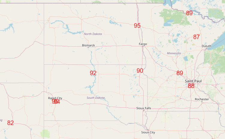
Ahead of that weather system, record warmth will continue, with a number of records – both warm minimums and high temperatures – likely on Sunday.
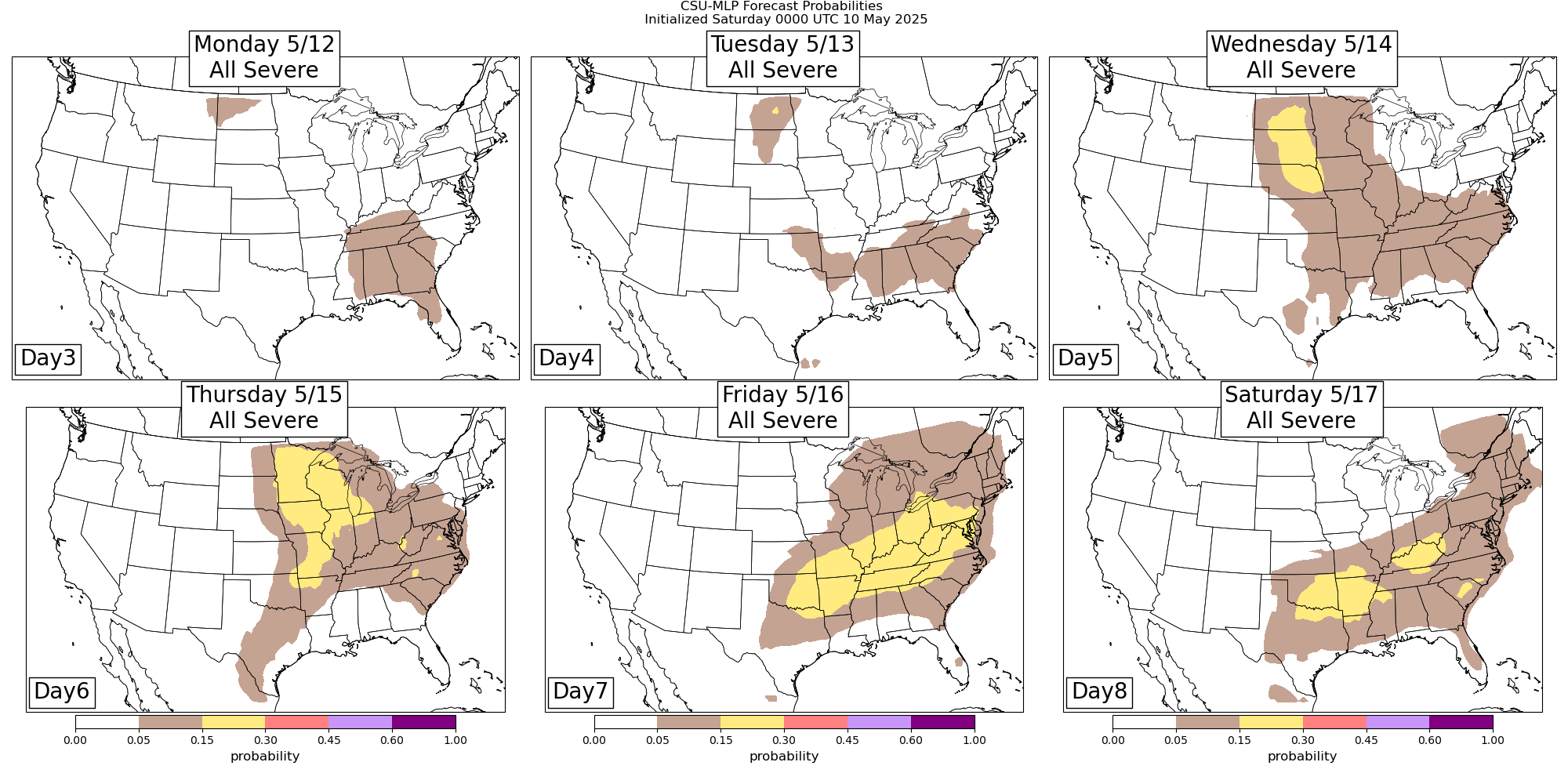
Headed into next week, the Southeast upper level low will continue to slowly move northeast and finally exit off the coast by midweek. Meanwhile, the Northwest US system will continue to strengthen and move slowly east, and as it starts to interact with slowly returning Gulf moisture and instability, will bring an increasing risk of severe weather Wednesday into Friday. Ahead of the cold front associated with that weather system, warm conditions will spread over much of the eastern two-thirds of the country, and record warmth will be possible especially late in the work week.

Leave a comment