And severe weather risks increase as well

Saturday ended up being a bit more of an active day severe weather wise than anticipated, with number of damaging winds in the northern Intermountain West region from dry microburst thunderstorms. Also, a rather intense supercell in the Florida Panhandle that produced a tornado on the east side of Destin. Several businesses and vehicles were damaged.
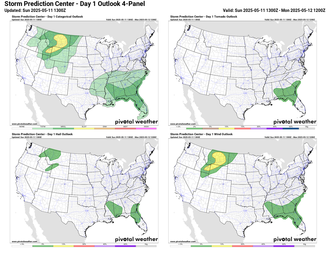
For today, a new storm system moving into the Northwest will bring further enhancement to the thunderstorm activity in the northern Intermountain West, and the Storm Prediction Center has a slight (level 2 of 5) risk of severe storms in this area. Damaging winds will again be the primary risk again in this region. The plodding upper level low in the Southeast will bring another day of thunderstorms to this region, and once again isolated severe storms will be possible.
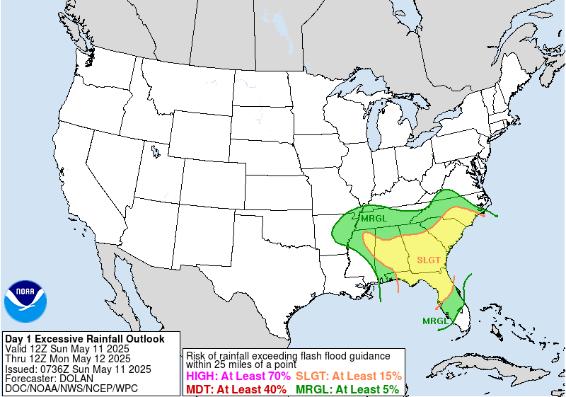

Flash flooding will be an increasing risk with the thunderstorms in the Southeast over the next 24 to 48 hours as repeated waves of thunderstorms cause more saturated conditions, yielding an increased likelihood of flash flooding. The Weather Prediction Center has slight (level 2 of 4) risks of excessive rainfall in place across parts of the region today into Monday.

Along with the severe weather in the northern Intermountain Region, Saturday also brought unusual warmth to the western and north central part of the country. More than two dozen record high temperatures were set, some by several degrees including 99F at Downtown Los Angeles (prior record 95F in 1934), 101F at Burbank (prior record 95F in 1981) and Anaheim with 98F (prior record 92F in 1993).

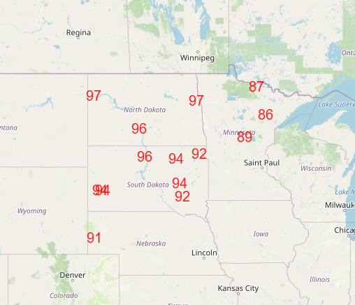
More record warmth is anticipated across the north central states the next couple of days ahead of the storm system continuing to develop over the western states.
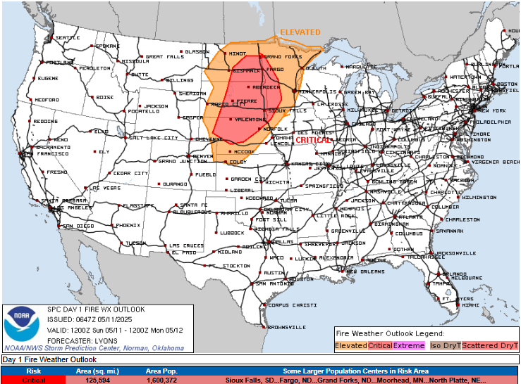
In addition to the record heat, gusty south winds and dry conditions will bring critical fire danger to a large part of the Northern Plains today.
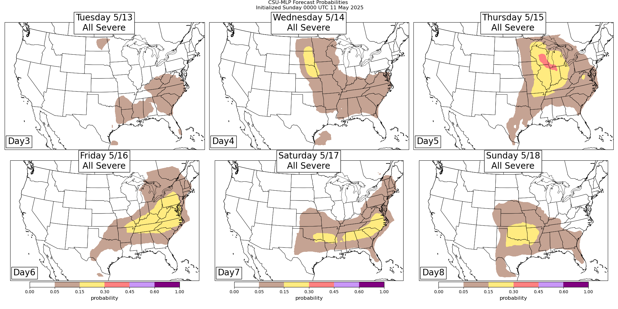
The western US system will move east as a rather strong storm storm system Wednesday into Thursday, and as it encounters increasing Gulf moisture and instability, the threat of severe weather will increase with it, starting in the northern Plains on Wednesday and then expanding across the Midwest and Great Lakes region on Thursday. Thursday has signs of being a more potent severe weather day that we will need to keep an eye on. By Friday, as we have seen several times this spring the cold front associated with this weather system will stall out from the the Great Lakes to the Southern Plains, and the severe weather risk will become more focused along it into the weekend.
Record warmth will also be a big story for the rest of this week. By Tuesday, record highs will be possible both in the north central US and in Texas. For the remainder of the week, record warmth will expand across the eastern United States. As is often the case, record warm minimums look as if they will be particularly widespread with dozens of records possible across the east Friday and Saturday. Record high temperatures will also be under threat as well. Rather than trying to post all of the graphics, if you would like to see the locations with record temperatures forecast, you can find them at the Weather Prediction Center’s website here.

Leave a reply to Barry Crook Cancel reply