And record warmth continues in the south and east
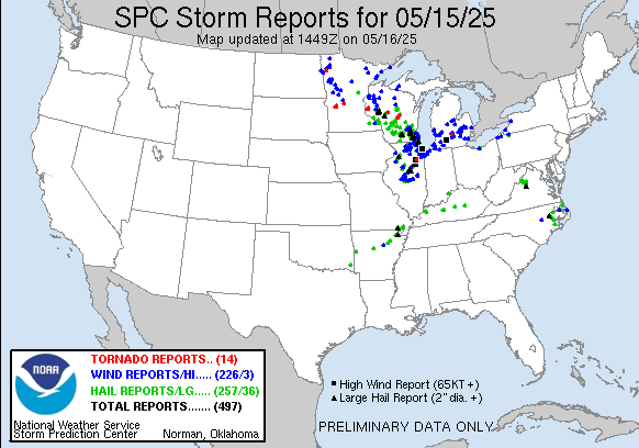
Thursday was a very active severe weather day, with nearly 500 reports of severe weather including three dozen reports of very large hail 2” in diameter or greater. Several tornadoes occurred in Wisconsin, and while luckily casualties seem to have been few there was significant damage to homes in businesses Juneau and Mayville. Read more about it in this article from the Milwaukee Journal Sentinel.
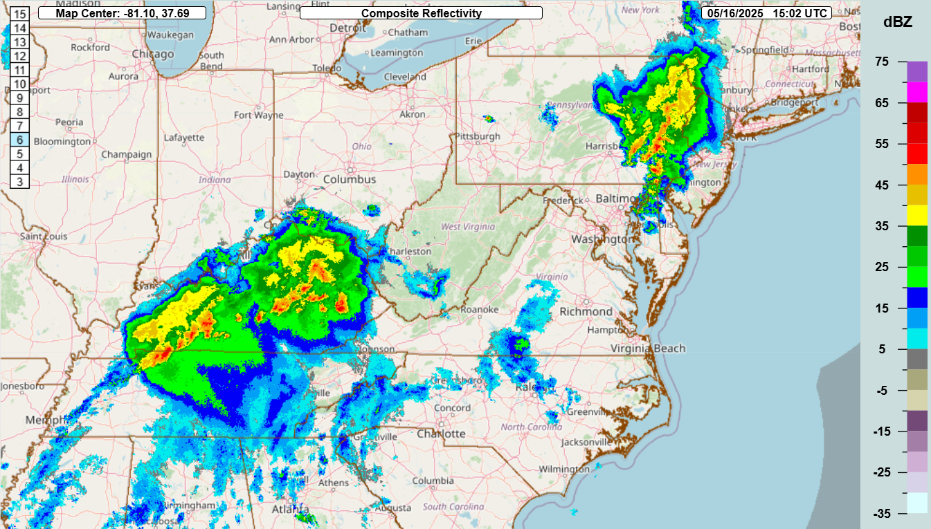
Strong to severe storms are already ongoing this morning over Kentucky – as well as over eastern Pennsylvania.
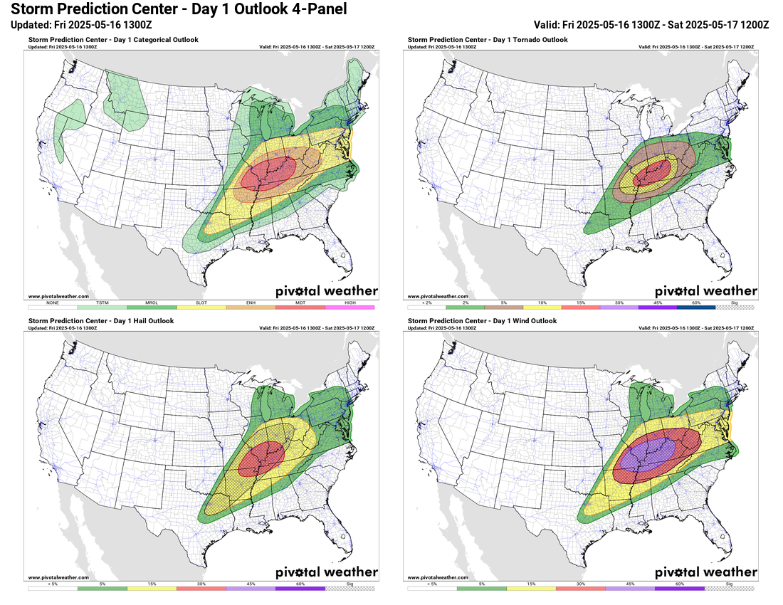
As those complexes of storms move east into the afternoon, they could produce additional incidences of severe weather. Meanwhile, the atmosphere behind these storms will become quite unstable, and as another upper level disturbance shifts into the Mid-Mississippi Valley, additional intense severe thunderstorms will develop. Very large hail will be a risk with these severe storms once again along with the potential for strong tornadoes and significant damage winds.
The mode of the thunderstorms will play a big role in the tornado potential. Some of the high resolution models show the storms remaining as individual storms for longer, which would result in a more significant risk of strong, long tracked tornadoes; other models show a more rapid transition to a squall line in the lower Ohio Valley which would likely mean a threat of more widespread straight line wind damage with embedded tornado risk. Regardless, it should be an active severe weather day, and the Storm Prediction Center has a moderate (level 4 of 5) risk in the region. There will also be a risk of at least isolated flash flooding, and the Weather Prediction Center has a slight (level 2 of 4) risk of excessive rainfall in the area.

Risks of severe storms will continue on Saturday along and ahead of the slow moving cold front, but Saturday will likely be the “calmest” with regard to severe weather risk as the pattern resets toward a more active setup in the central United States again early next week. Still, slight risks of severe storms are in place along the East Coast and in the Arklatex region where very large hail and a few tornadoes will be possible.
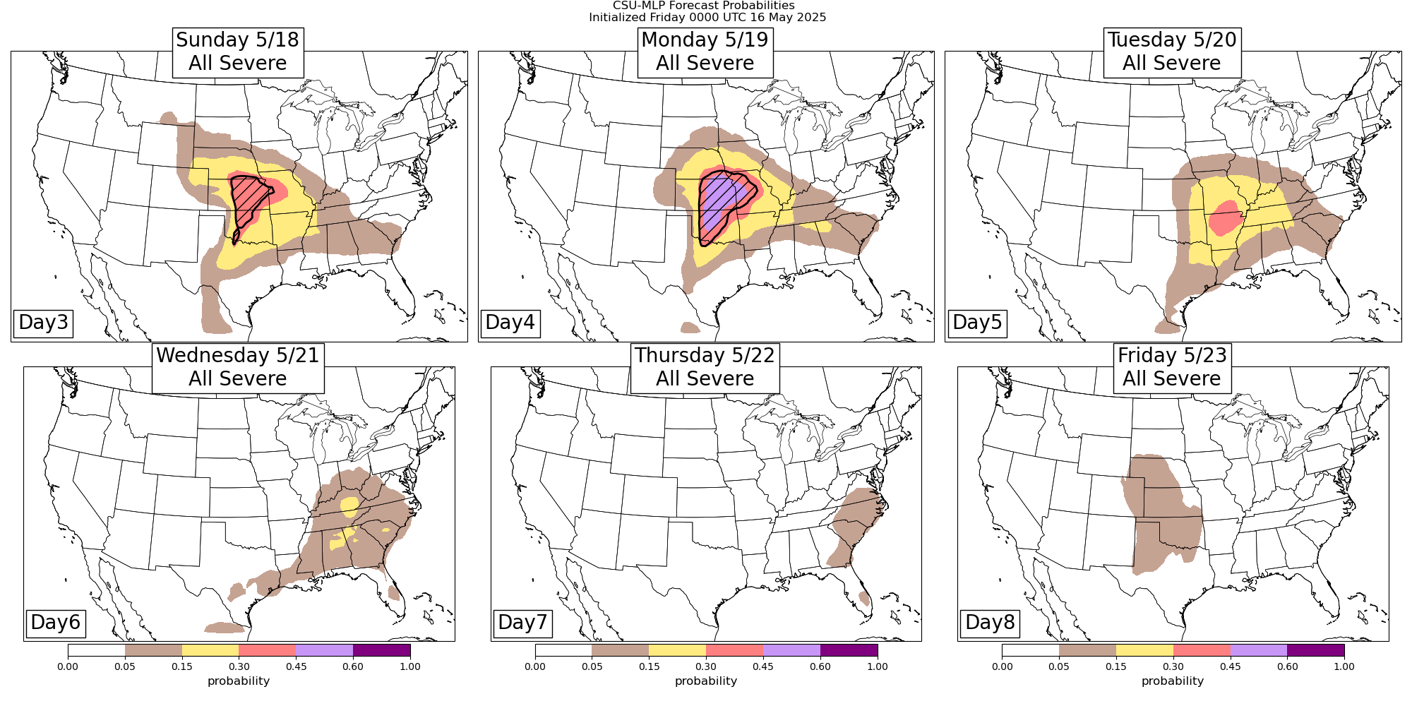
An active severe weather pattern is anticipated early next week as a strong storm system develops over the westernowly moves east into the Midwest. Each day during the period Sunday through Tuesday could see significant severe weather episodes with strong tornadoes and very large hail possible. The weather pattern should calm down a bit beyond the middle of next week.
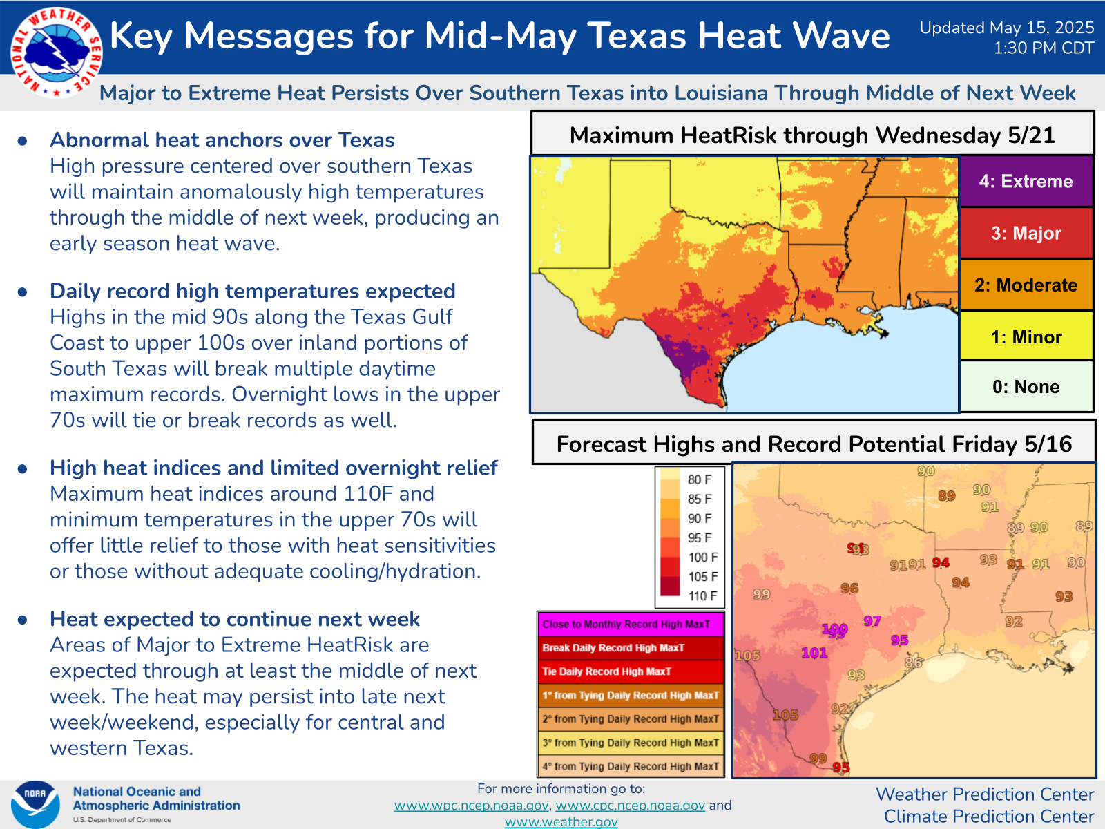
I don’t want to forget about the record warmth occurring over parts of the southern and eastern United States. This graphic from the Weather Prediction Center outlines the heat impacts expected over Texas the next several days. Multiple record high maximums and minimums were set on Thursday, including Chicago O’Hare reaching 94F which broke the old record of 91F, along with record highs at Peoria, IL and Madison, WI and Houston Hobby, San Antonio, Corpus Christi, Brownsville, McAllen, Del Rio and Austin in Texas. More records will be set in the south and east today into the weekend.
Programming Note: I am currently in Florida to participate in the Main Street 16 Challenge at Walt Disney World, raising money for Make-a-Wish of Central and Northern Florida (find out more if interested here). Hence, my posts will be a little more sporadic than normal – and because I will be participating in the challenge event on Saturday, there will not be a newsletter that day.

Leave a comment