A break still on the horizon
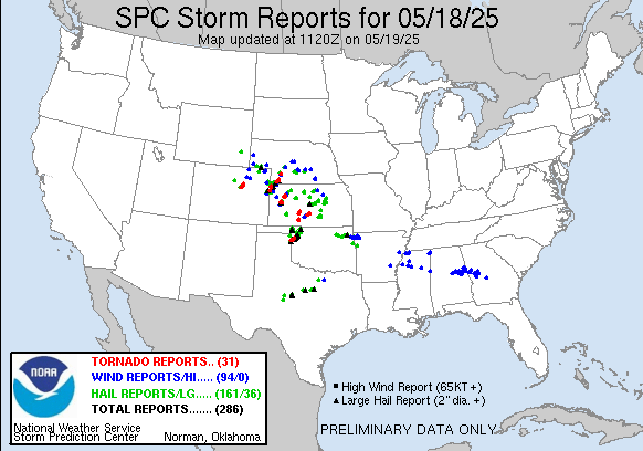
Welcome to a new work week. Yesterday was another active severe weather day, with three dozen reports of very large hail 2” or greater in diameter – including several 4” and greater reports over Kansas and northwest Oklahoma – and a number of tornadoes over northwest Oklahoma into Kansas, southwest Nebraska and northeast Colorado.
The University of Oklahoma research radar RaXPol had a close up view of this significant tornado in northwest Oklahoma, with incredible detail being seen in the reflectivity data including a small debris ball maximum within the hook on the first image. Another strong tornado hit the town of Plevna, KS just before midnight last night, causing significant damage.
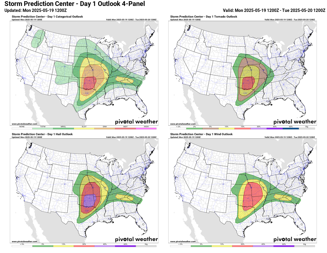
The next 48 hours looks to remain very active, starting today with a moderate (level 4 of 5) risk of severe storms across central and eastern Oklahoma, and large enhanced risk surrounding it. A couple of waves of intense supercell storms should develop this afternoon within a broad area favorable for strong tornadoes, very large hail and damaging winds. These storms should evolve into a complex or two of severe storms that will spread northeast into the Mid-Mississippi Valley overnight.
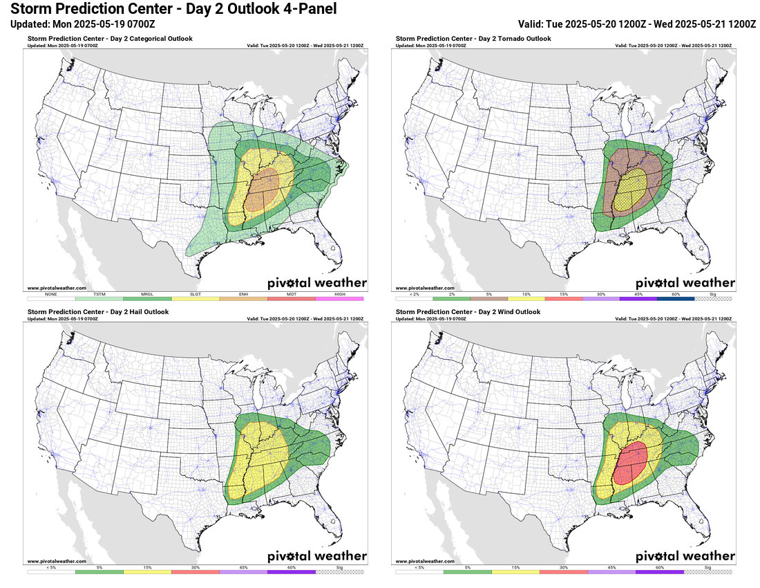
As the strong storm system responsible for the severe weather moves slowly east on Tuesday, another round of significant severe weather is expected from the lower Ohio Valley across the Mid-South. Strong tornadoes, large hail and damaging winds will be possible with the strongest storms in this area, and an enhanced (level 3 of 5) risk of severe weather is in place in this region.
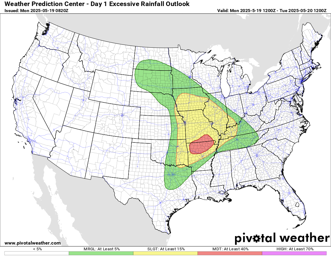
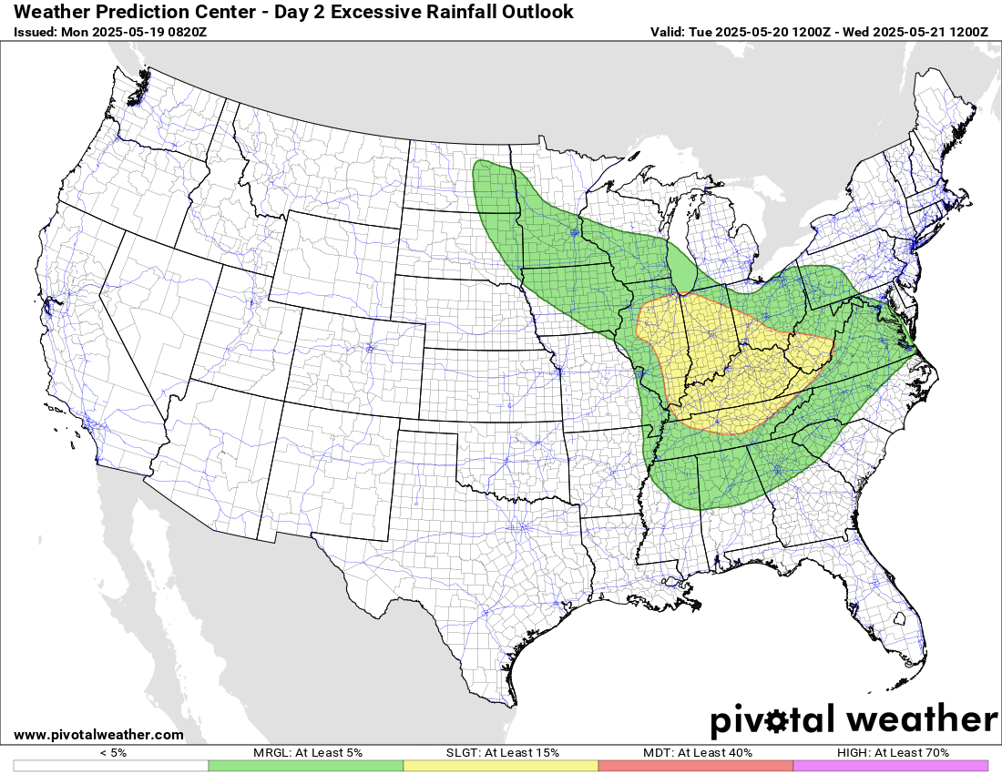
Flash flooding will also be a risk the next 48 hours as these storms will be evolving in a very moist environment supportive of repeated rounds of heavy rainfall. The greatest flash flood risk is expected to be in northern Arkansas and southern Missouri later today and tonight where a moderate (level 3 of 4) risk of excessive rainfall is in place.
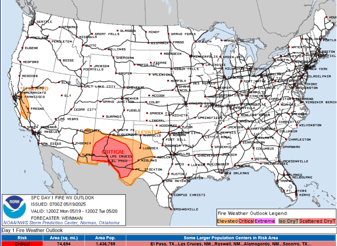
Critical fire danger will also be a concern on the “dry” side of this system across southern New Mexico and west Texas with a combination of gusty winds and very low relative humidity values.
By Wednesday this system will approach the East Coast with a lessening severe weather risk, and it still appears like beyond that time a major weather pattern change will evolve with an upper level trough of low pressure developing across the eastern half of the country. That should bring a reprieve from the very active period of severe weather.

Leave a comment