Less active late week – but still some severe storm areas to watch
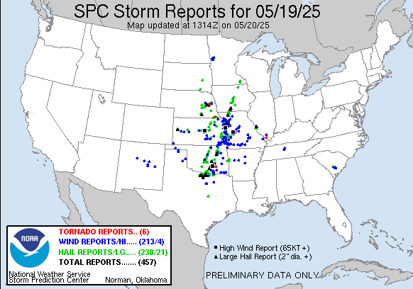
Monday was another busy day over severe weather with nearly 500 reports of severe weather across the middle part of the nation, including more than 20 incidences of very large hail and several tornadoes.
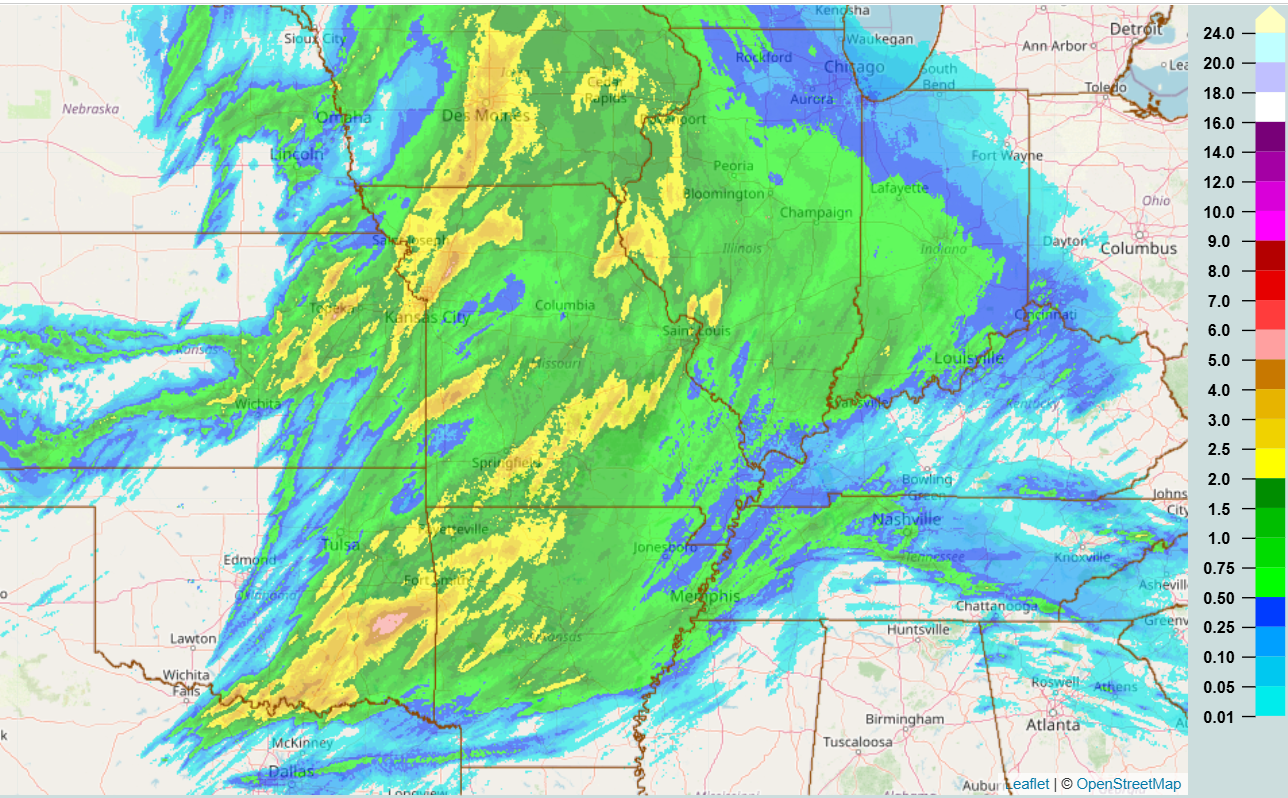
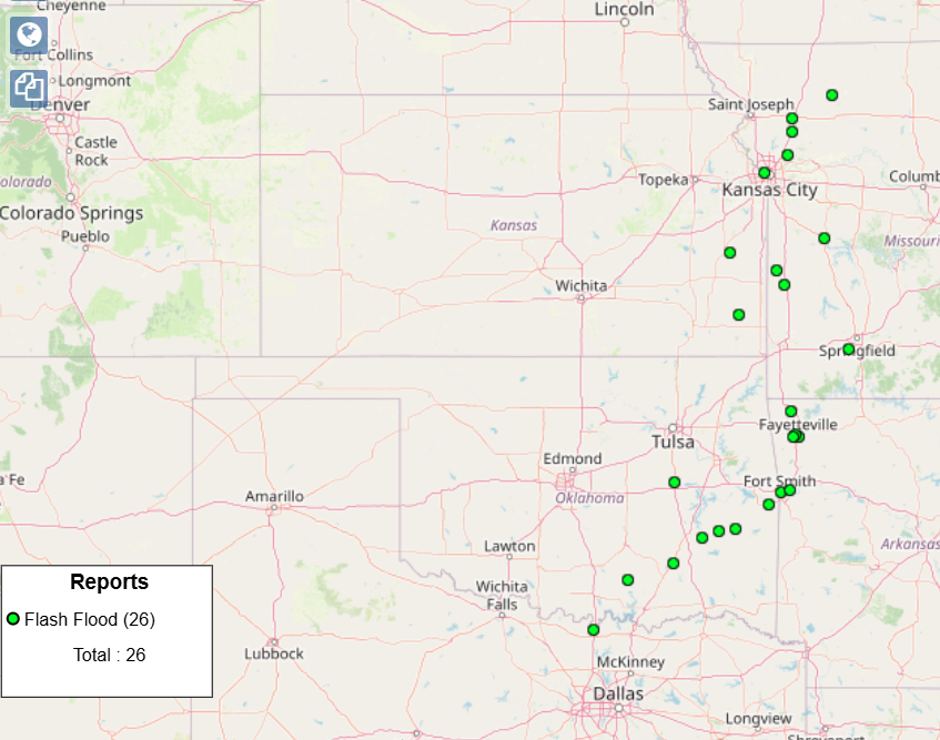
Several swaths of heavy rain greater than 2” also fell across the region, with the heaviest rain over eastern Oklahoma where there was an area of 5-6” of rain southwest of Fort Smith, AR where some roads were closed by flash flooding. Other reports of flash flooding were scattered across the region.
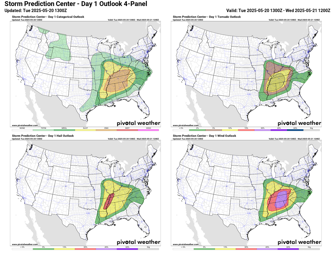
Today will see yet another active day as scattered severe thunderstorms will develop across the Mid-South and lower Ohio Valley regions this afternoon. The initial development will likely have the greatest tornado risk, with the Storm Prediction Center discussing this morning that the region from northern Mississippi into middle Tennessee likely has the highest risk of supercell producing tornadoes. The storms are expected to evolved into a band of severe storms with increased wind damage potential as it moves across the Tennessee Valley tonight. Overall, SPC has a large enhanced (level 3 of 5) risk of severe weather for tornadoes (some strong), damaging winds and large hail across the region.
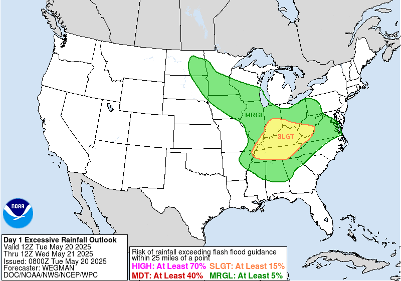
The storms may also produce some flash flooding, with the greatest risk anticipated across the Ohio Valley where the Weather Prediction Center has a slight (level 2 of 4) risk in place.
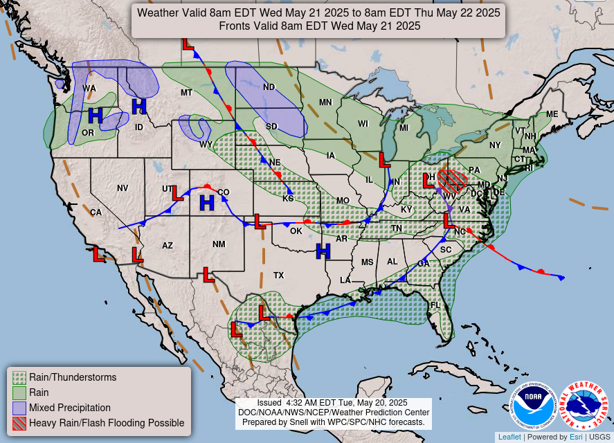
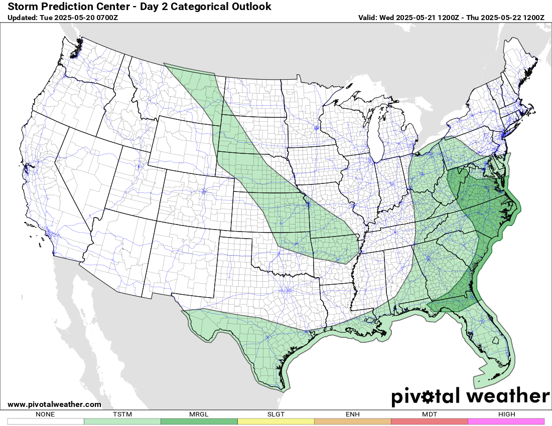
The storm system responsible for the severe weather today will continue to move east Wednesday with scattered showers and thunderstorms expected across the region. While the threat of severe storms and heavy rainfall will be less than the last several days, there will likely be some isolated incidences of severe weather and flash flooding, with a marginal (level 1 of 5) risk of severe weather along the East Coast.
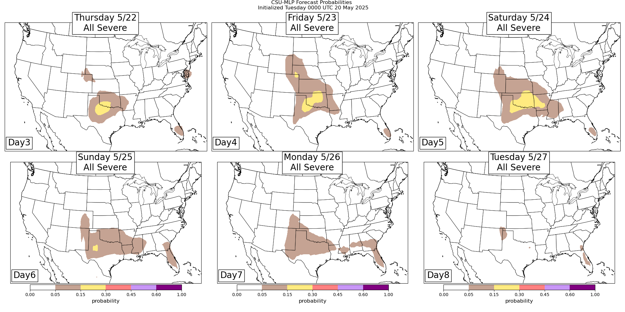
Beyond Wednesday, a large upper level trough of low pressure will develop over the eastern United States with a ridge of high pressure developing in the West. Overall, this will be a much less active pattern for severe weather. However, northwest flow in middle and upper levels of the atmosphere along with an increasingly unstable airmass will likely result in some severe thunderstorm activity in the Southern Plains and eventually the Arklatex region later this week.

Leave a comment