And where the risk of severe weather is for Memorial Day
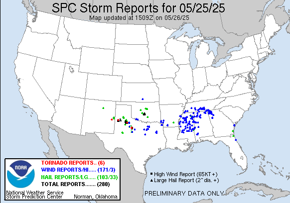
There was plenty of severe weather again over the last 24 hours, and the SPC map of reports provides an opportunity to look at one of the challenges of severe weather forecasting and communication: distinguishing between coverage and intensity of severe weather. As expected, the most intense severe storms on Sunday and Sunday night were in the Southern Plains, as clusters of supercell storms produced more than 30 reports of very large (2” or larger) hail and several tornadoes. From a coverage perspective, though, the most widespread severe weather occurred over the Mid-South and Tennessee Valley region, where a band of severe storms moved during the late afternoon and evening hours, producing more than 100 reports of wind damage.
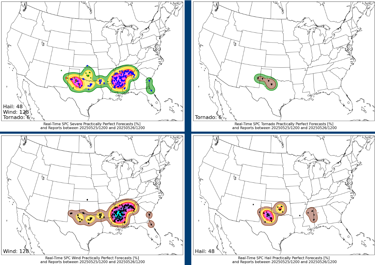
The above graphics show the “practically perfect forecast” of the severe reports from the last 24 hours – essentially taking the reports and mapping them using the Storm Prediction Center’s forecast methodology, providing what the SPC probabilistic forecast for yesterday “should” have been if it had been a perfect forecast. You can see the wind report map in the lower left actually has a rather large 60% area from northern Mississippi across the Tennessee Valley – which per SPC’s conversion between probabilities and categorical outlooks would imply a moderate (level 4 of 5) risk. However, while there were numerous reports of severe weather, they were mainly rather marginal in intensity, and societal impacts were likely rather sporadic; power outages are not elevated in the region this morning, and reading through the reports, they are mostly downed trees.
This is not to minimize these severe weather reports in the Southeast – obviously if severe storms knock down trees on your house or in front of your car, that is a huge impact to you personally. However, while lesser in coverage the reports from the Southern Plains are in general more intense, with large hail up to 6” (!) in diameter, wind gusts over 80 mph and a number of tornadoes. So while the coverage of severe weather was greater in the Southeast, the intensity and potential societal impact for any one location from a the strongest storms in the Plains was greater. Distinguishing between coverage and intensity is one of the biggest challenges in severe weather forecasting. SPC uses hatched areas on their probabilistic outlooks to highlight where there is at least a 10% conditional risk for significant severe weather – defined as EF2+ tornadoes, 2” or larger hail, wind gusts of 75 mph or greater – to try to communicate where higher end severe storms are possible regardless of coverage. The significant severe probability also plays an important role in how the probabilistic forecast maps to their categorical outlook. Using yesterday as a demonstration, no matter how high the coverage of wind in the Southeast had gotten, without a corresponding area of at least 10% coverage of significant reports of wind, a high (level 5 of 5) categorical risk would not be supported.

Turning to today’s weather situation, another day of severe weather is anticipated with a focus in Texas. Daytime heating should result in a very unstable atmosphere across central Texas this afternoon, and as an upper level disturbance interacts with a boundary from overnight thunderstorms in the region, several intense supercell severe storms should develop. Very large hail, damaging winds and a few tornadoes will be likely with these storms.
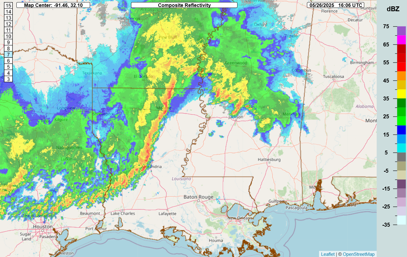
Meanwhile, farther east the remnant band of thunderstorms from the overnight severe weather is moving toward southern Mississippi. Plenty of sunshine is warming and destabilizing the atmosphere ahead of this line of storms, so some intensification is possible as these storms move east, with severe storms capable of damaging downburst winds and a few reports of large hail possible.
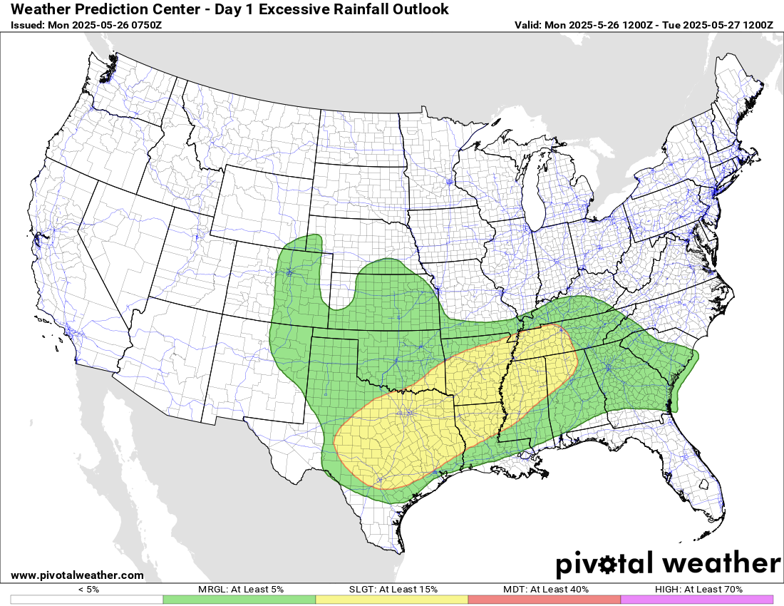
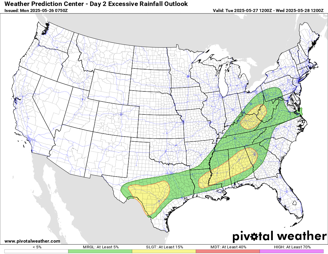
Training storms could also result in some localized flash flooding, and the Weather Prediction Center has a large slight (level 2 of 4) risk of excessive rainfall from Texas across the Tennessee Valley.
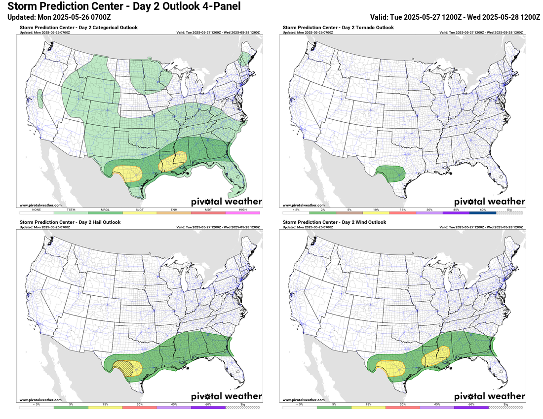
The slow moving front which has marked the division between warm, moist air with severe weather and heavy rain potential ahead of it and unseasonably cool air behind it will continue to press slowly south and east on Tuesday. An associated risk of severe storms and heavy rainfall will continue along the front from Texas into the Southeast and Mid-Atlantic.
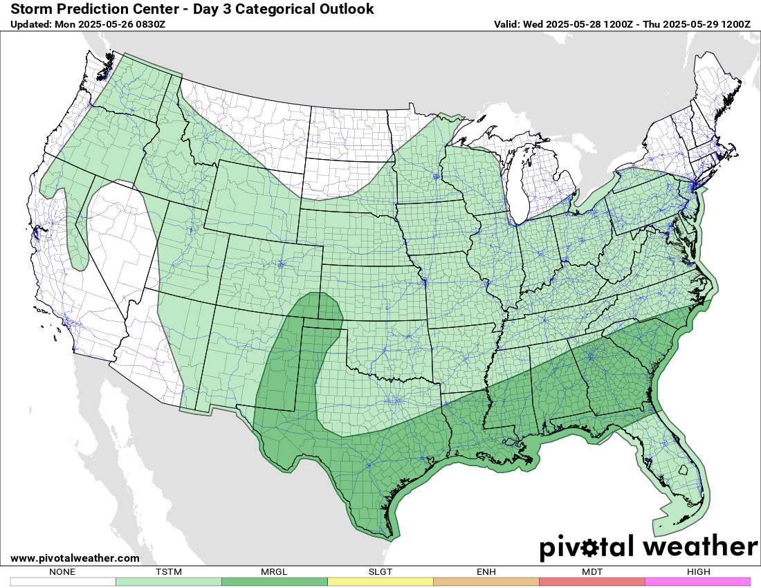
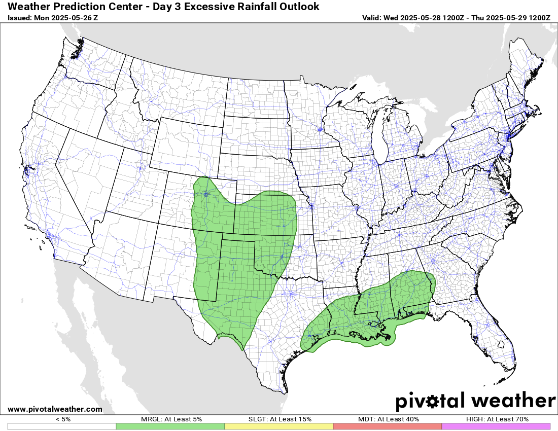
By Wednesday, the slow moving front will be along the Gulf Coast and then northwest nito the central Plains region, with a continuing risk for strong storms and locally heavy rainfall along it.

Leave a comment