Canadian wildfire smoke becoming an increasing problem for central US
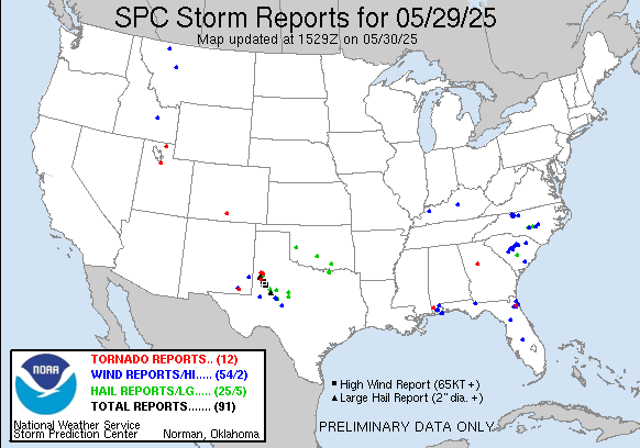
Happy Friday! Lots to talk about today, so let’s get right to it. Yesterday saw several pockets of active severe weather, including supercell storms across west Texas that produced several tornadoes and giant hail up to 3.5” in diameter.
The ICECHIP research project was luckily operating in this area and able to capture data that will hopefully help scientists better understand these giant hail producing storms and the societal impacts of very large hail.
Other severe storms occurred in the Southeast, mainly in the Carolinas and northern Florida. But a lone isolated supercell developed within a large area of rain across Georgia in the afternoon and produced a tornado in Henry County south of Atlanta. The tornado produced some fairly significant damage as it crossed Interstate 75, and unfortunately critically injured an 18 year old.
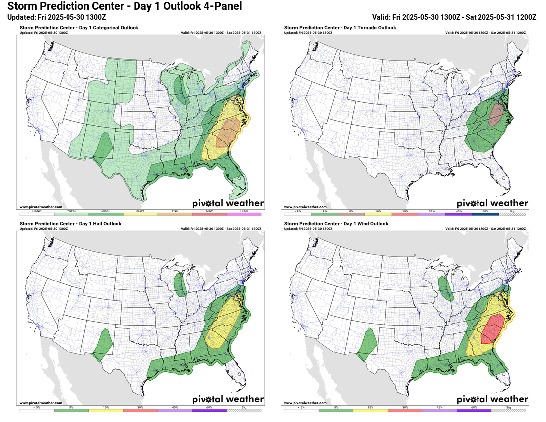
As we have been talking about the last few days, an upper level impulse swinging into the Eastern US today will result in the development of an intensifying surface low pressure system in the Mid-Atlantic states. This will focus a more organized risk of severe storms today from the Mid-Atlantic south into the Florida Panhandle. The Storm Prediction Center has an enhanced (level 3 of 5) risk for severe storms for much of the Carolinas into eastern Georgia, with a surrounding slight risk that extends north into the greater DC area.
Damaging winds along a band of severe storms this afternoon and evening is the primary severe weather risk, but large hail and a few tornadoes are also possible. The overall pattern and some of the high resolution models suggest that there could be an increased risk for tornadoes in the area around the greater DC metro area closer to the developing low pressure center should enough instability develop in that region. This will be something to keep an eye on as we go into the afternoon hours.
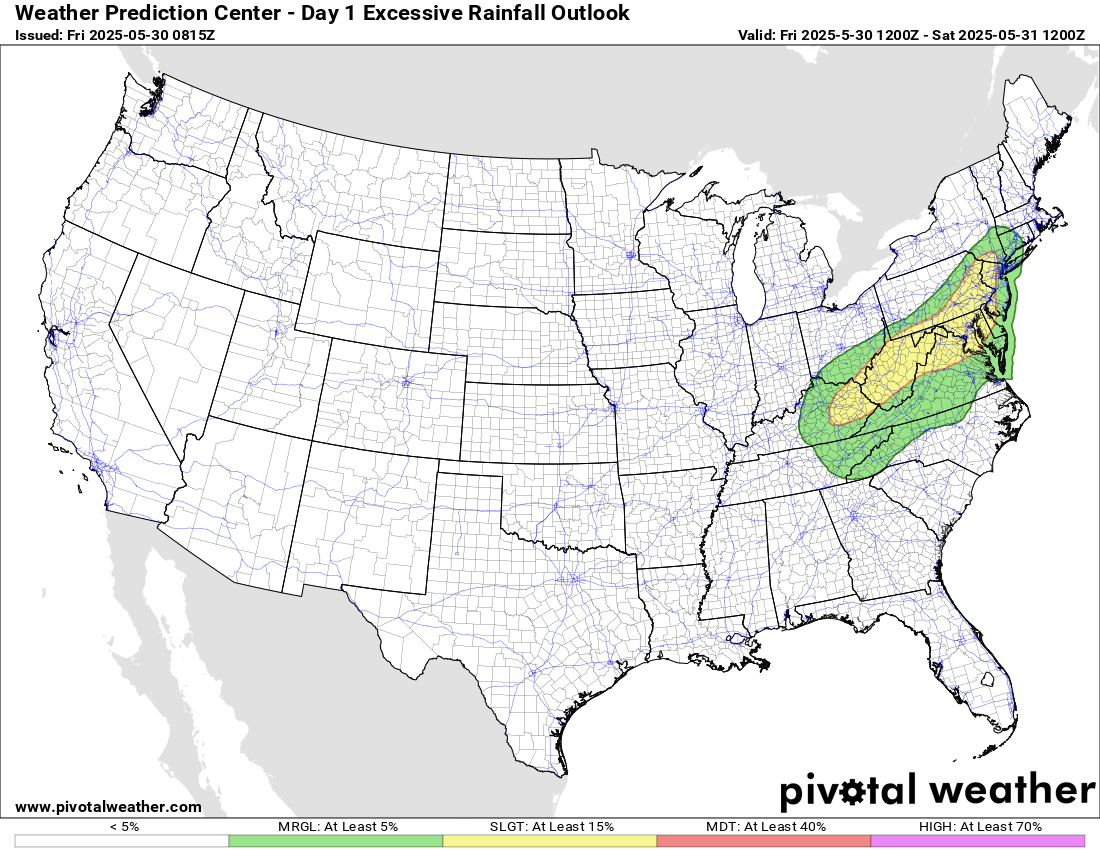
There will also be a risk of flash flooding closer to the developing surface low pressure center as showers and storms producing heavy rain are focused from eastern Kentucky up toward the New York City area. Localized rainfall amounts near 3” could cause some instances of flash flooding.
The weather system in the East today will put the finishing touches on a transition to an upper level weather pattern for this weekend dominated by a large ridge of high pressure in the Western US with a corresponding downstream trough of low pressure over the East. This will result in record warm temperatures in the West with a number of records possible Saturday into Sunday, including possibly a few monthly records on Saturday, the last day of May. Cooler than normal weather will dominate the Eastern Seaboard this weekend.
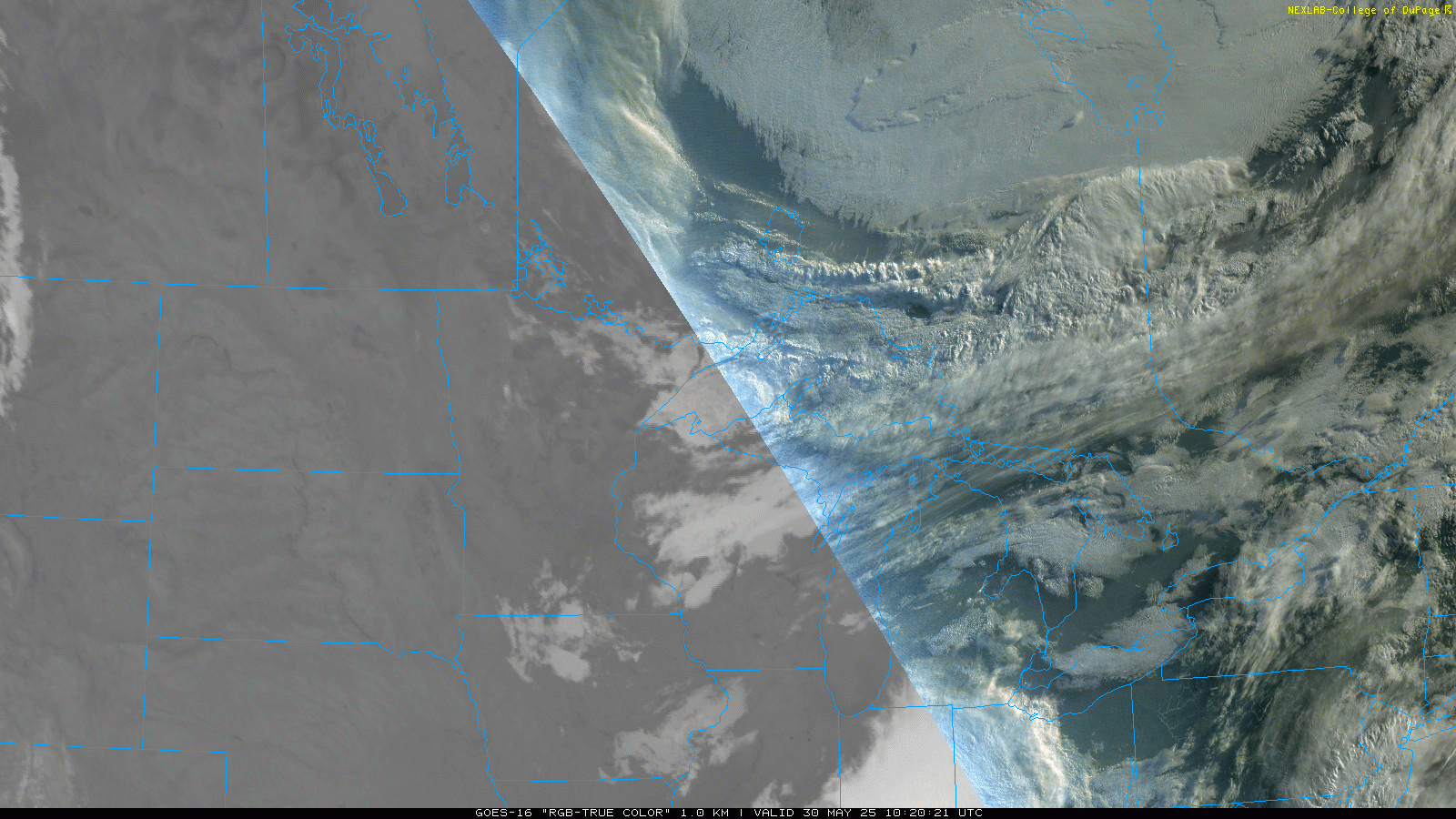
This weather pattern is also going to lead to increased north to northwest winds throughout the lower and middle part of the atmosphere across central North America, leading to a significant increase in the the transport of smoke from serious wildfires in Manitoba and Saskatchewan south into the central United States. This morning’s visible satellite loop above already shows smoke pouring south into Minnesota, Wisconsin and the eastern Dakotas. Air quality alerts are already in effect for much of this region.
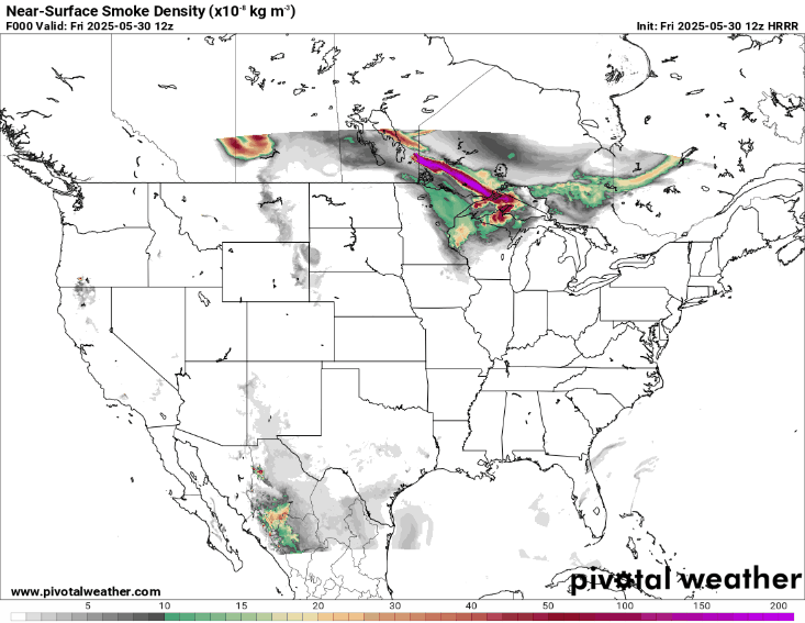
The morning run of the High Resolution Rapid Refresh smoke model shows the current wave of smoke over the upper Midwest making it down into the Ohio Valley tonight while a new more intense wave of smoke works down into the Upper Midwest into Saturday. Needless to say, this will be an increasing concern as we go into the weekend.
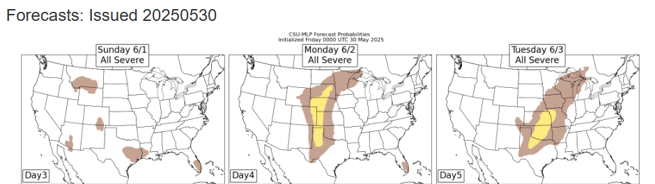
It still looks like this upper level weather pattern will be relatively short lived, with a new trough of low pressure developing across the West early next week, leading to a return in the risk of severe weather to the Plains.

Leave a comment