And talking wildfire smoke and a first look at what’s happening in the tropics
Programming note: I posted an article late last night – and updated it this morning – about the release of the President’s FY2026 budget and potential implications for meteorology. ICYMI, you can read it here.
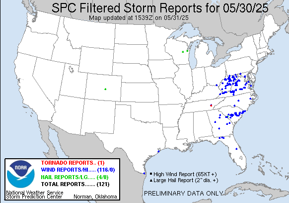
As anticipated, Friday was a fairly active day of severe weather from the Mid-Atlantic to northern Florida with over 100 reports of wind damage received by SPC. Nearly 50,000 customers are still without power in the Mid-Atlantic region per PowerOutage.US. The severe weather actually started in the pre-dawn hours across Kentucky and Tennessee, where a couple of impactful tornadoes occurred. One person was killed and 14 were injured by a tornado in Washington County, KY that NWS Louisville rated as an EF2 tornado.
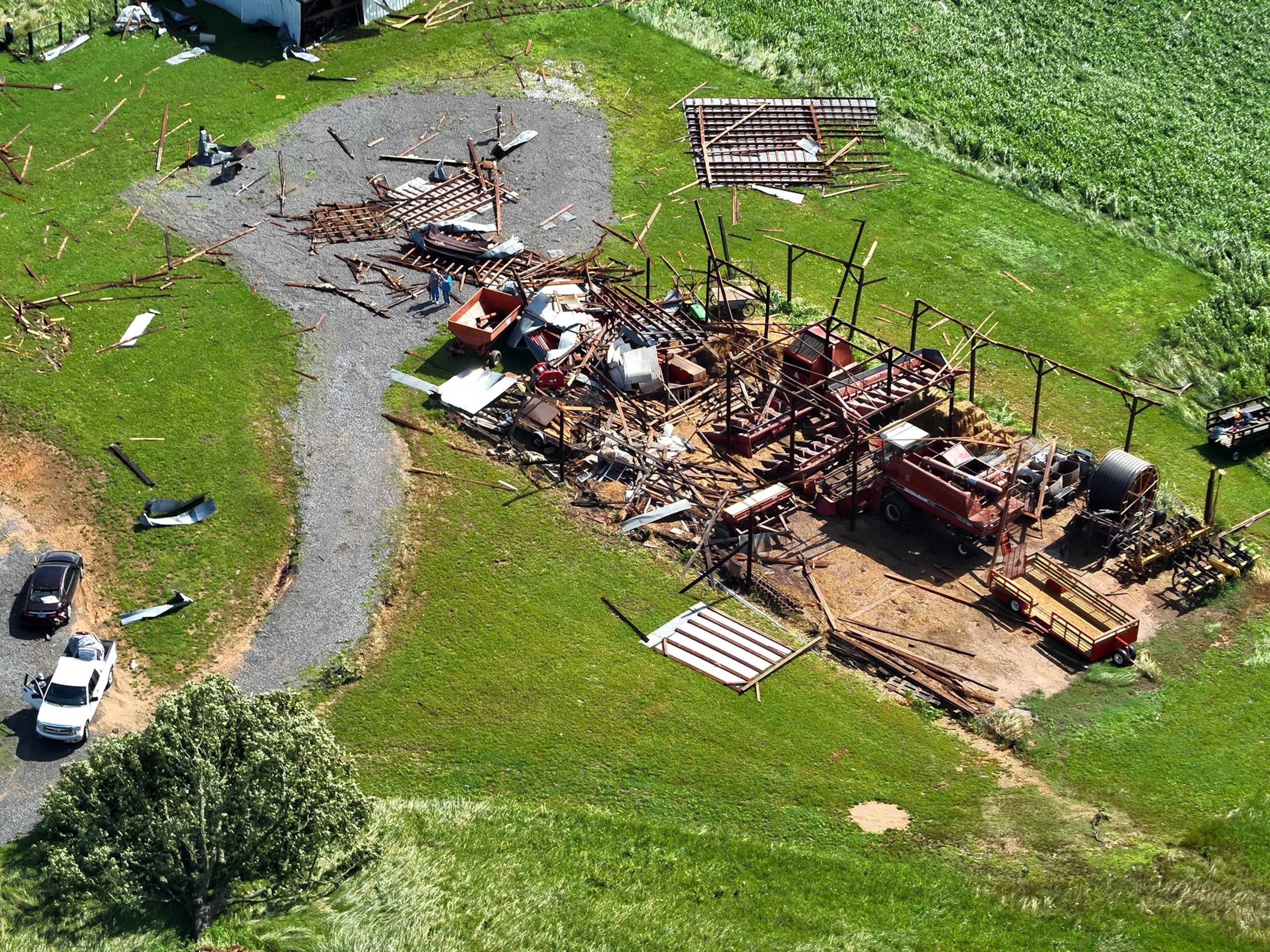
Another weaker tornado injured 5 people near Athens, TN, and caused damage to trees and buildings.
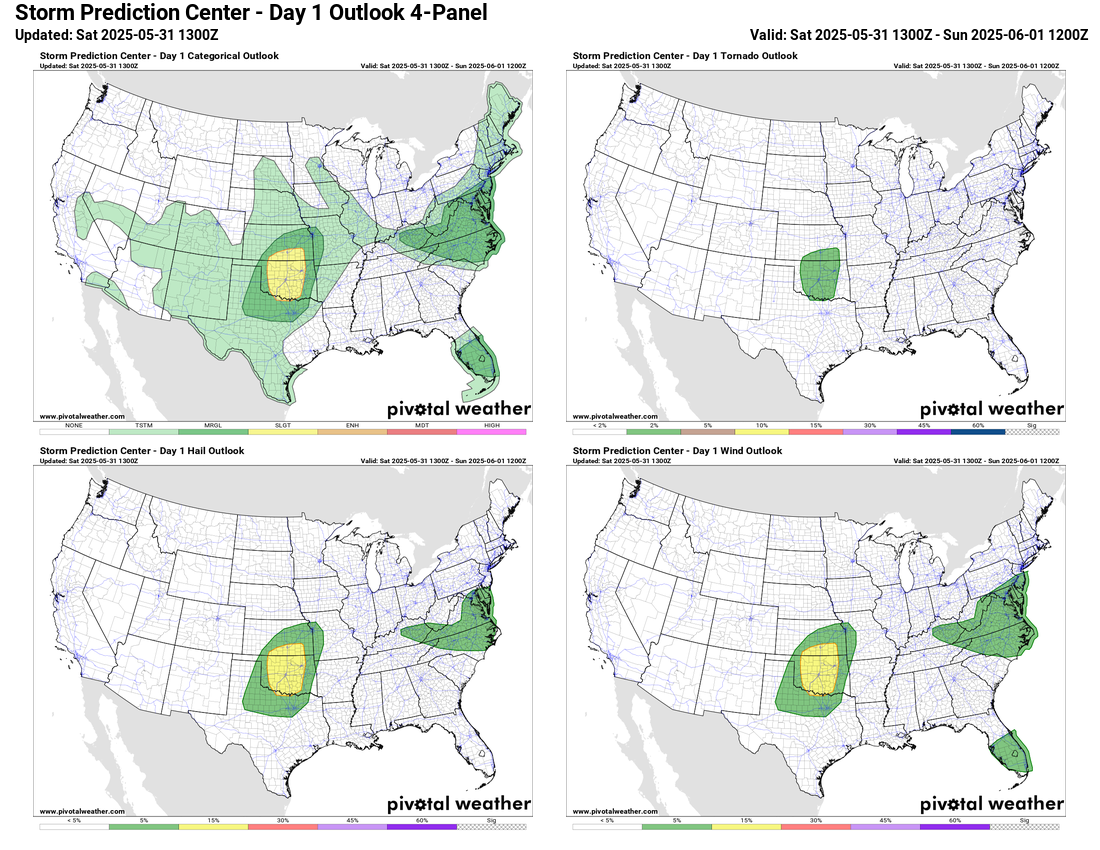
The severe weather threat today will primarily be focused in Oklahoma, where thunderstorms developing in northwest flow aloft between a strong ridge of high pressure over the West and a deep trough of low pressure along the East Coast could produce large hail and strong wind gusts.
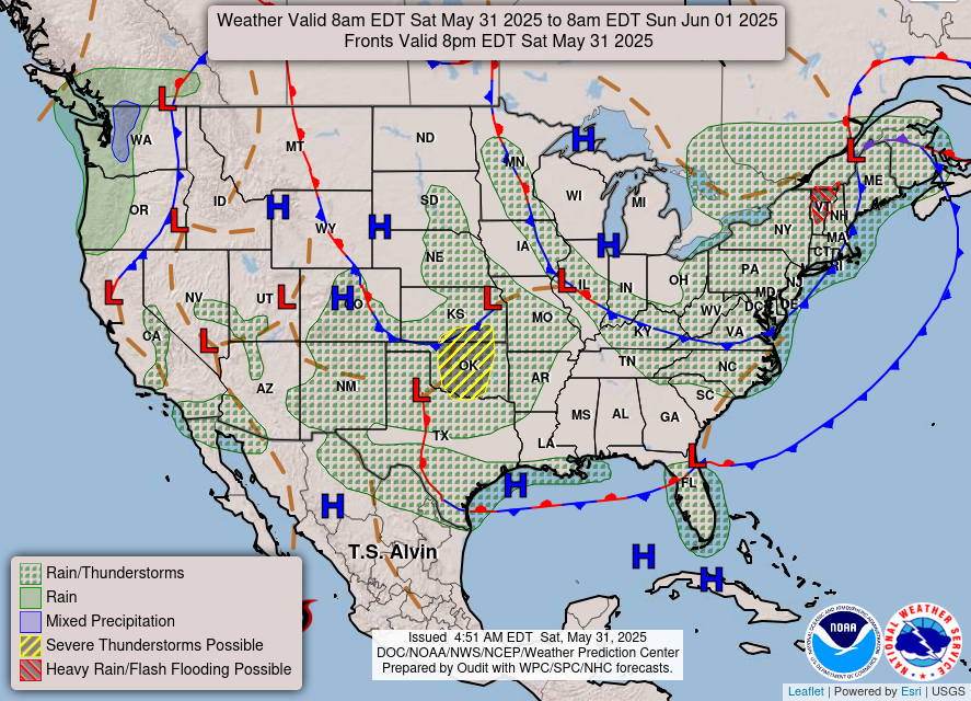
The upper level trough in the East has produced an unseasonably strong area of low pressure in the Northeast which will bring cool, wet and blustery conditions to much of that region today.
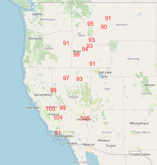
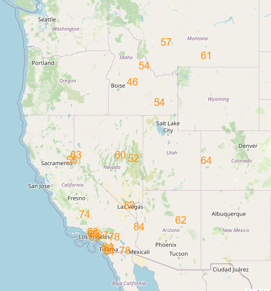
Meanwhile, in the West, record warmth will peak today and Sunday morning after a number of record highs were set on Friday in California and Nevada.

Smoke from the wildfires over central Canada has now made it all the way to the Gulf Coast and southwest Atlantic as can be seen in the visible satellite image this morning.
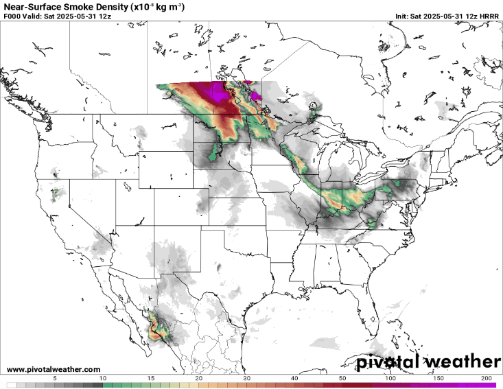
The latest forecast from the High Resolution Rapid Refresh model shows that waves of thicker, near surface smoke will be moving across the upper Midwest through the weekend. Air quality alerts are in effect for Minnesota.
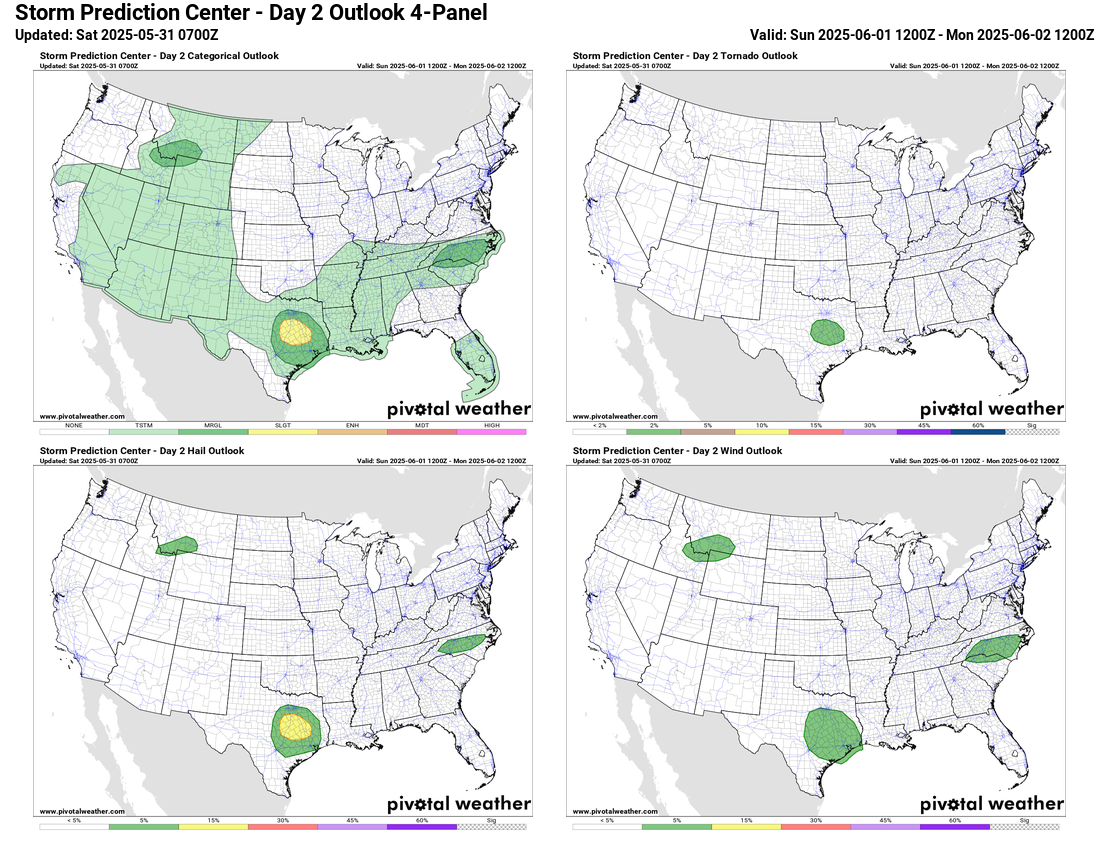
On Sunday, the risk of some northwest flow induced severe storms looks to shift south into the western Gulf Coast region.
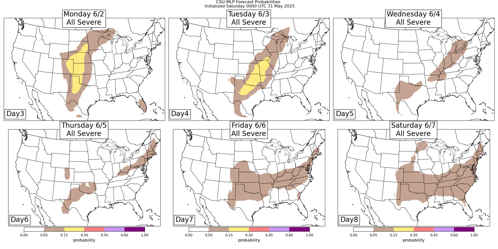
The upper level weather pattern of this weekend looks short lived, as an upper level trough of low pressure will develop over the western United States by early next week, with a corresponding downstream ridge of high pressure aloft in the East. This will result in the severe weather risk area shifting back to the Plains and Midwest, while the unseasonably cool temperatures along the East Coast this weekend will give way to above normal temperatures by the end of the upcoming week.
Tomorrow is June 1, and the “official” start of the Atlantic hurricane season. I am planning to put together a special newsletter for either Sunday or Monday talking about the upcoming season and doing a bit of a deep dive into hurricane forecasting. I did want to briefly talk about the tropical potential in early June given that there have been social media posts about the NWS Global Forecast System (GFS) model showing a potential tropical storm or hurricane in the Gulf Coast region in about 7-10 days. It is not unusual for the GFS to show a system like this around this time of year – and typically it is more of a model artifact than something that the real atmosphere produces.
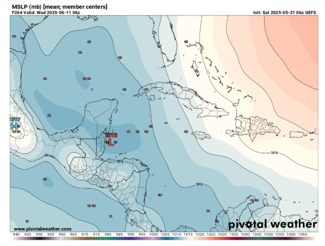
Having said that, there have been signs in the ensemble models – even to some extent the European ensemble – of a possible system developing in the western Caribbean or Gulf region in the June 10-15 timeframe, and that is a region where systems can develop at this time of year. So while I am not panicked about what the GFS is showing – and am not going to post it – I do think it is worth keeping an eye on that part of the tropics in about 10 days for possible development.
Meanwhile, in the eastern Pacific, tropical storm Alvin formed a couple of days ago and has already weakened. However, moisture associated with the system will enhance rainfall chances in the Southwest early next week.

Leave a comment