And the long slog of hurricane season starts today
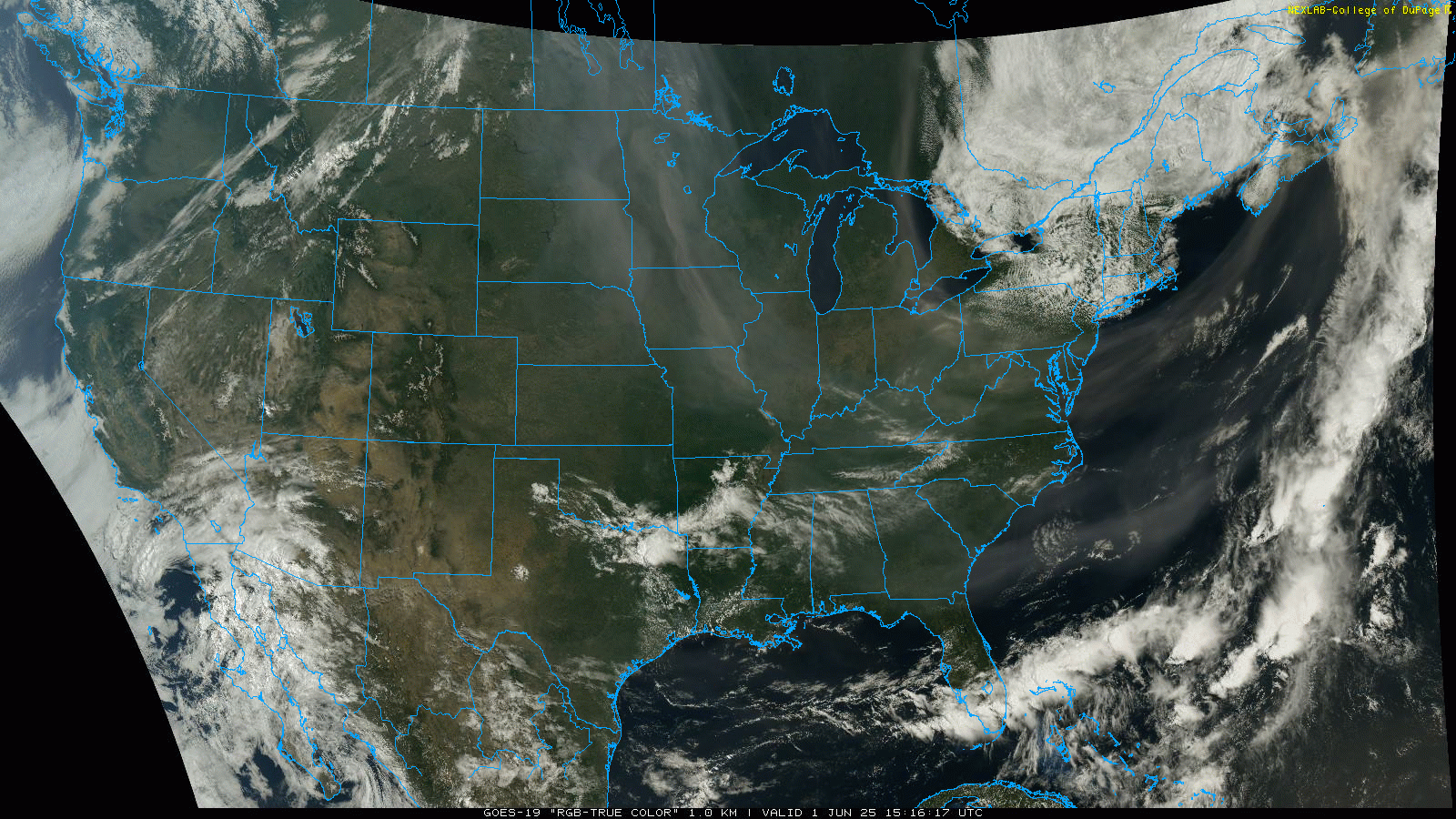
Looking at this morning’s visible satellite imagery reminds me of the old Platters classic that I used to sing (very poorly) to my baby daughter. (For you young people, click on the link and listen, it’s worth it). Smoke from the central Canada wildfires is prevalent across the eastern half of the country – so prevalent that I don’t think it’s worth me trying to draw on the image to show it. I will highlight a pretty remarkable sight though – you can see that smoke has extended all the way down into the Southwest Atlantic Ocean off the coast and is now being drawn up into the low pressure over eastern Canada.

The thickest near-surface smoke is over the upper Midwest, where air quality alerts are in effect for Minnesota and the Upper Peninsula of Michigan. The latest smoke forecast from the High Resolution Rapid Refresh (HRRR) model shows a couple of additional waves of smoke coming into the upper Midwest over the next couple of days behind a cold front that will be moving into the region tonight. Unfortunately, the weather for the next several days in Manitoba and Saskatchewan does not look particularly promising for the fires to be brought under more control.

Turning to severe weather, yesterday was one of the quietest days in recent weeks, as not much in the way of severe storm activity came to fruition in the Plains, and the primary severe weather was with some severe storms over the Delmarva region that resulted in about three dozen reports of severe wind and hail. For today, the focus will be over eastern Texas, where a disturbance in northwest flow aloft will result in scattered supercell storms capable of producing very large hail and damaging wind gusts.
The upper level pattern of this weekend that resulted in numerous record warm temperatures in the western United States and cool, wet blustery conditions in the Northeast will break down relatively quickly early this week, with a new trough of low pressure developing over the western United States.

This evolution will bring a return of severe weather risks to the central United States starting on Monday.

By Tuesday this trough and an associated slow moving cold front will shift far enough east for the the main severe weather risk to run from north central Texas to southern Wisconsin. As of now, neither of these days appear to be particularly high end severe weather days, but clusters of severe storms could produce large hail and damaging winds. Heavy downpours associated with the storms could also caused localized flash flooding.

Finally, today is the start of the Atlantic hurricane season. I will be posting a special newsletter later today or Monday talking about the outlooks for the upcoming season and some hurricane forecasting topics. No tropical cyclone activity is forecast for this week, but as I talked about yesterday, there are still some signs in the ensemble models of a potential system in the Gulf or western Caribbean during the week 2 period. Definitely nothing more than something to keep an eye on at this point.

Leave a comment