Plus: first tropical area of interest and increasing severe weather threats later in the week

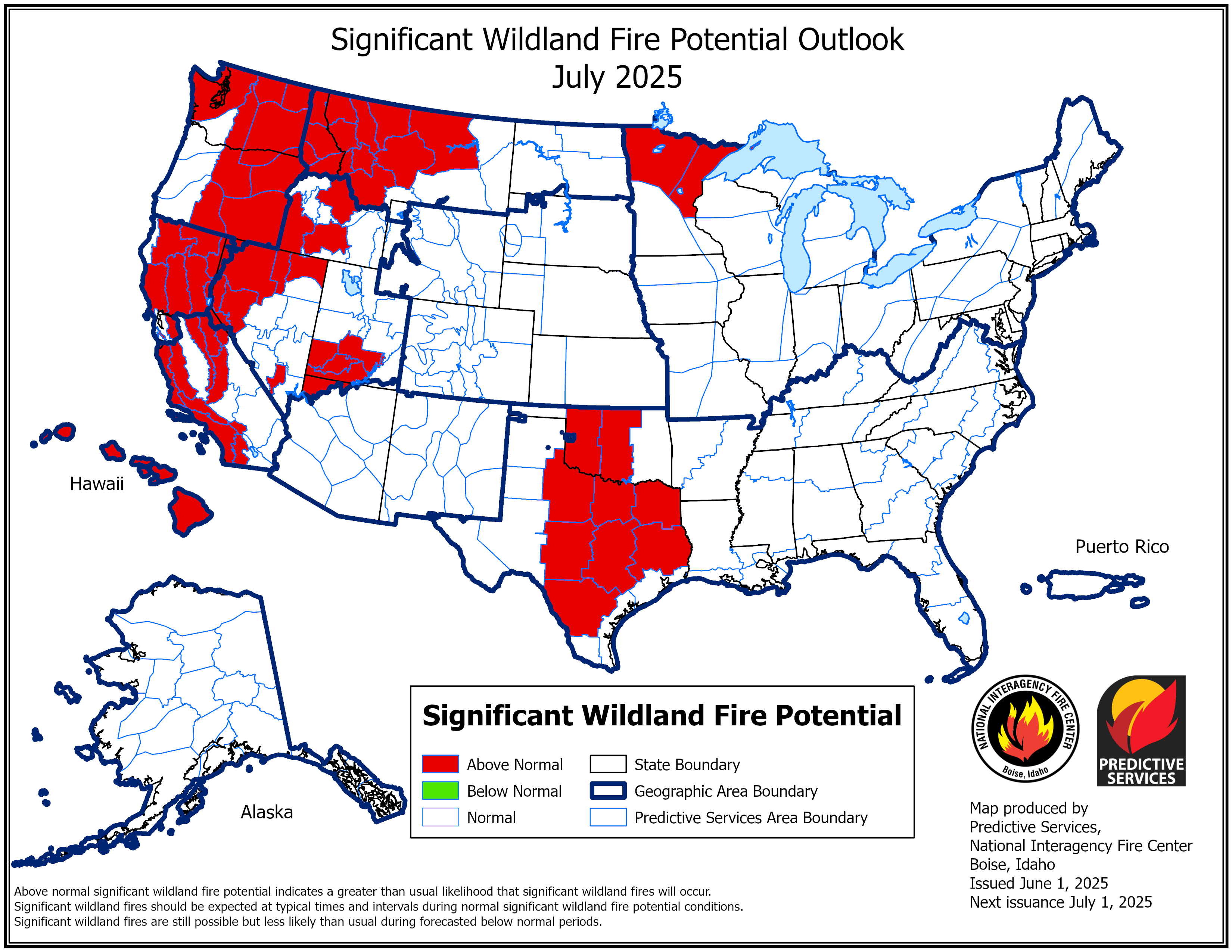
Along with June 1st being the start of the hurricane season and of meteorological summer, it also marked the issuance of the latest seasonal significant wildfire potential outlook from the US Forest Service Predictive Services team as we head toward the ramping up of fire danger season in the West. The full outlook can be read at this link, but I wanted to highlight a couple of graphics that show the concern for an above normal fire season for a large part of the western United States.
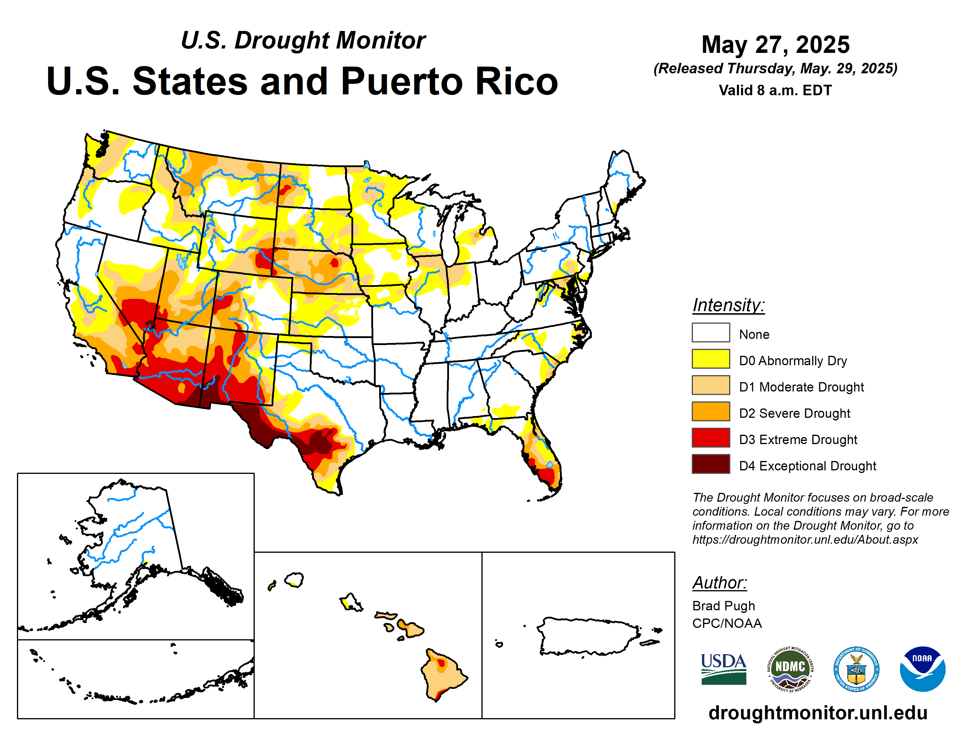
Much of the region has been quite dry for the last several months, and the US Drought Monitor shows drought conditions in significant parts of the West and in much of Hawaii. The USFS outlook discusses the fact that fire activity is above normal in a number of areas, raising concerns that above normal fire activity will continue into the summer with a warmer and drier than normal season anticipated. Monitoring trends for more active periods of fire danger will be something I will be keeping an eye on as we go into summer.
Speaking of wildfires, the Canadian wildfires continue to burn, and satellite and model forecasts shows that quite a bit of wildfire smoke remains over the eastern half of the United States. Over the next couple of days, a slow moving cold front will become nearly stationary from the Great Lakes through the Southern Plains. East of that front, “old” smoke will continue to be circulated in southerly flow while behind the front, “newer” smoke will be transported south and southeast by more northerly flow.
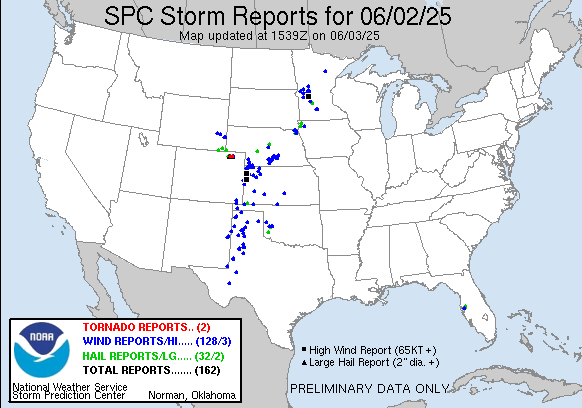
Turning to severe weather, yesterday was a fairly active severe thunderstorm day with over 150 reports from the Southern Plains up into Minnesota.
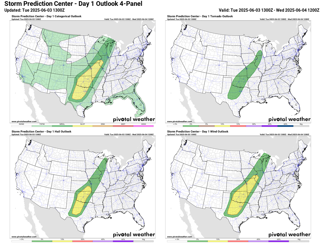
Today the slow moving frontal boundary I talked about above will provide the focus for a broad area of somewhat favorable conditions for severe storms this afternoon and tonight. SPC has a slight (level 2 of 5) risk from northern Texas up into the Mid-Mississippi Valley. Large hail, damaging winds, and a few tornadoes will be possible with the most intense storms in this region.
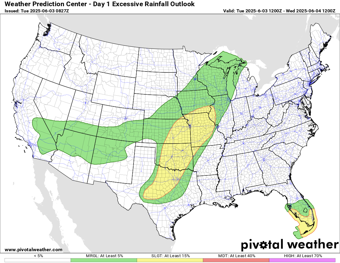
Storms along the front will be relatively slow moving and combined with higher than normal moisture across the region, some pockets of flash flooding will also be possible in the same general region, and the Weather Prediction Center has a slight (level 2 of 4) risk of flash flooding in place. A slight risk is also in place across south Florida where southwesterly flow around a weak area of low pressure off the east coast of Florida (more on that later) could focus thunderstorm activity through tonight.
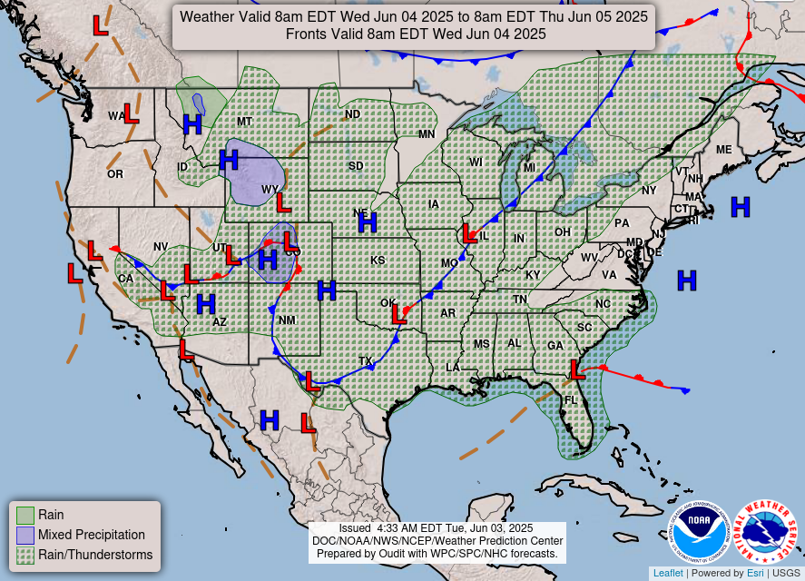
Wednesday looks a bit less active overall, but there could still be some pockets of strong storms and heavy rain along and ahead of the slow moving front in the Midwest and south central states.
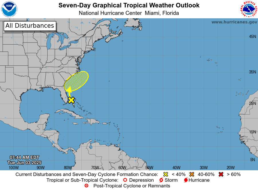
Along the Southeast coast, as I mentioned above, a weak area of low pressure has developed off the east coast of Florida, and is expected to move slowly north along the coast the next couple of days. The National Hurricane Center is noting this area in their tropical weather outlook as an area of interest, but as of now only have a 10% probability of it developing into a tropical cyclone. Regardless of any development, the system should remain relatively weak with heavy rain along the coast being the primary concern.
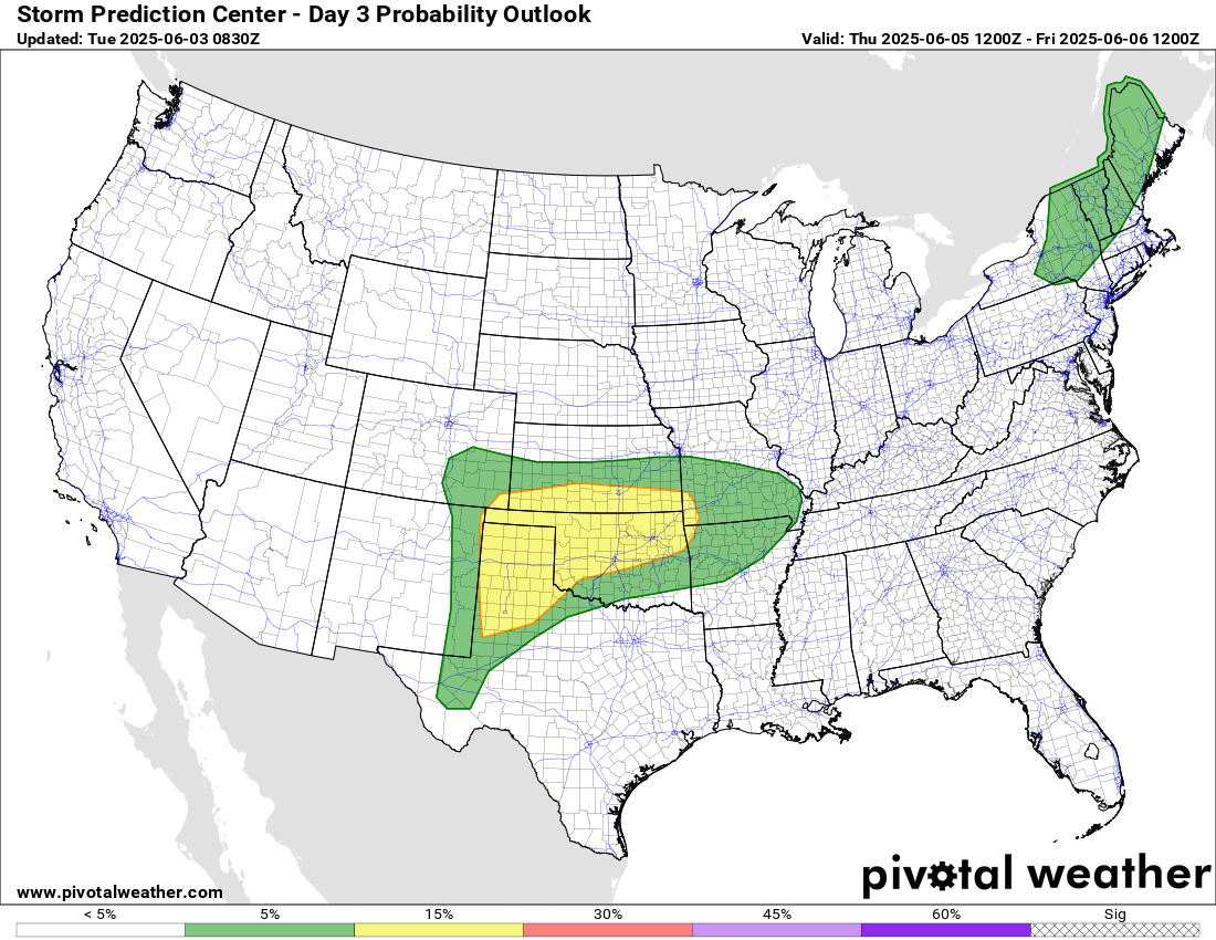
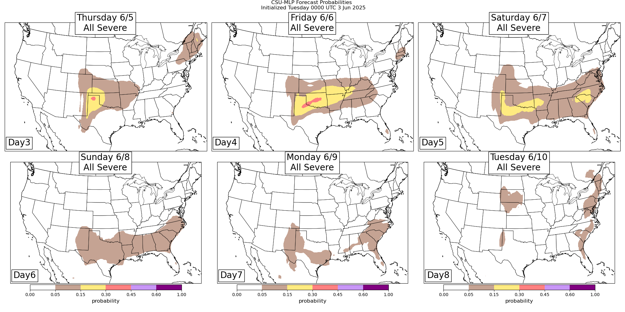
Headed beyond Wednesday, the slow moving front will become more or less stationary east-west from the Southern Plains into the Southeast. Very unstable air along the front combined with increasing mid level winds on the north side of a developing mid and upper level high pressure area over south Texas will yield a rather favorable environment for severe storms along the front, particularly across the Southern Plains region.

Leave a comment