And an active looking pattern for the end of the week
I have mentioned in some earlier newsletters that the more you get into the heart of the warm season, severe weather risks are more readily modulated by the impacts of individual thunderstorms or storm complexes. These types of evolutions are more difficult for the models – even the high resolution, thunderstorm scale models – to handle, and thus forecast surprises become an increasing possibility.

I got a personal surprise yesterday as I did not expect Tuesday to be one of the handful of days I have actually had to get in our in-ground storm shelter with my wife and two dogs.
We ended up there, though, as this supercell storm captured by the University of Oklahoma RaXPol research radar produced a tornado between Newcastle and Norman, OK, just to the west of the National Weather Center and several miles southwest of our house. Luckily the supercell was overtaken by a developing line of storms to its west which disrupted it, and there doesn’t seem to have been a lot of damage (though it was clearly visible both visually and with a debris signature on radar).

While going into yesterday the tornado risk looked to be relatively low given the overall weather setup, the atmosphere at a smaller scale evolved to be more favorable for tornadoes, both over Oklahoma and farther north across northern Missouri into eastern Iowa and northwest Illinois. While right now the only tornado on the SPC storm reports map is the one I talked about in central Oklahoma, there were a number of tornado warnings issued from Oklahoma to northwest Illinois yesterday and there will likely be some additional confirmed tornadoes once storm surveys occur. There were nearly 200 reports of damaging winds along with some scattered large hail reports on Tuesday.

There were also a number of reports of flash flooding, particularly along the corridor of the Kansas Turnpike from Wichita to Kansas City where a band of 3-6” of rain in several hours occurred during the day. You can also see a handful of flash flood and severe weather reports in the Southwest, where the combination of an upper level low pressure area and moisture from the remnants of eastern Pacific Tropical Storm Alvin brought scattered thunderstorms, with some spots picking up more than an inch of rain over the last couple of days. Any rainfall in early June is quite unusual in this region – and is welcome for the most part given ongoing drought.

Today does look to be a quieter day overall. Pockets of strong storms and heavy rainfall will continue to be possible along the slow moving cold front from eastern Texas north into the Great Lakes region. A bit of a more organized severe weather threat may develop later today in eastern New Mexico and northwest Texas where SPC has a slight (level 2 of 5) risk of severe storms that could produce large hail, damaging winds and possibly a tornado.
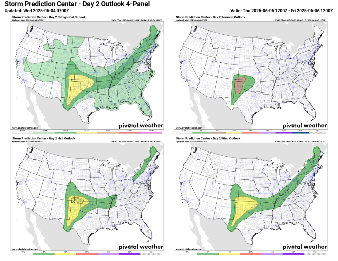

The severe weather risk over New Mexico and Texas will be the start of a weather pattern that will favor multiple episodes of severe storms over the next several days from the Southern Plains east into the Southeast. A band of relatively strong (for June) westerly winds in mid and upper levels of the atmosphere will develop on the north side of a building area of high pressure aloft centered over south Texas. Warm and very humid air in the region will provide plenty of fuel for intense thunderstorm activity, and the stronger winds at higher levels of the atmosphere will yield wind shear that will organize the storms.
This weather setup should support some areas of higher end severe storms capable of producing significant severe weather, particularly strong, damaging straight line winds and some very large hail. However, along with what I discussed as far as yesterday’s tornado risk, the exact areas and timing will be very dependent upon how thunderstorms evolve each day and affect thunderstorm development the next day. For now, though, the main takeaway should be that an active period of severe weather looks likely for the region from the Southern Plains to the Southeast from Thursday into the weekend, and if you are in those areas you will want to keep up to date with the weather.
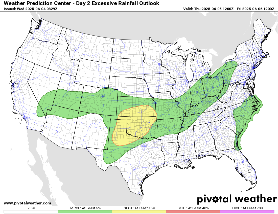
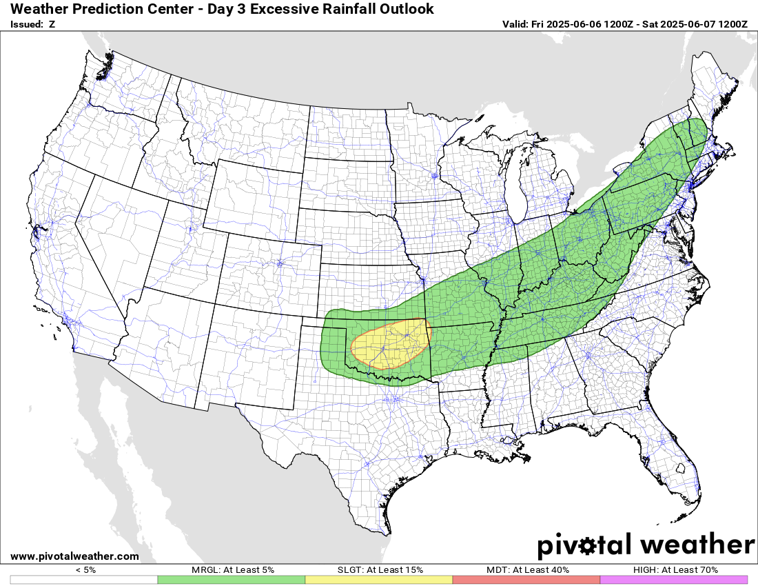
Given multiple rounds of thunderstorms, flash flooding will also be a risk as well.
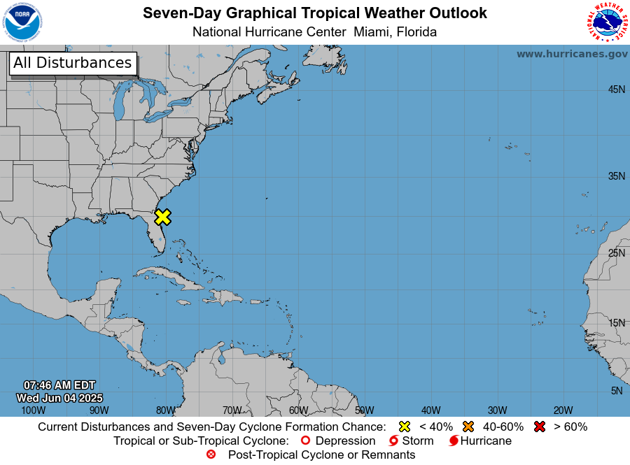
A quick note about the tropics: NHC continues to monitor the area of low pressure off the east coast of Florida, but the latest indications are that this system will move inland over the next couple of days, and even the low chances of tropical development have diminished. Still, locally heavy rain will be possible along the coast the next couple of days.

Leave a comment