And talking a bit about the tropics
There’s lots going on right now in the weather world, both actual weather and in weather policy/governmental issues. I was going to try to talk about both of them today in this newsletter, but quickly realized it was going to become insanely long. So focusing on actual weather first – and I will post another more “weather news” newsletter soon.

As expected, yesterday saw most of the severe weather confined to eastern New Mexico and northwest Texas. There was a complex of storms near St. Louis that produced strong winds and resulted in a couple of tornado warnings.
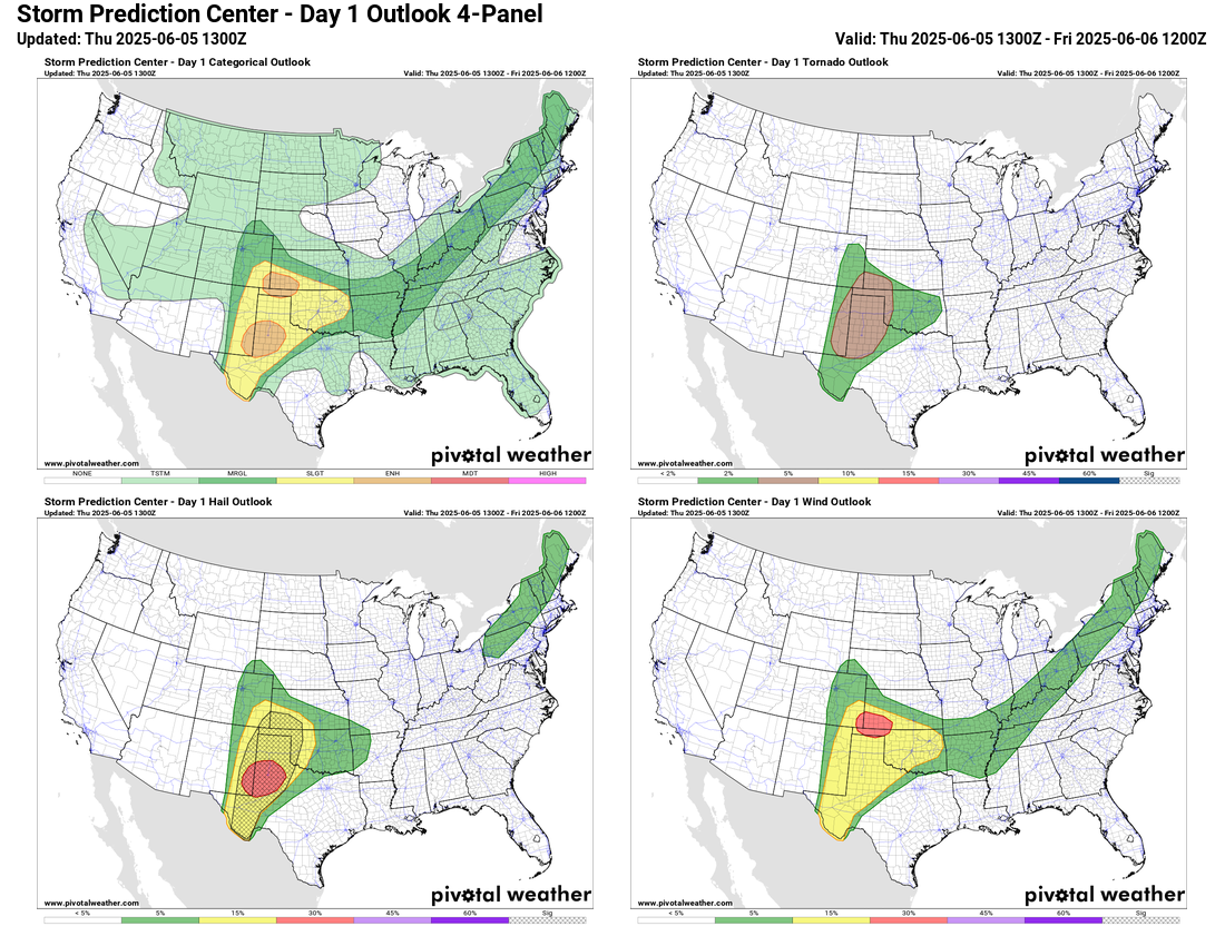
The same general area of northwest Texas and eastern New Mexico will be under a severe weather risk today, but it will also expand north and east to include areas up into the central Plains and across Oklahoma. As we discussed the last couple of days, increasing mid and upper level winds on the north side of an upper level high pressure center over south Texas will provide favorable wind shear to help organize severe storms across this region the next couple of days. Today supercells will likely develop in the High Plains region with a threat of very large hail and potentially tornadoes, and then evolve into complexes of storms with a wind damage and hail threat as they move east.
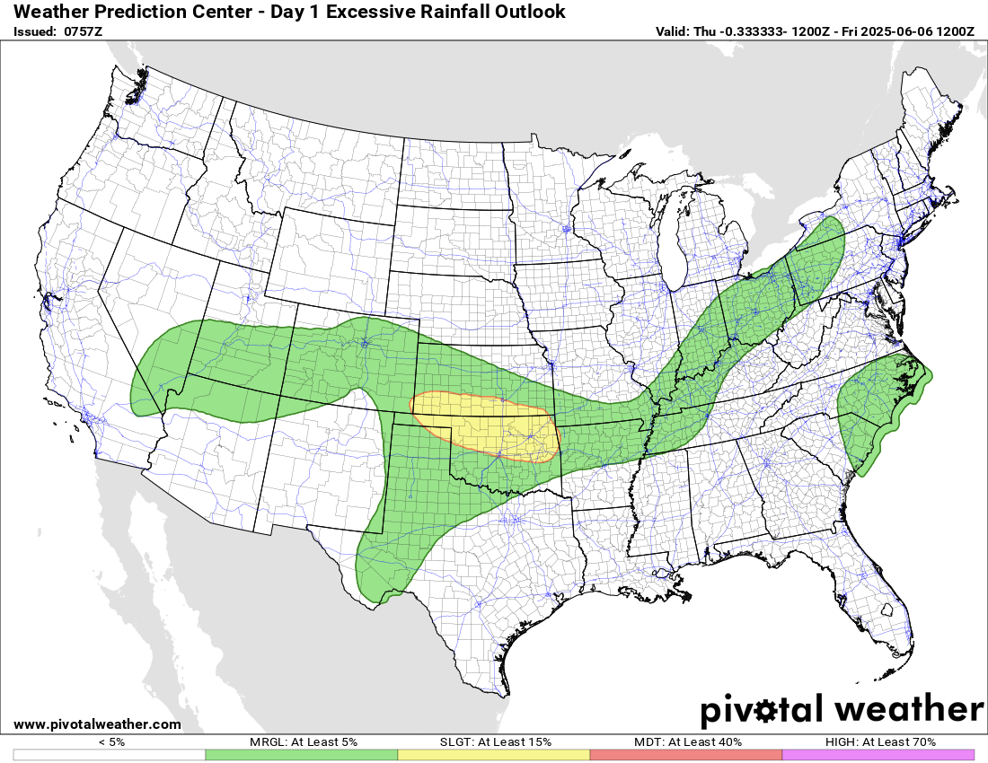
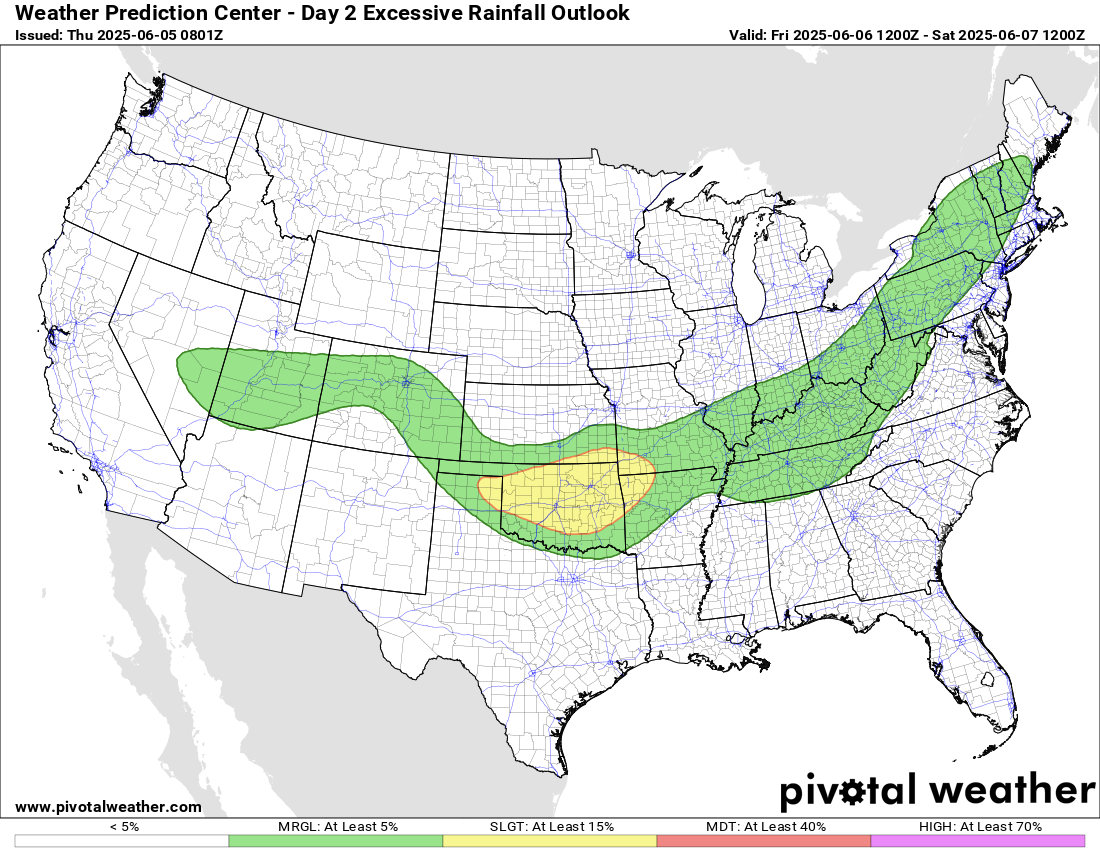
Flash flooding will also be a concern as this area has been active with heavy rain producing thunderstorms for the last several weeks, and heavy rainfall will run off relatively quickly and potentially cause flash flooding. The greatest risk is across northern Oklahoma and southern Kansas where WPC has a slight (level 2 of 4) risk of excessive rainfall in place.
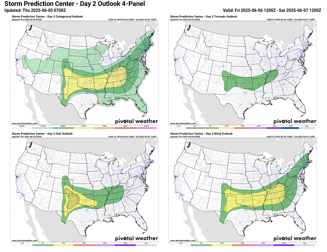
The overall weather pattern for Friday looks rather similar to today. The risk of severe weather will expand east as storm complexes that develop later today will continue to move east in a favorable environment to produce additional severe weather, mainly damaging downburst winds.
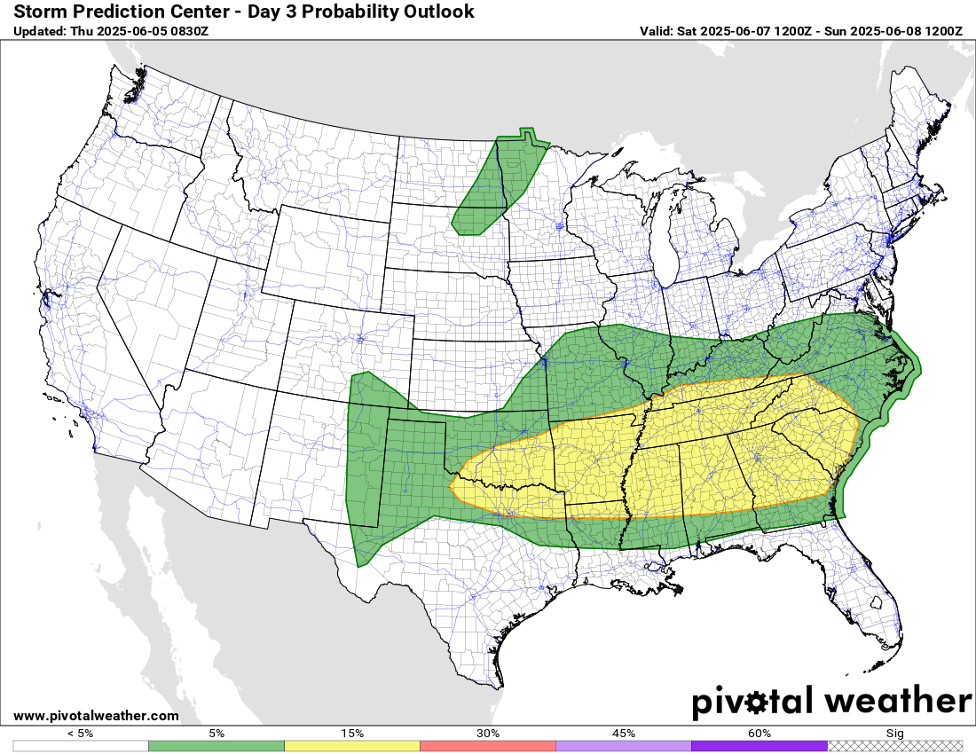
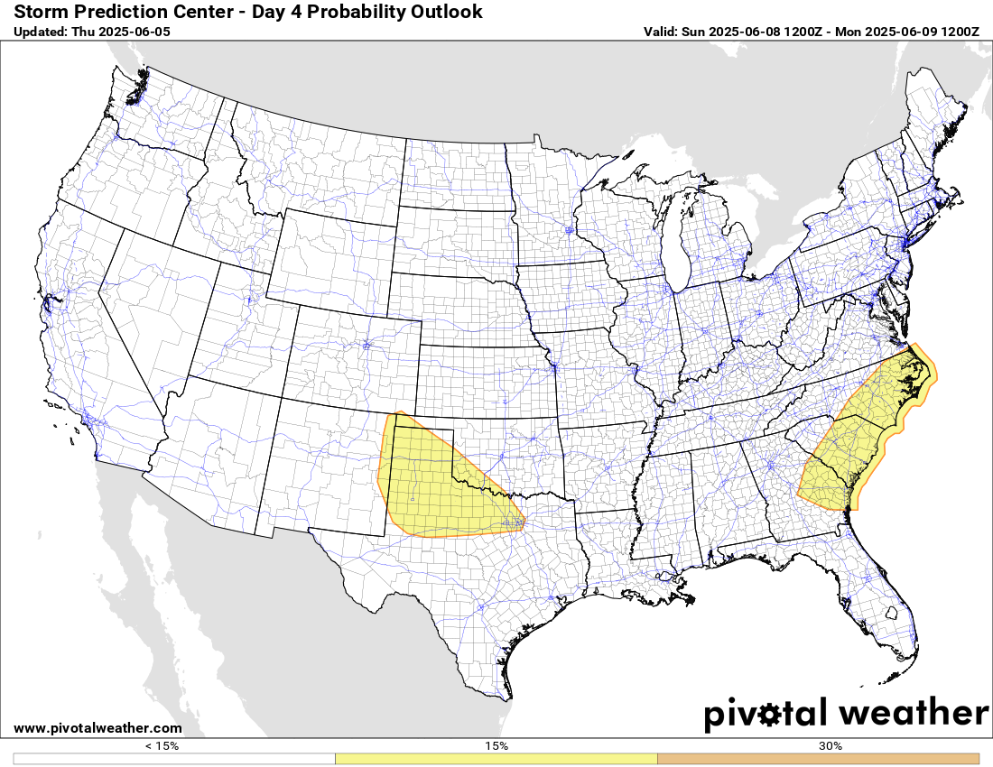
As we go into the weekend, it looks like there will another change in the weather pattern that will result in an upper level trough of low pressure developing over the eastern United States. For Saturday, the risk of severe weather should continue along the same general axis as the next couple of days, but by Sunday in the east it should become more focused along the Southeast coast ahead of a developing low pressure center and cold front with the new upper level trough. Meanwhile, yet another active severe weather day is expected Sunday in the southern Plains as very strong instability combines with northwest flow aloft on the backside of the developing eastern system, resulting in a favorable setup for potentially significant severe storms.
In the tropics, NHC is no longer highlighting the system along the Southeast coast, and the tropical weather outlook is clear. I continue to keep an eye on the period in mid-June as the large scale weather pattern looks to become a bit more conducive for tropical development in the central America region. The ensemble model forecasts suggest some development, but the European ensemble seems more focused on development over the eastern Pacific while the American global forecast system has more members showing something developing in the southern Gulf or northwest Caribbean. Again, at this point it’s still a rather low probability of any sort of an impactful system for the US – just something to keep an eye on.

Leave a comment