Additional severe storms possible in the Mid-Atlantic and Southeast
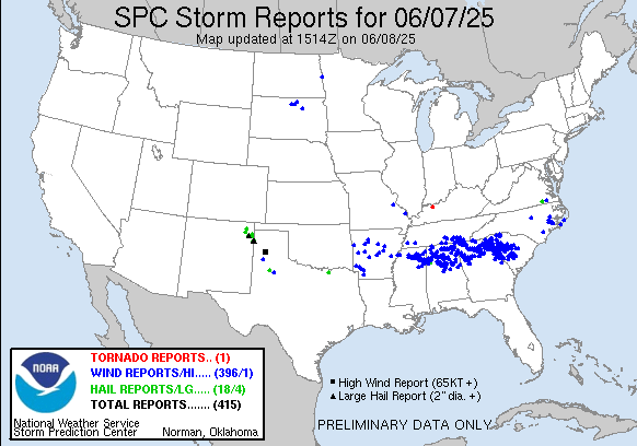
Before we get into what is expected to be a very active day of severe thunderstorm activity, I want to quickly recap yesterday’s activity. As expected, the complex of severe storms over the Mid-South I discussed in yesterday’s newsletter intensified and drove east producing widespread wind damage. More than 100K customers are still without power this morning across South Carolina and northern Georgia and Alabama per PowerOutage.us. Widely scattered severe storms with large hail and some damaging winds did develop Saturday evening across the Mid-South and Arklatex regions in the wake of that complex, and also in the High Plains. An isolated severe storm also produced a tornado near De Soto, MO just south of St. Louis.

Conditions today continue to support a outbreak of intense severe storms across the Southern Plains with the potential for very large hail, extreme straight line winds and some tornadoes. The Storm Prediction Center has placed northern Texas and southern Oklahoma, including much of the Dallas-Fort Worth Metroplex, Wichita Falls, and Lawton, in a moderate (level 4 of 5) risk of severe storms today, with a large enhanced risk surrounding it.

The morning upper air sounding data from Fort Worth shows very clearly why the atmosphere is so supportive of severe weather. The lower 1-2 km of the atmosphere are very warm and moist, while the atmosphere above in the mid levels of the atmosphere is dry and relatively cold. This combination means the atmosphere is quite unstable, and will only become more unstable as daytime heating warms temperatures into the 90s.
As intense thunderstorms develop in this unstable atmosphere, the dry air in the mid levels of the atmosphere will support strong downdrafts in these storms. I’ve highlighted with a purple box on the sounding the “DCAPE” parameter. This parameter is similar to the CAPE (Convective Available Potential Instability) parameter meteorologists talk about with atmospheric instability, only instead of quantifying how much air parcels can accelerate upwards, we are trying to estimate how quickly they can accelerate downwards once downdrafts form in a storm. The DCAPE value on this sounding of nearly 1500 J/kg, is very high, and suggests that storms will be capable of particularly strong, damaging straight line winds.
Indeed, the moderate risk of severe storms is “driven” primarily by the straight line wind damage potential, with a large area of high probabilities of significant (greater than 75 mph) wind gusts. High resolution models have been consistently showing complexes of severe storms moving southeast across the moderate risk area this afternoon and evening with swaths of intense wind gusts – some models are showing thunderstorm winds greater than 100 mph which is quite rare to see in the high resolution models. The upper air sounding also shows rather strong (for June) northwest winds in the mid levels of the atmosphere. This will help organize these storms and move them relatively quickly southeast, further enhancing the damaging wind potential. These stronger mid level winds will also provide wind shear that will support rotation within these storms, which when combined with the extreme instability will support a very large hail and some tornado risk with the most intense storms.
Confidence in a high impact severe weather event in the moderate risk area is rather high today. Having said that, the confidence in how the storms evolve, the timing, and exactly how intense and widespread the highest end severe weather becomes is still uncertain. As I have discussed before, we are now in the time of year where how individual storms develop and interact play a bigger role in the evolution of severe weather events, and the high resolution models show that today with a wide variety of potential scenarios. For example, some models show multiple complexes of intense severe storms moving southeast across the region, while others show an initial wave of supercell storms that eventually coalesces into a single band of severe storms that plows southeast and eventually moves into the lower Mississippi Valley region by early Monday morning. Meteorologists will be watching the observational data closely today for clues on how things are most likely to evolve.
Regardless of the exact details of how the storms end up evolving, again the confidence in high end severe storms in the moderate risk area is high and people in this area should be paying close attention to the weather today. While the northward extent of the most intense severe storms into the enhanced risk area is still uncertain, there is definitely potential for high end severe storms across much of Oklahoma this afternoon and evening. The threat of severe storms will spread southeast toward the lower Mississippi Valley later tonight into early Monday; if the scenario eventually evolves to a single, well organized band of intense severe storms – more of a derecho event – significant straight line wind potential could continue with the storms as they move southeast through this region later tonight.

There will be an additional risk of severe storms in the East this afternoon and evening as an area of low pressure develops across the region. As we talked about yesterday, there appears to be a bit of an enhanced tornado risk across parts of eastern Virginia, with the potential for damaging winds and hail extending south into coastal Georgia.


The threat of severe storms will continue across parts of the East the next couple of days as an upper level trough of low pressure brings a couple of weather systems through the region. Damaging downburst winds appear to be the greatest risk of severe storms the next couple of days.
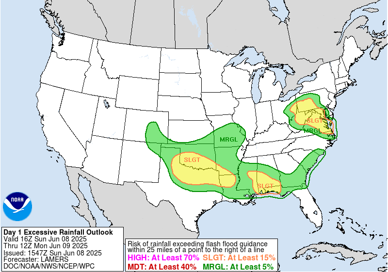
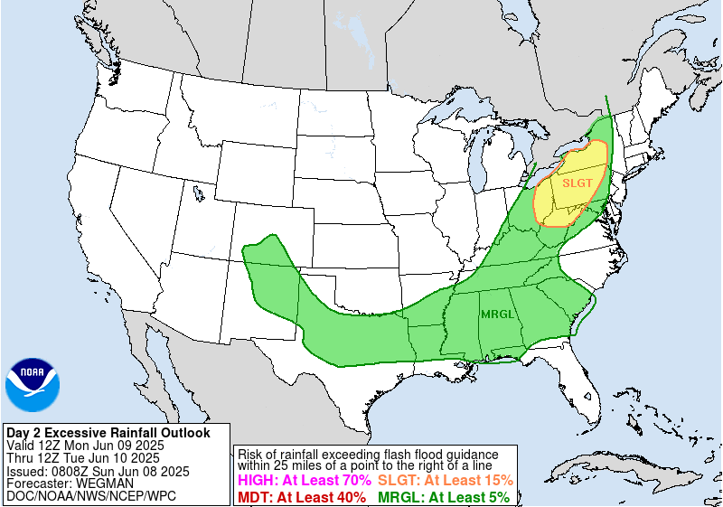
In addition to the severe weather risk, localized heavy rainfall will bring a risk of flash flooding, and the Weather Prediction Center has marginal and slight risks of flash flooding outlooked accordingly.

In the tropics, both of the eastern Pacific systems we talked about yesterday have developed, with tropical storm Barbara off the coast of southwest Mexico and Tropical Depression Three-E farther west-southwest. Barbara is now forecast by NHC to become the first hurricane of the season as it moves parallel to the coast the next couple of days before turning west and weakening. Outer bands of Barbara will cause heavy rains and possible flooding/mudslides in southwest Mexico.
Conditions still look to become more favorable around the central America region in about 5-10 days, with NHC now showing a medium probability of development in the area south of the Isthmus of Tehuantepec. The models continue the trends we discussed yesterday, with the European ensemble members keeping most development focused in the eastern Pacific while the American GEFS ensemble shows some potential development eventually in the Caribbean or western Gulf. Right now any kind of development to have any concern over still remains a low probability and we will just continue to keep an eye out.
I plan to make BlueSky posts and post Substack notes about the evolving severe weather risk today, and may go live either on Substack video or chat depending on how things evolve. Hope everyone in the Southern Plains keeps weather aware and stays safe today!

Leave a comment