More smoke to come south from Canada next couple of days
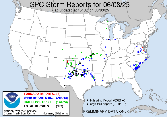
Happy Monday 🙂 Meteorologically, things worked out about as expected over the last 24 hours with numerous severe storms across the Southern Plains and into parts of the Midwest, with nearly 300 reports of severe weather in this region. This included nearly 20 reports of measured significant wind gusts (75 mph or greater) and two dozen reports of very large hail (greater than 2”). A measured wind gust of 100 mph was recorded at the West Texas Mesonet Site in Knox County, TX, and grapefruit sized hail was reported in Armstrong County, TX. In the eastern US, severe storms produced a number of reports of wind damage and large hail from eastern Virginia into South Carolina, and as expected a few tornadoes also occurred in eastern Virginia.
Diving a bit more into the details of how things evolved with the anticipated outbreak of severe storms in the Southern Plains, a few things worked in our favor to keep things from getting too out of hand. As I alluded to yesterday, this was an event that was very much driven by the extreme instability and how the individual intense thunderstorms would evolve, interact with each other and grow upscale into more organized complexes of severe storms.
While there were numerous high impact severe storms in the Texas Panhandle, northwest Texas, and parts of Oklahoma, it did not really become organized into a single, well developed line of intense storms – a quasi-linear convective system (QLCS) – until it reached northeast Texas late Sunday evening. Some significant wind damage reports occurred in this area with this evolution, but by the time the QLCS developed it was starting to move out of the more unstable air and the intensity decreased as it moved farther east toward Louisiana.
As I alluded to over the weekend, anticipating how such evolution on a storm scale will take place is still a huge forecasting challenge – each high resolution model this weekend run pretty much showed a different solution. Some of the models showed a more defined QLCS evolving earlier in this event which would have resulted in more widespread significant winds over a large area; luckily these scenarios did not come to pass.

Still, looking at the “practically perfect forecast” mapping of wind reports from yesterday, a large area of 45-60% coverage of severe wind reports occurred over northern Texas. Combined with the number of significant wind reports that also occurred in this area, this certainly equates to a moderate risk level event for northern Texas from an objective perspective. Luckily, though, from a subjective societal impact level, it appears to not as been as impactful as it could have been if the storm scale evolution had happened differently.

Looking ahead to this afternoon, a band of showers and storms along a cold front from the eastern Great Lakes to the Mid-South should see some intensification and could produce some severe weather with damaging winds the primary threat. Additionally, a couple of remnant complexes of showers and storms moving across the southeast could see some intensification with daytime heating and also produce some damaging downburst winds. SPC has these areas under a slight (level 2 of 5) risk of severe weather. Some widely scattered strong to severe storms could also occur farther west along the slowing cold front trailing through Texas and back northwest into eastern New Mexico.

Pockets of flash flooding are also possible with these thunderstorms as well, and WPC has marginal and slight risks of excessive rainfall in place accordingly.
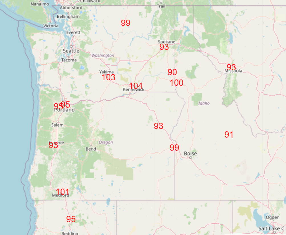
Another weather story yesterday was record heat in the Northwest, as a number of record high temperatures were set, including at Portland (96F, previous record was 94F in 1955). More record heat is anticipated today, with a number of triple digit readings likely.
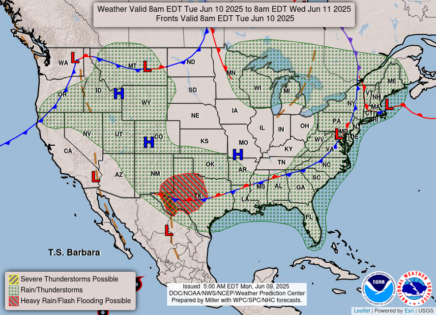

As we go through the week, the current upper level weather pattern of a strong ridge of high pressure in the West and downstream trough in the East will break down by the middle of the week, which will result in a more nondescript weather pattern. The main focus of impact weather looks to be – once again – in the Southern Plains where a weak area of low pressure aloft will form. This will be the focus for thunderstorms producing heavy rainfall, and WPC has slight (level 2 of 5) risks of flash flooding Tuesday and Wednesday as shown above.

That risk will shift slowly east with the upper level system Thursday and Friday.

More northwesterly flow at all levels of the atmosphere will be transporting additional wildfire smoke south from the central Canadian wildfires into the United States the next few days. The top loop shows the near surface smoke concentration as forecast by the HRRR-Smoke model over the next 48 hours, with a wave of thicker smoke anticipated to move down into the Dakotas. Meanwhile, the bottom loop is the HRRR forecast of vertically integrated smoke – i.e., smoke throughout the atmosphere – and several waves are forecast to rotate through the central and eastern US over the next couple of days.

Finally turning to the tropics, in the eastern Pacific Barbara has strengthened to the first hurricane of the season, and Tropical Depression 3-E strengthened into Tropical Storm Cosme. Both of these systems will continue to move northwest today, and by midweek should weaken and turn more westerly. A new system could form in the Gulf of Tehuantepec later this week as conditions become more favorable for development again. I will have my full weekly tropical update newsletter out later today or Tuesday.

Leave a comment