And Canadian wildfire smoke continues to stream south into the US
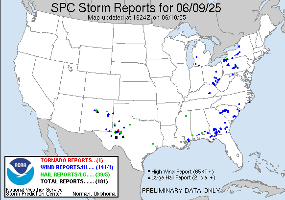
I spent a lot of my morning working on the weekly tropical weather newsletter, so this will be a bit of an abbreviated daily newsletter. Looking at severe weather, there was a smattering of severe weather reports across the eastern and southern United States from several clusters of strong to severe storms. The most intense storms were again with some supercells over the southern Plains, with reports of hail up to 3” in diameter and wind gusts up to 75 mph.
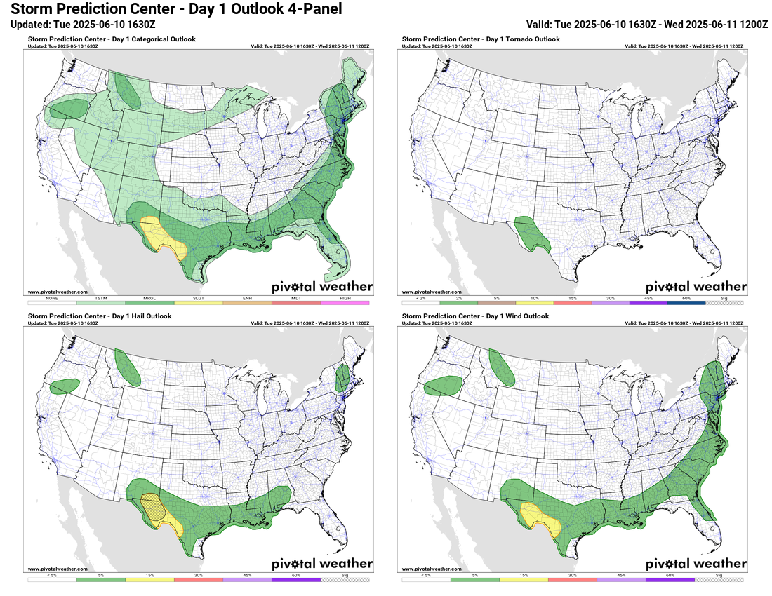
The most intense storms today should again be in western Texas and southeast New Mexico where scattered supercells could bring very large hail along with damaging winds and a couple of tornadoes. SPC has a slight (level 2 of 5) risk of severe storms in place here. Scattered strong to occasionally severe storms are possible all along a slow moving cold front from the Northeast to the Gulf Coast, and a marginal (level 1 of 5) risk is in effect. A few severe storms are also possible in parts of the Northwest with damaging winds and large hail as an upper level disturbance moves through the region.

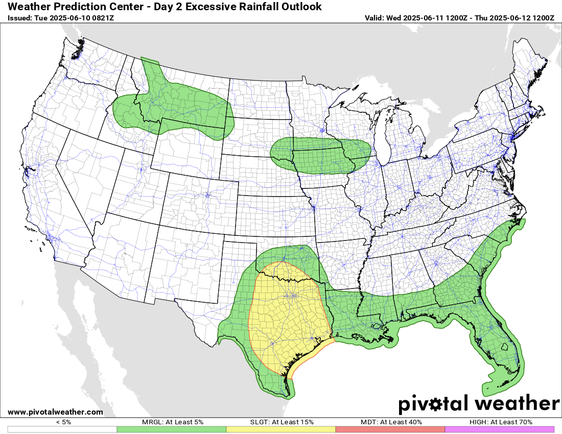
Flash flooding will also become a somewhat increasing risk across Texas as an upper level low pressure system gradually evolves, resulting in increasing coverage of slow moving thunderstorms producing heavy rainfall.
This risk will continue and expand a bit on Wednesday as the upper low slowly moves east.
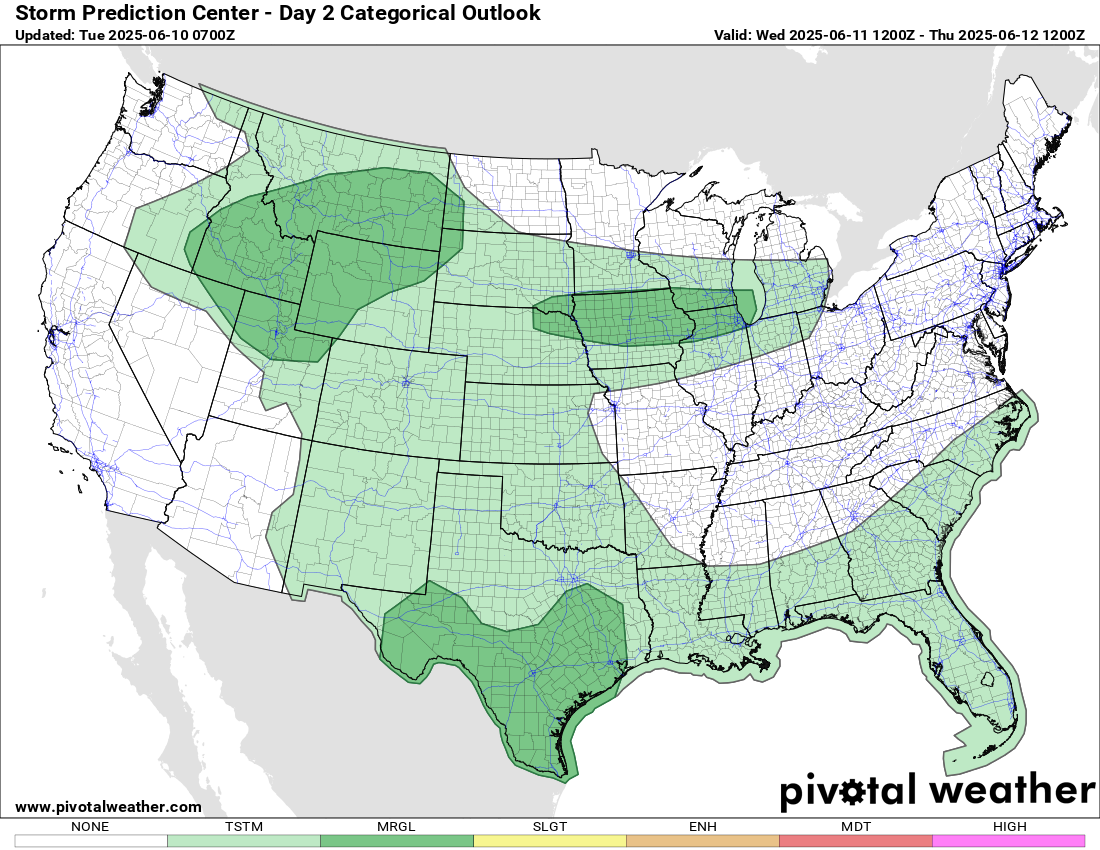
A few severe storms are also possible in this region, as well as over the northern Intermountain West and the the upper Missouri and Mississippi Valleys where increasing thunderstorm activity will be a story over the next several days.
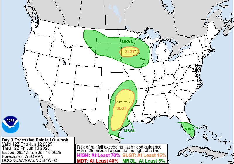
On Thursday, slow moving thunderstorms with heavy rain potential will continue to be a threat with the upper low over Texas and Oklahoma. WPC also has a slight risk (level 2 of 4) of excessive rainfall over southern Minnesota.
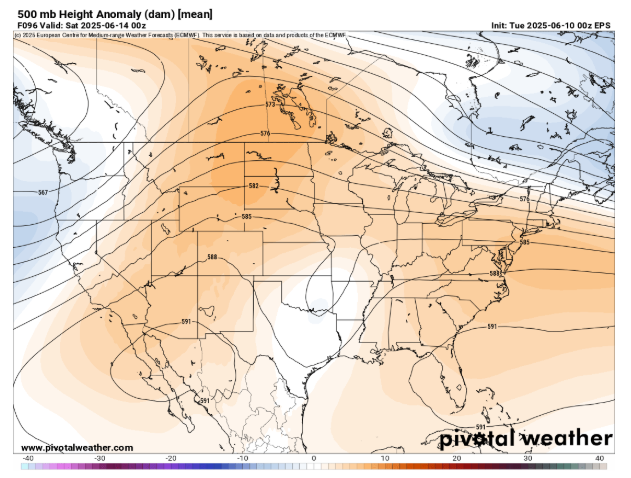
As we go through the rest of the week, the weather pattern across the US will become dominated by two large and building areas of upper level high pressure, one over the Southwest and another over Florida and the Southwest Atlantic. The weak upper low over the south central US in between those two features will continue to drive slow moving thunderstorms with heavy rain, while across the northern tier of states, increasing mid and upper level winds and disturbances moving through this flow will drive increasing thunderstorm activity.
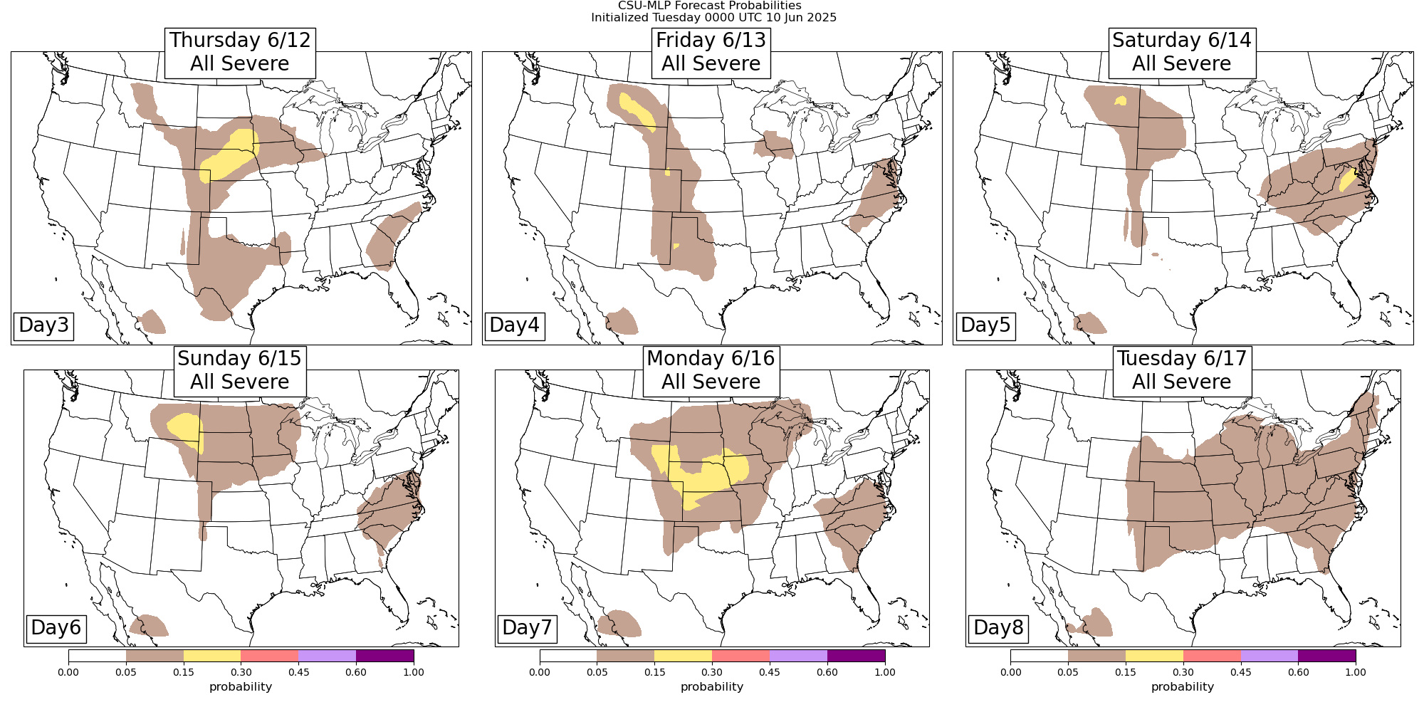
The Colorado State University Machine Learning Probabilities (CSU-MLP) system shows areas of severe potential during the Thursday through Tuesday with this overall pattern. While the details of this will evolve, this gives an idea of the general trend for severe weather threats to mainly be from the central and northern Plains east to the East Coast in the stronger flow to the north of the upper level high pressure centers.
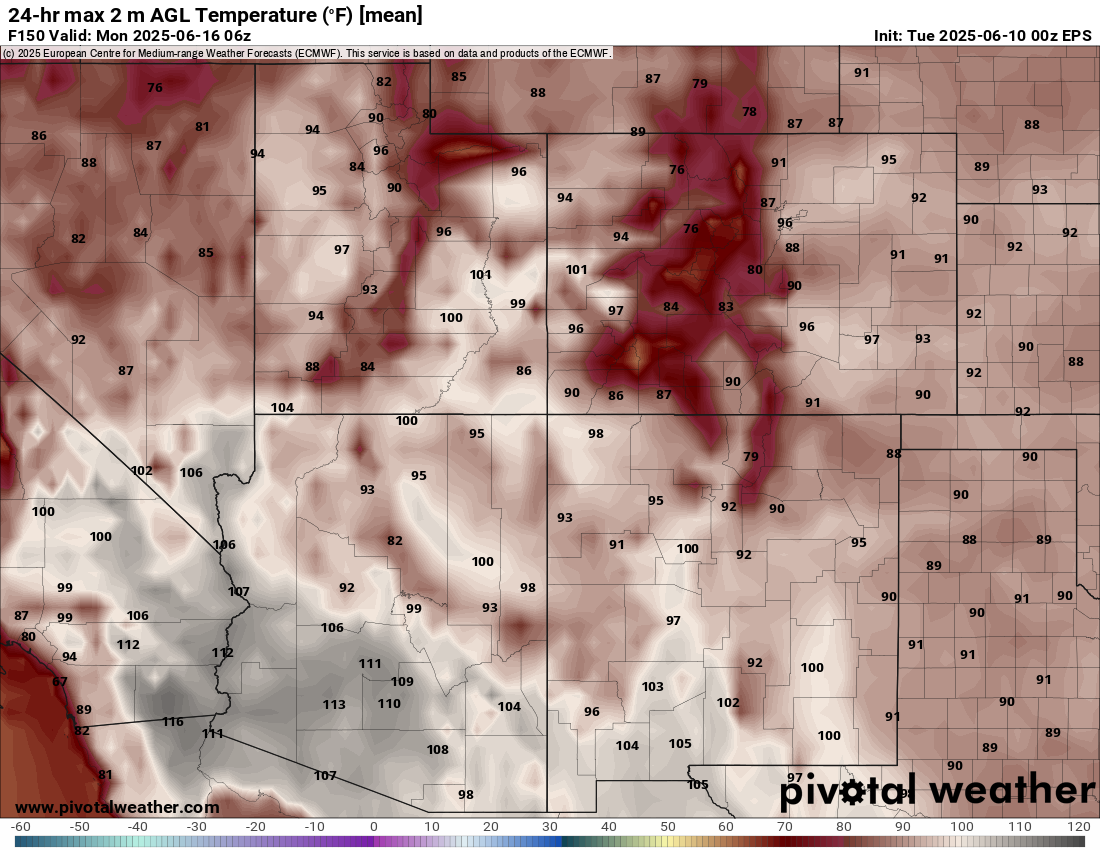
While right now record temperatures are not forecast, significant heat is expected to build in the Southwest into this weekend with the upper level high in that region, with the first 110+F readings of the year likely for Phoenix.
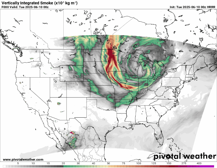
Last but not least, I want to be sure to reinforce that Canadian wildfire smoke will continue to be an issue for many areas in the central and eastern United States for the foreseeable future. Over the next couple of days, the HRRR-Smoke model above shows several waves of smoke moving southeast across the country from the Rockies east.

Leave a comment