More storms for south with upper level low – and more Canadian wildfire smoke
We are getting into the time of year when the weather pattern – particularly in the southern United States – will be increasingly dominated by the large area of high pressure known as the Subtropical Ridge (STR). This large ridge of high pressure throughout the atmosphere causes building heat and generally leads to less thunderstorm activity directly under it. Low pressure centers can often develop in between centers of high pressure, though, and we are seeing this sort of pattern over the United States this week.
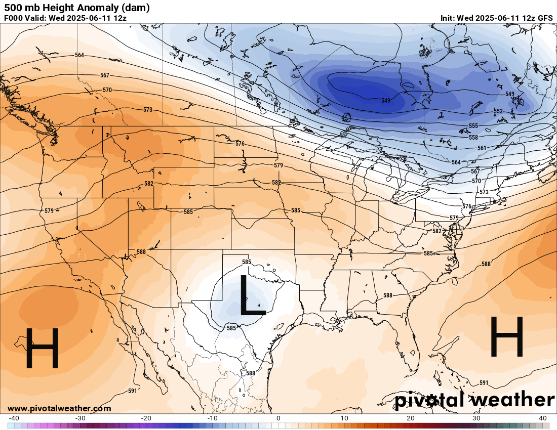
As can be seen in this morning’s weather map at 500 millibars – about 18,000 ft AGL – large areas of high pressure in mid and upper levels of the atmosphere are building in the Southwest Atlantic and east Pacific into the Southwest. In between, an upper level low pressure center has developed across Texas. These upper level lows can cause heavy rain and flash flooding as they cause slow moving thunderstorms to develop in the very humid environment that typically is in place, especially over the south central and southeast US.
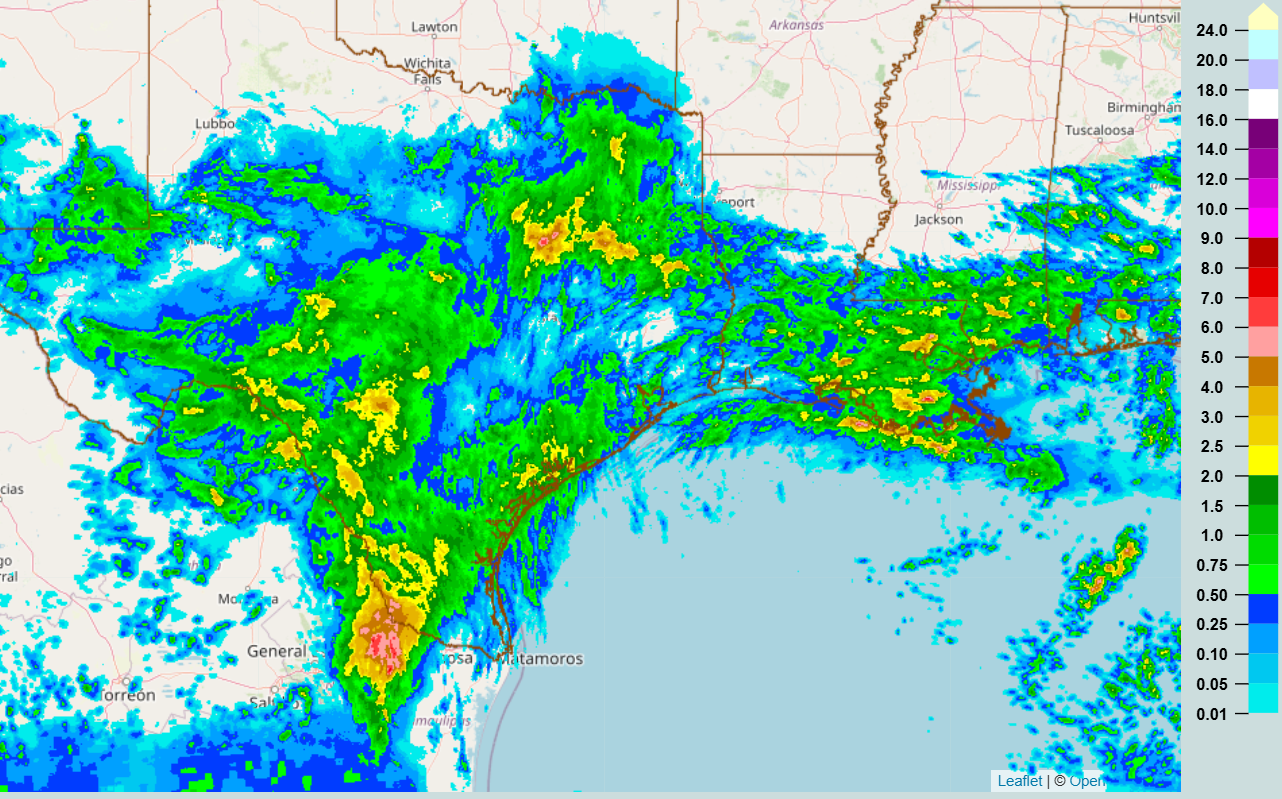
This upper level low has already caused heavy rainfall across Texas, with areas of 2-4” shown by the 24 hour MRMS multi-sensor rainfall estimate product.
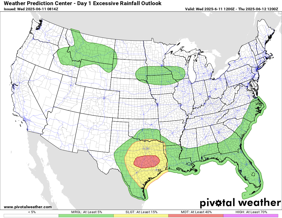
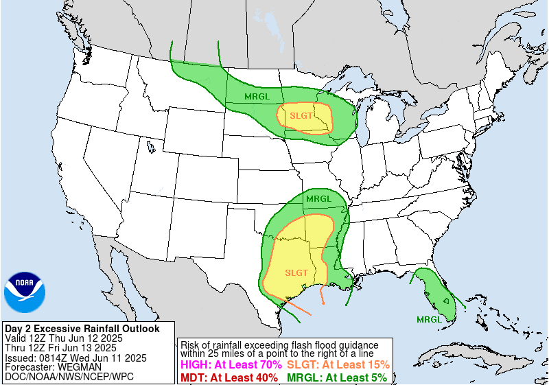
These upper level lows are also notorious for providing forecast surprises, as computer models struggle to forecast them, partially because the extensive thunderstorm activity that they can produce affects the structure and movement of the upper level low itself and as we have discussed in earlier posts, the models have a tough time capturing how individual thunderstorms develop. Having said all that, the current global and high resolution models suggest that a few rounds of intense storms with torrential rain will rotate around the south and east side of the upper low today, with the potential for some locations to pick up 2-4” of rain in just a couple of hours and totals of up to 10” where multiple rounds of storms move over the same location. Given this, the Weather Prediction Center has issued a moderate (level 3 of 4) risk of excessive rainfall and flash flooding across parts of eastern Texas, with a large surrounding slight risk.
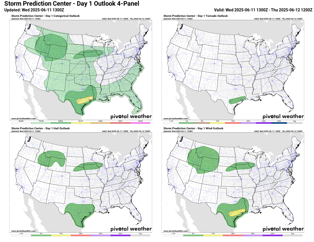
A few severe storms are also possible with this activity. A marginal (level 1 of 5) risk of severe storms is also in place across the northern Intermountain West and parts of the upper Missouri and Mississippi Valley regions.
The upper level low should start to slowly move east on Thursday, with the risk of heavy rain and flash flooding expanding a bit east as well. Additionally, increasing thunderstorm activity is expected over the upper Midwest where disturbances will begin to move through a band of increasing mid level west to northwest winds on the north side of the building high pressure areas. Strong – and maybe a few severe – storms will also be possible in both of these areas.
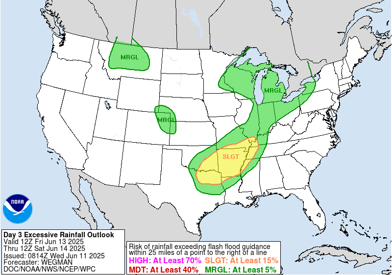
By Friday, the upper level low will start to weaken and move a bit faster east and northeast, but should still be a focus for thunderstorms with heavy rainfall across the Arklatex and Mid-South.

As we head into the weekend, the upper low will continue to weaken and the upper level areas of high pressure will become the dominant weather features for most of the country. Disturbances moving through stronger mid level winds across the northern half of the country to the north of these high pressure areas should provide the focus for thunderstorm activity, some of which could be severe.
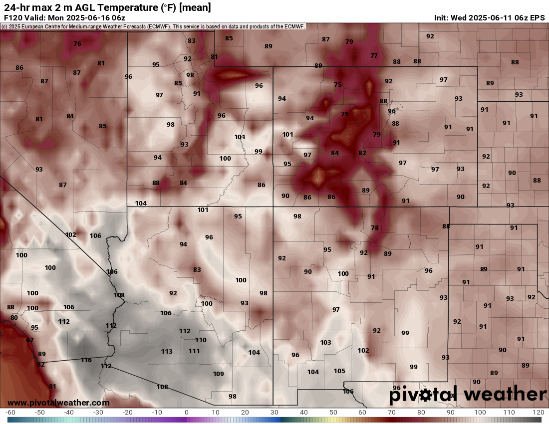
The building high pressure area over the Southwest will bring building heat as well, with widespread 110+F temperatures expected in the deserts of Arizona and southern California.
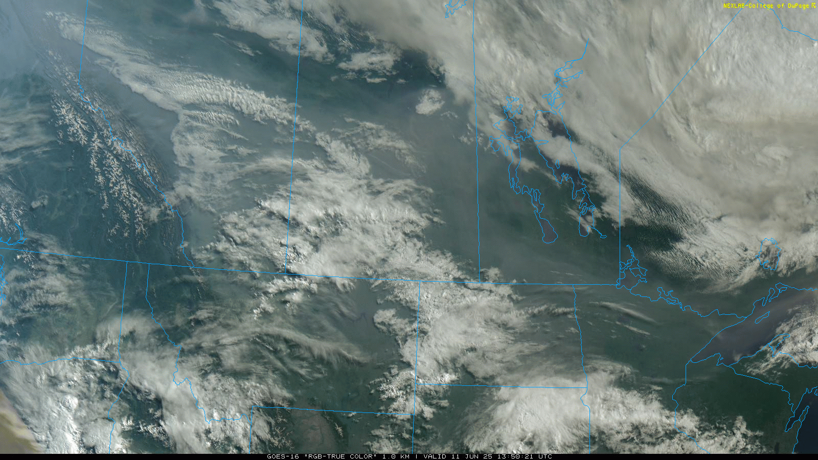
I want to finish off today’s newsletter with a quick overview of what is happening with the Canadian wildfire smoke. This morning’s visible satellite imagery shows that smoke is blanketing much of Alberta, southern Saskatchewan and southern Manitoba, with smoke spreading into Montana, the Dakotas and Minnesota.
Air quality is particularly poor where the smoke is thickest in parts of Canada including Calgary. Air quality alerts are in effect in these regions as well as in parts of northeast Montana.
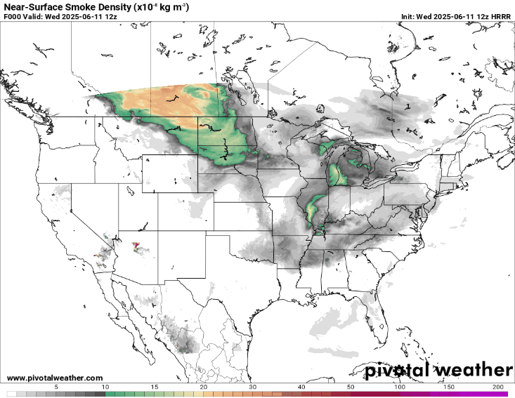
The latest forecast from the HRRR-Smoke model for near-surface smoke shows that the thickest smoke will continue to plague central Canada and parts of the north-central US for the next couple of days.
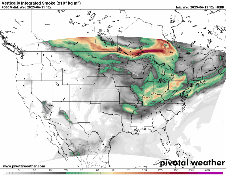
At higher levels of the atmosphere, waves of smoke will continue to move southeast through much of the north central and eastern United States.

Leave a comment