Heat building in the Southwest into the weekend
Starting off today by talking about the heavy rain and flash flooding with the upper low in Texas. I posted a quick note last evening showing the evening high resolution model rainfall forecasts – and talked about while the exact locations would likely not be right, that the models’ ideas of some extreme rainfall amounts up to 10” were very possible.
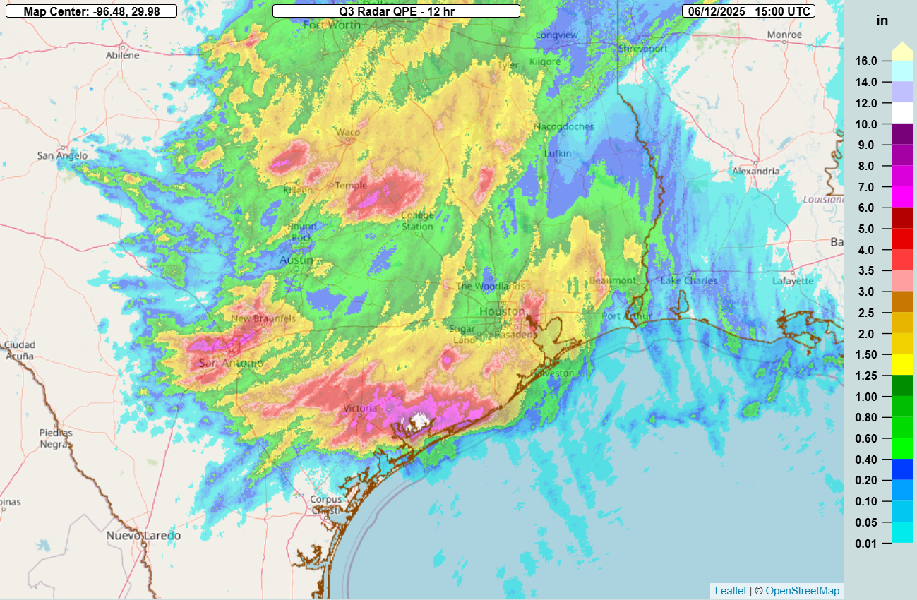
Looking at the MRMS 12-hour radar rainfall estimates, we can see that played out quite well. A swath of 6-10” fell overnight into mid morning from Victoria east to the to the coast, with additional areas of 6+” in the northern part of the San Antonio metro area and between Temple and College Station.
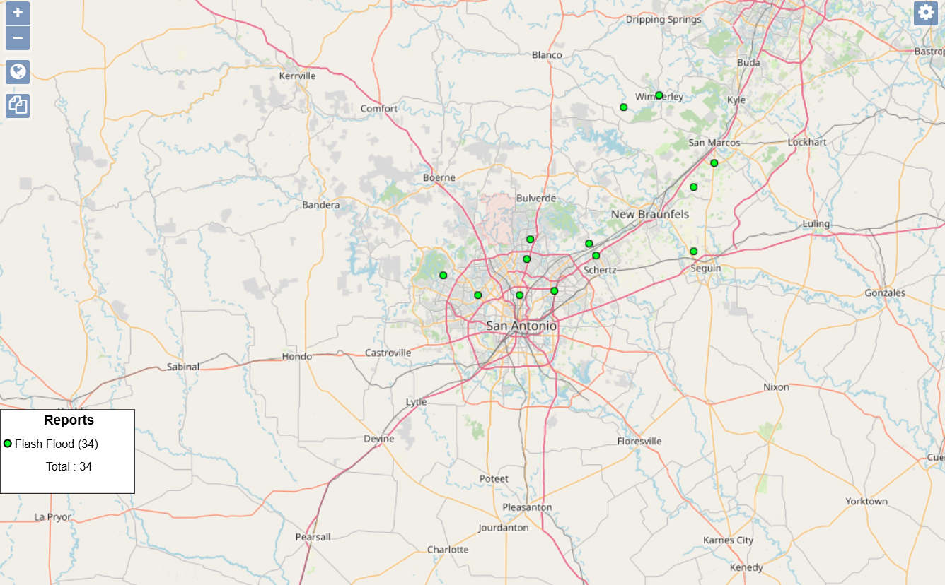
The most impactful flash flooding appears to have been in the San Antonio area where the heavy rainfall interacted with the urban area during the overnight hours. Thunderstorms with incredible rainfall rates moved through the region, with San Antonio Int’l Airport reporting 3.98” of rain in an hour between 3 and 4 am.
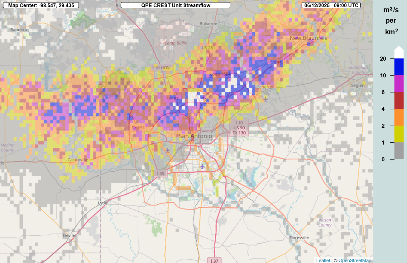
The MRMS FLASH unit streamflow product clearly shows how these rainfall rates overwhelmed the urban area, with large areas with values greater than 20, showing extreme runoff and likely major flash flooding. Vehicles were overtaken by flood waters on Interstate 35, and numerous water rescues were reported in the area. Unfortunately, media reports indicate that at least 4 people were killed when their vehicles were swept away, with 2 people still missing.

There are currently some heavier showers and storms affecting southern parts of the San Antonio metro area, but for the rest of today, the observations and high resolution models suggest that the heaviest rain should be shifting farther east from the Arklatex down into the Gulf Coast region.
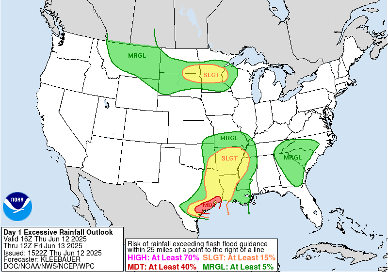
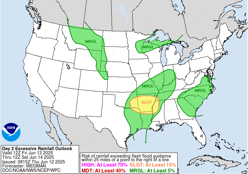
The Weather Prediction Center continues to have a moderate (level 3 of 4) risk of excessive rainfall and flash flooding across extreme southeast Texas, with a large surrounding slight risk. A slight risk of flash flooding is also in place for parts of the upper Midwest where a complex of thunderstorms is anticipated later today and this evening.
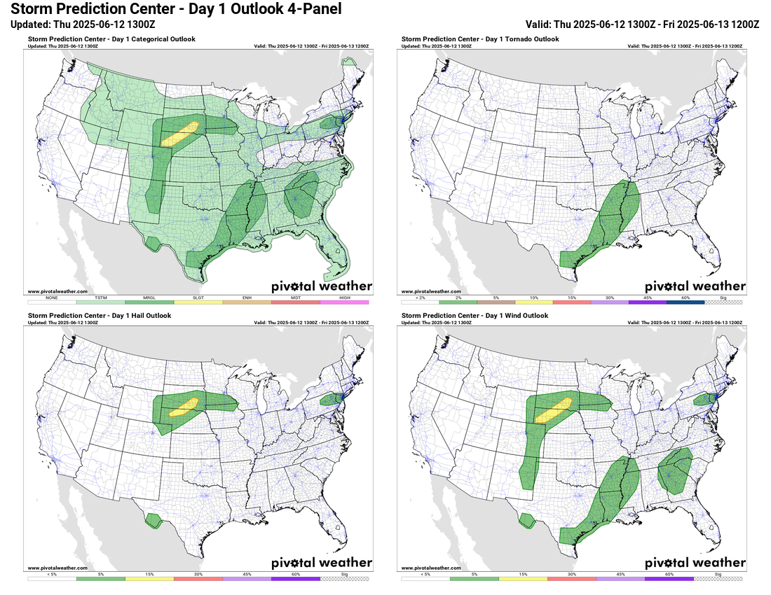
The severe weather risk today will be relatively limited, with the only slight (level 2 of 5) risk over the northern Plains.
Heading into Friday, the upper level low responsible for the flooding over Texas will begin to weaken and lift northeast, but will still provide a focus for thunderstorms with heavy rainfall over the Mid-South region.
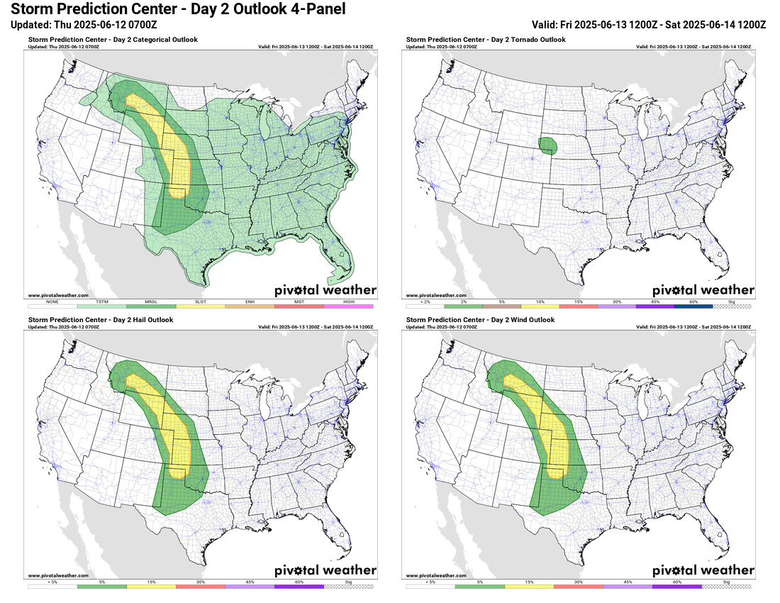
The threat for severe thunderstorms on Friday will be along an axis of unstable air that will develop from the Southern Plains northwest into Montana. Scattered thunderstorms capable of damaging winds, large hail and perhaps a couple of tornadoes are expected.
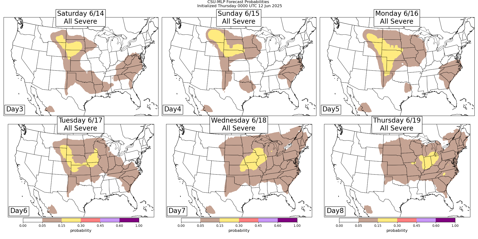
Going into the weekend and first part of next week, the weather pattern will become increasingly dominated by building areas of mid and upper level high pressure centered over the Southwest and Florida. Most of the severe weather risk will be on the north side of these high pressure areas where disturbances will move through a band of stronger mid and upper level winds. While the exact locations of the daily risk will likely evolve, the CSU-MLP AI system shows the general idea of where the risks will be over the next several days.
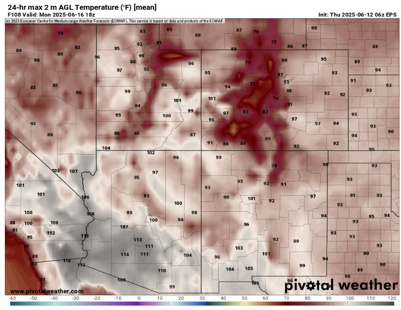
Heat will build under the upper level high pressure over the Southwest, with 110+F temperatures becoming widespread over the desert regions.
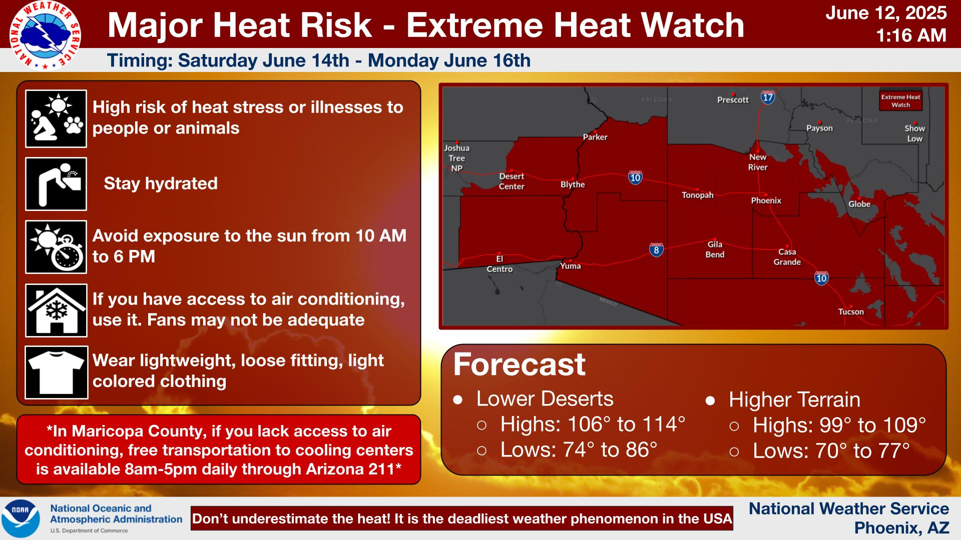
Extreme heat watches are in effect including the Phoenix, Tucson and Yuma areas.
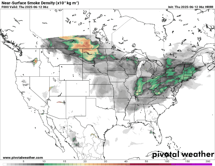
With regard to the Canadian wildfire smoke, low level winds will become more southerly across the upper Midwest over the next couple of days, with the HRRR-Smoke model showing the near surface smoke becoming increasingly confined to Canada. While this would be an improvement, there is still quite a bit of wildfire smoke across the region this morning, and Air Quality Alerts are in effect for much of Wisconsin and southern Minnesota.
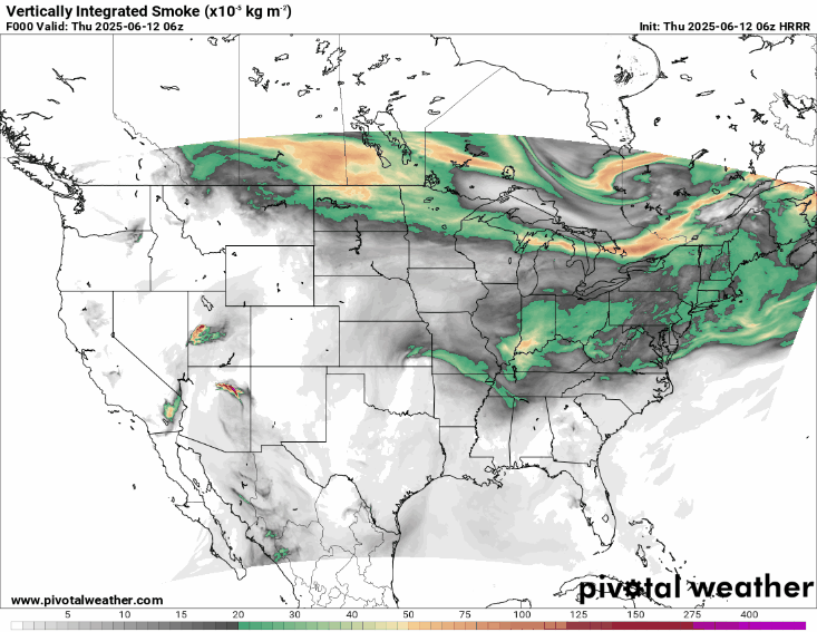
As the mid and upper level flow becomes more westerly, the HRRR-Smoke model shows even the higher level smoke also becoming a lesser issue with time over the next couple of days.

Leave a comment