June 23, 2025 weekly tropical newsletter
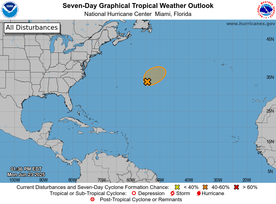
For the first time since the start of the hurricane season, NHC has a system it is monitoring in the Atlantic for potential tropical cyclone formation in the short term. Invest 90L is located east of Bermuda, and NHC has a medium probability of development for it over the next 48 hours.
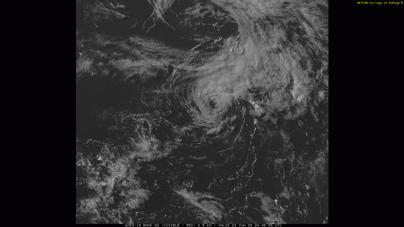
Visible satellite imagery this afternoon shows that 90L has a well developed low pressure system, and in fact satellite derived wind estimates show that it is producing gale force winds. However, there is little in the way of any shower and thunderstorm activity associated with it and what there is mainly well away from the center. For a system to be a tropical cyclone, it must have thunderstorm activity that is associated with the center of the low pressure area. Right now that is not the case, and NHC actually lowered the probability of development from 70% to 60% in its most recent update.
Any development will have to take place in the next 12-24 hours, as 90L will be moving into a more hostile environment with strong upper wind shear and cooling sea surface temperatures. Even if it were to briefly develop into a tropical storm, it should be of little impact as it will stay over the open waters of the Atlantic.
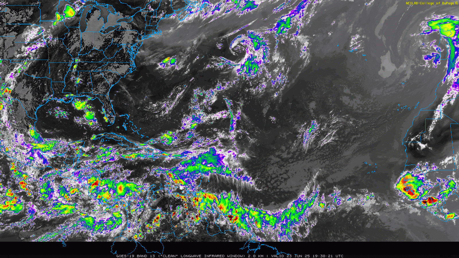
Elsewhere in the Atlantic, things are relatively quiet with a few upper level low pressure areas slowly moving west. A decent tropical wave is coming off the west coast of Africa, but it is still a bit too early in the season for a system to develop in the deep tropical Atlantic. The Madden-Julian oscillation (MJO) looks to stay weak and of little influence on the tropics for the next two weeks, and the models show little if anything of interest in the Atlantic as of right now.
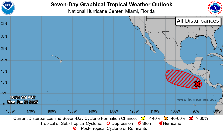
So with the overall conditions remaining stable, one could assume that the focus for any tropical development will remain in the eastern Pacific, and as of now that looks to be correct. The ensemble models have a strong signal for another system to develop south of central America later this week, and NHC has a 70% likelihood of development in the next 7 days in this area. As of now, most of the model guidance suggests that this system will not be as intense as Erick and will likely stay offshore. In the longer term, the models suggest another eastern Pacific system after this one, perhaps next week.

Leave a comment