Severe storms possible in the Southeast
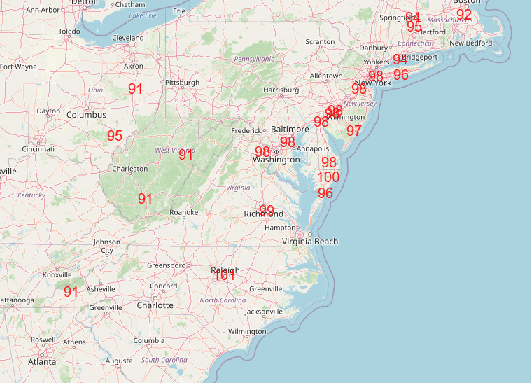
Tuesday was a rather historic day from a climate perspective, as several state June records for high temperatures were tied or broken in the Northeast as summarized above by Extreme Temperatures Around the World. A number of major climate sites ties or broke their all time record for June, including Boston (102F), Providence (100F), Bangor ME (98F), Portland ME (99F, broke daily record by 6 degrees), Newark (103F), NYC JFK airport (102F) and Islip (101F, breaking previous June record by 5 degrees). Additionally, Augusta ME tied their all-time record high temperature with 100F. Numerous record warm lows were set as well from the Midwest to the East Coast, including Wilmington DE and Allentown PA tying their all time record warm minimums for the month of June.
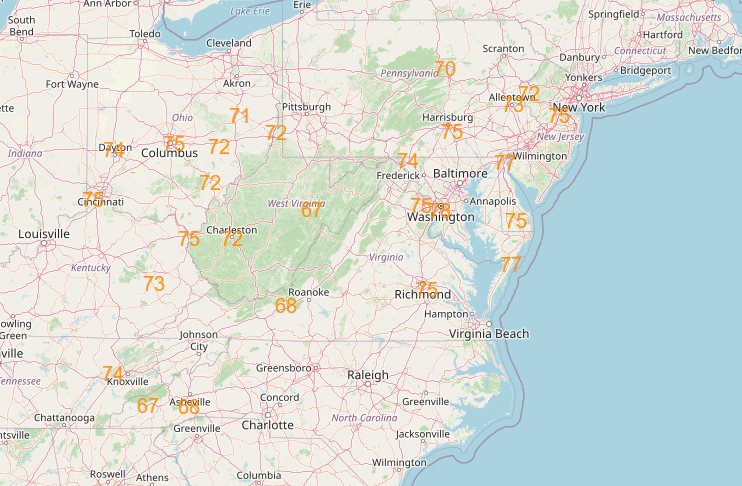
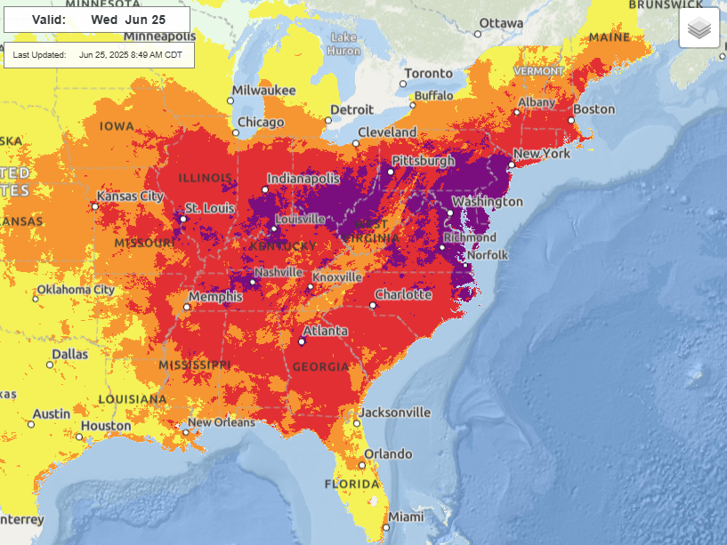
The heat will begin to abate a bit today, but it will still be plenty hot with numerous record high temperatures and overnight record warm minimums, and widespread major to extreme heat risk across the eastern half of the country.
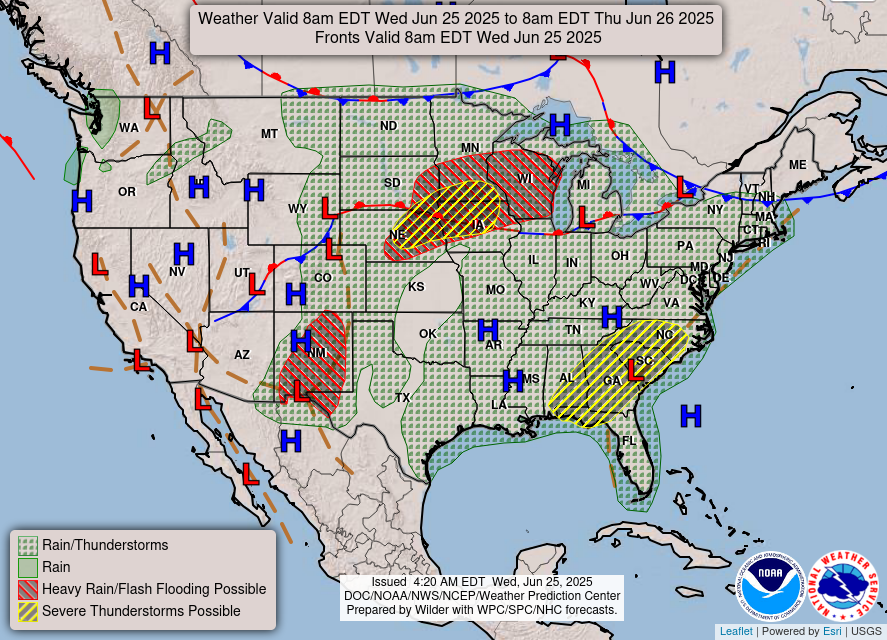
With regard to thunderstorms today, there will be two main areas of severe weather risk. Over the Southeast, clusters of thunderstorms will develop and move south/southwest with primarily a risk of damaging winds, while over the upper Midwest scattered severe storms capable of damaging winds and perhaps a tornado or two are expected. Strong to occasionally severe storms are also possible along the slow moving cold front extending east from this region into the Northeast. Flash flooding will continue to be a risk the next couple of days over New Mexico as abnormally high monsoonal moisture remains in place, and over the upper Midwest where repeated rounds of thunderstorms with heavy rainfall are anticipated.
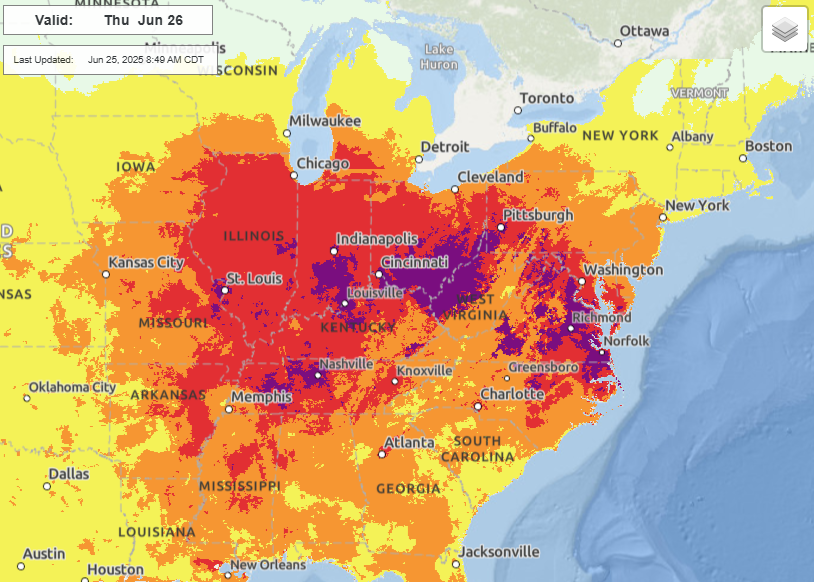
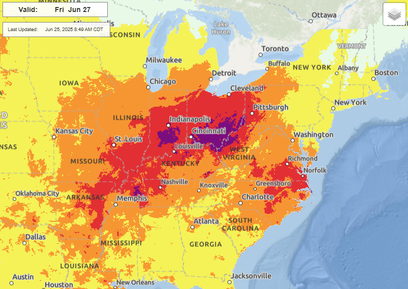
While the heat dome over the East will continue to slowly weaken and erode around the edges, the core of it will remain in place through Friday, bringing continued major to extreme heat risk to the Ohio Valley and parts of the Mid-Mississippi Valley and Mid-Atlantic regions. This will be the culmination of a prolonged several day heat event for this region.
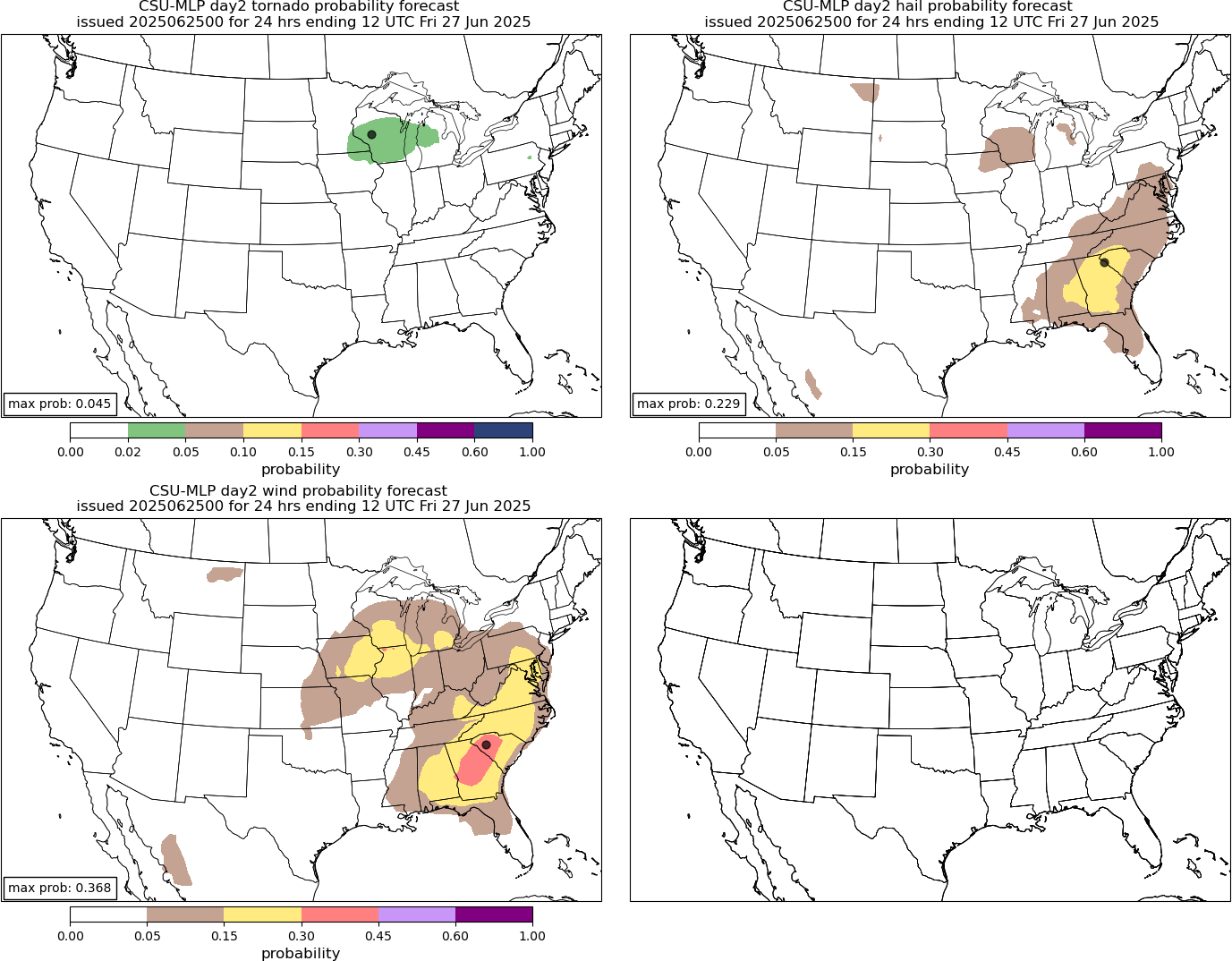
As far as severe weather is concerned, the primary risk on Thursday should be in the Southeast where an approaching upper low from the southeast will continue to fuel storms capable of damaging downburst winds.
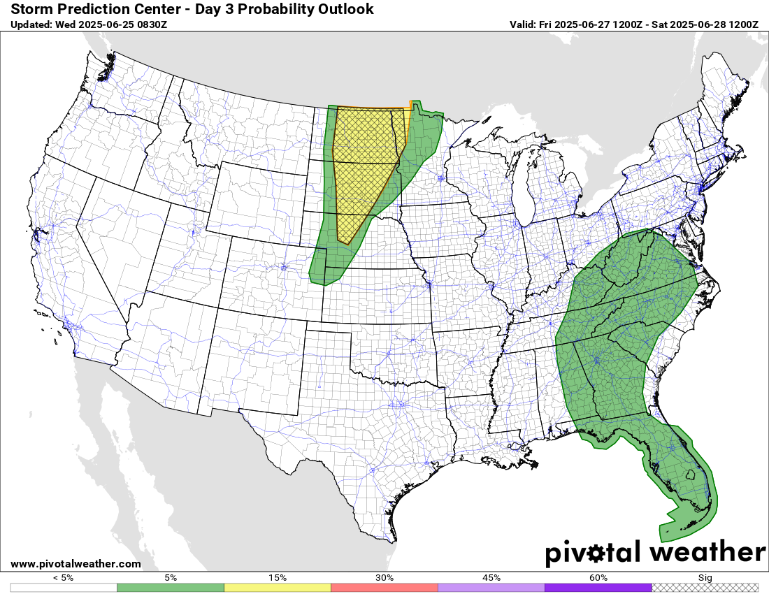
By Friday, the risk will shift back to the northern Plains, where scattered supercell storms capable of very large hail and damaging winds will be possible.
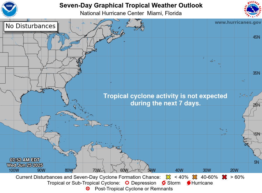
In the tropics, as expected, Andrea quickly dissipated in the Atlantic, and no additional activity is anticipated over the next 7-10 days.

Leave a comment