Meanwhile, Eastern heat dome slowly shrinks
Unfortunately, we are starting off this morning talking about another major blow to the weather community. NOAA announced through a data change notice yesterday that all access to data from the Defense Meteorological Satellite Program (DMSP) instruments was being terminated. The US Space Force has a webpage that provides an overview of the DMSP, which is a polar orbiting satellite system in which satellites with a variety of meteorological instrumentation provide crucial information from data sparse regions. The DMSP has been in operations for more than 50 years, and initially the data gathered was classified. In 1972, the data was declassified and began to be used by the civilian meteorological community. The rationale for the termination of DMSP access is unclear as of now.
The loss of this data has significant impacts on the operational meteorological community, and the most urgent and alarming is the impact on hurricane forecasting. Data from the DMSP’s Special Sensor Microwave Imager Sounder (SSMIS) is a crucial tool for forecasting tropical cyclones because it allows forecasters to be able to see beneath the clouds and look at the internal structure of a tropical cyclone, akin to an MRI or X-ray of a human for a doctor.
This post by NHC forecaster Philippe Papin on BlueSky is a classic example of the utility of SSMIS data for hurricane forecasting. This data enabled NHC to know that Erick was undergoing an eyewall replacement cycle and adjust the intensity forecast for the hurricane accordingly. SSMIS data is particularly crucial for forecasting tropical cyclones that are in data sparse regions like the Pacific and tropical Atlantic, but even in areas with radar and reconnaissance data they are an important tool. I encourage you to read this article from my meteorologist colleague Michael Lowry that provides a deep dive from tropical experts on the impacts of losing the SSMIS data.
The loss of SSMIS data would be a big story just for the impacts for the hurricane forecasting program, but obviously that is not the only way in which DMSP SSMIS data is used. This data is important for marine forecasting, ice monitoring and analysis, and a variety of other meteorological applications.
One of those applications is data assimilation for the numerical weather prediction systems. Both the European Centre for Medium-Range Weather Forecasts and NOAA’s Environmental Modeling Center use SSMIS data in the data assimilation for the operational computer models that the community uses for all of its forecasting applications. When discussion focused on the loss of upper air balloon soundings at a number of NWS locations a couple of months, one of the things we discussed was that computer models had become less reliant upon that data because of improved use of satellite data in the models. SSMIS is one of those important satellite data sources for the computer models, and we are now losing it.
Polar orbiting satellites by their nature only provide data at any given point on the globe periodically, so it is a uniquely precious (I can’t think of a better phrase) data source. While there will still be some microwave data available from other polar orbiting satellites, the loss of SSMIS will result in a 50% reduction in the data for the applications discussed above. Given all of the important applications SSMIS data has in meteorological operations, I have little doubt that this is a loss that will have tangible negative impacts on public forecasts and warnings.

Let’s finish up this morning with an abbreviated look at the actual weather happenings around the country. While yesterday was not quite as extreme as Tuesday with regards to heat in the East, it was still plenty hot with numerous record warm temperatures set. This included NYC JFK Airport tying their monthly June record – set Tuesday – with 102F, and Wilmington DE setting their all-time June monthly warm minimum with a low of 78F. Today will see the heat dome continue to slowly erode, but major to extreme heat risk is still anticipated from the Midwest to the Mid-Atlantic coast.
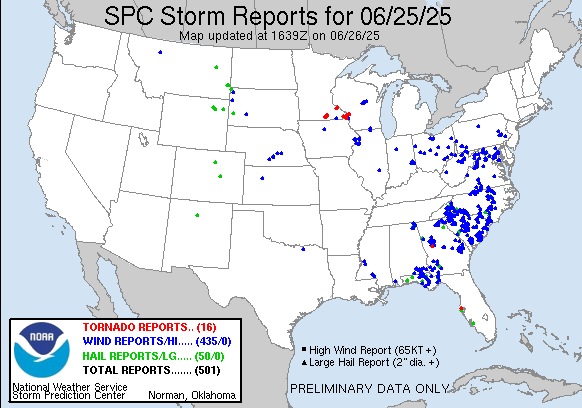
Wednesday ended up being a bit busier of a severe weather day than anticipated. The expected clusters of severe storms in the Southeast produced numerous incidences of wind damage, but there were also quite a few severe storms with damaging wind gusts reported in the Mid-Atlantic and upper Ohio Valley regions as well. Several tornadoes occurred in southeast Minnesota associated with a complex of severe storms that moved through the region Wednesday evening.
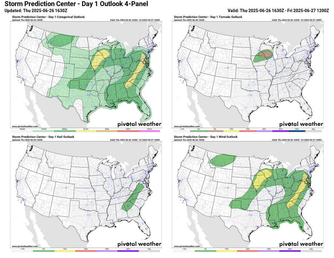
Today will see severe weather risks in similar areas, with a slight risk (level 2 of 5) in the Mid-Atlantic and parts of the Southeast primarily for scattered severe storms capable of producing damaging downburst winds. A slight risk is also in place in the upper Midwest for storms capable of damaging winds and potentially a few tornadoes.
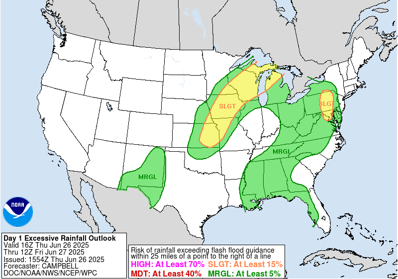
Slight risks (level 2 of 4) of excessive rainfall and flash flooding are also in place as high levels of atmospheric moisture will help fuel storms with high rainfall rates.
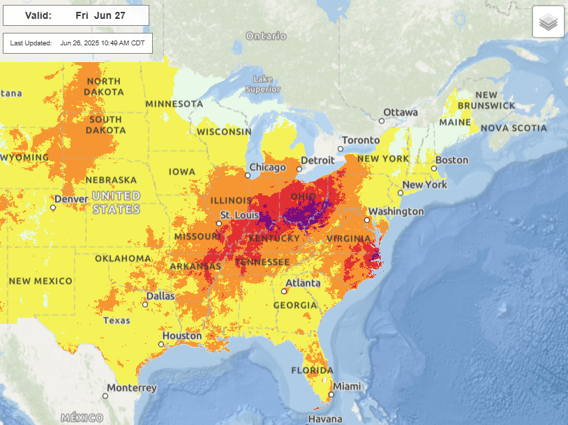
As we end the work week on Friday, the heat dome will continue to erode, but the core will remain over the Ohio Valley and parts of the Mid-Atlantic where major to extreme heat risk will persist for one more day.
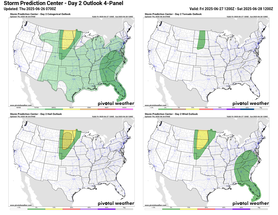
While a marginal risk of severe storms with damaging downburst winds will continue in the hot and humid Southeast, on Friday the main severe weather risk should shift to the northern Plains, where severe storms capable of very large hail and damaging winds are possible.
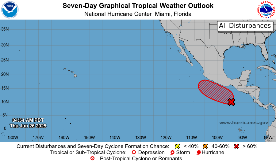
In the tropics, the Atlantic will remain quiet, but NHC is forecasting a high risk for the next eastern Pacific system to develop by sometime this weekend.

Leave a comment