And more severe storms for the upper Midwest
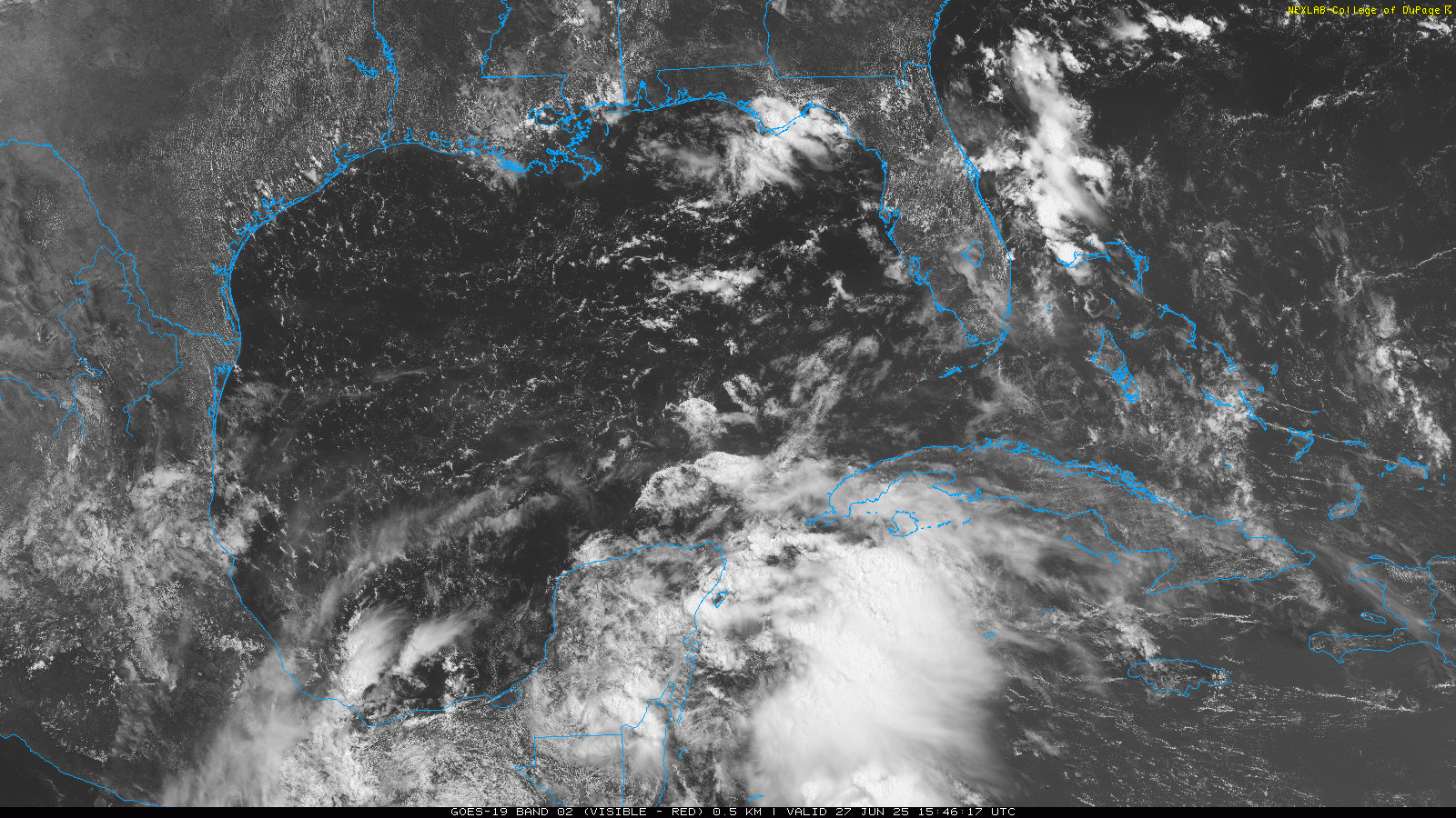
Happy Friday and apologies for the delayed newsletter, it’s been a busy morning. For the first time, we are starting off the daily newsletter talking about a tropical system we are watching in the Atlantic. While the focus for the tropical cyclone development over the next few days still looks as if it will be in the eastern Pacific, this area of disturbed weather has developed in the northwest Caribbean. If you look at the visible imagery above, you can see that it actually has a little bit of organization now, with some twisting in the clouds indicative of a developing weak area of low pressure, and there is quite a bit of thunderstorm activity on the eastern side of the system. However, it will be moving inland over the Yucatan Peninsula soon, which will end any development risk in the near term.
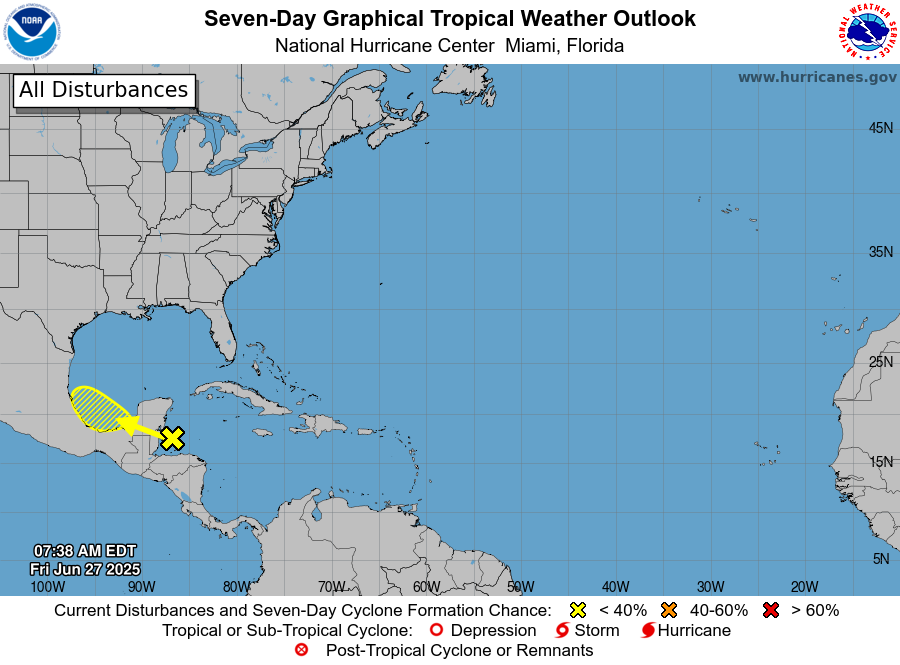
However, once it gets back over the warm waters of Bay of Campeche, conditions for development look marginally favorable as an upper level high pressure area will be developing over the region, helping to reduce wind shear in the area. As of now, NHC is showing a 20% probability of a tropical cyclone developing over the weekend. A handful of ensemble members from the European and US model systems develop a tropical depression or storm before the system makes landfall, but there are not any model signals for anything stronger than that.

Regardless of development, the system should spread heavy rainfall across Belize and Yucatan Peninsula the next couple of days, and then into much of eastern Mexico into early next week. Any system that develops should not be a threat to the US coastline.
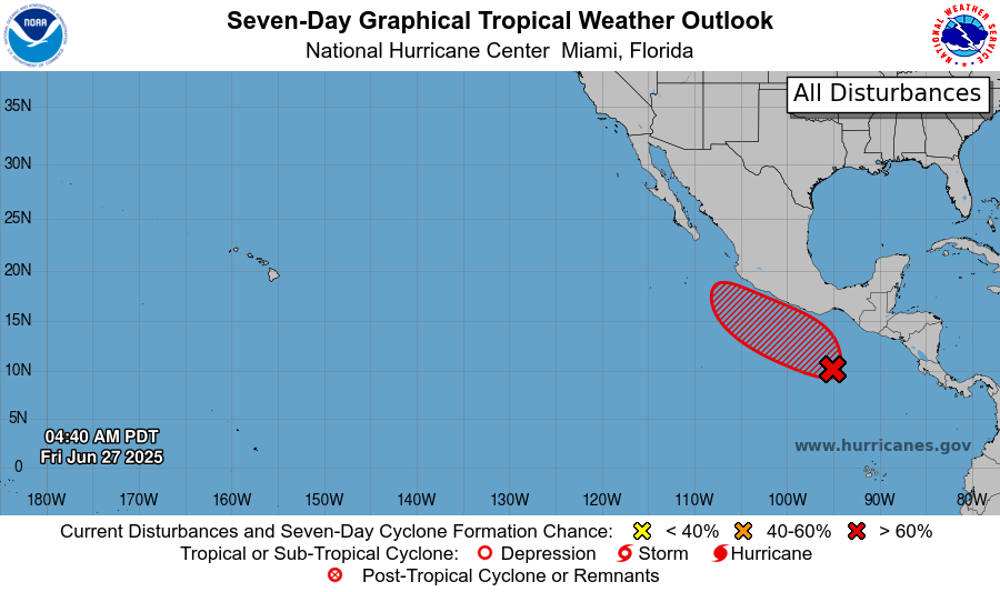
Meanwhile to the west a tropical cyclone is likely to develop over the eastern Pacific south of Mexico this weekend or early next week. This system should be in a more favorable environment for development than the Atlantic system, and could eventually become a hurricane. Right now it looks like the system will remain offshore of southern Mexico through early next week.

Turning back stateside, the Eastern US heat dome continues to slowly weaken, but we are still looking at one more day of very hot and humid conditions for the Ohio Valley and mid-Mississippi valley regions, and heat advisories are in effect for much of this area. Heat is starting to rebuild again in the West, and extreme heat warnings are in effect once for southern Arizona for this weekend as temperatures will approach 115F again in the Phoenix metro area by Sunday.
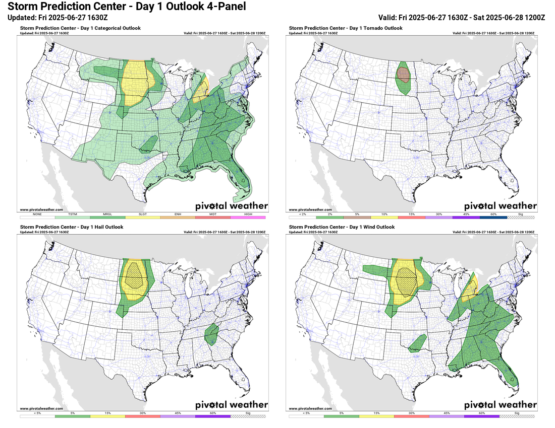
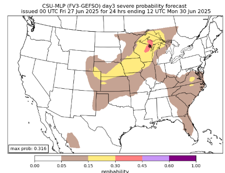
The severe weather risk today will primarily be focused in the northern Plains, where clusters of severe storms capable of very large hail, significant damaging wind gusts, and a few tornadoes are expected. Additional severe storms are possible in the eastern Great Lakes and down into the Southeast, with damaging winds being the primary risk in this area.
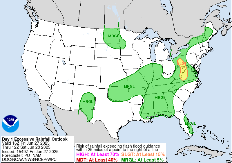
Localized flash flooding will be a risk with slow moving thunderstorms in the eastern US today, with a more focused risk over the central Appalachians where heavy rainfall and flash flooding over the last couple of weeks have left soils saturated and more vulnerable to heavy rainfall rates. Flash flood watches are in effect for this region today.
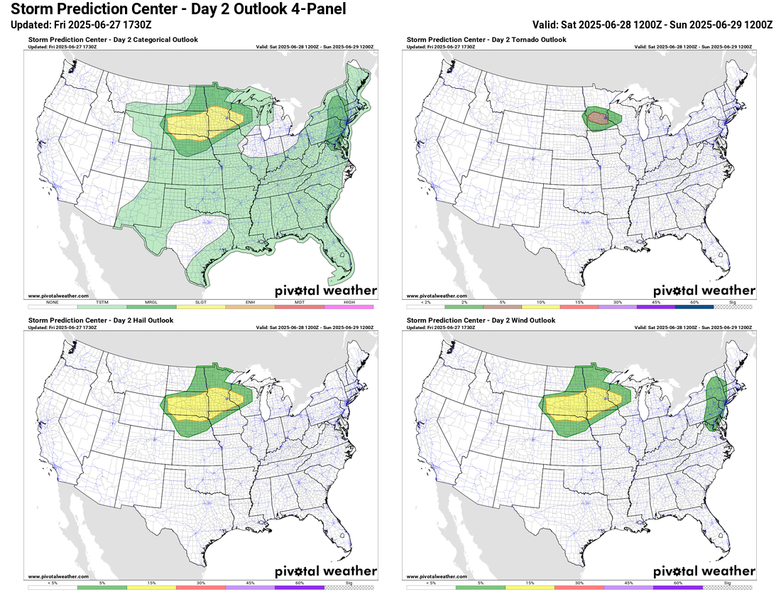
Headed into the weekend, a weak cold front moving through the upper Midwest will bring a risk of severe storms to parts of the upper Midwest on Saturday, with damaging winds and large hail possible. A few tornadoes will also be possible across southern Minnesota.
This risk will shift south and east with the cold front on Sunday, with isolated strong to severe storms possible in the Southeast.

Leave a comment